Category Archives: Maps
Windsor Forest and District 1887
Windsor Forest and District in 1887 in a series of reproductions of Ordnance Survey’s famous “Inch to the Mile” maps published in the Alan Godfrey Editions to provide a historical record of England and Wales on the second half of 19th and early 20th century.The map is centred on Windsor Great Park and covers the
Tottenham (North) 1894 – 8a

Tottenham North in 1894 in a fascinating series of reproductions of old Ordnance Survey plans in the Alan Godfrey Editions, ideal for anyone interested in the history of their neighbourhood or family. The map covers the northern part of Tottenham, stretching from Bruce Grove northward to the border with Edmonton, eastward to Chalgrove Road. Features
Croydon Woodside 1911
Croydon Woodside in 1911 in a fascinating series of reproductions of old Ordnance Survey plans in the Alan Godfrey Editions, ideal for anyone interested in the history of their neighbourhood or family. The map covers map the north-eastern area of Croydon from Sundridge Road eastward to Ham Farm, and from Ferndale Road southward to Bingham
Derby (South) 1899 – 50.13a
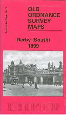
Derby South in 1899 in a fascinating series of reproductions of old Ordnance Survey plans in the Alan Godfrey Editions, ideal for anyone interested in the history of their neighbourhood or family. The map covers the southern part of Derby, stretching from Macklin Street and East Street southward to Stanhope Street, and from Wood`s Lane
Stourbridge (North) & Amblecote 1901 – 4.10a
Stourbridge North and Amblecote in 1901 in a fascinating series of reproductions of old Ordnance Survey plans in the Alan Godfrey Editions, ideal for anyone interested in the history of their neighbourhood or family. The map covers the northern part of Stourbridge, in Worcestershire, and also extends north to Coalbournbrook and a stretch of Amblecote
North Finchley 1911
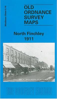
North Finchley in 1911 in a fascinating series of reproductions of old Ordnance Survey plans in the Alan Godfrey Editions, ideal for anyone interested in the history of their neighbourhood or family. Two versions for this area have been published to show how it developed across the years. Each covers the same area, from the
Ipswich 1902 – 75.11

Ipswich in 1902 in a fascinating series of reproductions of old Ordnance Survey plans in the Alan Godfrey Editions, ideal for anyone interested in the history of their neighbourhood or family. Ipswich is covered by four maps. This title, IPSWICH, covers much of the town centre, extending from Hanford Hall and Hanford Bridge eastward to
Thornton Heath and Norbury 1894
Thornton Heath and Norbury in 1894 in a fascinating series of reproductions of old Ordnance Survey plans in the Alan Godfrey Editions, ideal for anyone interested in the history of their neighbourhood or family. Two versions for this area have been published to show how it developed across the years – the two maps are
Wollaston 1901 – 4.09
Wollaston in 1901 in a fascinating series of reproductions of old Ordnance Survey plans in the Alan Godfrey Editions, ideal for anyone interested in the history of their neighbourhood or family. The map straddles the Worcestershire/Staffordshire border; the western half of the map is Staffordshire sheet 71.09. Most development is on the Worcestershire side in
Central Nottingham 1899 – 42.02b
Central Nottingham in 1899 in a fascinating series of reproductions of old Ordnance Survey plans in the Alan Godfrey Editions, ideal for anyone interested in the history of their neighbourhood or family. The map covers the heart of Nottingham, stretching from Portland Road and General Cemetery eastward to Sneinton Elements and Randolph Street, and from
Walton on the Hill 1906
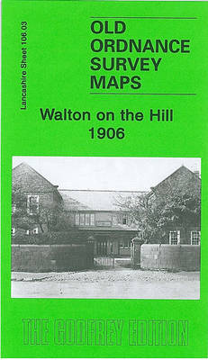
Walton on the Hill in 1906 in a fascinating series of reproductions of old Ordnance Survey plans in the Alan Godfrey Editions, ideal for anyone interested in the history of their neighbourhood or family. The map covers the eastern part of Walton on the Hill, stretching from Walton Lane eastward to Strawberry Lane and Scarisbrick
Belfast (East) 1902 – 4.11
Belfast East in 1902 in a fascinating series of reproductions of old Ordnance Survey plans in the Alan Godfrey Editions, ideal for anyone interested in the history of their neighbourhood or family. The map covers part of east Belfast, east of the Lagan. Note that the Co Antrim area west of the Lagan is left
Sedgley South-East with Swan Village and West Coseley 1901
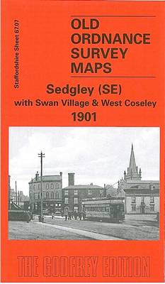
Sedgley South-East with Swan Village and West Coseley in 1900 in a fascinating series of reproductions of old Ordnance Survey plans in the Alan Godfrey Editions, ideal for anyone interested in the history of their neighbourhood or family. The map covers an area stretching from the south-eastern corner of Sedgley, including All Saints church, southward
Holmside and Edmondsley 1896
Holmside and Edmondsley in 1896 in a fascinating series of reproductions of old Ordnance Survey plans in the Alan Godfrey Editions, ideal for anyone interested in the history of their neighbourhood or family. The map is double-sided. The main map covers the hamlet of Holmside, including Warland Green, stretching eastward to Edmondsley Colliery (Wellington Pit).
Nottingham (South) 1899 – 42.06b
Nottingham South in 1899 in a fascinating series of reproductions of old Ordnance Survey plans in the Alan Godfrey Editions, ideal for anyone interested in the history of their neighbourhood or family. The map covers the southern part of Nottingham, stretching from Broad Marsh and Narrow Marsh southward to Trent Bridge cricket ground, and from
North West Surrey 1888
North West Surrey in 1888 in a series of reproductions of Ordnance Survey’s famous “Inch to the Mile” maps published in the Alan Godfrey Editions to provide a historical record of England and Wales in the second half of 19th and early 20th century.Coverage stretches from Farnham and Aldershot Common eastward to East Horsley and
Holland Park & Shepherds Bush 1894 – 73.2

Holland Park and Shepherds Bush in 1894 in a fascinating series of reproductions of old Ordnance Survey plans in the Alan Godfrey Editions, ideal for anyone interested in the history of their neighbourhood or family. Three versions cover this area, stretching from Iffley Road, Hammersmith eastward to Phillimore Gardens, Kensington; and from Royal Crescent and
Teddington & Hampton Hill 1894 – 131.2
Teddington and Hampton Hill in 1894 in a fascinating series of reproductions of old Ordnance Survey plans in the Alan Godfrey Editions, ideal for anyone interested in the history of their neighbourhood or family. Two versions cover this area: the western part of Teddington, including Broad Street, Church Road and Park Road, and the area
Bristol (NE) 1902 – 72.13a
Bristol North-East in 1902 in a fascinating series of reproductions of old Ordnance Survey plans in the Alan Godfrey Editions, ideal for anyone interested in the history of their neighbourhood or family. The map covers a major part of Bristol including the Easton area to the north-east. Coverage stretches from Castle Street eastward to Lyppiatt
Flodden Field & North Cheviots 1901 – 3
Flodden Field and North Cheviots in 1901 in a series of reproductions of Ordnance Survey’s famous “Inch to the Mile” maps published in the Alan Godfrey Editions to provide a historical record of England and Wales in the second half of 19th and early 20th century.This title, originally called by the Ordnance Survey `Ford`, covers