Category Archives: Maps
Hollywood CA Global Graphics detailed Street Map
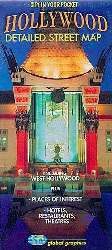
Hollywood with West Hollywood on a detailed indexed street plan from Global Graphics with lists of selected hotels and restaurants, theatres, museums and other places of interest.The plan indicates main traffic routes and shows metro stations. Longer streets are annotated with block numbers. Symbols show locations of selected hotels and restaurants, theatres, shopping centres, etc.
Los Angeles and Hollywood CA Global Graphics Street Map
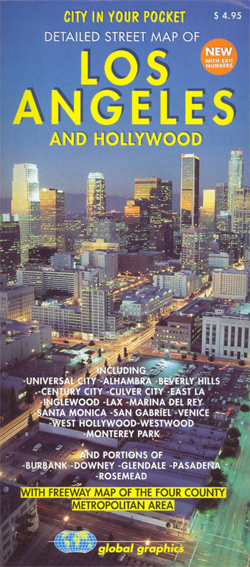
Indexed street plan of Los Angeles and Hollywood at 1:45,000 with a freeway map of the four county metropolitan area. The main map covers Los Angeles’ central and western areas, with the block numbers shown, as well as all metro lines and stations. Airports are clearly marked with passenger terminals and access.Points of interest such
Jebel Acacus
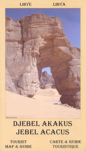
Topographic map of this highland region in the south west of the country, with notes for visitors. The cartography is based on Russian military mapping, and complemented by more recent survey work. Road detail distinguishes surfaced and unsurfaced roads, ill-defined routes and paths. Relief is shown by contours at 40m intervals, with additional spot heights
South Shields 1895

South Shields in 1895 in a fascinating series of reproductions of old Ordnance Survey plans in the Alan Godfrey Editions, ideal for anyone interested in the history of their neighbourhood or family. SThe map covers the heart of South Shields, stretching from Ocean Road southward to Dean Lane, and from West Holborn eastward to Sea
Altai Mountains
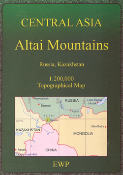
A detailed topographic map, at a scale of 1:200,000, of the Altai Mountains in Russia’s Kazakhstan. The low-contrast of the print reproduction makes some of the fine detail a little difficult to discern. Officially recognized un-surfaced tracks are marked on the map, as is the section of the M52 that snakes through the area. Relief
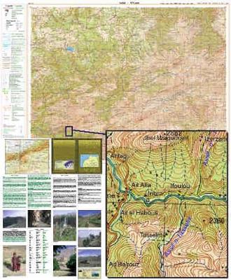
Toubkal Massif
Toubkal Massif in a series of GPS compatible maps at 1:160,000 published by EWP and West Col Productions and covering Morocco’s Atlas Mountains with its neighbouring deserts and coastal areas. The maps use the cartography of the Russian military survey of the area, providing a very detailed representation of the terrain, with contours at 40m
Ouarzazate
Ouarzazate and the region to the east of it including Skoura and the western part of Jbel Sarhro in a series of GPS compatible maps at 1:160,000 published by EWP and West Col Productions and covering Morocco’s Atlas Mountains with its neighbouring deserts and coastal areas. The maps use the cartography of the Russian military
Gateshead Fell & Sheriff Hill 1895 – 7.05a
Gateshead Fell and Sheriff Hill in 1895 in a fascinating series of reproductions of old Ordnance Survey plans in the Alan Godfrey Editions, ideal for anyone interested in the history of their neighbourhood or family. The map covers the Gateshead Fell area, south of Gateshead and east of Low Fell. The `Old Durham Road`, Sodhouse
Low Fell 1895
Low Fell in 1895 in a fascinating series of reproductions of old Ordnance Survey plans in the Alan Godfrey Editions, ideal for anyone interested in the history of their neighbourhood or family. The map covers Low Fell, on the south side of Gateshead, and much of the area now covered by the Team Valley Trading
Central Sunderland 1895 – 8.14
Sunderland Central in 1895 in a fascinating series of reproductions of old Ordnance Survey plans in the Alan Godfrey Editions, ideal for anyone interested in the history of their neighbourhood or family. Coverage stretches from Sorley Street and the Workhouse eastward to Suffolk Street, and from Monkwearmouth station southward to Belvedere Road and Park Road.
Sunderland South 1895
Sunderland South in 1895 in a fascinating series of reproductions of old Ordnance Survey plans in the Alan Godfrey Editions, ideal for anyone interested in the history of their neighbourhood or family. The map covers the southern area of Sunderland around Ashbrooke Hall, including part of Hendon. Coverage stretches from Mowbray Road southward about a
Alloa 1899
Alloa in 1899 in a fascinating series of reproductions of old Ordnance Survey plans in the Alan Godfrey Editions, ideal for anyone interested in the history of their neighbourhood or family. The main map covers the centre and northern part of the town, stretching from Bank Street northward to Inglewood and Holton Square. Features include
Charing Cross 1871-1894
Charing Cross area of London in 1871-1894 in a series of exceptionally detailed reproductions of old Ordnance Survey street plans for areas of larger cities which have undergone substantial redevelopment in the late 19th or the early 20th century, published in the Alan Godfrey Editions.The plans, printed in back and white, have been taken from
Kensal Green & Queen`s Park 1894 – 47.2
Kensal Green and Queen`s Park in 1894 in a fascinating series of reproductions of old Ordnance Survey plans in the Alan Godfrey Editions, ideal for anyone interested in the history of their neighbourhood or family. Four versions of this map have been published, with Kensal Green on the west side, west Kilburn to the east,
Tyneside and Wearside 1878
Tyneside and Wearside in 1878 in a series of reproductions of Ordnance Survey’s famous “Inch to the Mile” maps published in the Alan Godfrey Editions to provide a historical record of England and Wales in the second half of 19th and early 20th century.The map is double-sided. Sheet 20 is on one side and covers
Pamir West
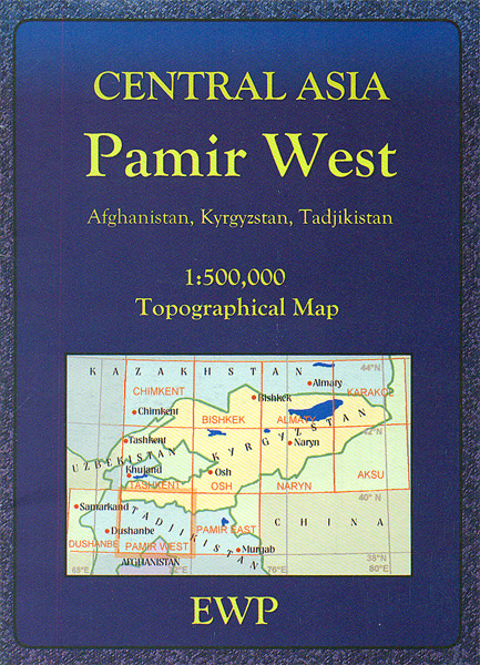
Western Pamir Mountains at 1:500,000 in a series of detailed, contoured maps of the mountains of Central Asia derived from the Soviet era topographic survey but with transliterated place names and an English language map legend. Maps in this series provide coverage of the Tien Shan and Pamir Mountains, with the whole of Kyrgyzstan, northern
Stranton & Southern Hartlepool 1896 – 37.15
Stranton and Southern Hartlepool in 1896 in a fascinating series of reproductions of old Ordnance Survey plans in the Alan Godfrey Editions, ideal for anyone interested in the history of their neighbourhood or family. The map covers the area from Burbank Street and All Saints church southward to Foggy Furze and Longhill Farm. Various iron
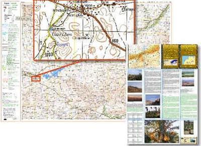
Azilal – M`Goun
Azilal – M`Goun region in a series of GPS compatible maps at 1:160,000 published by EWP and West Col Productions and covering Morocco’s Atlas Mountains with its neighbouring deserts and coastal areas. The maps use the cartography of the Russian military survey of the area, providing a very detailed representation of the terrain, with contours