Category Archives: Maps
Utah Benchmark Road & Recreation Atlas
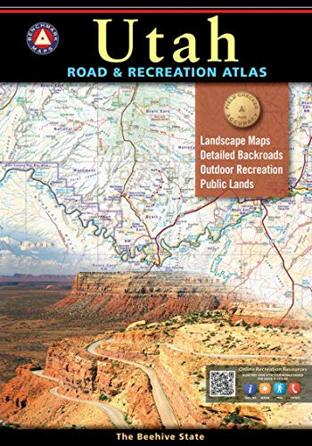
The new National Geographic Benchmark Recreation Atlases are an ideal recreation resource complete with accurate, detailed topographic maps. They contain a wealth of robust travel information, including campground locations, state park maps, sports and activity destinations, museums, hunting and fishing information, historic sites and even climate details. Every feature is clearly labelled, field-checked and verified,
Greater Yellowstone & Grand Teton Benchnark Maps Recreation Atlas & Guide
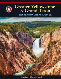
Greater Yellowstone and Grand Teton Recreation Atlas & Guide from Benchmark Maps in an A4 paperback format, with coverage of the two parks on detailed, GPS compatible ‘Recreational” section at 1:100,000, regional map coverage of a wider area, plus a 10-page recreational guide with list of various facilities, etc.The more detailed ‘Landscape” part of the
Washington State Road & Recreation Atlas
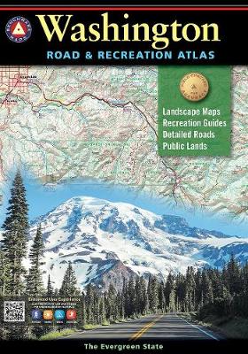
Washington State at 1:200,000 in a series of excellent, detailed, GPS compatible state atlases from Benchmark Maps with extensive information on diverse recreational opportunities and facilities, covering The Rockies and the western states of the United States. Each atlas consists of three main sections:*Landscape:* with detailed mapping at scales around 1:250,000, according to the size
California Benchmark Road & Recreation Atlas
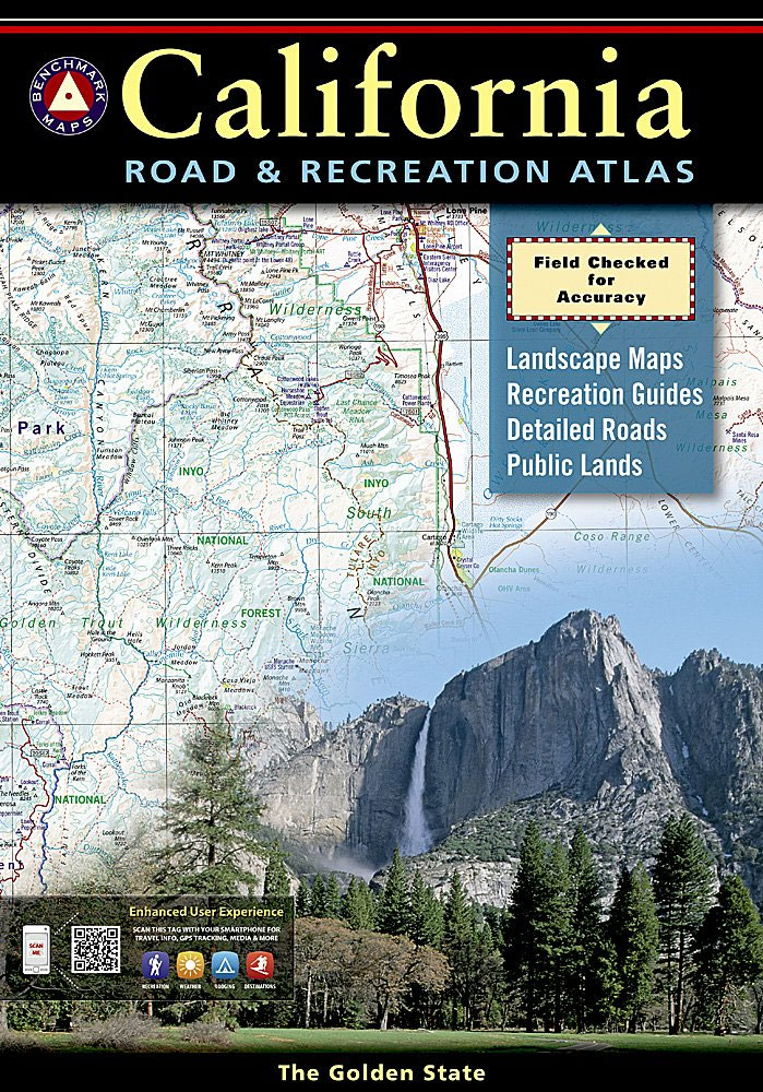
California at 1:300,000 in a series of excellent, detailed, GPS compatible state atlases from Benchmark Maps with extensive information on diverse recreational opportunities and facilities, covering The Rockies and the western states of the United States. Each atlas consists of three main sections:*Landscape:* with detailed mapping at scales around 1:250,000, according to the size of
Nevada Road & Recreation Atlas
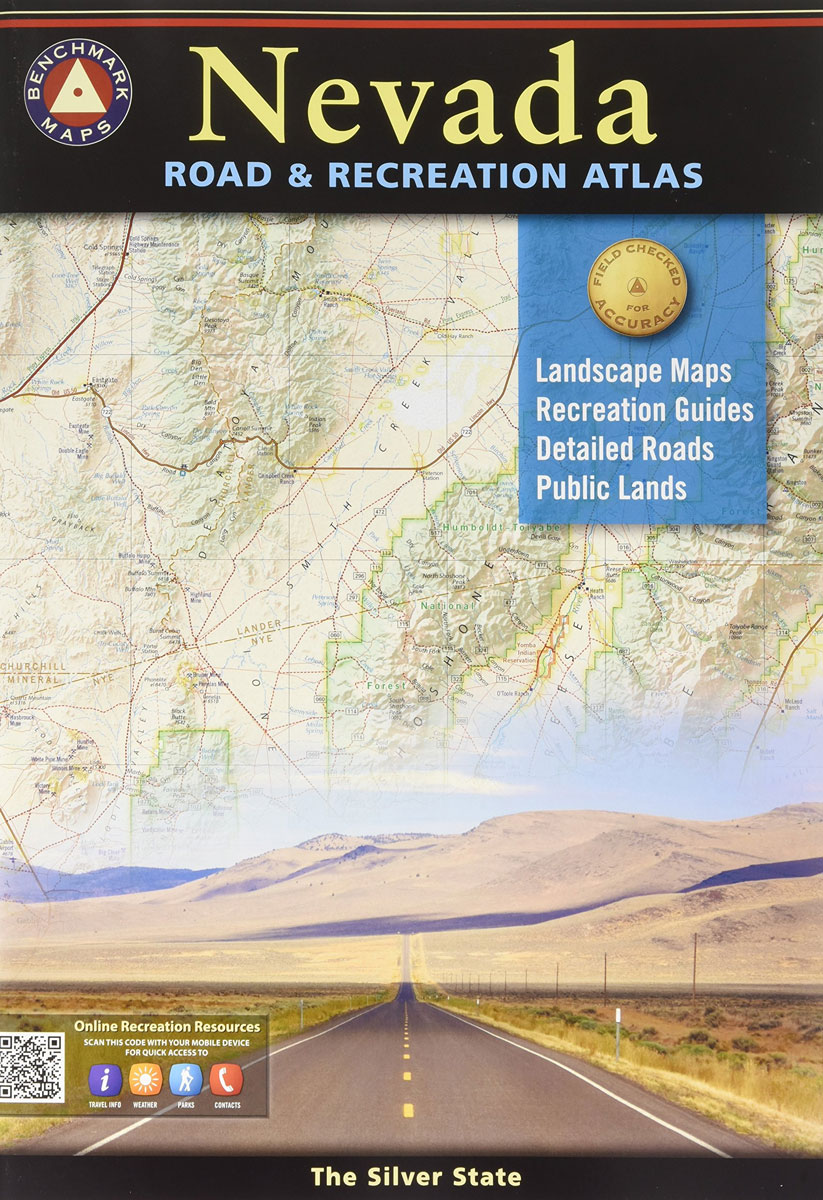
Nevada at 1:280,000 in a series of excellent, detailed, GPS compatible state atlases from Benchmark Maps with extensive information on diverse recreational opportunities and facilities, covering The Rockies and the western states of the United States. Each atlas consists of three main sections:*Landscape:* with detailed mapping at scales around 1:250,000, according to the size of
San Francisco CA in detail Global Graphics Street Map

San Francisco on an indexed street plan from Global Graphics with in the reverse detailed enlargements for its downtown area, Fisherman’s Wharf and the Golden Gate Park.On one side is a street plan at 1:19,000 of the whole city within its municipal boundary. The map shows main traffic arteries across the city, one way streets,
Glasgow Green 1892

Glasgow Green in 1892 in a fascinating series of reproductions of old Ordnance Survey plans in the Alan Godfrey Editions, ideal for anyone interested in the history of their neighbourhood or family. The map is centred on Glasgow Green but also includes parts of the Gorbals, Hutcheson Town and Bridgeton. Gorbals Cross is in the
Silicon Valley CA Global Graphics detailed Street Map
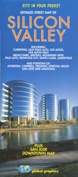
Silicon Valley on an indexed street plan from Global Graphics with an enlargement showing downtown San Jose in greater detail. The plan indicates freeways and expressways with carpool lanes. The area’s light rail system is shown with names of stations. Longer streets are annotated with block numbers. Symbols indicate locations of important buildings, schools, post
Sheffield Central 1903
Sheffield Central in 1903 in a fascinating series of reproductions of old Ordnance Survey plans in the Alan Godfrey Editions, ideal for anyone interested in the history of their neighbourhood or family. Two versions have been published for this area. The map covers the heart of Sheffield, stretching from Tenter Street and Hawley Street eastward
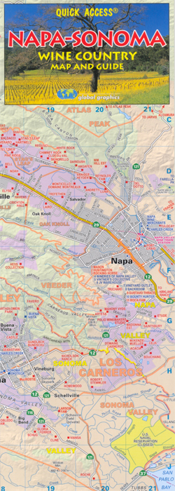
California Wine Map Global Graphics
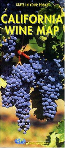
A general road map of California showing all the appellation wine growing areas. On one side is a map of California state with larger scale insets showing areas of particular interest, including: Temecula, South Central Coast, North Central Coast, Los Carneros, Lodi & Sierra Foothills, North Sonoma, Napa & Sonoma Valleys and Mendocino & Lake.The
West Hartlepool 1914 – 37.11c
West Hartlepool in 1914 in a fascinating series of reproductions of old Ordnance Survey plans in the Alan Godfrey Editions, ideal for anyone interested in the history of their neighbourhood or family. Three versions of this map have been published, showing how the area developed across the years. They cover West Hartlepool – the new
Great Smoky Mountains National Park, NC/TN
Great Smoky Mountains National Park in North Carolina and Tennessee at 1:62,500 in a series of detailed, contoured maps from Earthwalk Press with cartography based on the USGS topographic survey of the country plus additional information for visitors, printed on light, waterproof and tear-resistant synthetic paper. The text has over 60 trail descriptions including the
Anza-Borrego Desert Region, CA
Anza-Borrego Desert Region in California at 1:72,000 approx in a series of detailed, contoured maps from Earthwalk Press with cartography based on the USGS topographic survey of the country plus additional information for visitors, printed on light, waterproof and tear-resistant synthetic paper. Coverage includes Cuyamaca Rancho State Parks, Laguna Mountain and Pine Creek Wilderness in
Lassen Volcanic National Park, CA
Lassen Volcanic National Park in California at 1: 48,000 in a series of detailed, contoured maps from Earthwalk Press with cartography based on the USGS topographic survey of the country plus additional information for visitors, printed on light, waterproof and tear-resistant synthetic paper. Maps in this series have contours usually at 40 feet and all
Sawtooth Wilderness, ID
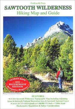
Sawtooth Wilderness in Idaho at 1:48,000 a series of detailed, contoured maps from Earthwalk Press with cartography based on the USGS topographic survey of the country plus additional information for visitors, printed on light, waterproof and tear-resistant synthetic paper. Maps in this series have contours usually at 40 feet and all heights are also given
North Wind River Range
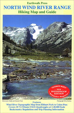
Northern Wind River Range: Elkhart Park to Union Pass in Wyoming at 1:48,000 a series of detailed, contoured maps from Earthwalk Press with cartography based on the USGS topographic survey of the country plus additional information for visitors, printed on light, waterproof and tear-resistant synthetic paper. Maps in this series have contours usually at 40