Category Archives: Maps
Croyde Walking Map 08 – Georgeham & Saunton
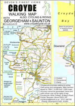
Croyde area of northern Devon on a very detailed, GPS compatible hiking, cycling and horse riding map from Croydecycle at 1:12,500, printed on light, waterproof and tear-resistant synthetic paper. The map is part of publishers’ series covering the western coast of Somerset, both coastlines of Devon, and the adjoining areas of Dorset. Each handy size,
White Water Nepal
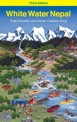
“White Water Nepal” is probably the most iconic and famous rivers guidebook in the world of international kayaking and rafting, and it is the book that you will find on every international river runner`s bookshelf or wish list. This new and thoroughly updated third edition opens the doors to the exhilarating joys of Himalayan river
Great Britain Canoe and Kayak Map
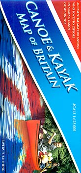
Great Britain Canoe and Kayak Map from Rivers Publishing showing navigable rivers, lakes and canals, artificial white water courses, different classes of river difficulty, popular trips along the waterways, selected coastal paddles, specialist paddling retailers, etc.The base is provided by a double-sided road map of Britain at 1:625,000. Different colouring indicates tidal rivers, waterways used
Topographical Map of the Lake District – Wainwright Fells
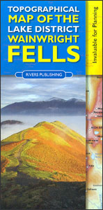
The fells of the Lake District shown on a contoured map at 1:100,000 approx. from Rivers Publishing, with on the reverse side tables showing the 214 fells grouped by location and each presented with its height and a column so the user can record the date climbed or other personal notes. Coverage extends from the
Kerry County
County Kerry at 1:100,000 in a series of double-sided, GPS-compatible maps from Xploreit Maps, with contours, altitude colouring, hiking trails and cycling routes, and printed on light, waterproof and tear-resistant plastic paper.Topography is shown by altitude colouring with contours (interval varies) and plenty of names of geographical features. Road network includes local secondary roads and
Cork County
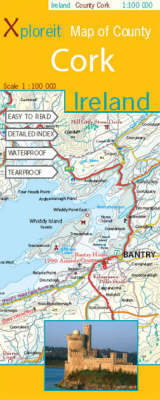
County Cork at 1:100,000 in a series of double-sided, GPS-compatible maps from Xploreit Maps, with contours, altitude colouring, hiking trails and cycling routes, and printed on light, waterproof and tear-resistant plastic paper.Topography is shown by altitude colouring with contours (interval varies) and plenty of names of geographical features. Road network includes local secondary roads and
San Juan Islands WA

San Juan Islands Road and Recreation Map at 1:70,000 from the Great Pacific Recreation & Travel Maps highlighting recommended cycling routes, with town maps and very extensive tourist information about recreational facilities, places of interest, transport, etc.The map presents the islands with altitude colouring to show their topography. Moran State Park and other protected areas
The Andes: A guide for climbers and skiers

This is the 5th English edition of the only complete guidebook to the peaks of the Andes. It covers many areas not described in any other source. Previous editions have been translated into French, Spanish, Polish and Czech. The author, John Biggar, is a very experienced high-altitude mountaineer who has been climbing and skiing in
Maui – Moloka`i – Lana`i Phears Travel Map
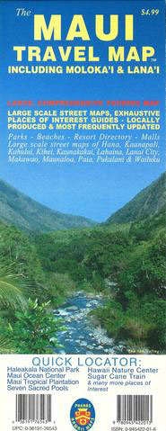
Large Scale Street Maps, Exhaustive Places of Interest Guides – Locally Produced & Most Frequently UpdatedParks – Beaches – Resort Directory – MallsLarge scale street maps of Hana, Kaanapali, Kahului, Kihei, Kaunakakai, Lahaina, Lanai City, Makawao, Maunaloa, Paia, Pukalani & Wailuku
Kaua`i Phears Travel Map
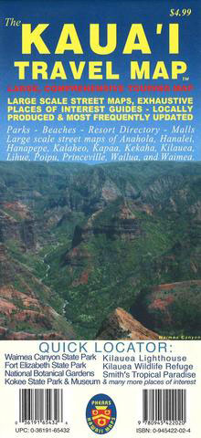
A large, comprehensive touring map provides you with an overview of the island of Kauai. As with our other products, the touring map includes detailed point of interest information. The Kauai Travel Map also includes detailed street maps of all major areas including Anahola, Hanalei, Hanapepe, Kalaheo, Kapaa, Kekaha, Kilauea, Lihue, Poipu, Princeville, Wailua, and
O`ahu Phears Travel Map
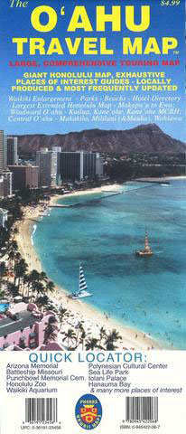
A large, comprehensive touring map provides you with an overview of the entire islands highways and major thoroughfares, as well as providing detailed point of interest information. The Oahu Travel Map also features the largest extended Honolulu map of any available fold-up map! Makapuu to Ewa Beach on a single side! Other detailed street maps
Hawai`i Phears Travel Map
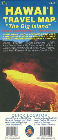
A large, comprehensive touring map provides you with an overview of the Big Island of Hawaii. As with our other products, the touring map includes detailed point of interest information. The Hawaii Travel Map also includes detailed street maps of all major areas including Kona, Hilo, Waimea, Honokaa, Kapaau, Hawaiian Paradise Park, and large scale
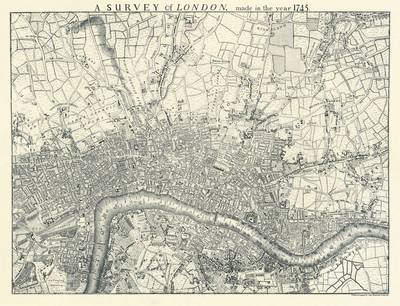
Tallis Map of London 1851

Fully titled Tallis’s Illustrated Plan of London and its Environs, this reproduction map measures 76x56cm. It was originally published in 1851 to mark that year’s Great Exhibition of Industry of all Nations, the location of which is marked in Hyde park on the map. Coverage extends from Fulham in the south west to Leyton Marsh
Wainwright Maps (4): The Southern Fells
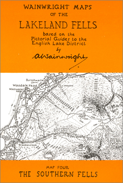
About this series:This series brings together all the small maps that were printed in A. Wainwrights famous Fell guides. Each of the six maps in the series covers a specified area and retains all the detail of the original maps, including the path information. These maps are ideal for walkers wishing to reflect on there
Wainwright Map 6 – North Western Fells
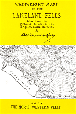
About this series:This series brings together all the small maps that were printed in A. Wainwrights famous Fell guides. Each of the six maps in the series covers a specified area and retains all the detail of the original maps, including the path information. These maps are ideal for walkers wishing to reflect on there
Wainwright Map 1 – Eastern Fells
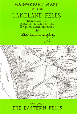
About this series:This series brings together all the small maps that were printed in A. Wainwrights famous Fell guides. Each of the six maps in the series covers a specified area and retains all the detail of the original maps, including the path information. These maps are ideal for walkers wishing to reflect on there
Wainwright Maps (2): The Far Eastern Fells
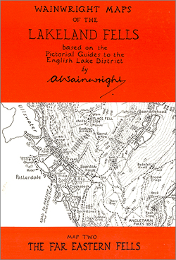
About this series:This series brings together all the small maps that were printed in A. Wainwrights famous Fell guides. Each of the six maps in the series covers a specified area and retains all the detail of the original maps, including the path information. These maps are ideal for walkers wishing to reflect on there
Wainwright Maps (3): The Central Fells
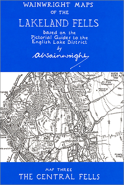
About this series:This series brings together all the small maps that were printed in A. Wainwrights famous Fell guides. Each of the six maps in the series covers a specified area and retains all the detail of the original maps, including the path information. These maps are ideal for walkers wishing to reflect on there
Wainwright Maps (5): The Northern Fells
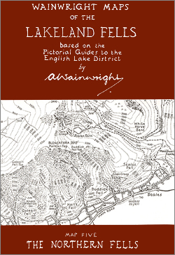
About this series:This series brings together all the small maps that were printed in A. Wainwrights famous Fell guides. Each of the six maps in the series covers a specified area and retains all the detail of the original maps, including the path information. These maps are ideal for walkers wishing to reflect on there