Category Archives: Maps
World Atlas of Sport

The World Atlas of Sport profiles who plays what, where and why. Looking at the globe`s major competitive sports, from American football to wrestling, a commentary on significant sporting moments and celebrities is combined with factual data, infographics, illustrative maps and an analysis of the global business. The book is divided into chapters on international
Future Map Company Commemorative Olympic World Wall Map PAPER

World Commemorative Olympic Games Political Wall Map from the Future Mapping Company, size 101.5 x 59.5cm / 40″ x 23.5″ approx ‘“ paper version, printed in the colors of the five Olympic rings and highlighting the host cities from Athens in 1896 to Rio de Janeiro in 2016. Published to coincide with the 2012 Olympic
Newton Ferrers – Noss Mayo & Wembury Walking Map 21
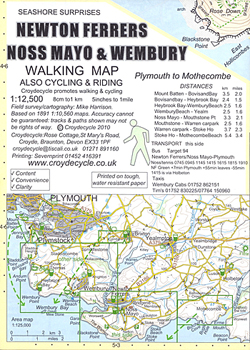
Newton Ferrers, Noss Mayo and Wembury area of southern Devon on a very detailed, GPS compatible hiking, cycling and horse riding map from Croydecycle at 1:12,500, printed on light, waterproof and tear-resistant synthetic paper. The map is part of publishers’ series covering the western coast of Somerset, both coastlines of Devon, and the adjoining areas
Bigbury, Avon & Erme Walking Map 22
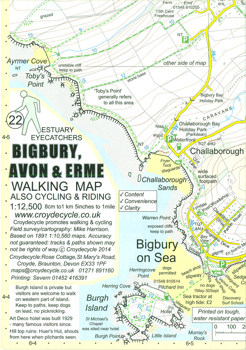
Bigbury, Avon and Erme area of southern Devon on a very detailed, GPS compatible hiking, cycling and horse riding map from Croydecycle at 1:12,500, printed on light, waterproof and tear-resistant synthetic paper. The map is part of publishers’ series covering the western coast of Somerset, both coastlines of Devon, and the adjoining areas of Dorset.
Salcombe & Hope Walking Map 20
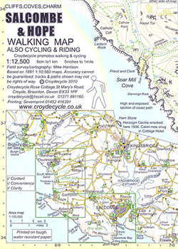
Salcombe and Hope area of southern Devon on a very detailed, GPS compatible hiking, cycling and horse riding map from Croydecycle at 1:12,500, printed on light, waterproof and tear-resistant synthetic paper. The map is part of publishers’ series covering the western coast of Somerset, both coastlines of Devon, and the adjoining areas of Dorset. Each
Prawle & Beesands Walking Map 24
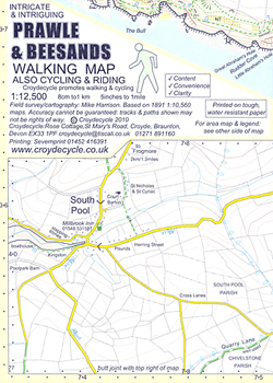
Prawle and Beesands area of southern Devon on a very detailed, GPS compatible hiking, cycling and horse riding map from Croydecycle at 1:12,500, printed on light, waterproof and tear-resistant synthetic paper. The map is part of publishers’ series covering the western coast of Somerset, both coastlines of Devon, and the adjoining areas of Dorset. Each
Scottish Cycle Routes: 30 Lowland & Highland Road Routes
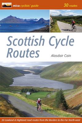
In the cyclists` guide series from Mica publishers, here are 30 circular road cycle routes of 35 miles to 115 miles, exploring the best of Scotland`s panoramic back roads from the Far North-West to the Borders. The routes include two Cairngorm crossings and the spectacular Bealach na Ba in Applecross, some of the toughest and
Chasing the Ephemeral: 50 Routes for a Successful Scottish Winter

Being in the right place at the right time is critical when Scottish Winter Climbing. This guide will help you make the right choices – do you go high or low, head east, west or north, or attempt snowed-up rock, mixed or ice climbs? With more than 600 new Scottish Winter Climbs to his credit,
Future Mapping Co. Sinu-Mollweide Political World Wall Map V.2: blue/emerald/pink/yellow PAPER
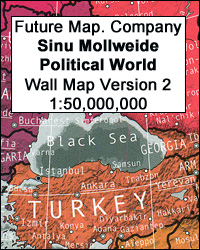
Future Mapping Company’s beautiful and innovative Sinu-Mollweide Projection Political World Wall Map in the blue – emerald – pink – yellow colouring and printed on high quality medium weight silk-finish paper. With its bright but well-coordinated glossy colours and 101 x 57.5cm / 40″ x 22.5″ in size, the map provides an excellent eye-catching, equal-area
Four Counties Ring Pearson`s Canal Companion
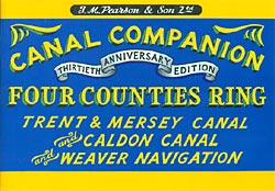
Four Counties Ring Pearson`s Canal Companion from Wayzgoose, showing sections of the Trent and Mersey Canal, the Staffordshire and Worcestershire Canal, the Shropshire Union, the Caldon Canal, the Trent Navigation, and the Weaver Navigation.Pearson’s Canal Companions have for over 30 year now been presenting Britain’s network of inland waterways on handy size, informative guides which
Porlock Walking Map 02
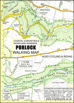
Porlock area of the western coast of Somerset on a very detailed, GPS compatible hiking, cycling and horse riding map from Croydecycle at 1:12,500, printed on light, waterproof and tear-resistant synthetic paper. The map is part of publishers’ series covering the western coast of Somerset, both coastlines of Devon, and the adjoining areas of Dorset.
Kennet & Avon Canal and River Thames Pearson`s Canal Companion

Kennet & Avon Canal and River Thames Pearson`s Canal Companion from Wayzgoose, linking London with Oxford and Bristol and showing parts of the Thames, the Avon, the Kennet and the Kennet & Avon Canal.Pearson’s Canal Companions have for over 30 year now been presenting Britain’s network of inland waterways on handy size, informative guides which
South West Coast Path Map 1 – Exmoor – Minehead – Watermouth Map 57

The easternmost part of the northern section of the South West Coast Path National Trail between Minehead and Watermouth on an exceptionally detailed contoured map at 1:15,000 from Croydecycle printed on light, waterproof and tear-resistant paper. Included in this title are street plans of Porlock, Lynton and Combe Martin.Each of the publishers’ three handy size,
Cheshire Ring and South Pennine Ring Pearson`s Canal Companion

Cheshire Ring and South Pennine Ring Pearson`s Canal Companion from Wayzgoose, showing over 165 miles of canal network including sections of the Ashton Canal, Bridgewater Canal, Calder & Hebble Navigation, Huddersfield Canals, Macclesfield Canal, Rochdale Canal, Peak Forest Canal, and Trent & Mersey Canal. Current edition of this title was published in May 2013.Pearson’s Canal
South West Coast Path Map 2 – Big Beach Devon – Watermouth – Westward Ho! Map 58
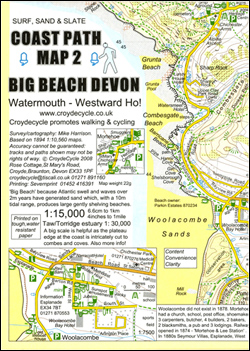
The central part of the northern section of the South West Coast Path National Trail in Devon between Watermouth and Westward Ho! on an exceptionally detailed contoured map from Croydecycle printed on light, waterproof and tear-resistant paper. The route from Watermouth to Saunton Sands is presented at 1:15,000, with the less demanding terrain around Braunton
Oxford, Grand Union and Upper Thames Pearson`s Canal Companion
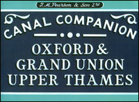
Oxford, Grand Union and Upper Thames Pearson`s Canal Companion from Wayzgoose, showing the Coventry Canal, the Oxford Canal, the upper stretch of the Thames, the Grand Union Canal and the Leicester Line. Current edition of this title was published in July 2013.Pearson’s Canal Companions have for over 30 year now been presenting Britain’s network of
Braunton & Ilfracombe Cycle Map 60 – with Tarka Trail & Barnstaple
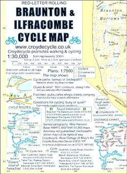
Braunton and Ilfracombe Cycle Map at 1:30,000 from Croydecycle covering the northern coast of Devon between Combe Martin and Bideford; handy size, double-sided, contoured, printed on light waterproof and tear-resistant synthetic paper and showing National Cycle routes and numerous local facilities, including campsites, pubs, etc.Topography is indicated by contours at 10m intervals, with colouring for

Hartland & Clovelly Walking Map 11
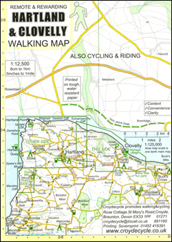
Hartland and Clovelly area of northern Devon on a very detailed, GPS compatible hiking, cycling and horse riding map from Croydecycle at 1:12,500, printed on light, waterproof and tear-resistant synthetic paper. The map is part of publishers’ series covering the western coast of Somerset, both coastlines of Devon, and the adjoining areas of Dorset. Each
Horner & Dunkery Walking Map 03
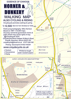
Horner and Dunkery area on the western coast of Somerset and the edge of Exmoor on a very detailed, GPS compatible hiking, cycling and horse riding map from Croydecycle at 1:12,500, printed on light, waterproof and tear-resistant synthetic paper. The map is part of publishers’ series covering the western coast of Somerset, both coastlines of