Category Archives: Maps
Morocco Rock: The Anti-Atlas

The Anti-Atlas, by Morocco Rock, is the latest selected climbs guide to Morocco`s winter sun trad climbing destination, featuring the very best routes to be found in the region around the busy market town of Tafraout, and only a couple of hours from Agadir airport.This revised and updated guide documents a colossal 1700 routes on
London – Land`s End Cycle Route: Beautiful Cycling Across Southern England

This king of guidebooks takes you onto a unique trail of traffic-calmed cycle routes in southern England from London to Land`s End; ideal if you love cycling, but don`t like traffic! A variety of landscapes, a high density of famous English landmarks and word-class cycle routes like the Bristol and Bath Railway Path, Camel Trail,
Cycling in Amsterdam and the Netherlands: The Very Best Routes in the Cyclist`s Paradise

There is no happier cyclist than a Dutch cyclist. This is not only because The Netherlands is mainly flat, but also because the Dutch enjoy the most extensive cycle network in the world. Amsterdam is famous for its cyclists and with this guidebook you`ll cycle on those routes the locals love themselves. Whether you are
Escaping London Pocket Map/Guide: a Pre-Raphaelite Pilgrimage Route
Escaping London Pocket Map/Guide from Curio-City presenting a 13-mile Pre-Raphaelite Pilgrimage Route from London Bridge to William Morris`s Red House in Bexleyheath. On one side the route is highlighted on four panels of street plans, with brief descriptions of various interesting points including the famous George Inn, Greenwich Park, the tomb of Christophe Marlowe in
Curiocity F – Fictional London
Escaping London Pocket Map/Guide from Curio-City presenting a 13-mile Pre-Raphaelite Pilgrimage Route from London Bridge to William Morris`s Red House in Bexleyheath. On one side the route is highlighted on four panels of street plans, with brief descriptions of various interesting points including the famous George Inn, Greenwich Park, the tomb of Christophe Marlowe in
Zambia InfoMap
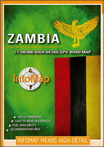
Zambia on a double-side road map from South African publishers International Motoring Productions with GPS waypoints for selected road junctions, small towns or settlements, places of interest and recommended accommodation.The map, one of a series of similar maps covering countries and selected regions of southern Africa, has rather simple cartography with somewhat basic elevation tinting,
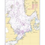
London all-on-one Transport Map
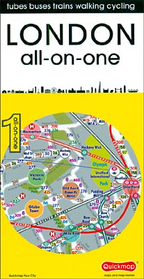
London all-on-one Transport Map from Quickmap, a handy-size, very useful pocket map for everyone who needs an at-a glance picture of public transport options, combining together information on the capital’s bus, tube and train lines.Bus routes are annotated with line numbers and streets are drawn with their width indicating the frequency of the services. Presenting
Boulder Britain: The Essential Guide to British Bouldering
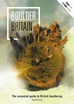
When Boulder Britain first appeared in 2012 there was nothing else like it; eight years on, there still isn`t.The UK`s most ambitious guidebook set out to showcase and guide users through the ripe wealth of bouldering all across Britain. From Cornwall to Scotland, from Wales to Northumberland, taking in the Peak, Yorkshire, Lake District and
Avon Ring and Droitwich Ring Heron Map
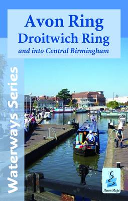
Kennet and Avon Canal and River Avon double sided map at 1:50,000 by Heron Maps offers both navigation and tourist information and includes many small detailed town plans at 1:12,500.The map divides the canal in three sections and illustrates its corridor and its proximities. Colouring distinguishes urban, woodland and areas of outstanding beauty. Motorways A
Lost Lanes: 36 Glorious Bike Rides in Southern England
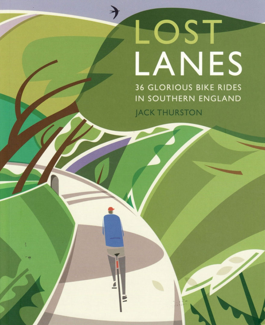
Lost Lanes: 36 Glorious Bike Rides in Southern England presents an imaginative selection of interesting bike routes in southern England including the Home Counties. 30 tours are grouped geographically, with a special ‘best for” section providing a selection of best rides for families, wild camping, pubs, gourmets, history, etc. Six of the routes are the
World Atlas of Sport

The World Atlas of Sport profiles who plays what, where and why. Looking at the globe`s major competitive sports, from American football to wrestling, a commentary on significant sporting moments and celebrities is combined with factual data, infographics, illustrative maps and an analysis of the global business. The book is divided into chapters on international
Future Map Company Commemorative Olympic World Wall Map PAPER

World Commemorative Olympic Games Political Wall Map from the Future Mapping Company, size 101.5 x 59.5cm / 40″ x 23.5″ approx ‘“ paper version, printed in the colors of the five Olympic rings and highlighting the host cities from Athens in 1896 to Rio de Janeiro in 2016. Published to coincide with the 2012 Olympic
Newton Ferrers – Noss Mayo & Wembury Walking Map 21
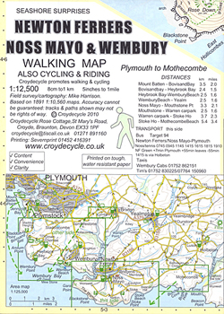
Newton Ferrers, Noss Mayo and Wembury area of southern Devon on a very detailed, GPS compatible hiking, cycling and horse riding map from Croydecycle at 1:12,500, printed on light, waterproof and tear-resistant synthetic paper. The map is part of publishers’ series covering the western coast of Somerset, both coastlines of Devon, and the adjoining areas
Bigbury, Avon & Erme Walking Map 22
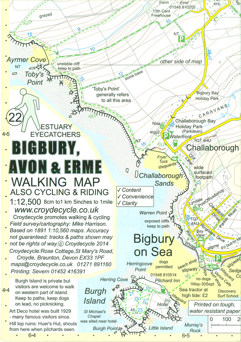
Bigbury, Avon and Erme area of southern Devon on a very detailed, GPS compatible hiking, cycling and horse riding map from Croydecycle at 1:12,500, printed on light, waterproof and tear-resistant synthetic paper. The map is part of publishers’ series covering the western coast of Somerset, both coastlines of Devon, and the adjoining areas of Dorset.
Salcombe & Hope Walking Map 20
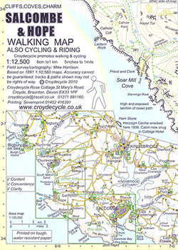
Salcombe and Hope area of southern Devon on a very detailed, GPS compatible hiking, cycling and horse riding map from Croydecycle at 1:12,500, printed on light, waterproof and tear-resistant synthetic paper. The map is part of publishers’ series covering the western coast of Somerset, both coastlines of Devon, and the adjoining areas of Dorset. Each
Prawle & Beesands Walking Map 24
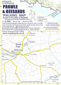
Prawle and Beesands area of southern Devon on a very detailed, GPS compatible hiking, cycling and horse riding map from Croydecycle at 1:12,500, printed on light, waterproof and tear-resistant synthetic paper. The map is part of publishers’ series covering the western coast of Somerset, both coastlines of Devon, and the adjoining areas of Dorset. Each
Devon Coast to Coast – Route 27 Cycle Map 66

Devon Coast to Coast Cycle Route, No. 27 in the Sustrans National Cycle Network, presented at 1:60,000 on a handy size, 50x35cm, double-sided contoured map from Croydecycle, printed on waterproof and tear-resistant synthetic paper. The 160km (100 miles) route from Ilfracombe to Plymouth, via Barnstaple, Bideford, Great Torrington, Okehampton and Tavistock, is presented on four
Exmoor & Taunton Cycling Map 84
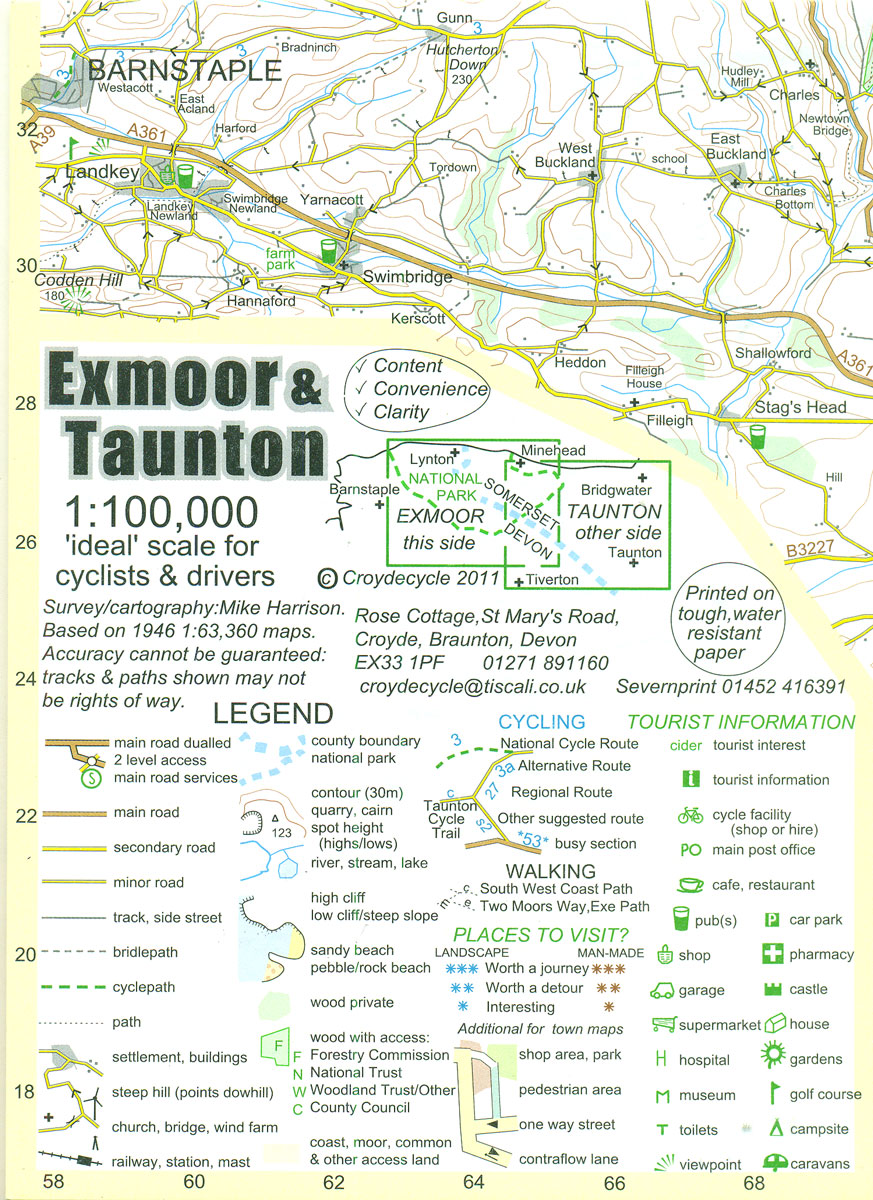
Exmoor and Taunton area of Devon and Somerset at 1:100,000 on a handy size, 50x35cm, double-sided contoured map from Croydecycle, printed on waterproof and tear-resistant synthetic paper and showing National Cycle routes and numerous local facilities, including campsites, pubs, etc. Coverage extends from Combe Martin, Barnstaple and South Molton in the west, across Exmoor, Brendon
True Grit: Selected Climbs on Peak Gritstone

True Grit is a selective topo-style guidebook covering the major Peak Gritstone crags in a single volume. The six areas featured are: The Eastern Edges; Staffordshire Grit; Castle Naze and Windgather; The Kinder Plateau; The Longdendale Valley; The Chew Valley. The style is immensely visual, with many of the crag shots offering a level of