Category Archives: Maps
Tibet ITMB
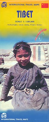
Tibet at 1:1,680,000 on an indexed, double-sided map from ITMB printed on light, waterproof and tear-resistant synthetic paper, with a map of the Lhasa Valley and enlargements of the Potala ‘“ Barkor area and the Norbulingka.The map is double-sided, dividing the region east/west, with a small overlap and Lhasa included on both sides. Coverage includes
Baja California ITMB
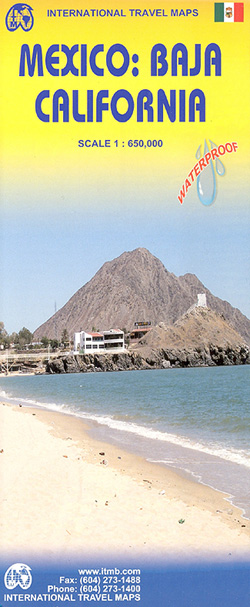
Baja California at 1:650,000 from ITMB on a waterproof and tear-resistant, indexed map, with street plans of central Tijuana, Mexicali, Ensenada, La Paz, San Jose del Cabo and Cabo San Lucas, plus historical notes and tourist information.The map is double-sided, dividing the peninsula north/south with a good overlap between the sides and also covers a
Great Britain ITMB
Great Britain on an indexed, double-sided map from ITMB printed on light, waterproof and tear-resistant synthetic paper. The map divides the country north/south across the southern part of the Lake District, with a small overlap between the sides. Coverage inludes most of Northern Ireland. Topography is shown by altitude colouring with names of main mountain
Sumatra ITMB
Sumatra at 1:1,100,000 on an indexed, double-sided map from ITMB, with coverage of the southern part of the Malaysian Peninsula with Kuala Lumpur, plus street plans of Medan, Padang and Palembang. Coverage includes the Riau and Linggga archipelagoes and most of Bangka, plus the islands west of Sumatra: Simeulue, Tuangku and the Banyak Archipelago, Nias,
Myanmar / Burma ITMB
Indexed map of Burma at 1:1,350,000 from ITMB with large, clear street plans of central Yangon (Rangoon) and Mandalay, plus an enlargement of the Bagan area. The map is double-sided, dividing the county north-south with an overlap between the sides; each side is provided with a separate index of localities.Altitude colouring presents the topography, with
Kilimanjaro & Tanzania North ITMB
Kilimanjaro on a GPS compatible map at 1:62,500 from ITMB, showing main trekking and climbing routes, with on the reverse an indexed road map of Northern Tanzania with street plans of Arusha, Dar Es Salam and Zanzibar’s Stone Town.On one side is a map of Kilimanjaro at 1:62,500. Relief is vividly shown by elevation tinting,
Saudi Arabia & Kuwait ITMB

Saudi Arabia presented at 1:1,750,000, indexed, divided between both sides of the map and accompanied by a street plan of central Riyadh, plus as a separate panel Kuwait at 1:390,000 with a street plan of Kuwait City. On one side is the northern part of Saudi Arabia, extending south to Riyadh and along the Gulf
Bangkok & Thailand South ITMB
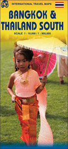
Double-sided map from ITMB, printed on light and tear-resistant synthetic paper presenting on one side a street plan of Bangkok’s central districts, with on the reverse a map of the southern part of Thailand and a street plan of Pattaya.On one side is a clear, indexed and well presented street plan of Bangkok’s central districts
Argentina North & Uruguay ITMB

Northern Argentina at 1:2,200,000 and Uruguay at 1:800,000 on a double-sided, indexed map from ITBM with large, clear street plans of central Buenos Aires and Montevideo, plans of Cรณrdoba, Rosario, Colonia del Sacramento and Punta del Este, plus an enlargement of the environs of Buenos Aires.On one side is Argentina from Buenos Aires northwards, and
Accra & Ghana South ITMB
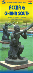
Street plan of Accra on a double-sided map from ITMB which also offers on the reverse a road map of southern Ghana and small street plans of Kumasi and Cape Coast. On one side is street plan showing Accra at 1:23,000 with coverage extending east to the Mallam district, north to the West Legon Botanical
Vancouver & Greater Vancouver ITMB
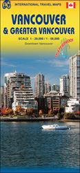
Street plan of Vancouver on waterproof and tear-resistant map from locally- based ITMB, combining on one side coverage of the central districts with an enlargement for the downtown area, plus on the reverse a map of the city with its outer suburbs, extending east to Langley and north to West Vancouver.On one side the city’s
Africa ITMB
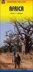
Africa on a large, indexed map at 1:5,000,000 from ITMB with country names and boundaries clearly marked on a base with physical colouring. The map is double-sided, with the division of the continent arranged so that all the countries are shown complete on either one side of the map or the other. Cape Verde Islands
Caribbean Islands East & South ITMB Travel Atlas

The islands of the eastern and southern Caribbean presented by ITMB in a handy size, A5, paperback, indexed atlas with city centre street plans of main cities. The mapping is taken from ITMB’s extensive coverage of the region on individual country maps, so scales vary.The atlas covers: Antigua and Barbuda (1:35,000/25,000, with street plans of
Antigua & Dominica ITMB

Dominica at 1:50,000 with Antigua at 1:35,000, each shown on one side of a map from ITMB indexed and accompanied by street plans of Roseau plus St John’s and the English Harbour area respectively. Road network is presented on a base showing the islands’ topography by contours and altitude colouring.Symbols indicate various places of interest
Silk Road ITMB Travel Atlas

Silk Road Travel Atlas from ITMB in a handy A5 size paperback format, showing the route from the Mediterranean ports of Syria and Lebanon, across Baghdad, Teheran, Bukhara, Samarkand, Tashkent and Kashgar to Xi’an on maps at varying scales, accompanied by a selection of street plans.The atlas uses the cartography from ITMB’s maps of the
Mauritius & Reunion ITMB
A double-sided map from ITMB presenting on one side Mauritius (1:90,000) with Rodrigues (1:140,000 approx.) and street plans of central Port Louis and Curepipe, with on the reverse a map of Reunion at 1:80,000. The islands are presented with altitude colouring and spot heights, plus names of various topographic features. National parks and other protected
Turkey ITMB
Turkey on an indexed road map at 1:1,100,000 from ITMB printed on light, waterproof and tear-resistant synthetic paper; an inset provides a street plan of the old historic part of Istanbul with the city’s main tourist sights. The map is double-sided, with a small overlap between the sides. Most of the Mediterranean coastline is covered
Nepal ITMB
Nepal on an indexed, double-sided map with an enlargement for Kathmandu Valley and a street plan of the capital. The map divides the country east/west, with a generous overlap between the two sides. Topography is shown by elevation colouring with peak heights in metres, but, given the importance of geography to the country’s tourism, relatively
New Guinea (Papua New Guinea and Indonesia) ITMB
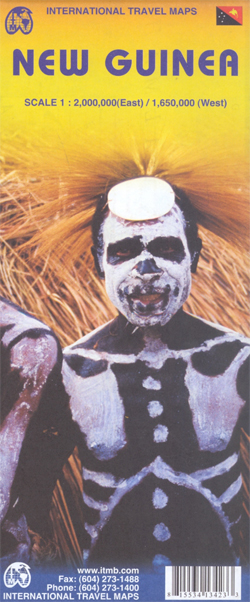
New Guinea Island on a double-sided, indexed map from ITMB covering on one side Papua New Guinea at 1:2,000,000 and on the reverse the Papua Province of Indonesia with the adjoining islands of western Indonesia. On one side is a map of Papua New Guinea at 1:2,000,000 covering the whole of the country except for