Category Archives: Maps
Ontario Southwestern: Brantford – London – Kitchener/Waterloo – Bruce Peninsula
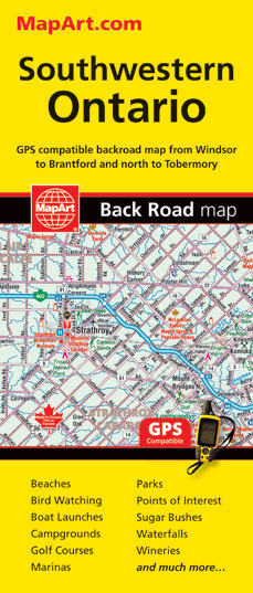
The south-western part of Ontario on a detailed, double-sided road map at 1:250,000 extending from Lake Erie to Lake Huron and the Bruce Peninsula, with five street plans at 1:25,000 covering central London, Windsor, Sarnia, Owen Sound and Stratford.Coverage of the region is divided between the two sides of the map, with a good overlap
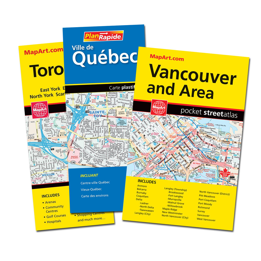
Ontario South Central – Toronto – Niagara Falls – Kitchener-Wateroo Mapart Back Road Map
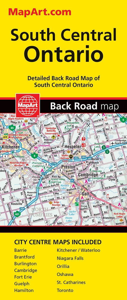
The south-central part of Ontario on a detailed, double-sided road map at 1:250,000 extending from Niagara Falls west to Kitchener/Waterloo and north beyond Orillia, with 13 street plans covering central Toronto, Niagara Falls, Guelph and other main cities of the region.On one side is an indexed road map showing the region at 1:250,000. Coverage extends
Ontario Eastern MapArt
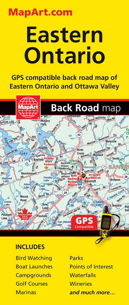
Eastern Ontario on an indexed, double-sided, GPS-compatible road map at 1:250,000 presenting the region on three panels. On one side coverage extends along the northern shore of Lake Ontario from Newcastle Village (east of Toronto and Oshawa) to Kingston and northwards to the southern access to the Algonquin Provincial Park. On the reverse two more
Sault Ste. Marie
Double-sided, indexed street plan of Sault Ste. Marie, including Sioux Lookout, Elliot Lake, Espanola, Thessalon, Wawa, Blind River, and Chapleau.Street plans from the MapArt / Canadian Cartographics Corporation / JDM Gรฉo publishing group are usually produced at scales around 1:25,000 to 1:35,000 with smaller towns often shown at more detailed scales. All plans have street
Canada – USA – Mexico Road Atlas
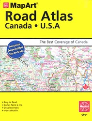
Canada and USA on an A4 spiral-bound road atlas from MapArt Publishing with 36 city maps for Canada and over 40 maps of towns and urban conurbations in USA. Canada is covered at different scales according to the density of urban development (see below), with for USA continuous coverage at 1:2,130,000 rather than state-by-state mapping
Calgary & Southern Alberta Street Atlas
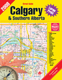
Street atlas of Calgary and Southern Alberta, Aidrie, Banff, Beiseker, Black Diamond, Bragg Creek, Brooks, Canmore, Chestermere, Coaldale, Cochrane, Crowsnest Pass, Crossfield, Drumheller, High River, Innisfail, Irricana, Lake Louise, Medicin Hat, Okotoks, Olds, Red Deer, Redwood Meadows, Strathmore, Taber and Turner Valley. The atlas is part of an extensive coverage of Canadian cities and towns
Edmonton & Northern Alberta Street Atlas
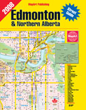
Street atlas of Edmonton and northern Alberta, including Beaumont, Bonnyville, Camrose, Cold Lake, Devon, Drayton Valley, Edson, Fort McMurray, Fort Saskatchewan, Grande Prairie, Hinton, Jasper, Lacombe, Leduc, Lloydminster, Morinville, Nisku, Peace River, Ponoka, Red Deer, Rocky Mountain House, St. Albert, St. Paul, Sherwood Park, Slave Lake, Stettler, Stony Plain, Sylvan Lake, Vegreville, Wainwright, Wetaskiwin and
Western Canada MapArt
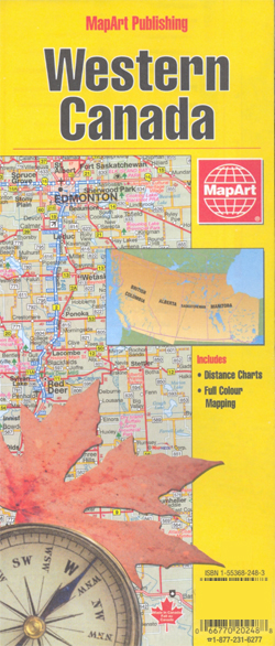
Double-sided overview map of Western Canada, showing on one side the western part of Ontario (from approx. 90ยบ, the boundary of the Central Time Zone), Manitoba and Saskatchewan, and on the reverse Alberta and British Columbia, plus the Alaska panhandle below 60 ยบ.The map shows the region’s road network, including selected local roads. Rest and
Winnipeg Pocket Street Atlas
Pocket street atlas of Winnipeg, part of an extensive coverage of Canadian cities and towns from the country’s largest map publisher, MapArt. The mapping is usually at 1:25,000 or 1:31,250. Colouring distinguishes general build-up areas, shopping centres, public buildings and institutions, historical sites and places of interest, parks, etc. One way streets and pedestrian zones
Inflatable Globe NASA Earth from Space

The 40 cm diameter EarthBall by ITMB features the latest generation of NASA satellite imagery and are the most visually authentic world globes available.
Calgary Pocket Street Atlas
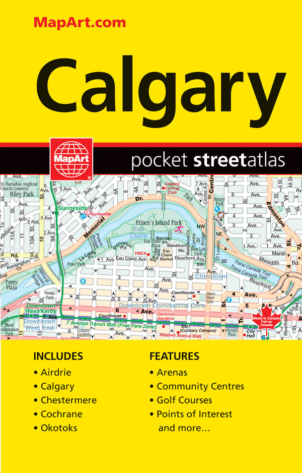
Pocket size street atlas of Calgary area at 1:25,000 with an enlargement showing the downtown Area in greater detail at 1:15,000, plus road maps of the environs of Calgary at 1:333,333 and of southern Alberta at 1:2,500,000Street plans and pocket atlases from the MapArt / Canadian Cartographics Corporation / JDM Gรฉo publishing group are usually
Alberta MapArt Back Road Atlas
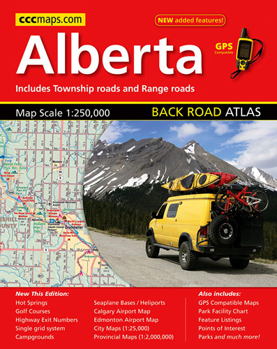
Alberta Back Roads Atlas at 1:250,000 in an A4 spiral-bound road atlas, with its extensive index also listing points of interest, plus a table of facilities in the national and provincial parks, town centre street plans of the province’s four main cities, airport access maps, etc.Mapping at 1:250,000 covers the bulk of the province, including
Atlantic Canada – New Brunswick – Nova Scotia – Prince Edward Island – Newfoundland
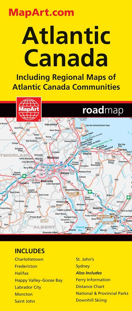
Atlantic Provinces of Canada on an indexed road map at 1:800,000 with Newfoundland at 1:1,400,000, plus street maps of the region’s main cities, an overview route planning map, a distance table, and contact details for information on ferry services.On one side two panels present at 1:800,000 New Brunswick, Nova Scotia and Prince Edward Island, plus
Florida ITMB
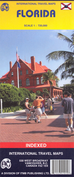
This double-sided sheet carries a great amount of information on Florida: on one side is a map of the larger part of the State and in an inset an administrative map showing counties and population per county. On the reverse, the Western part of the State, with a distance chart in miles, maps showing average
Africa North-East ITMB
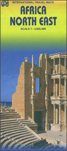
North-western Africa at 1:3,800,000 on an indexed, double-sided map from ITMB with topography presented by altitude colouring. The map divides the region north/south, extending on its northern side from the Mediterranean to the southernmost tip of Eritrea and Ndjamena in Chad, plus westwards to the longitude of 10ยฐ west. The southern half extends to beyond
Bosnia & Montenegro ITMB
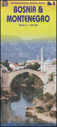
Bosnia-Herzegovina and Montenegro presented at 1:400,000 on a double-sided road map from ITMB. The map divides the region north/south, with a very generous overlap and Sarajevo included on both sides. Coverage includes the whole of Kosovo. Names of larger towns in Montenegro, Kosovo and in the adjoining regions of Serbia are also shown in the
Africa Western ITMB
Western Africa at 1:3,400,000 on an indexed, double-sided map from ITMB providing coverage of the whole of Benin, Burkina Faso, Gambia, Ghana, Guinea, Guinea Bissau, Ivory Coast, Liberia, Mali, Mauritania, Morocco, Senegal, Sierra Leone and Togo, plus most of Algeria and the western parts of Niger and Nigeria. The map is double-sided, dividing the region
England & Wales ITMB
England and Wales on an indexed road map at 1:580,000 from the Vancouver-based ITMB, with coverage extending north just beyond Perth and Dundee to include the southern and the central part of Scotland. The map is double-sided, with a good overlap between the sides, and shows the road network with the numbering of the A
USA South: Atlantic States ITMB
The southern part of the Atlantic Seaboard of USA on an indexed, double-sided road map at 1:1,000,000 from ITMB, with an enlargement of the Orlando Region including Disney World, plus street plans of the International Drive area, downtown Miami, and Miami Beach. Coverage by the road map extends north to Philadelphia, and westwards to Pittsburgh