Category Archives: Maps
Edmonton – Sherwood Park FastTrack Map
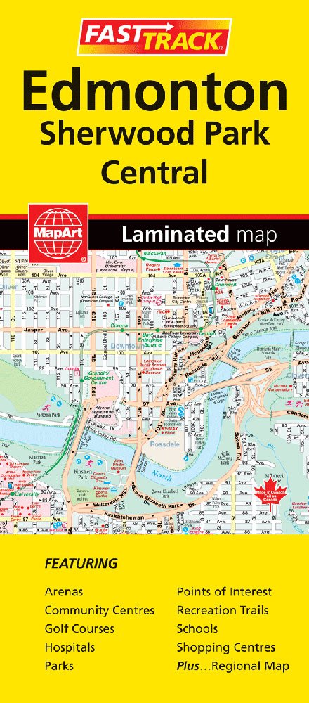
Edmonton on an indexed, double-sided, waterproof and tear-resistant FastTrack map presenting the city’s central districts and Sherwood Park at 1:30,000, with an enlargement showing in greater detail Edmonton’s downtown area at 1:15,000, plus a map of the Edmonton conurbation at 1:250,000. Street plans from the MapArt / Canadian Cartographics Corporation / JDM Gรฉo publishing group
Calgary FastTrack
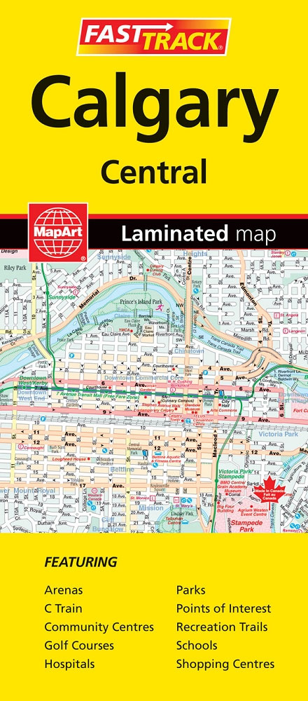
Central districts of Calgary on a double-sided, waterproof and tear-resistant, indexed street plan at 1:28,000. Coverage includes the city’s international airport.Street plans from the MapArt / Canadian Cartographics Corporation / JDM Gรฉo publishing group are usually produced at scales around 1:25,000 to 1:35,000 with smaller towns often shown at more detailed scales. All plans have
Ottawa – Gatineau FastTrack
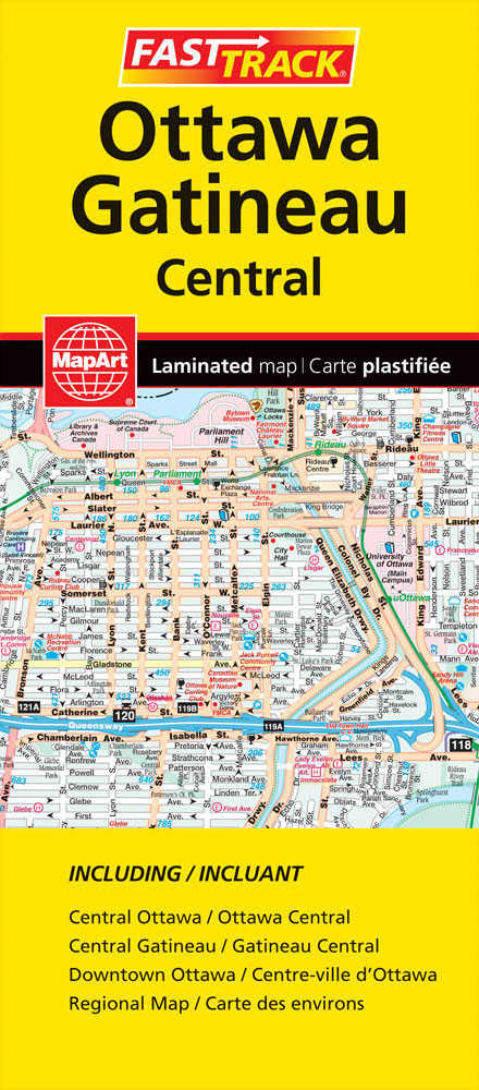
Ottawa with Gatineau on an indexed, double-sided, waterproof and tear-resistant street plan. On one side are the central districts of Ottawa, presented at 1:26,500, with coverage extending to show road access to the Ottawa Macdonald-Cartier International Airport. On the reverse coverage of the main map is extended across the river to include Hull and Gatineau.
Niagara Region (Canada) FastTrack Map
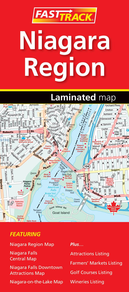
The Canadian side of the Niagara Falls region on an indexed, double-sided, waterproof and tear-resistant FastTrack map presenting the region on four panels. On one side are street plans of central Niagara Falls, including the border crossings and the adjoining part of the US side, plus Niagara-on-the-Lake (both at1:25,000). The downtown area of Niagara Falls
Quebec City and Environs Street Atlas
Street atlas of Quebec City and environs, including Beauport, Beaupre, Bernieres, Boischatel, Bourg-Royal, Breakeyville, Cap-Route, Cap-Sante, Charlesbourg, Charny, Chateau-Richer, Donnacona and other locations. The atlas is part of an extensive coverage of Canadian cities and towns from the country’s largest map publisher, MapArt. The mapping is usually at 1:25,000 or 1:31,250. Colouring distinguishes general build-up
Quรฉbec Province FastTrack
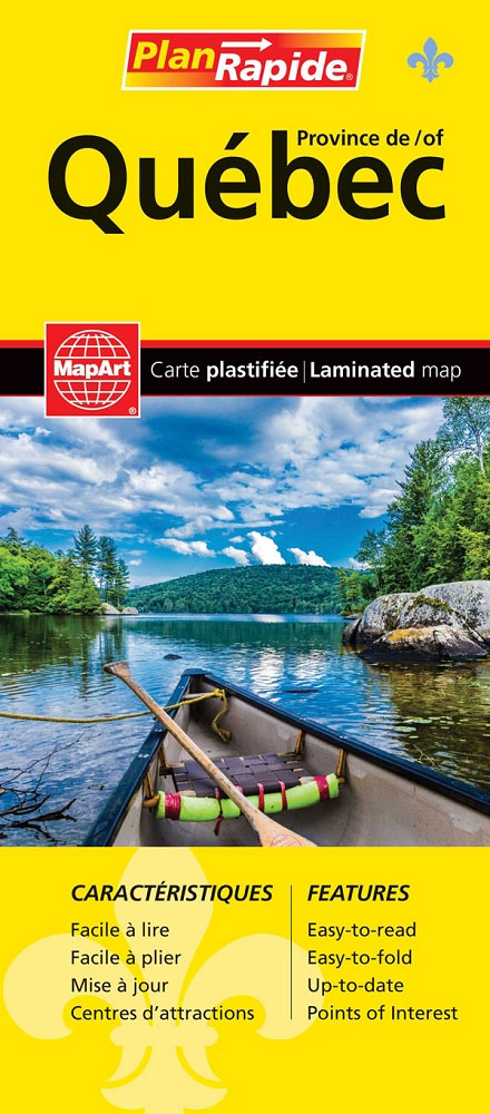
Waterproof and tear-resistant FastTrack map covering in a handy-size format Quebec Province, presented on five panels at different scales according to the density of the road network. Each panel clearly shows where to find the adjoining area.The main part of the province, roughly from Montreal to Quebec City, is shown at 1:588,000 indicating paved, loose
Prince George BC
Double-sided, indexed street plan of Prince George, including Dawson Creek, Fort St. John, Kitimat, Prince Rupert, Quesnel, Smithers, Terrace, and Williams Lake.Street plans from the MapArt / Canadian Cartographics Corporation / JDM Gรฉo publishing group are usually produced at scales around 1:25,000 to 1:35,000 with smaller towns often shown at more detailed scales. All plans
Victoria FastTrack
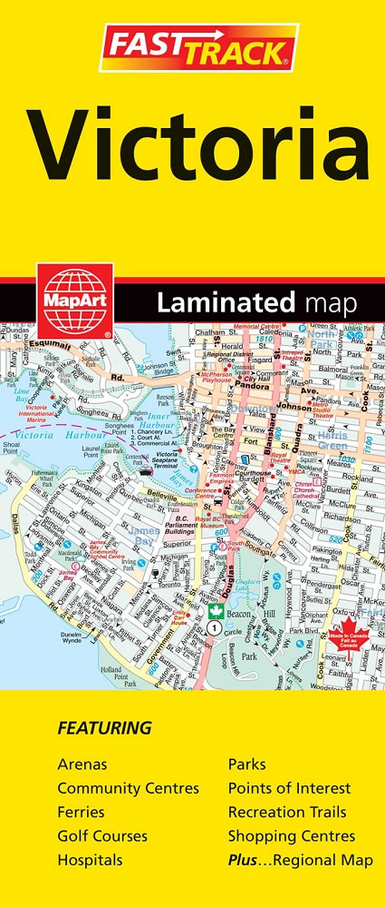
Victoria on an indexed, double-sided, waterproof and tear-resistant street plan, showing on one side the city at 1:25,000 with its downtown area presented in greater detail at 1:15,000. On the reverse coverage of the main map is extended westwards beyond View Royal to include Colwood and Langford. Also included here is a road map presenting
Florida MapArt Maps and Attractions Atlas
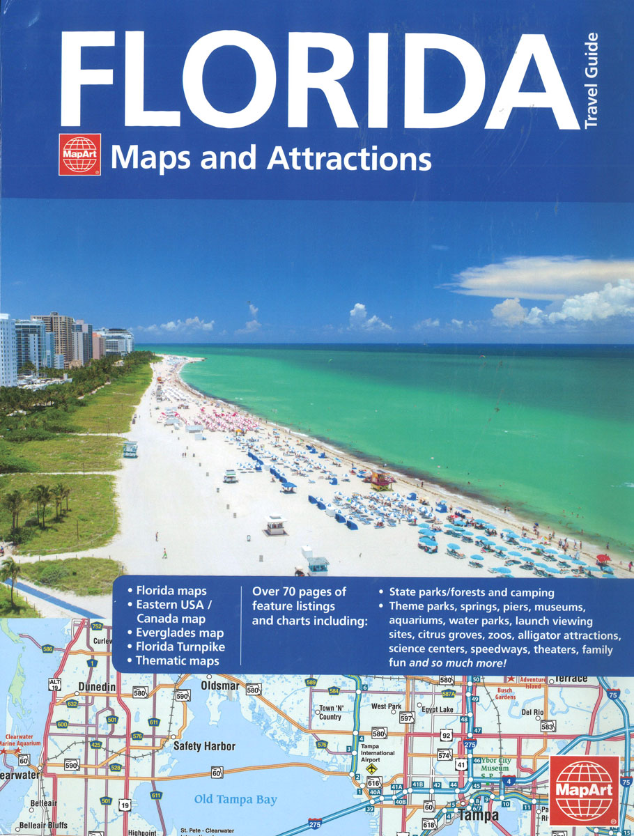
Mapping formthe entire state of Florida at 1:250,000 in an easy-to-read and aesthetically pleasing style to help you navigatePacked with over 3,00 listed attractions and features to discover all that Florida has to offer.An easy-to-read, simplified map of the Eastern USA/Canada to help you travel to your Florida destination from other states and provinces.Filled with
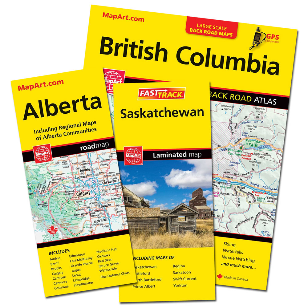
Alberta FastTrack
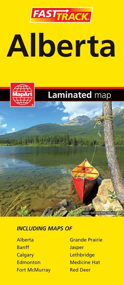
Waterproof and tear-resistant FastTrack map presenting in a handy-size format a road map of Alberta, plus enlargement of the environs of Calgary and Edmonton, and street plans Banff, Jasper, Fort McMurray, Grande Prairie, Lethbridge, Medicine Hat and Red Deer.The province is presented at 1:1,500,000 divided north/south with a small overlap between the sides. Its famous
Ontario Western Street Atlas
Street atlas of Western Ontario, inclding Amherstburg, Aylmer, Ayr, Belle River, Belmont, Blenheim, Blue Mountain, Brant, Brantford, and other locations. The atlas is part of an extensive coverage of Canadian cities and towns from the country’s largest map publisher, MapArt. The mapping is usually at 1:25,000 or 1:31,250. Colouring distinguishes general build-up areas, shopping centres,
Quebec City FastTrack
Montreal on an indexed, double-sided, waterproof and tear-resistant FastTrack map presenting the city’s central districts at 1:26,000, with an enlargement showing in greater detail Montreal’s downtown area at 1:15,000, plus a road map of the surrounding district at 1:250,000.Street plans from the MapArt / Canadian Cartographics Corporation / JDM Gรฉo publishing group are usually produced
Saskatchewan MapArt
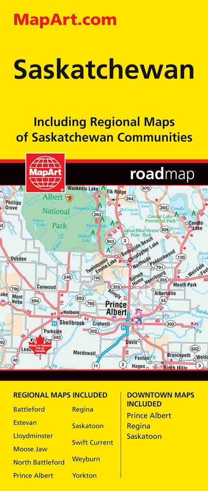
Saskatchewan on an indexed road map at 1:1,250,000 with on the reverse street maps of the province’s 10 main towns, including detailed plans of downtown Regina, Saskatoon and Prince Albert, plus a distance table.On one side is a road map of Saskatchewan at 1:1,250,000. Road network indicates paved, gravel and seasonal roads, with distance marked
British Columbia MapArt
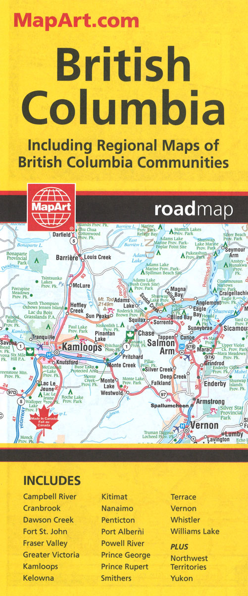
British Columbia, with coverage extending to Calgary to include the Banff and Jasper National Parks, on an indexed, double-sided road map presenting the whole province at 1:1,500,000, plus numerous enlargement and street plans providing more detailed mapping of the Vancouver – Fraser Valley area and several towns.The map divides the province north/south with a generous
Ottawa and Environs Street Atlas
169-page street atlas of Ottawa and Environs, including Angers, Aylmer, Buckingham, Cantley, Chelsea, Gatineau, Hull, Masson, St. Pierre de Wakefield, Brockville, Cornwall, Pembroke and other locations. The atlas is part of an extensive coverage of Canadian cities and towns from the country’s largest map publisher, MapArt. The mapping is usually at 1:25,000 or 1:31,250. Colouring
Ottawa – Gatineau Pocket Street Atlas
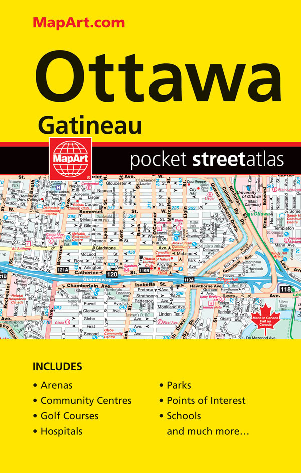
Pocket size street atlas of Ottawa and Gatineau at 1:30,000 with an enlargement showing the downtown area in greater detail at 1:20,000. The index includes a list of places of interest.Street plans and pocket atlases from the MapArt / Canadian Cartographics Corporation / JDM Gรฉo publishing group are usually produced at scales around 1:25,000 to
Ottawa MapArt Street Plan
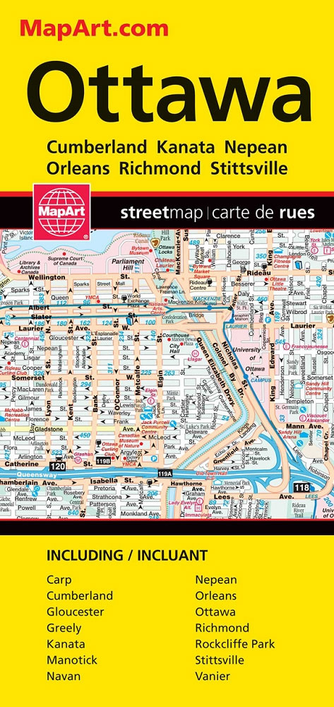
Ottawa at 1:25,000 on a large, double-sided, indexed street map of the city and its outskirts, with an enlargement for the downtown area at 1:20,000 plus a road map of the surrounding region at 1:800.000. Coverage extends from the riverside area of Gatineau and Hull north of the Ottawa River to Manotick, with Greely shown
Alberta MapArt
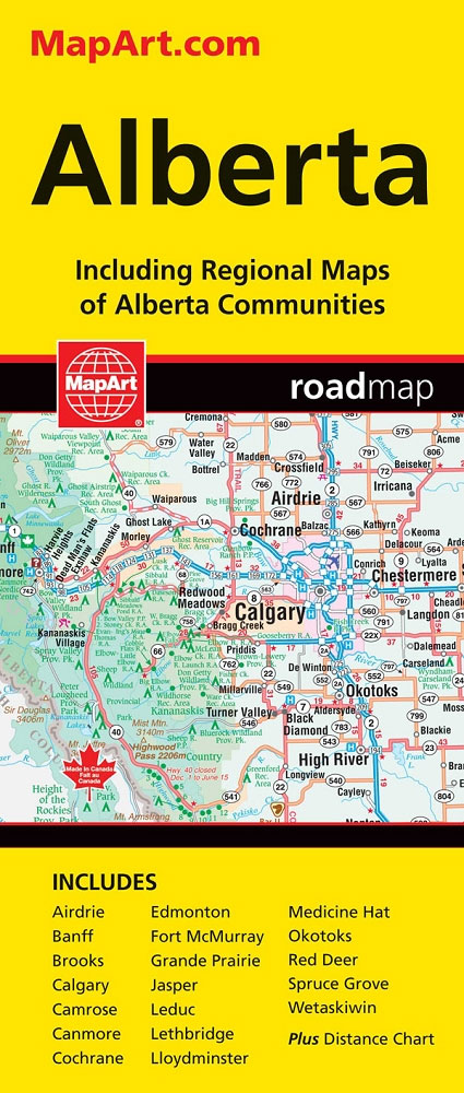
Alberta, including the Banff and Jasper National Parks, on an indexed road map at 1:1,500,000 accompanied by several street maps of its main cities, including plans of Calgary, Edmonton and the holiday resorts of Banff, Jasper and Canmore.The road map shows Alberta at 1:1,500,000 prominently highlighting its numerous national and provincial parks. Topography is shown
Montreal MapArt Street Plan

Double-sided, indexed street plan of Montreal, including the neighbouring Laval and Longeuil, with an enlargement for downtown area in greater detail. Coverage includes the city`s Pierre-Elliott-Trudeau international airport, plus Baie d’Urfรฉ, Beaconsfield, Brossard, Cรดte-St-Luc, Dollard-des-Ormeaux, Dorval, Hampstead, Kirkland, Mont-Royal, Outremont, Pointe-Claire, Senneville, Ste-Anne-de-Bellevue, St-Lambert, St-Pierre and Westmount. Map legend includes English.Street plans from the MapArt
Quรฉbec Province MapArt
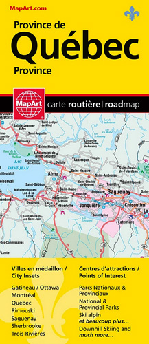
Quebec Province on an indexed, double-sided road map presenting its southern part in three panels. The main part of the province, from Montreal to Quebec City and Sherbooke, is covered at 1:500,000. Two further panels at 1:1,000,000 extend coverage further west and east: westward to the Ontario border and eastwards to Saguenay and Riviรจre-du-Loup (so