Category Archives: Maps
Greater Victoria BC MapArt
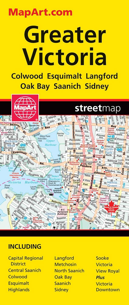
Double-sided, indexed street plan of Greater Victoria and the Saanich Peninsula at 1:27,000, with downtown Victoria shown in greater detail at 1:15,000. Coverage includes Colwood, Esquimalt, Langford, Oak Bay and Sidney.Also provided is road map showing the area covered by the street plan with the adjoining part of the Vancouver Island at 1:225,000.Street plans from
Vancouver Island – Sunshine Coast – Gulf Islands BC MapArt
Vancouver Island with the Sunshine Coast of mainland British Columbia plus the Gulf presented at 1:550,000 on an indexed road map presenting accompanied by numerous enlargements and street maps of the region’s most visited locations.On one side is the main indexed road map showing Vancouver Island with the adjoining mainland BC and the Gulf Islands
Abitibi-Tรฉmiscamingue QC
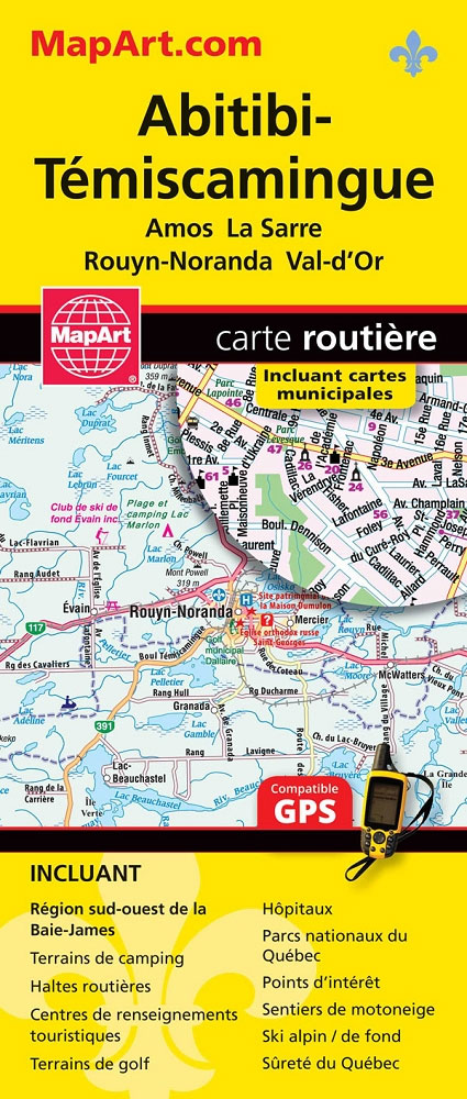
Street plans of several towns in south-western part of Quebec province.
Vancouver & Area MapArt Street Plan
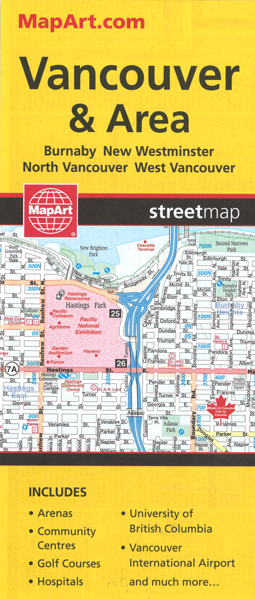
Double-sided, indexed street plan of Greater Vancouver at 1:25,000 with an enlargement of the downtown area in greater detail at 1:19,000. Coverage includes Burnaby, New Westminster, North Vancouver and West Vancouver.Street plans from the MapArt / Canadian Cartographics Corporation / JDM Gรฉo publishing group are usually produced at scales around 1:25,000 to 1:35,000 with smaller
Okanagan Communities – Kelowna BC
Double-sided, indexed street plan at 1:30,000 of towns in the Okanagan Region of British Columbia, including Kelowna, Penticton, Vernon, Coldstream, Enderby, Lake County, Okanagan Falls, Oliver, Armstron, Osoyoos, Peachland and Summerland. Also provided is a small road map of the region with coverage including Hope, Kamloops and Revelstoke.Street plans from the MapArt / Canadian Cartographics
Winnipeg – Headingley – Selkirk
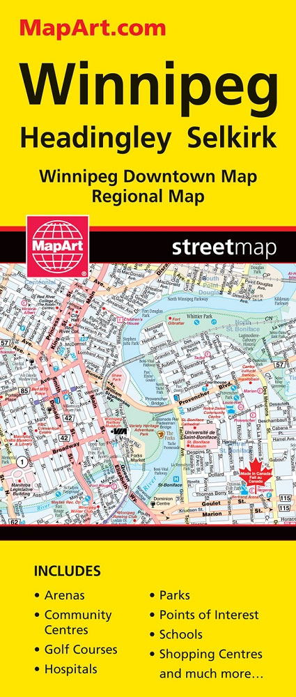
Double-sided indexed street plan of Winnipeg covering the city at 1:30,000 with an enlargement presenting its downtown area in greater detail at 1:20,000. Coverage includes Headingley and Selkirk. Also provided is a road map covering at 1:1,500,000 souther Manitoba from the US border to Fisher River.Street plans from the MapArt / Canadian Cartographics Corporation /
Kingston ON
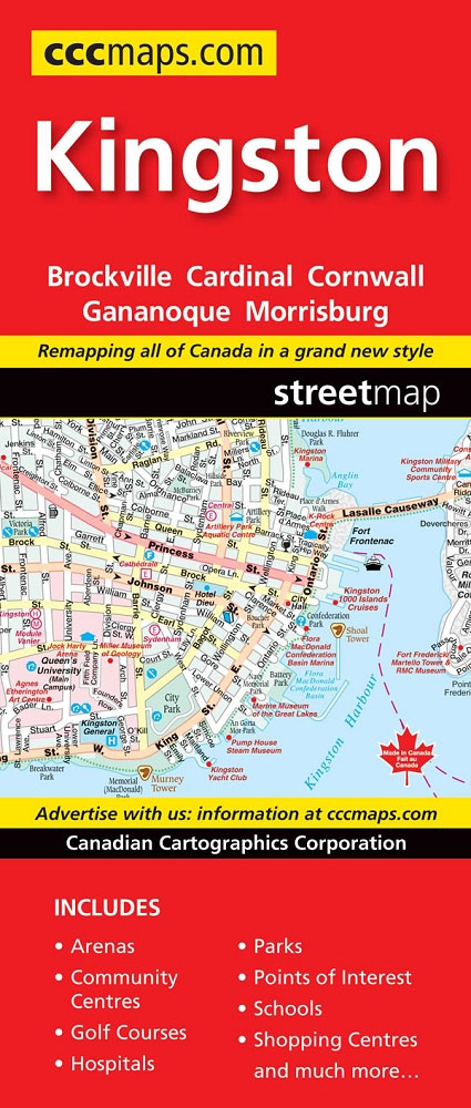
Kingston, Ontario on a double-sided map combining a street plan of Kingston at 1:25,000 with an enlargement of the downtown area, plus on the reverse individual street plans at 1:25,000 of Gananoque, Brockville, Prescott, Iroquois, Cardinal, Morrisburg and Cornwall with an extension to Long Sault Parkway. Each street plan is indexed.Street plans from the MapArt
My Father`s Paradise

In a remote corner of the world, forgotten for nearly three thousand years, lived an enclave of Kurdish Jews so isolated that they still spoke Aramaic, the language of Jesus. Mostly illiterate, they were self-made mystics and gifted storytellers and humble peddlers who dwelt in harmony with their Muslim and Christian neighbors in the mountains
St. John`s NL
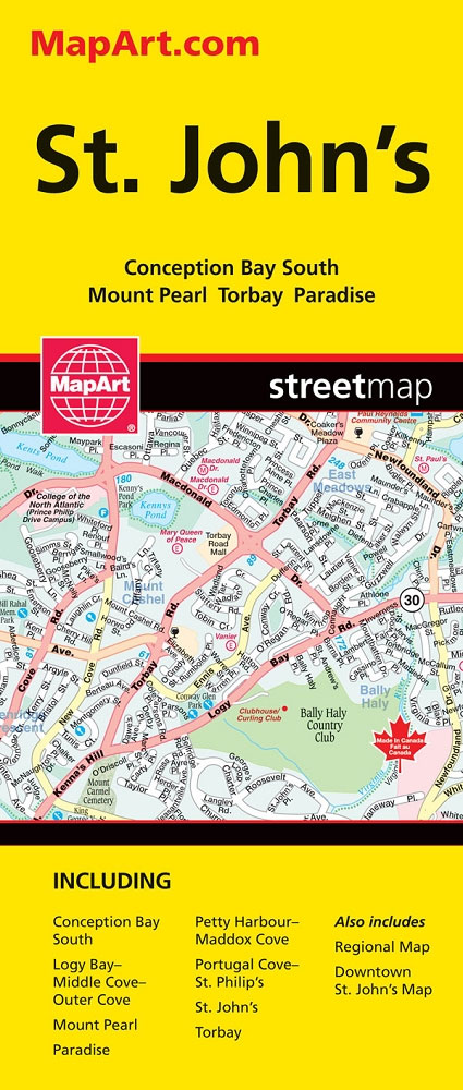
Double-sided indexed street plan of St. John’s, including Mount Pearl, Conception Bay South, Paradise and Torbay. An enlargement shows downtown St. John`s in greater detail at 1:15,000. Also included is a road map covering the Avalon Peninsula at 1:650,000.Street plans from the MapArt / Canadian Cartographics Corporation / JDM Gรฉo publishing group are usually produced
The Storyteller of Jerusalem: The Life and Times of Wasif Jawhariyyeh, 1904-1948

ONCE UPON A TIME IN JERUSALEM The memoirs of Wasif Jawhariyyeh are a remarkable treasure trove of writings on the life, culture, music, and history of Jerusalem. Spanning over four decades, from 1904 to 1948, they cover a period of enormous and turbulent change in Jerusalems history Ottoman rule, the British mandate, and the run-up
Halifax – Dartmouth & Area MapArt
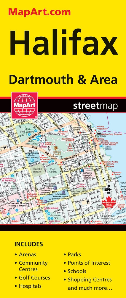
Double-sided indexed street plan of the Halifax – Dartmouth area at 1:25,000, with downtown Halifax shown in greater detail at 1:15,000. Coverage includes the Robert L. Stanfield International Airport, plus Beaver Bank, Bedford, Cole Harbour, Cow Bay, Eastern Passage, Fall River, Lakeside, Lower- Middle- and Upper Sackville, Middle Beaver Bank, Port Wallace, Timberlea and Waverley.Street

Brantford – Stratford – Woodstock

Double-sided, indexed street plan of Brantford, Stratford and Woodstock, including Simcoe Delhi, Paris, Port Dover, St. Marys, and Waterford. Street plans from the MapArt / Canadian Cartographics Corporation / JDM Gรฉo publishing group are usually produced at scales around 1:25,000 to 1:35,000 with smaller towns often shown at more detailed scales. All plans have street
Winnipeg and Area Street Atlas
Street atlas of Winnipeg and the surrounding area, part of an extensive coverage of Canadian cities and towns from the country’s largest map publisher, MapArt. The mapping is usually at 1:25,000 or 1:31,250. Colouring distinguishes general build-up areas, shopping centres, public buildings and institutions, historical sites and places of interest, parks, etc. One way streets
Manitoba & Saskatchewan MapArt Road Atlas
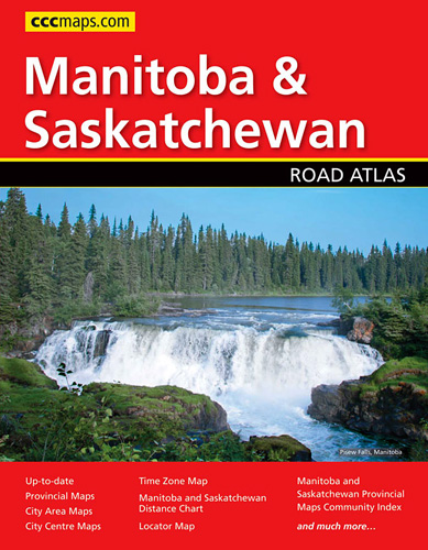
Manitoba and Saskatchewan in an A4 paperback road atlas from Canadian Cartographics Corporation covering the two provinces at 1:1,200,000, with more detailed mapping of 24 city areas, plus 19 street plans including Winnipeg, Regina and Saskatoon.Road mapping at 1:1,200,000 covers all but the northernmost parts of the two provinces. Road classification indicates unpaved or unimproved
Saskatchewan Back Road Atlas
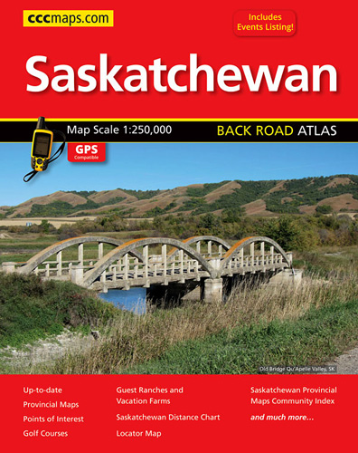
Saskatchewan road atlas presenting the province on detailed, GPS-compatible mapping at 1:250,000, plus a table of facilities in the national and provincial parks, an extensive list of local events, an index of points of interest, etc. Mapping at 1:250,000 covers most of the province, but without some parts of its northernmost regions, as indicated in
Ontario Northern FastTrack Map: North Bay – Sudbury – Thunder Bay – Lake of the Woods
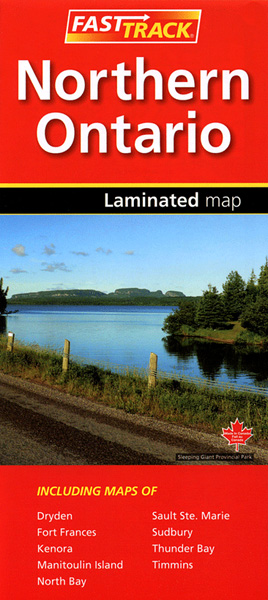
Waterproof and tear-resistant FastTrack map covering in a handy-size format the north-western part of Ontario, from North Bay and the border with Quebec to the province’s border with Manitoba, plus eight street maps of main cities and a distance table.On one side two panels present road maps. The main map at 1:1,930,000 covers the area
Calgary – Banff & Enviros FastTrack
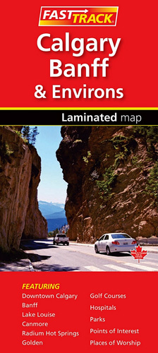
Waterproof and tear-resistant FastTrack map presenting in a handy-size format a street plan of Calgary and a road map of the nearby national and provincial parks in the Rocky Mountains, both at 1:250,000, plus a more detailed street plan of downtown Calgary and plans of the main holiday resorts.On one side Calgary with its outer
Newfoundland & Labrador FastTrack
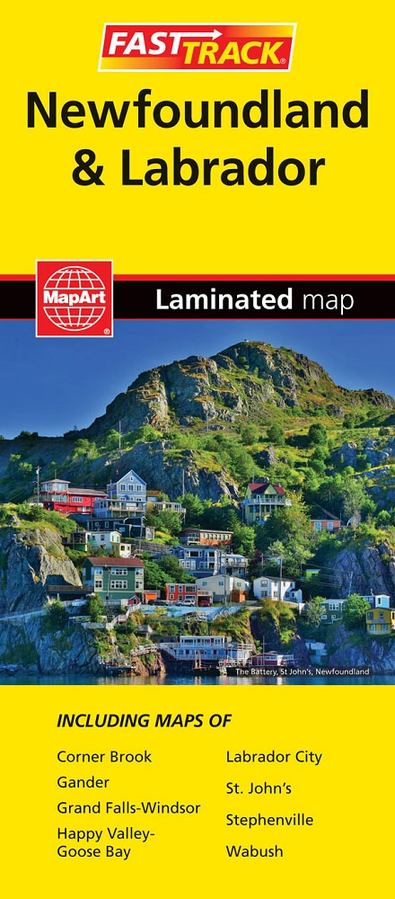
Waterproof and tear-resistant FastTrack map presenting in a handy-size format a road map of Newfoundland with an enlargement of the Avalon and Bonavista Peninsulas and several street maps including St. John’s, plus coverage of Labrador, also accompanied by street maps.Newfoundland is presented on an indexed map at 1:1,172,000, with its south-eastern area of the Avalon