Category Archives: Maps
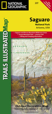
Mammoth Cave National Park KY
Map No. 234, Mammoth Cave National Park, KY, in an extensive series of GPS compatible, contoured hiking maps of USA’s national and state parks or forests and other popular recreational areas. Cartography based on the national topographic survey, with additional tourist information.The maps, with most titles now printed on light, waterproof and tear-resistant plastic paper,
Pagosa Springs – Bayfield CO

Map No. 145, Pagosa Springs – Bayfield, CO, in an extensive series of GPS compatible, contoured hiking maps of USA’s national and state parks or forests and other popular recreational areas. Cartography based on the national topographic survey, with additional tourist information.The maps, with most titles now printed on light, waterproof and tear-resistant plastic paper,
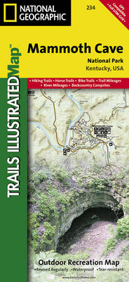
Saguaro National Park AZ
Map No. 237, Saguaro National Park, AZ, in an extensive series of GPS compatible, contoured hiking maps of USA’s national and state parks or forests and other popular recreational areas. Cartography based on the national topographic survey, with additional tourist information.The maps, with most titles now printed on light, waterproof and tear-resistant plastic paper, highlight
Merced and Tuolumne Rivers – Stanislaus National Forest CA
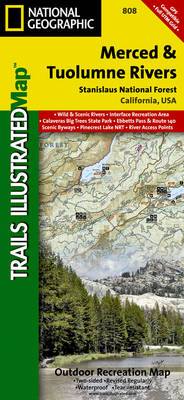
Map No. 808, Merced and Tuolumne Rivers / Stanislaus National Forest, CA, in an extensive series of GPS compatible, contoured hiking maps of USA’s national and state parks or forests and other popular recreational areas. Cartography based on the national topographic survey, with additional tourist information.The maps, with most titles now printed on light, waterproof
Shaver Lake – Sierra National Forest CA
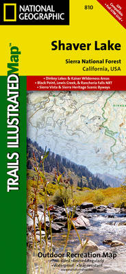
Map No. 810, Shaver Lake / Sierra National Forest, CA, in an extensive series of GPS compatible, contoured hiking maps of USA’s national and state parks or forests and other popular recreational areas. Cartography based on the national topographic survey, with additional tourist information.The maps, with most titles now printed on light, waterproof and tear-resistant
Northern Baja California NGS Adventure Map 3103
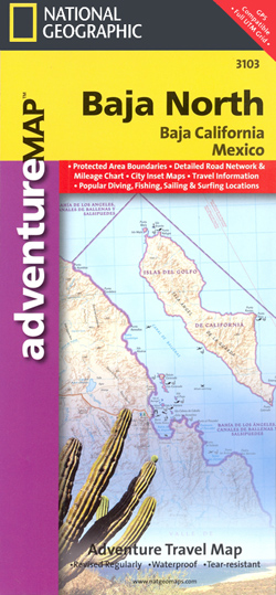
Northern Baja California on double-sided, waterproof and tear-resistant, GPS compatible Adventure Map at 1:450,000 from the NGS, with street plans of Tijuana, Mexicali and Ensenada and extensive tourist information.Topography is shown by contours at 100m intervals, enhanced by subtle relief shading, spot heights and graphics for marshlands to provide a very clear presentation of the
Caribbean National Forest – Puerto Rico NGS Trails Illustrated Map 790
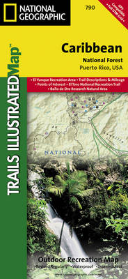
Map No. 790, Caribbean National Forest, Puerto Rico, in an extensive series of GPS compatible, contoured hiking maps of USA’s national and state parks or forests and other popular recreational areas. Cartography based on the national topographic survey, with additional tourist information.The maps, with most titles now printed on light, waterproof and tear-resistant plastic paper,
Southern Baja California NGS Adventure Map 3104
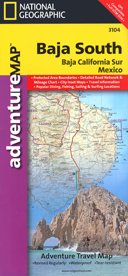
Southern Baja California on double-sided, waterproof and tear-resistant, GPS compatible Adventure Map at 1:450,000 from the NGS, with street plans of La Paz, San Josรฉ del Cabo and Cabo San Lucas, and extensive tourist information.Topography is shown by contours at 100m intervals, enhanced by subtle relief shading, spot heights and graphics for marshlands to provide
Kachemak Bay State Park AK NGS Trails Illustrated Map 763
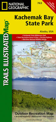
Map No. 763, Kachemak Bay State Park, AK, in an extensive series of GPS compatible, contoured hiking maps of USA’s national and state parks or forests and other popular recreational areas. Cartography based on the national topographic survey, with additional tourist information.The maps, with most titles now printed on light, waterproof and tear-resistant plastic paper,
Northern Yucatan Peninsula NGS Adventure Map 3105
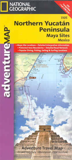
Northern Yucatan on a waterproof and tear-resistant, GPS compatible Adventure Map from the NGS, with street plans of central Cancรบn and Mรฉrida, plus ground plans, photos and descriptions of its main Maya remains.Topography is shown by contours at 25m intervals, enhanced by subtle relief shading, spot heights and graphics for marshlands to provide a very
Blacksburg – New River Valley – George Washington and Jefferson National Forest VA/VW 787
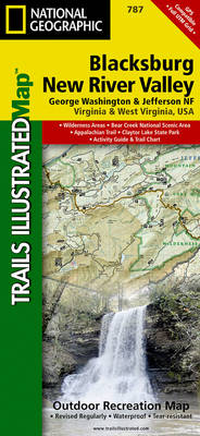
Map No. 787, Jefferson National Forest: Blacksburg – New River Valley, VA/VW, in an extensive series of GPS compatible, contoured hiking maps of USA’s national and state parks or forests and other popular recreational areas. Cartography is based on the national topographic survey, with additional tourist information.The maps, with most titles now printed on light,
Poudre River – Cameron Pass CO
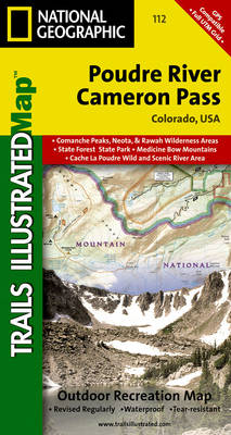
Map No. 112, Poudre River – Cameron Pass, CO, in an extensive series of GPS compatible, contoured hiking maps of USA’s national and state parks or forests and other popular recreational areas. Cartography based on the national topographic survey, with additional tourist information.The maps, with most titles now printed on light, waterproof and tear-resistant plastic
Covington – Alleghany Highlands – George Washington and Jefferson National Forests VA/WV 788
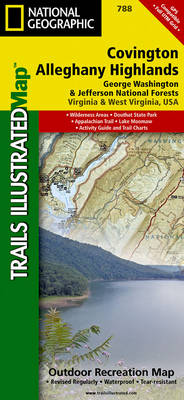
Map No. 788, George Washington and Jefferson National Forests: Covington – Alleghany Highlands, VA/WV, in an extensive series of GPS compatible, contoured hiking maps of USA’s national and state parks or forests and other popular recreational areas. Cartography based on the national topographic survey, with additional tourist information.The maps, with most titles now printed on
Crested Butte – Pearl Pass CO
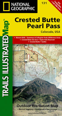
Map No. 131, Crested Butte – Pearl Pass in Colorado, at 1:40,680 in an extensive series of GPS compatible, contoured hiking maps of USA’s national and state parks or forests and other popular recreational areas. Cartography based on the national topographic survey, with additional tourist information.The maps, with most titles now printed on light, waterproof
Saskatoon SK
Double-sided, indexed street plan of Saskatoon at 1:25,000, with additional panels providing at the same scale indexed street plans of other towns in central and northern Saskatchewan: Battleford and Northern Battleford, Humboldt, Kindersley, La Ronge, Lloydminster, Martensville, Meadow Lake, Melfort, Nipawin, Prince Albert, Tisdale and Warman. Also provided is a road map of Saskatchewan at
Edmonton AB
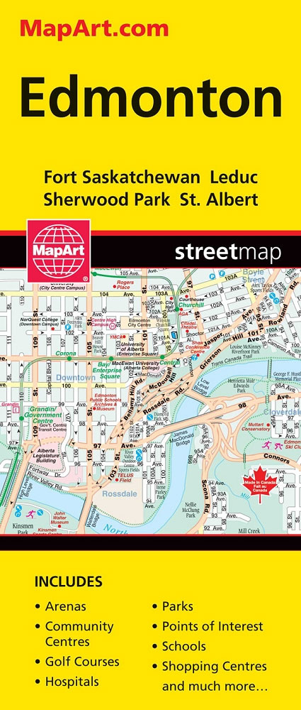
Street plan of Edmonton including coverage of Fort Saskatchewan, Leduc, Sherwood Park and St. Albert. Street plans from the MapArt / Canadian Cartographics Corporation / JDM Gรฉo publishing group are usually produced at scales around 1:25,000 to 1:35,000 with smaller towns often shown at more detailed scales. All plans have street indexes. Plans of larges
Greater Victoria BC MapArt
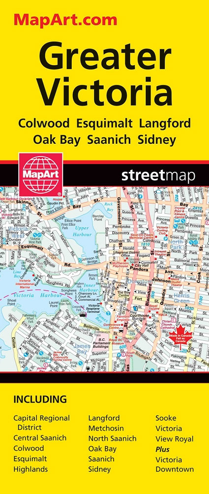
Double-sided, indexed street plan of Greater Victoria and the Saanich Peninsula at 1:27,000, with downtown Victoria shown in greater detail at 1:15,000. Coverage includes Colwood, Esquimalt, Langford, Oak Bay and Sidney.Also provided is road map showing the area covered by the street plan with the adjoining part of the Vancouver Island at 1:225,000.Street plans from
Vancouver Island – Sunshine Coast – Gulf Islands BC MapArt
Vancouver Island with the Sunshine Coast of mainland British Columbia plus the Gulf presented at 1:550,000 on an indexed road map presenting accompanied by numerous enlargements and street maps of the region’s most visited locations.On one side is the main indexed road map showing Vancouver Island with the adjoining mainland BC and the Gulf Islands
Abitibi-Tรฉmiscamingue QC
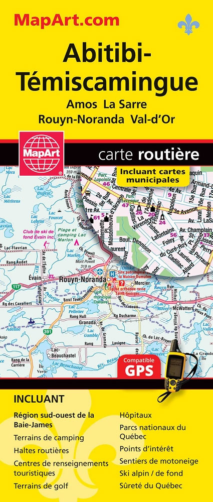
Street plans of several towns in south-western part of Quebec province.
Vancouver & Area MapArt Street Plan
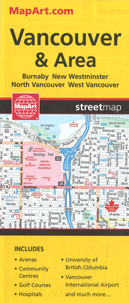
Double-sided, indexed street plan of Greater Vancouver at 1:25,000 with an enlargement of the downtown area in greater detail at 1:19,000. Coverage includes Burnaby, New Westminster, North Vancouver and West Vancouver.Street plans from the MapArt / Canadian Cartographics Corporation / JDM Gรฉo publishing group are usually produced at scales around 1:25,000 to 1:35,000 with smaller