Category Archives: Maps
Panama NGS Adventure Map 3101

Double-sided, waterproof and tear-resistant map with a street plan of central Panama City and an enlargement of the Panama Canal region. The country is divided east/west, with a generous overlap between the two sides. Relief is shown by contours at 100m intervals, enhanced by hill-shading and spot heights. The map indicates forests, mangroves, swamps and
Big Bend National Park TX
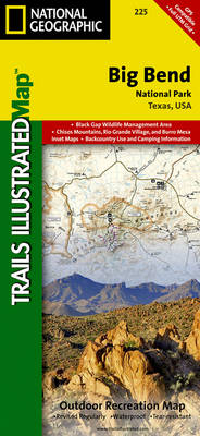
Map No. 225, Big Bend National Park, TX, in an extensive series of GPS compatible, contoured hiking maps of USA’s national and state parks or forests and other popular recreational areas. Cartography based on the national topographic survey, with additional tourist information.The maps, with most titles now printed on light, waterproof and tear-resistant plastic paper,
New River Blueway NC/VA/WV
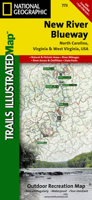
Map No. 773, New River Blueway, NC/VA/WV, in an extensive series of GPS compatible, contoured hiking maps of USA’s national and state parks or forests and other popular recreational areas. Cartography based on the national topographic survey, with additional tourist information.The maps, with most titles now printed on light, waterproof and tear-resistant plastic paper, highlight
Katmai National Park and Preserve AK
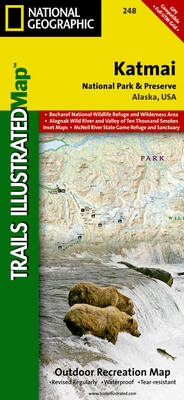
Map No. 248, Katmai National Park and Preserve, AK, in an extensive series of GPS compatible, contoured hiking maps of USA’s national and state parks or forests and other popular recreational areas. Cartography based on the national topographic survey, with additional tourist information.The maps, with most titles now printed on light, waterproof and tear-resistant plastic
Crystal Basin – Silver Fork – Eldorado National Forest CA
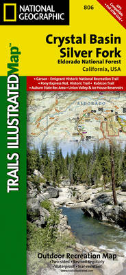
Map No. 806, Crystal Basin / Silver Fork / Eldorado National Forest, CA, in an extensive series of GPS compatible, contoured hiking maps of USA’s national and state parks or forests and other popular recreational areas. Cartography based on the national topographic survey, with additional tourist information.The maps, with most titles now printed on light,
Carson-Iceberg – Emigrant and Mokleumne Wilderness Areas CA
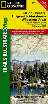
Map No. 807, Carson-Iceberg / Emigrant / Mokleumne Wilderness Areas, CA, in an extensive series of GPS compatible, contoured hiking maps of USA’s national and state parks or forests and other popular recreational areas. Cartography based on the national topographic survey, with additional tourist information.The maps, with most titles now printed on light, waterproof and
Mammoth Lakes – Mono Divide CA
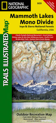
Map No. 809, Mammoth Lakes / Mono Divide, CA, in an extensive series of GPS compatible, contoured hiking maps of USA’s national and state parks or forests and other popular recreational areas. Cartography based on the national topographic survey, with additional tourist information.The maps, with most titles now printed on light, waterproof and tear-resistant plastic
Indian Peaks – Gold Hill CO NGS Trails Illustrated Map 102
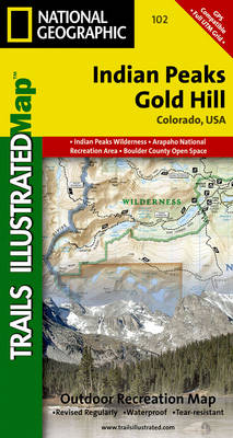
Map No. 102, Indian Peaks – Gold Hill in Colorado, at 1: 40,680 in an extensive series of GPS compatible, contoured hiking maps of USA’s national and state parks or forests and other popular recreational areas. Cartography based on the national topographic survey, with additional tourist information.The maps, with most titles now printed on light,
Winter Park – Central City – Rollins Pass CO NGS Trails Illustrated Map 103
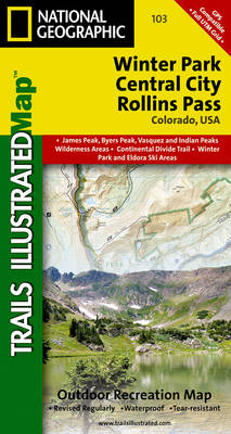
Map No. 103, Winter Park – Central City – Rollins Pass in Colorado, at 1:40,680 in an extensive series of GPS compatible, contoured hiking maps of USA’s national and state parks or forests and other popular recreational areas. Cartography is based on the national topographic survey, with additional tourist information.The maps, with most titles now
Deckers – Rampart Range CO
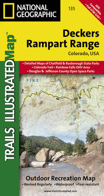
Map No. 135, Deckers – Rampart Range in Colorado, at 1:50,000/1:25,000 in an extensive series of GPS compatible, contoured hiking maps of USA’s national and state parks or forests and other popular recreational areas. Cartography based on the national topographic survey, with additional tourist information.The maps, with most titles now printed on light, waterproof and
Hahns Peak – Steamboat Lake CO
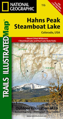
Map No. 116, Hahns Peak – Steamboat Lake in Colorado, at 1:40.680 in an extensive series of GPS compatible, contoured hiking maps of USA’s national and state parks or forests and other popular recreational areas. Cartography based on the national topographic survey, with additional tourist information.The maps, with most titles now printed on light, waterproof
Vail – Frisco – Dillon CO
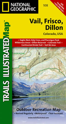
Map No. 108, Vail – Frisco – Dillon area of Colorado, at 1:40,680 in an extensive series of GPS compatible, contoured hiking maps of USA’s national and state parks or forests and other popular recreational areas. Cartography based on the national topographic survey, with additional tourist information.The maps, with most titles now printed on light,
Rand – Stillwater Pass CO
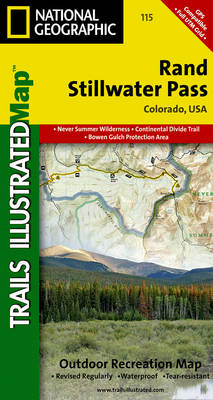
Map No. 115, Rand – Stillwater Pass, CO, in an extensive series of GPS compatible, contoured hiking maps of USA’s national and state parks or forests and other popular recreational areas. Cartography based on the national topographic survey, with additional tourist information.The maps, with most titles now printed on light, waterproof and tear-resistant plastic paper,
Red Feather Lakes – Glendevey CO
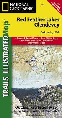
Map No. 111, Red Feather Lakes – Glendevey, CO, in an extensive series of GPS compatible, contoured hiking maps of USA’s national and state parks or forests and other popular recreational areas. Cartography based on the national topographic survey, with additional tourist information.The maps, with most titles now printed on light, waterproof and tear-resistant plastic
Blacksburg – New River Valley – George Washington and Jefferson National Forest VA/VW 787
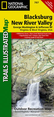
Map No. 787, Jefferson National Forest: Blacksburg – New River Valley, VA/VW, in an extensive series of GPS compatible, contoured hiking maps of USA’s national and state parks or forests and other popular recreational areas. Cartography is based on the national topographic survey, with additional tourist information.The maps, with most titles now printed on light,
Poudre River – Cameron Pass CO
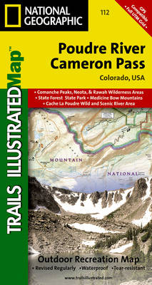
Map No. 112, Poudre River – Cameron Pass, CO, in an extensive series of GPS compatible, contoured hiking maps of USA’s national and state parks or forests and other popular recreational areas. Cartography based on the national topographic survey, with additional tourist information.The maps, with most titles now printed on light, waterproof and tear-resistant plastic
Covington – Alleghany Highlands – George Washington and Jefferson National Forests VA/WV 788
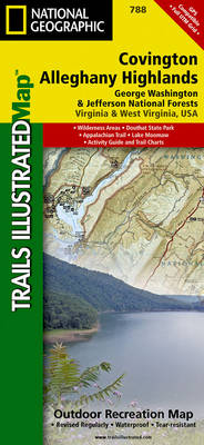
Map No. 788, George Washington and Jefferson National Forests: Covington – Alleghany Highlands, VA/WV, in an extensive series of GPS compatible, contoured hiking maps of USA’s national and state parks or forests and other popular recreational areas. Cartography based on the national topographic survey, with additional tourist information.The maps, with most titles now printed on
Crested Butte – Pearl Pass CO
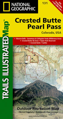
Map No. 131, Crested Butte – Pearl Pass in Colorado, at 1:40,680 in an extensive series of GPS compatible, contoured hiking maps of USA’s national and state parks or forests and other popular recreational areas. Cartography based on the national topographic survey, with additional tourist information.The maps, with most titles now printed on light, waterproof
Clinch Ranger District – Jefferson National Forest VA/KY NGS Trails Illustrated Map 793
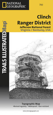
Map No. 793, Jefferson Nationa Forest: Clinch Ranger District, VA/KY, in an extensive series of GPS compatible, contoured hiking maps of USA’s national and state parks or forests and other popular recreational areas. Cartography based on the national topographic survey, with additional tourist information.The maps, with most titles now printed on light, waterproof and tear-resistant
Cape Town & Peninsula NGS Adventure Map 3200
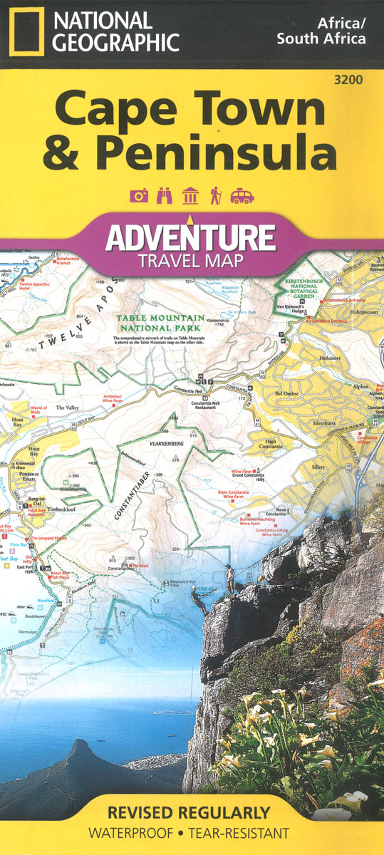
Waterproof and tear-resistant map with the Peninsula on one side, and a street plan of the city plus an enlargement of the Table Mountain area on the other. The whole of the Cape Peninsula including Cape Town is shown at 1:55,000, with contours at 20m intervals, spot heights and hill shading to show the relief.