Category Archives: Maps
Chiapas State – Tuxtla Gutiรฉrrez
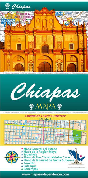
Road maps of Mexico’s states from Ediciones Independencia highlighting numerous places of interest and tourist facilities, with each title also providing a large street plan of the provincial capital plus maps of other local towns, popular tourist resorts and/or archaeological sites.The state maps show the road and rail networks on a clear base, with topography
Guerrero State – Acapulco – Chilpancingo – Zihuatanejo

Road maps of Mexico’s states from Ediciones Independencia highlighting numerous places of interest and tourist facilities, with each title also providing a large street plan of the provincial capital plus maps of other local towns, popular tourist resorts and/or archaeological sites.The state maps show the road and rail networks on a clear base, with topography
Hidalgo State
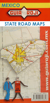
One of the titles in a series of road maps of the administrative states of Mexico, highlighting places of interest. The maps show four different grades of roads, with intermediate driving distances on main routes, railways, local airports, ferry connections and administrative boundaries. Topographic information is limited to names of main mountain ranges, spot heights
Chiapas State

One of the titles in a series of road maps of the administrative states of Mexico, highlighting places of interest. The maps show four different grades of roads, with intermediate driving distances on main routes, railways, local airports, ferry connections and administrative boundaries. Topographic information is limited to names of main mountain ranges, spot heights
Coahuila State

One of the titles in a series of road maps of the administrative states of Mexico, highlighting places of interest. The maps show four different grades of roads, with intermediate driving distances on main routes, railways, local airports, ferry connections and administrative boundaries. Topographic information is limited to names of main mountain ranges, spot heights
Oaxaca State

One of the titles in a series of road maps of the administrative states of Mexico, highlighting places of interest. The maps show four different grades of roads, with intermediate driving distances on main routes, railways, local airports, ferry connections and administrative boundaries. Topographic information is limited to names of main mountain ranges, spot heights
Baja California South State

One of the titles in a series of road maps of the administrative states of Mexico, highlighting places of interest. The maps show four different grades of roads, with intermediate driving distances on main routes, railways, local airports, ferry connections and administrative boundaries. Topographic information is limited to names of main mountain ranges, spot heights
Baja California North State

One of the titles in a series of road maps of the administrative states of Mexico, highlighting places of interest. The maps show four different grades of roads, with intermediate driving distances on main routes, railways, local airports, ferry connections and administrative boundaries. Topographic information is limited to names of main mountain ranges, spot heights
Nayarit State

One of the titles in a series of road maps of the administrative states of Mexico, highlighting places of interest. The maps show four different grades of roads, with intermediate driving distances on main routes, railways, local airports, ferry connections and administrative boundaries. Topographic information is limited to names of main mountain ranges, spot heights
Campeche State

One of the titles in a series of road maps of the administrative states of Mexico, highlighting places of interest. The maps show four different grades of roads, with intermediate driving distances on main routes, railways, local airports, ferry connections and administrative boundaries. Topographic information is limited to names of main mountain ranges, spot heights
Morelos State

One of the titles in a series of road maps of the administrative states of Mexico, highlighting places of interest. The maps show four different grades of roads, with intermediate driving distances on main routes, railways, local airports, ferry connections and administrative boundaries. Topographic information is limited to names of main mountain ranges, spot heights
Sonora State

One of the titles in a series of road maps of the administrative states of Mexico, highlighting places of interest. The maps show four different grades of roads, with intermediate driving distances on main routes, railways, local airports, ferry connections and administrative boundaries. Topographic information is limited to names of main mountain ranges, spot heights
Puebla State

One of the titles in a series of road maps of the administrative states of Mexico, highlighting places of interest. The maps show four different grades of roads, with intermediate driving distances on main routes, railways, local airports, ferry connections and administrative boundaries. Topographic information is limited to names of main mountain ranges, spot heights
Quintana Roo State

One of the titles in a series of road maps of the administrative states of Mexico, highlighting places of interest. The maps show four different grades of roads, with intermediate driving distances on main routes, railways, local airports, ferry connections and administrative boundaries. Topographic information is limited to names of main mountain ranges, spot heights
Nuevo Leon State

One of the titles in a series of road maps of the administrative states of Mexico, highlighting places of interest. The maps show four different grades of roads, with intermediate driving distances on main routes, railways, local airports, ferry connections and administrative boundaries. Topographic information is limited to names of main mountain ranges, spot heights
Veracruz State

One of the titles in a series of road maps of the administrative states of Mexico, highlighting places of interest. The maps show four different grades of roads, with intermediate driving distances on main routes, railways, local airports, ferry connections and administrative boundaries. Topographic information is limited to names of main mountain ranges, spot heights
Mexico State

One of the titles in a series of road maps of the administrative states of Mexico, highlighting places of interest. The maps show four different grades of roads, with intermediate driving distances on main routes, railways, local airports, ferry connections and administrative boundaries. Topographic information is limited to names of main mountain ranges, spot heights
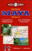
Maya World
Federal District

One of the titles in a series of road maps of the administrative states of Mexico, highlighting places of interest. The maps show four different grades of roads, with intermediate driving distances on main routes, railways, local airports, ferry connections and administrative boundaries. Topographic information is limited to names of main mountain ranges, spot heights
Sinaloa State

One of the titles in a series of road maps of the administrative states of Mexico, highlighting places of interest. The maps show four different grades of roads, with intermediate driving distances on main routes, railways, local airports, ferry connections and administrative boundaries. Topographic information is limited to names of main mountain ranges, spot heights


