Category Archives: Maps
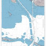
Glacier National Park – Two Medicine MT
Map No. 315, Glacier National Park: Two Medicine, MT, in an extensive series of GPS compatible, contoured hiking maps of USA’s national and state parks or forests and other popular recreational areas. Cartography based on the national topographic survey, with additional tourist information.The maps, with most titles now printed on light, waterproof and tear-resistant plastic
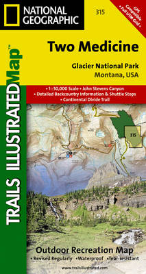
Mount Hood and Willamette National Forests OR
Map No. 820, Mount Hood and Willamette National Forests in Oregon, in an extensive series of GPS compatible, contoured hiking maps of USA’s national and state parks or forests and other popular recreational areas. Cartography based on the national topographic survey, with additional tourist information.The maps, with most titles now printed on light, waterproof and
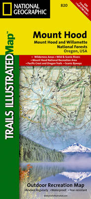
Columbia River Gorge OR/WA
Map No. 821, Columbia River Gorge in Oregon and Washington State, in an extensive series of GPS compatible, contoured hiking maps of USA’s national and state parks or forests and other popular recreational areas. Cartography based on the national topographic survey, with additional tourist information.The maps, with most titles now printed on light, waterproof and
Mazatzal & Pine Mountain Wilderness Areas – Tonto National Forest AZ
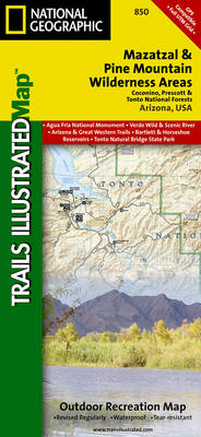
Map No. 850, Tonto National Forest: Mazatzal and Pine Mountain Wilderness Areas, AZ, in an extensive series of GPS compatible, contoured hiking maps of USA’s national and state parks or forests and other popular recreational areas. Cartography based on the national topographic survey, with additional tourist information.The maps, with most titles now printed on light,
Superstition & Four Peaks Wilderness Areas – Tonto National Forest AZ
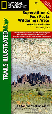
Map No. 851, Tonto National Forest: Superstition and Four Peaks Wilderness Areas, AZ, in an extensive series of GPS compatible, contoured hiking maps of USA’s national and state parks or forests and other popular recreational areas. Cartography based on the national topographic survey, with additional tourist information.The maps, with most titles now printed on light,
Hellsgate – Salome & Sierra Ancha Wilderness Areas – Tonto National Forest AZ
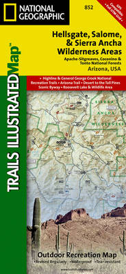
Map No. 852, Tonto National Forest: Hellsgate, Salome and Sierra Ancha Wilderness, AZ, in an extensive series of GPS compatible, contoured hiking maps of USA’s national and state parks or forests and other popular recreational areas. Cartography based on the national topographic survey, with additional tourist information.The maps, with most titles now printed on light,
Salt River Canyon – Tonto National Forest AZ
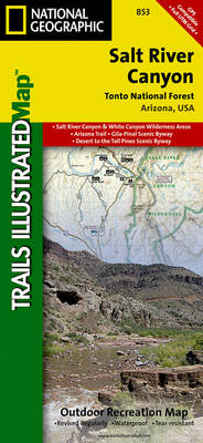
Map No. 853, Tonto National Forest: Salt River Canyon, AZ, in an extensive series of GPS compatible, contoured hiking maps of USA’s national and state parks or forests and other popular recreational areas. Cartography based on the national topographic survey, with additional tourist information.The maps, with most titles now printed on light, waterproof and tear-resistant
Grand Junction – Fruita CO

Map No. 502, Grand Junction – Fruita, CO, in an extensive series of GPS compatible, contoured hiking maps of USA’s national and state parks or forests and other popular recreational areas. Cartography based on the national topographic survey, with additional tourist information.The maps, with most titles now printed on light, waterproof and tear-resistant plastic paper,
Durango – Cortez CO
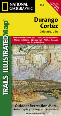
Map No. 144, Durango – Cortez, CO, in an extensive series of GPS compatible, contoured hiking maps of USA’s national and state parks or forests and other popular recreational areas. Cartography based on the national topographic survey, with additional tourist information.The maps, with most titles now printed on light, waterproof and tear-resistant plastic paper, highlight
Carlsbad Caverns National Park NM
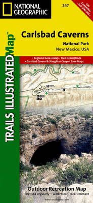
Map No. 247, Carlsbad Caverns National Park in New Mexico at 1:35,000 in an extensive series of GPS compatible, contoured hiking maps of USA’s national and state parks or forests and other popular recreational areas. Cartography based on the national topographic survey, with additional tourist information.The maps, with most titles now printed on light, waterproof
Theodore Roosevelt National Park / Maah Daah Hey Trail ND
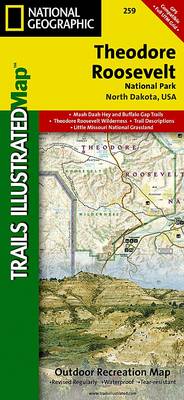
Map No. 259, Theodore Roosevelt National Park/ Maah Daah Hey Trail in North Dakota, at 1:40,000 in an extensive series of GPS compatible, contoured hiking maps of USA’s national and state parks or forests and other popular recreational areas. Cartography based on the national topographic survey, with additional tourist information.The maps, with most titles now
DelMarVa Peninsula – Delaware – Maryland – Virginia Recreational Map
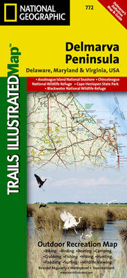
Map No. 772, DelMarVa Peninsula (Delaware, Maryland, Virginia) Recreational Map, in an extensive series of GPS compatible, contoured hiking maps of USA’s national and state parks or forests and other popular recreational areas. Cartography based on the national topographic survey, with additional tourist information.The maps, with most titles now printed on light, waterproof and tear-resistant
Franconia Notch – Lincoln – White Mountain National Forest NH 740
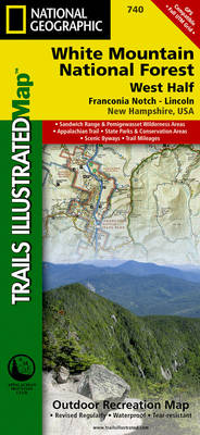
Map No. 740, White Mountains National Forest: Franconia Notch – North Conway, NH, in an extensive series of GPS compatible, contoured hiking maps of USA’s national and state parks or forests and other popular recreational areas. Cartography based on the national topographic survey, with additional tourist information.The maps, with most titles now printed on light,
Bandelier National Monument NM
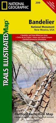
Map No. 209, Bandelier National Monument in New Mexico, at 1:35,000 in an extensive series of GPS compatible, contoured hiking maps of USA’s national and state parks or forests and other popular recreational areas. Cartography based on the national topographic survey, with additional tourist information.The maps, with most titles now printed on light, waterproof and
Tahoe National Forest – Yuba & American Rivers CA
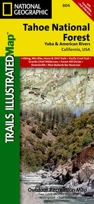
Map No. 804, Tahoe National Forest: Yuba and American Rivers, CA, in an extensive series of GPS compatible, contoured hiking maps of USA’s national and state parks or forests and other popular recreational areas. Cartography based on the national topographic survey, with additional tourist information.The maps, with most titles now printed on light, waterproof and
Black Mesa – Curecanti Pass CO NGS Trails Illustrated Map 134
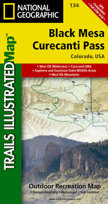
Map No. 134, Black Mesa – Curecanti Pass, CO, in an extensive series of GPS compatible, contoured hiking maps of USA’s national and state parks or forests and other popular recreational areas. Cartography based on the national topographic survey, with additional tourist information.The maps, with most titles now printed on light, waterproof and tear-resistant plastic
Longs Peak – Bear Lake / Wild Basin – Rocky Mountains National Park CO
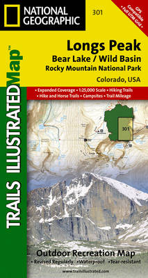
Map No. 301, Longs Peak, CO, in an extensive series of GPS compatible, contoured hiking maps of USA’s national and state parks or forests and other popular recreational areas. Cartography based on the national topographic survey, with additional tourist information.The maps, with most titles now printed on light, waterproof and tear-resistant plastic paper, highlight walking
Old Faithful – Yellowstone National Park SW WY/MT
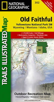
Map No. 302, Yellowstone SW: Old Faithful, WY/MT, in an extensive series of GPS compatible, contoured hiking maps of USA’s national and state parks or forests and other popular recreational areas. Cartography based on the national topographic survey, with additional tourist information.The maps, with most titles now printed on light, waterproof and tear-resistant plastic paper,
Mammoth Hot Springs – Yellowstone National Park NW WY/MT
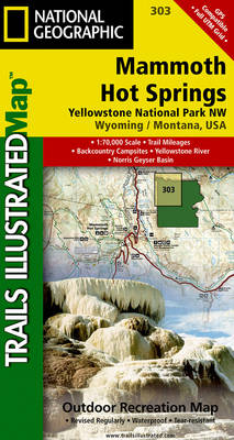
Map No. 303, Yellowstone NW: Mammoth Hot Springs, WY/MT, in an extensive series of GPS compatible, contoured hiking maps of USA’s national and state parks or forests and other popular recreational areas. Cartography based on the national topographic survey, with additional tourist information.The maps, with most titles now printed on light, waterproof and tear-resistant plastic
Tower – Canyon – Yellowstone National Park WY/MT
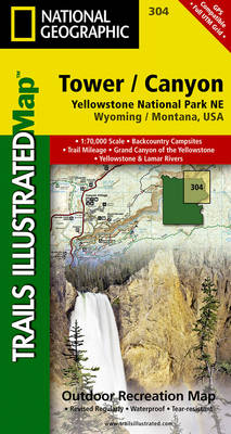
Map No. 304, Yellowstone NE: Tower/Canyon, WY/MT, in an extensive series of GPS compatible, contoured hiking maps of USA’s national and state parks or forests and other popular recreational areas. Cartography based on the national topographic survey, with additional tourist information.The maps, with most titles now printed on light, waterproof and tear-resistant plastic paper, highlight