Category Archives: Maps
New Zealand Adventure Map
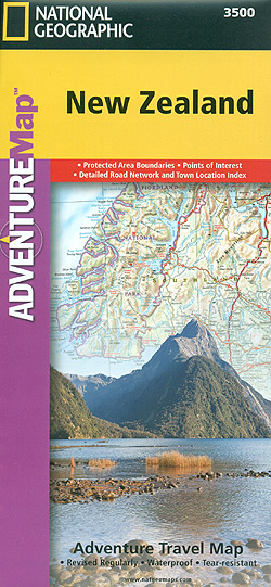
New Zealand at 1:1,100,000 in a series of Adventure maps from the National Geographic Society with cartography provided by Reise Know-How. The map, double-sided and printed on light waterproof and tear-resistant plastic paper, presents North and South Islands separately. Insets at varying scales show New Zealand’s offshore islands: Snares, Auckland, Chatham, Bounty, Antipodes and Campbell.Cartographic
Boston Harbor Islands National Recreation Area MA
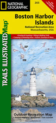
Map No. 765 covering at 1:25,000 the Boston Harbor Islands National Recreation Area in Massachusetts. The title is part of an extensive series in the National Geographic’s Trails Illustrated imprint of GPS compatible, contoured hiking maps of USA’s national and state parks or forests and other popular recreational areas. Cartography is based on the national
Mount Tamalpais and Point Reyes CA
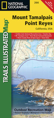
Map No. 266, Mount Tamalpais and Point Reyes, CA, in an extensive series of GPS compatible, contoured hiking maps of USA’s national and state parks or forests and other popular recreational areas. Cartography based on the national topographic survey, with additional tourist information.The maps, with most titles now printed on light, waterproof and tear-resistant plastic
Angeles National Forest CA
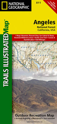
Map No. 811, Angeles National Forest, CA, in an extensive series of GPS compatible, contoured hiking maps of USA’s national and state parks or forests and other popular recreational areas. Cartography based on the national topographic survey, with additional tourist information.The maps, with most titles now printed on light, waterproof and tear-resistant plastic paper, highlight
Big Sur – Ventana Wilderness – Los Padres National Forest CA
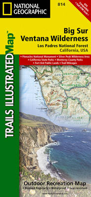
Map No. 814, Angeles National Forest, CA, in an extensive series of GPS compatible, contoured hiking maps of USA’s national and state parks or forests and other popular recreational areas. Cartography based on the national topographic survey, with additional tourist information.The maps, with most titles now printed on light, waterproof and tear-resistant plastic paper, highlight
Los Padres National Forest West CA
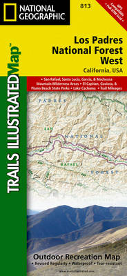
Map No. 813, Los Padres National Forest West, CA, in an extensive series of GPS compatible, contoured hiking maps of USA’s national and state parks or forests and other popular recreational areas. Cartography based on the national topographic survey, with additional tourist information.The maps, with most titles now printed on light, waterproof and tear-resistant plastic
Los Padres National Forest East CA
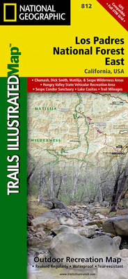
Map No. 812, Los Padres National Forest East, CA, in an extensive series of GPS compatible, contoured hiking maps of USA’s national and state parks or forests and other popular recreational areas. Cartography based on the national topographic survey, with additional tourist information.The maps, with most titles now printed on light, waterproof and tear-resistant plastic
Uncompahgre Plateau North CO
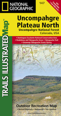
Map No. 147, covering the northern part of the Uncompahgre Plateau in Colorado at 1:63,360 in an extensive series of GPS compatible, contoured hiking maps of USA’s national and state parks or forests and other popular recreational areas. Cartography based on the national topographic survey, with additional tourist information.The maps, with most titles now printed
Slovenia Adventure Map
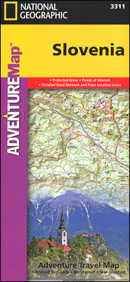
Slovenia at 1:205,000 on a doubled-sided, indexed map from the National Geographic Society. Cartographic information provided by Reise Know-How has been adjusted to follow the house style of the NGS Adventure series with greater emphasis on the country’s topography. Altitude colouring in broader bands has been replaced here by contours at 200m intervals enhanced by
Uncompahgre Plateau South CO
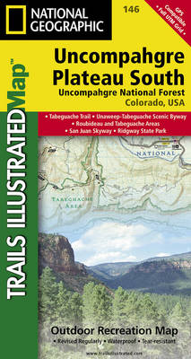
Map No. 146, covering the southern part of the Uncompahgre Plateau in Colorado at 1:63,360 in an extensive series of GPS compatible, contoured hiking maps of USA’s national and state parks or forests and other popular recreational areas. Cartography based on the national topographic survey, with additional tourist information.The maps, with most titles now printed
Argentina NGS Adventure Map 3400
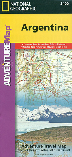
Argentina at 1:2,300,000 in a series of Adventure maps from the National Geographic Society with cartography provided by Reise Know-How. The map, double-sided and printed on light waterproof and tear-resistant plastic paper, divides Argentina north/south with an overlap between the sides. The north-eastern corner with the Missiones province and the Iguazu Falls is shown as

Nicaragua – Honduras – El Salvador NGS Adventure Map 3109
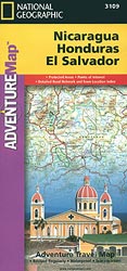
Nicaragua, Honduras and El Salvador at 1:710,000 in a series of Adventure maps from the National Geographic Society with cartography provided by Reise Know-How. The map, double-sided and printed on light waterproof and tear-resistant plastic paper, presents El Salvador with Honduras on one side, with Nicaragua on the reverse. Cartographic information provided by Reise Know-How
Egypt NGS Adventure Map 3202
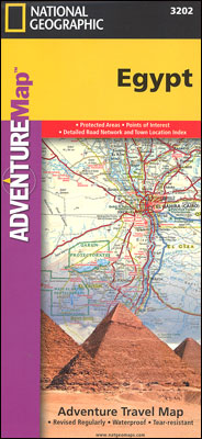
Egypt at 1:1,250,000 in a series of Adventure maps from the National Geographic Society with cartography provided by Reise Know-How. The map is double-sided, printed on light waterproof and tear-resistant synthetic paper, and covers the whole country, including the whole of the Western Desert and the Sinai, with just the southernmost part of the Red
Morocco NGS Adventure Map 3203
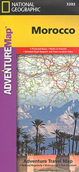
Morocco at 1:1,000,000 in a series of Adventure maps from the National Geographic Society with cartography provided by Reise Know-How. The map is double-sided and printed on light waterproof and tear-resistant synthetic paper.The map has a very generous overlap between the sides: Marrakesh and the Jbel Toubkal region of the High Atlas are on both
South Africa Adventure Map
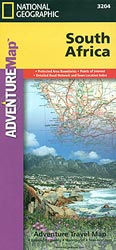
South Africa at 1:1,550,000 in a series of Adventure maps from the National Geographic Society with cartography provided by Reise Know-How. The map is double-sided and printed on light waterproof and tear-resistant plastic paper.Cartographic information provided by Reise Know-How has been adjusted to follow the house style of the NGS Adventure series with greater emphasis
Finland and Northern Scandinavia NGS Adventure Map 3300
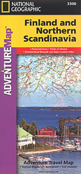
Finland and Northern Scandinavia at 1:975,000 in a series of Adventure maps from the National Geographic Society with cartography provided by Reise Know-How. The map is double-sided and printed on light waterproof and tear-resistant synthetic paper.Cartographic information provided by Reise Know-How has been adjusted to follow the house style of the NGS Adventure series with
Southern Sweden and Norway Adventure Map

Southern Sweden and Norway at 1:975,000 in a series of Adventure maps from the National Geographic Society with cartography provided by Reise Know-How. The map is double-sided and printed on light waterproof and tear-resistant synthetic paper.Cartographic information provided by Reise Know-How has been adjusted to follow the house style of the NGS Adventure series with