Category Archives: Maps
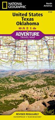
Texas NGS Guide Map
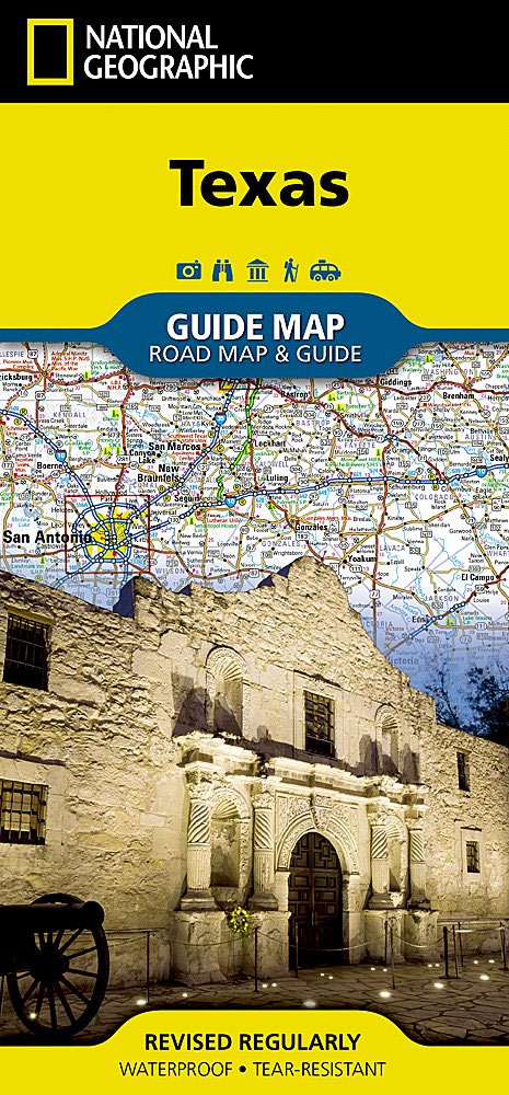
Expertly researched and loaded with helpful information, National Geographic`s Texas Guide Map is a must-have for travelers exploring “The Lone Star State.” In addition to a state map, inset maps provide detail on the Texas Panhandle and the cities of Dallas, Fort Worth, Houston, Amarillo, Abilene, Lubbock, Waco, Laredo, Beaumont, El Paso, Odessa-Midland, McAllen, Corpus
Pacific Crest Trail – Oregon South NGS Topographic Map-Guide 1005
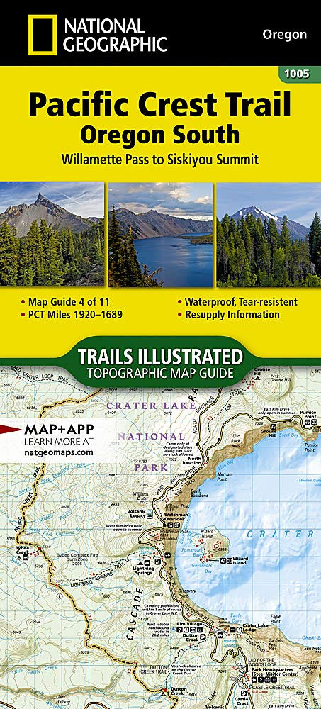
The Pacific Crest Trail (PCT) covered in the Oregon South Topographic Map Guide mostly travels below the high mountain tops and ridges, skirting the bases of the enormous volcanoes of Diamond Peak, Mount Thielsen, and Mount Mazama (home to Crater Lake). Winding south of Ashland and towards the border with California, it enters the Klamath
Pacific Northwest NGS Adventure Map 3118
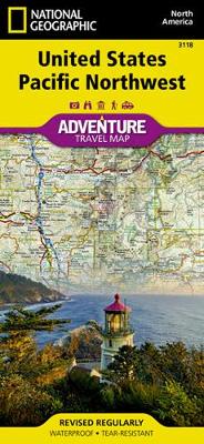
There are few nations as vast and spectacularly diverse as the United States of America. From the Atlantic to the Pacific, “America the Beautiful” offers boundless destinations and experiences for travelers seeking outdoor adventures, small town delights, or the excitement of urban culture.The United States Pacific Northwest Adventure Map will guide you through one of
Wisconsin NGS Guide Map

National Geographic`s Wisconsin Guide Map provides travelers with the perfect combination of detail and perspective in a highly functional travel tool. Cities and towns are clearly indicated and easy to find in the user-friendly index. A complete road network of highways, tollways, and other roads, along with distances noted in miles for major highways, will
Rocky Mountains NGS Adventure Map 3120
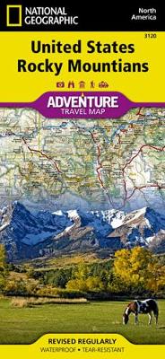
There are few nations as vast and spectacularly diverse as the United States of America. From the Atlantic to the Pacific, “America the Beautiful” offers boundless destinations and experiences for travelers seeking outdoor adventures, small town delights, or the excitement of urban culture.The United States Rocky Mountains Adventure Map will guide you through one of
USA Southwest NGS Adventure Map 3121
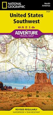
There are few nations as vast and spectacularly diverse as the United States of America. From the Atlantic to the Pacific, “America the Beautiful” offers boundless destinations and experiences for travelers seeking outdoor adventures, small town delights, or the excitement of urban culture.The United States Southwest Adventure Map will guide you through one of the
Europe NGS Adventure Map 3328
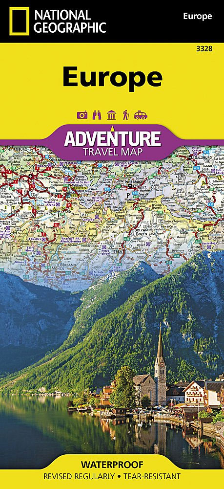
National Geographic`s Europe Adventure Map provides global travelers with the perfect combination of function and perspective. Designed to meet the needs of adventure travelers with its detailed, accurate information, this map includes the location of cities and towns with a user-friendly index and a clearly marked road network complete with distances and designations for roads/motorways,
USA Northern Plains NGS Adventure Map 3122
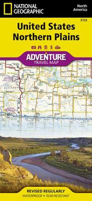
There are few nations as vast and spectacularly diverse as the United States of America. From the Atlantic to the Pacific, “America the Beautiful” offers boundless destinations and experiences for travelers seeking outdoor adventures, small town delights, or the excitement of urban culture.The United States Northern Plains Adventure Map will guide though a varied landscape,
USA Great Lakes NGS Adventure Map 3124
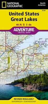
There are few nations as vast and spectacularly diverse as the United States of America. From the Atlantic to the Pacific, “America the Beautiful” offers boundless destinations and experiences for travelers seeking outdoor adventures, small town delights, or the excitement of urban culture.The United States Great Lakes Adventure Map will guide you to the five

South Platte River Middle Fork – Alma to Elevenmile Canyon Reservoir

: Waterproof ‘: Tear-Resistant ‘: Fishing & River MapThe South Platte River [Middle Fork], Alma to Elevenmile Canyon Reservoir Fishing & River Map Guide is designed to be the perfect companion to anyone recreating on the upper reaches of the Middle Fork of the South Platte. In the upper reaches of the South Platte basin,
South Platte River – Elevenmile Canyon Reservoir to Chatfield Reservoir
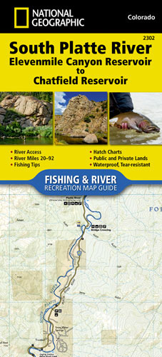
: Waterproof ‘: Tear-Resistant ‘: Fishing & River MapThe South Platte River, Elevenmile Canyon Reservoir to Chatfield Reservoir Fishing & River Map Guide is designed to be the perfect companion to anyone recreating on the South Platte from just below Elevenmile Canyon Reservoir to the southwestern suburbs of Denver. The South Platte below Elevenmile is
Arkansas River – Leadville to Salida
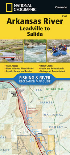
: Waterproof ‘: Tear-Resistant ‘: Fishing & River MapThe Arkansas River, Leadville to Salida Fishing & River Map Guide is designed to be the perfect companion to anyone recreating on the upper Arkansas. On the upper river, there is a great distinction to be drawn between the waters above and below the confluence with Lake
Arkansas River – Salida to Canon City
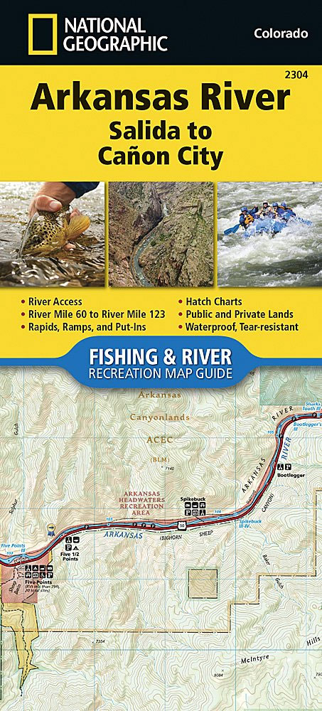
: Waterproof ‘: Tear-Resistant ‘: Fishing & River MapThe Arkansas River, Salida to Caรฑon City Fishing & River Map Guide is designed to be the perfect companion to anyone recreating on this section of the Arkansas. From Salida to Caรฑon City, the Arkansas River cuts east through a series of high desert canyons collectively known
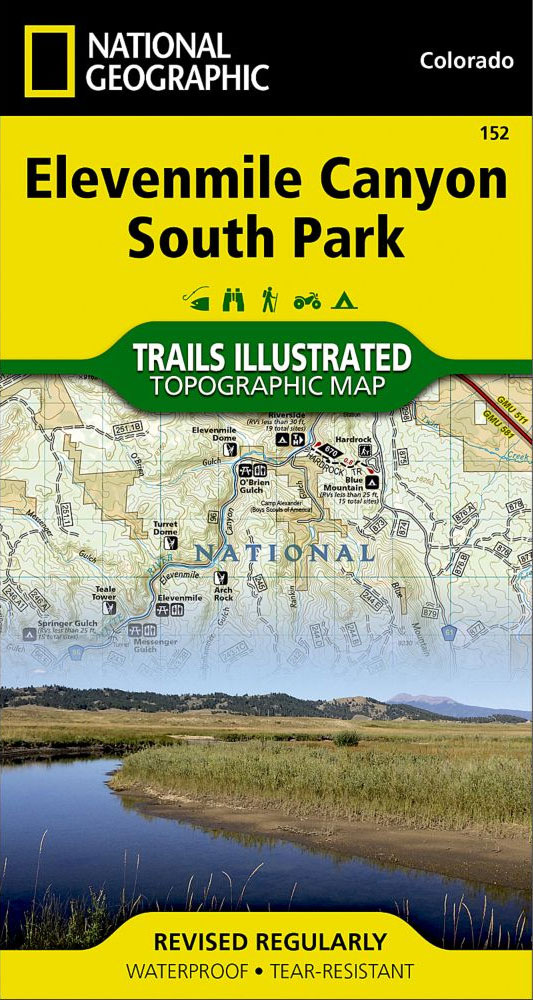
Elevenmile Canyon – South Park CO
Map No. 152 covering at 1:63,360 the Saddle Mountain area in Northern Oregon. The title is part of an extensive series in the National Geographic’s Trails Illustrated imprint of GPS compatible, contoured hiking maps of USA’s national and state parks or forests and other popular recreational areas. Cartography is based on the national topographic survey,
Alaska NGS Adventure Map 3117
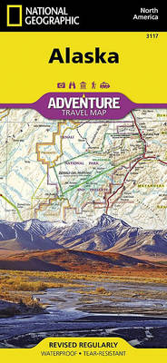
Alaska`s most famous hotspots, like Denali, Anchorage, the Inside Passage, Klondike Gold Rush National Historical Park, and many others are clearly marked on the map. The boundaries of National Parks, National Forests, Natural Reserves and Wildlife Refuges are all clearly marked. With such a wealth of content, the map is an ideal complement to National