Category Archives: Maps
Adirondacks NY
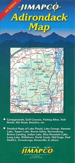
The Adirondacks and the north-eastern part of New York state at 1:1:389,220 on a detailed, extensively indexed road map from Jimapco, highlighting numerous recreational facilities, plus enlargements for main towns.On one side is a road map at 1:285,000 of the Adirondacks covering an area between the Canadian border and highway 90, and extending from the
Bennington County, VT
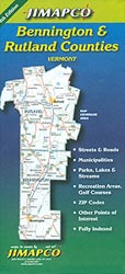
Bennington and Rutland Counties in Vermont on a double-sided, indexed map from Jimapco combining several street plans of local towns with a road map of the two counties and enlargements for selected areas.On one side are 11 panels presenting at 1:36,000 street plans of local towns, with names of individual streets and locations of various
Adirondack NY Qickmap
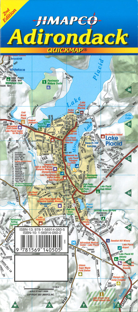
The Adirondack Quickmap from Jimapco in a more handy format, covering the mountains on a laminated, waterproof map at approx. 1:350,000, with enlargements for the most visited areas. On one side is a road map of the Adirondacks covering an area between the Canadian border and highway 90, and extending from the Vermont border to
Finger Lakes, NY Qickmap
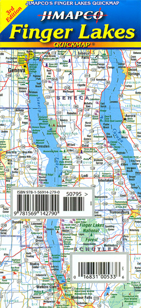
Fingers Lakes region in the western part of New York State on a laminated, waterproof and tear-resistant road map at 1:316,800 from Jimapco, with on the reverse 14 more detailed maps of main towns. The index also lists places of interest and various local facilities.On one side is the map showing the region’s road and
Hudson Valley NY Qickmap
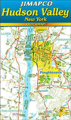
Hudson Valley from New York City northwards to Albany on, laminated, waterproof and tear-resistant road map from Jimapco. The index includes places of interest and the central part of the valley is presented enlarged to show more detail.The main map at 1:1,000,000 is spread across both sides. The map shows the region’s road network, prominently
New England Quickmap
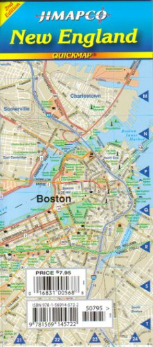
Laminated folding road map of Connecticut, Rhode Island, Massachusetts, Vermont, New Hampshire, and Maine. Includes expanded areas of Eastern MA/Boston, downtown Boston, and major metro areas of each state. Points out amusement parks, breweries, campgrounds, colleges, ski areas, golf courses, historic sites, parks, and other points of interest.
The Poconos, PA Qickmap
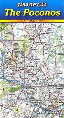
Poconos Mountains in Pennsylvania at 1:90,080 on a detailed indexed road map from Jimpaco, highlighting numerous recreational facilities, plus enlargements and street maps for local towns.On one side is a road map at 1:90,080 covering the mountains from Port Jervis in New York State westwards to Nanticoke and Hazleton. Coverage north/south extends from Honesdale to
Maine Seacoast Quickmap
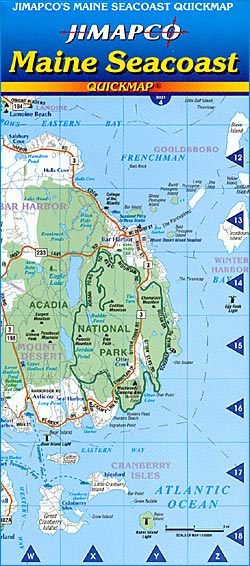
The seacoast of Maine shown in three sections on a double-sided, indexed, laminated map from Jimapco at 1:270,000, with seven insets providing enlargements to show the most popular areas in greater detail. The coastline is presented on three larger panels at 1:270,000, indicating which areas are presented in greater detail on the surrounding enlargements. The
Zurner`s World 1710

An attractive and decorative map of the world drawn by Zurner in about 1710. The map depicts the geographical knowledge of Europeans at the time – eastern Australia and western North America are largely blank spaces. The interior of Africa is wildly inaccurate – the Nile, Niger and Congo rivers all join up and the
Vancouver Island NGS Adventuer Map 3128
Waterproof and tear-resistant FastTrack map presenting in a handy-size format Vancouver Island at 1:550,000, plus a street plan of downtown Victoria and on the reverse enlargements at 1;50,000 covering the island’s other most visited areas.On one side Vancouver Island is shown at 1:550,000, with its northern part presented on a separate panel. Coverage includes Vancouver

Florida NGS Guide Map
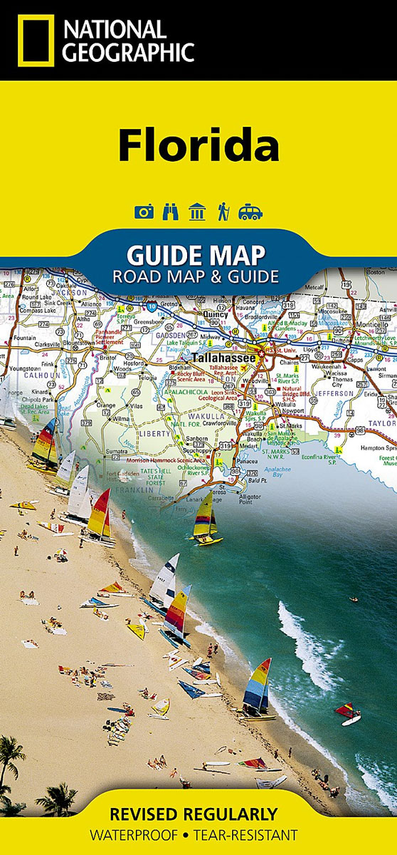
Whether travelling for business or leisure, let National Geographic`s Florida Guide Map lead you on your visit to the Sunshine State. Coverage is unparalleled with one large road map encompassing the entire state and several detailed city and metropolitan area inset maps, including Jacksonville, Miami, Tampa-St. Petersburg, Orlando, Tallahassee, Fort Myers-Cape Coral, Gainesville, Melbourne-Kennedy Space
Chicago NGS City Destination Map
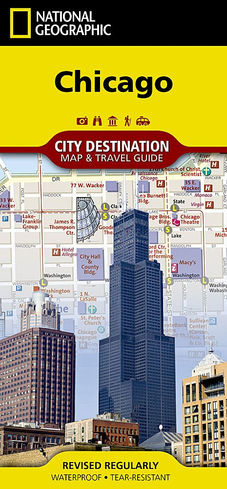
Business and leisure travelers alike will marvel at National Geographic`s City Destination map of Chicago. The main road map covers the city`s downtown area from the Gold Coast Historic District in the north to McCormick Place in the south. Along the way hundreds of popular and lesser know points of interest in pinpointed, including public
London NGS City Destination Map
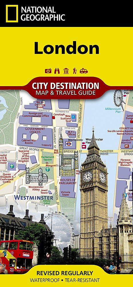
The National Geographic map of London at 1:10,700 is a durable waterproof city map and transport guide designed for tourism. Clear and easy-to-read street mapping has main attractions highlighted and 3D illustrations of top sights. Hotels, churches, theatres and information points are among the tourist features marked on the map. One-way streets and pedestrian areas
Prague NGS City Destination Map
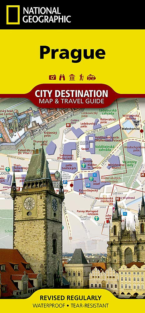
Well know for its rich history and historic city center, Prague is one of the most visited cities in all of Europe. Expertly researched, National Geographic`s City Destination map of Prague is a unique combination of an easy-to-read road map with a travel guide. The front side covers the five quarters of the city center
Kentucky NGS Guide Map
Expertly researched and loaded with helpful information, National Geographic`s Kentucky Guide Map is a must-have for travelers exploring “The Bluegrass State.” Cities and towns are easy to find with the map`s helpful index. Highways, roadways, toll roads, scenic routes, and other roads are clearly designated. Distances in miles are noted on major highways so travelers