Category Archives: Maps
Aguascalientes State – Aguascalientes City
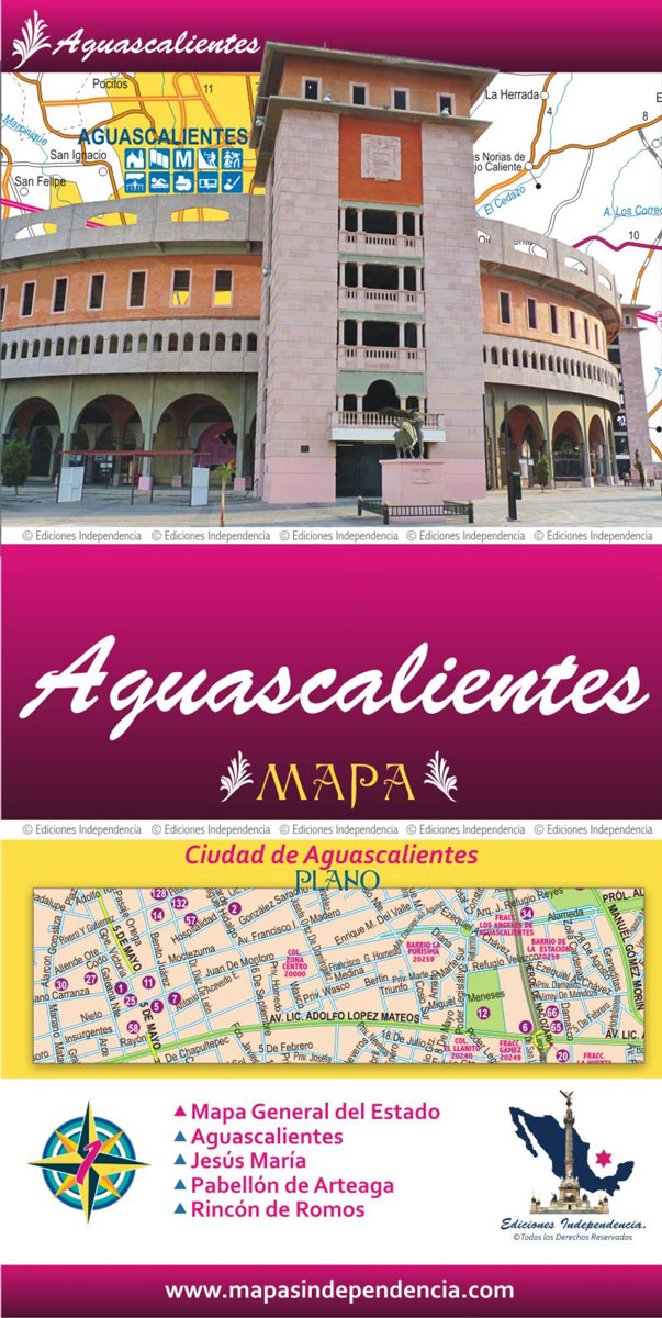
Road maps of Mexico’s states from Ediciones Independencia highlighting numerous places of interest and tourist facilities, with each title also providing a large street plan of the provincial capital plus maps of other local towns, popular tourist resorts and/or archaeological sites.The state maps show the road and rail networks on a clear base, with topography
Tamaulipas State – Ciudad Vittoria
Road maps of Mexico’s states from Ediciones Independencia highlighting numerous places of interest and tourist facilities, with each title also providing a large street plan of the provincial capital plus maps of other local towns, popular tourist resorts and/or archaeological sites.The state maps show the road and rail networks on a clear base, with topography
Guanajuato State – Guanajuato City
Road maps of Mexico’s states from Ediciones Independencia highlighting numerous places of interest and tourist facilities, with each title also providing a large street plan of the provincial capital plus maps of other local towns, popular tourist resorts and/or archaeological sites.The state maps show the road and rail networks on a clear base, with topography
Durango State – Durango City
Road maps of Mexico’s states from Ediciones Independencia highlighting numerous places of interest and tourist facilities, with each title also providing a large street plan of the provincial capital plus maps of other local towns, popular tourist resorts and/or archaeological sites.The state maps show the road and rail networks on a clear base, with topography
Tlaxcala State – Tlaxcala City
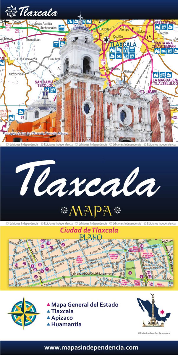
Road maps of Mexico’s states from Ediciones Independencia highlighting numerous places of interest and tourist facilities, with each title also providing a large street plan of the provincial capital plus maps of other local towns, popular tourist resorts and/or archaeological sites.The state maps show the road and rail networks on a clear base, with topography
Zacatecas State – Zacatecas City
Road maps of Mexico’s states from Ediciones Independencia highlighting numerous places of interest and tourist facilities, with each title also providing a large street plan of the provincial capital plus maps of other local towns, popular tourist resorts and/or archaeological sites.The state maps show the road and rail networks on a clear base, with topography
San Luis Potosรญ State – San Luis Potosรญ City
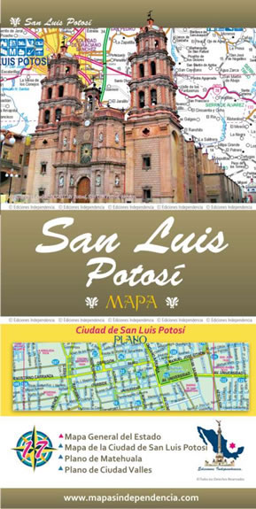
Road maps of Mexico’s states from Ediciones Independencia highlighting numerous places of interest and tourist facilities, with each title also providing a large street plan of the provincial capital plus maps of other local towns, popular tourist resorts and/or archaeological sites.The state maps show the road and rail networks on a clear base, with topography
Jalisco State – Guadalajara
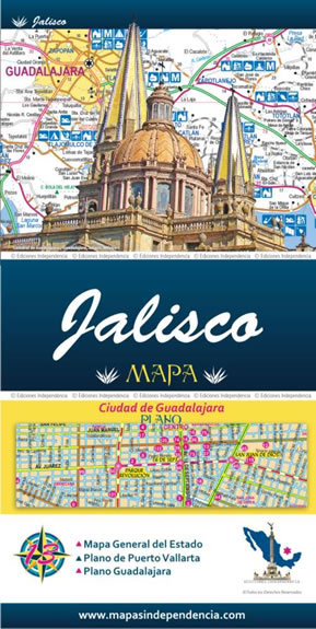
Road maps of Mexico’s states from Ediciones Independencia highlighting numerous places of interest and tourist facilities, with each title also providing a large street plan of the provincial capital plus maps of other local towns, popular tourist resorts and/or archaeological sites.The state maps show the road and rail networks on a clear base, with topography
Coahuila State – Saltillo
Road maps of Mexico’s states from Ediciones Independencia highlighting numerous places of interest and tourist facilities, with each title also providing a large street plan of the provincial capital plus maps of other local towns, popular tourist resorts and/or archaeological sites.The state maps show the road and rail networks on a clear base, with topography
Nuevo Lรฉon State – Monterrey
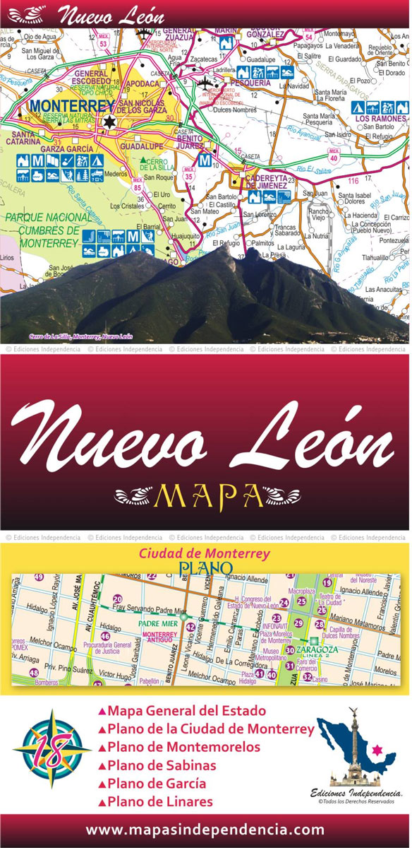
Road maps of Mexico’s states from Ediciones Independencia highlighting numerous places of interest and tourist facilities, with each title also providing a large street plan of the provincial capital plus maps of other local towns, popular tourist resorts and/or archaeological sites.The state maps show the road and rail networks on a clear base, with topography
Baja California North State – Mexicali and Tijuana
Road maps of Mexico’s states from Ediciones Independencia highlighting numerous places of interest and tourist facilities, with each title also providing a large street plan of the provincial capital plus maps of other local towns, popular tourist resorts and/or archaeological sites.The state maps show the road and rail networks on a clear base, with topography
Baja California South State – La Paz
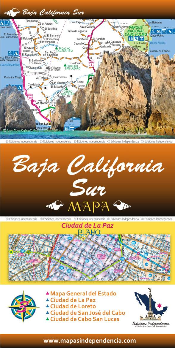
Road maps of Mexico’s states from Ediciones Independencia highlighting numerous places of interest and tourist facilities, with each title also providing a large street plan of the provincial capital plus maps of other local towns, popular tourist resorts and/or archaeological sites.The state maps show the road and rail networks on a clear base, with topography
Historic Maps and Views of New York
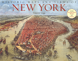
Historic Maps and Views of New York” has 24 reproductions of old maps and panoramic views dating from 1600s to the present; each one is removable and ready for framing in a custom format or in a standard 11″ x 14″ frame (28x36cm).This fascinating collection includes one of the earliest known maps of Manhattan, a
Hidalgo State – Pachuca
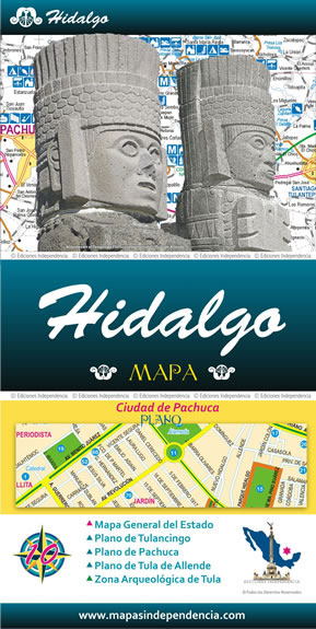
Road maps of Mexico’s states from Ediciones Independencia highlighting numerous places of interest and tourist facilities, with each title also providing a large street plan of the provincial capital plus maps of other local towns, popular tourist resorts and/or archaeological sites.The state maps show the road and rail networks on a clear base, with topography
Japan Bilingual Atlas

A bilingual road atlas of Japan from Kodansha International in a glovebox paperback format with additional street plans, railway networks diagrams, thematic tourist maps highlighting important sights, etc. All place names are in both Latin alphabet and in Japanese; places of interest and the supporting text are in English. The atlas is divided into several
Japan Bilingual Map

Japan at 1:1,500,000 on a bilingual road map from Kodansha International, with mapping of the whole country presenting its topography, plus on the reverse more detailed maps of the more densely populated areas. On one side is a map of the whole country at 1:1,500,000 with Hokkaido shown as a separate inset. Several more panels
The Rebel of Rangoon: A Tale of Defiance and Deliverance in Burma

An epic, multigenerational story of courage and sacrifice set in a tropical dictatorship, The Rebel of Rangoon captures a gripping moment of possibility in Burma (Myanmar) Once the shining promise of Southeast Asia, Burma in May 2009 ranks among the world`s most repressive and impoverished nations. Its ruling military junta seems to be at the
The Longest August: The Unflinching Rivalry Between India and Pakistan

The partitioning of British India into independent Pakistan and India in August 1947 occurred in the midst of communal holocaust, with Hindus and Sikhs on one side and Muslims on the other. More than 750,000 people were butchered, and 12 million fled their homes–primarily in caravans of bullock-carts–to seek refuge across the new border: it
Albany City & County, NY
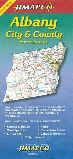
Albany, NY on a double-sided map from Jimapco combining a street plan of the city and its immediate surroundings with a more detailed enlargement of downtown Albany, plus a road map Albany County covering of a wider region around the city.On one side is a street plan of Albany at 1:28,000, with coverage including Colonie,
Adirondacks NY
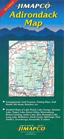
The Adirondacks and the north-eastern part of New York state at 1:1:389,220 on a detailed, extensively indexed road map from Jimapco, highlighting numerous recreational facilities, plus enlargements for main towns.On one side is a road map at 1:285,000 of the Adirondacks covering an area between the Canadian border and highway 90, and extending from the