Category Archives: Maps
United States NGS Explorer Wall Map ENCAPSULATED
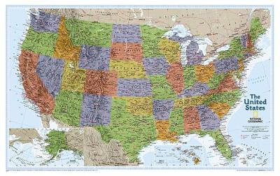
National Geographic Wall Maps offer a special glimpse into current and historical events, and they inform about the world and environment. Offered in a variety of styles and formats, these maps are excellent reference tools and a perfect addition to any home, business or school. There are a variety of map options to choose from,
Colima State – Colima City
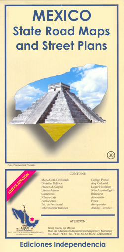
Road maps of Mexico’s states from Ediciones Independencia highlighting numerous places of interest and tourist facilities, with each title also providing a large street plan of the provincial capital plus maps of other local towns, popular tourist resorts and/or archaeological sites.The state maps show the road and rail networks on a clear base, with topography
California Southern
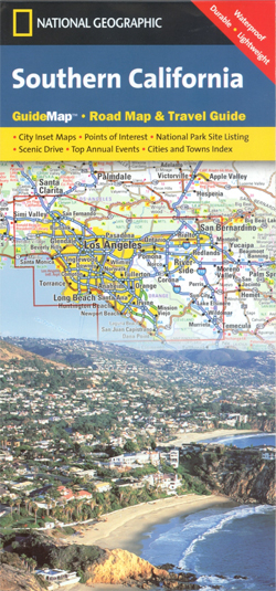
Southern California in a series of US state maps from the National Geographic with cartography from Mapquest. Coverage extends from San Diego north to San Francisco. City maps and enlargements cover the Los Angeles conurbation (including the Orange County and extending east beyond San Bernardino) with a street plan of downtown LA, the San Diego
Nayarit State – Tepic
Road maps of Mexico’s states from Ediciones Independencia highlighting numerous places of interest and tourist facilities, with each title also providing a large street plan of the provincial capital plus maps of other local towns, popular tourist resorts and/or archaeological sites.The state maps show the road and rail networks on a clear base, with topography
United States NGS Explorer Wall Map PAPER

National Geographic Wall Maps offer a special glimpse into current and historical events, and they inform about the world and environment. Offered in a variety of styles and formats, these maps are excellent reference tools and a perfect addition to any home, business or school. There are a variety of map options to choose from,
Sonora State – Hermosillo
Road maps of Mexico’s states from Ediciones Independencia highlighting numerous places of interest and tourist facilities, with each title also providing a large street plan of the provincial capital plus maps of other local towns, popular tourist resorts and/or archaeological sites.The state maps show the road and rail networks on a clear base, with topography
USA NGS Scenic Drives
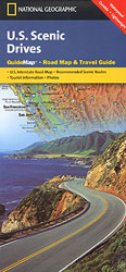
USA on a light, waterproof and tear-resistant tourist map from the National Geographic Society combining an overview road map of the whole country with, on the reverse, 20 panels presenting the publishers choices for 20 best scenic drives in various states.On one side is an overview map of USA at 1:7,810,000 approx. showing the network
Allegheny National Forest
Map No. 739, Allegheny National Forest South in Pennsylvania at 1:70,000, in an extensive series of GPS compatible, contoured hiking maps of USA’s national and state parks or forests and other popular recreational areas. Cartography is based on the national topographic survey, with additional tourist information.The maps, with most titles now printed on light, waterproof
U.S. College and University Professor Pathfinder`s Reference Map

U.S. College and University Professor Pathfinder`s Reference Map from Hedberg Maps showing locations of over 1300 colleges and universities across the whole of the USA, distinguishing between private and public institutions.The map covers the whole of USA, including Alaska, Hawaii, Puerto Rico and the US Virgin Islands. Enlargements show in greater detail areas with many
Titanic Reference Map
Titanic Reference Map is a double sided, colour, info-graphic foldout sheet illustrating the story of the doomed ocean liner from a geographic perspective. The first complete map of the world’s most famous shipwreck, has been revised and updated. Map side: the routes of the 1912 shipping lanes are indicated before and after the disaster; the
Baseball Travel Map USA
Baseball Travel Map of USA in Professor Pathfinder’s series from Hedberg Maps, showing locations of teams in the Major, Minor and Independent Leagues, with lists of all the teams and their contact details.The map, presented in a convenient concertina format, locates professional teams in North America, including southern Canada and northern Mexico, indicating whether major
Vietnamese Memories #1: Leaving Saigon

The testimonies of five family members, over five different periods, as they are respectively forced to leave their home country of Vietnam when outside forces or inner turmoil shatter their normal lives. Each story follows the journey of a family member as they have to leave everything behind, adapt to a new country and culture,
Secret Lives of the U.S. Presidents: Strange Stories and Shocking Trivia from Inside the White House

In this book you ll discover that: Teddy Roosevelt was blinded in a White House boxing match John Quincy Adams loved to skinny-dip in the Potomac River Gerald Ford once worked as a Cosmopolitan magazine cover model Warren G. Harding gambled with White House china when he ran low on cash Jimmy Carter reported a
Everest: The West Ridge
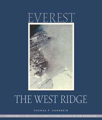
This is the 2013 special anniversary edition to commemorate the 50th anniversary of the first ascent of Mount Everest via the West Ridge which remains the least attempted and most deadly of recognised routes on Everest. In 1963, Jim Whittaker became the first American to summit Everest via the South Col route. Roughly two weeks
Baja California North State – Mexicali and Tijuana
Road maps of Mexico’s states from Ediciones Independencia highlighting numerous places of interest and tourist facilities, with each title also providing a large street plan of the provincial capital plus maps of other local towns, popular tourist resorts and/or archaeological sites.The state maps show the road and rail networks on a clear base, with topography
Baja California South State – La Paz
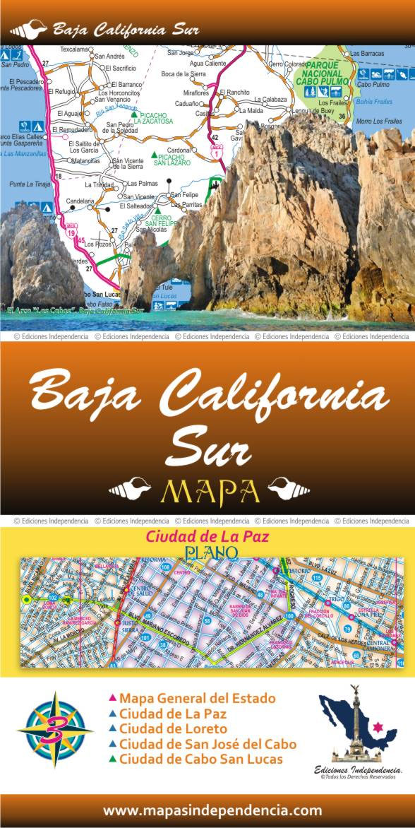
Road maps of Mexico’s states from Ediciones Independencia highlighting numerous places of interest and tourist facilities, with each title also providing a large street plan of the provincial capital plus maps of other local towns, popular tourist resorts and/or archaeological sites.The state maps show the road and rail networks on a clear base, with topography
Historic Maps and Views of New York
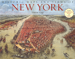
Historic Maps and Views of New York” has 24 reproductions of old maps and panoramic views dating from 1600s to the present; each one is removable and ready for framing in a custom format or in a standard 11″ x 14″ frame (28x36cm).This fascinating collection includes one of the earliest known maps of Manhattan, a
Hidalgo State – Pachuca
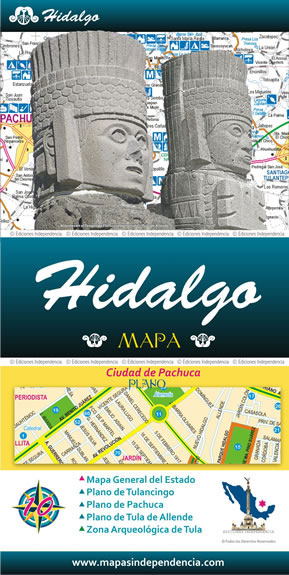
Road maps of Mexico’s states from Ediciones Independencia highlighting numerous places of interest and tourist facilities, with each title also providing a large street plan of the provincial capital plus maps of other local towns, popular tourist resorts and/or archaeological sites.The state maps show the road and rail networks on a clear base, with topography
1,000 Places to See Before You Die: A Photographic Journey
Patricia Schultz curates the world. When she published the original `1,000 Places to See Before You Die`, she created not only a new kind of travel book but also a new way of thinking about our experiences and interests. Now Schultz captivates our hearts in the same compelling way her original book spoke to our