Category Archives: Maps


LandScope USA Conservation NGS Wall Map
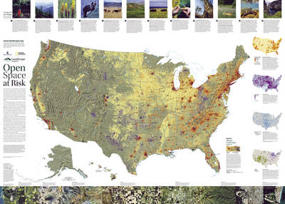
The National Conservation Wall Map tells the story of the changing face of land conservation in the United States and the continuing threats to the nation`s open space. Side one: ?Natural States of America,” highlights the ever-growing role that land trusts are playing in private land conservation across the U.S. It features descriptions of the
Baja NGS Adventure Map Bundle
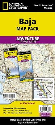
AdventureMaps provide global travellers with the perfect combination of detail and perspective, highlighting hundreds of points of interest and the diverse and unique destinations within the country. Each map is printed on durable synthetic paper, making them waterproof and tear-resistant. They also include the locations of cities and towns with a user-friendly index, plus a
Washington NGS Wall Map PAPER
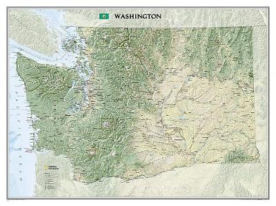
National Geographic Wall Maps offer a special glimpse into current and historical events, and they inform about the world and environment. Offered in a variety of styles and formats, these maps are excellent reference tools and a perfect addition to any home, business or school. There are a variety of map options to choose from,
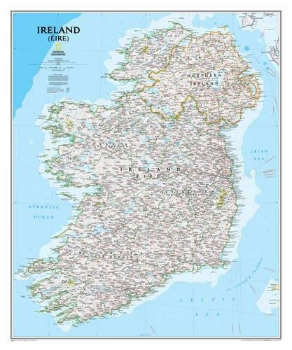
Ireland NGS Classic Wall Map PAPER
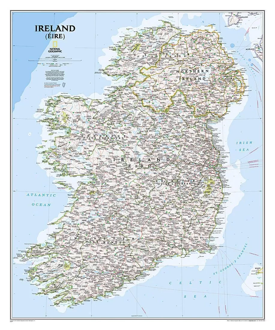
A wall map of Ireland with Northern Ireland at 1:550,000, 76 x 91cm (2ft 6″ x 3ft approx) ‘“ paper version, from the National Geographic Society in their traditional ‘classic” style and with county boundaries. Where appropriate, both Irish and English place names are shown.The map presents the island of Ireland on a pale base
Ireland NGS Classic Wall Map ENCAPSULATED
A wall map of Ireland with Northern Ireland at 1:550,000, 76 x 91cm (2ft 6″ x 3ft approx) ‘“ encapsulated version, from the National Geographic Society in their traditional ‘classic” style and with county boundaries. Where appropriate, both Irish and English place names are shown.The map presents the island of Ireland on a pale base
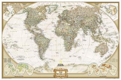
World NGS Executive Pacific-Centered Wall Map LARGE ENCAPSULATED
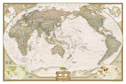
Encapsulated version of the enlarged size, 186 x 122cm (73″ x 48″ approx), Pacific centred political map of the world in the NGS Executive series which offers current information presented in elegant antique style. Countries are in rich but muted colours and oceans in beige, with additional panels and framing in shades of brown.An unusual
Africa NGS Executive Wall Map PAPER
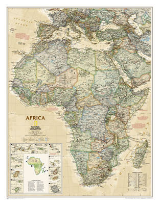
Africa wall map from the National Geographical Society, 61 x 79cm (2ft x 2ft 7″ approx) ‘“ paper version, in their executive style designed to present current information in colouring reminiscent of antique maps. The map presents Africa at 1: 14,244,000 and coverage includes the whole of the Mediterranean Basin, extending north to London. Islands
Las Vegas
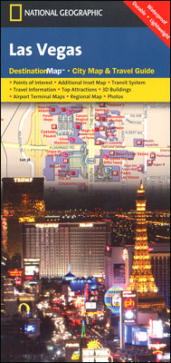
Waterproof and tear-resistant street plan of Las Vegas from the National Geographic highlighting individual hotels, with enlargements for the downtown area and the airport, a road map of the environs and extensive tourist information.On one side is a street plan of the city extending from downtown Las Vegas along The Strip to beyond the McCarran
Africa NGS Executive Wall Map ENCAPSULATED

Africa wall map from the National Geographical Society, 61 x 79cm (2ft x 2ft 7″ approx) ‘“ encapsulated version, in their executive style designed to present current information in colouring reminiscent of antique maps. The map presents Africa at 1: 14,244,000 and coverage includes the whole of the Mediterranean Basin, extending north to London. Islands
California NGS Wall Map ENCAPSULATED
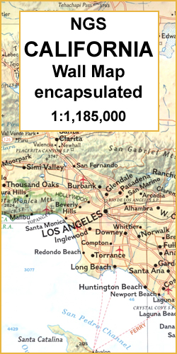
Physical wall map of California, *encapsulated version*, from the National Geographic Society showing the state’s topography by relief shading and colouring, with peak heights in feet. The map gives plenty of names of mountain ranges, peaks, valleys, etc. and highlights national parks and other protected areas.Principal roads and railways, as well as airports with passenger
Asia NGS Executive Wall Map PAPER
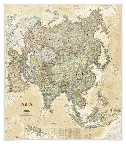
Asia wall map from the National Geographical Society, 84 x 97cm (2ft 9″ x 3ft 2″ approx) ‘“ paper version, in their executive style designed to present current information in colouring reminiscent of antique maps. The map presents Asia at 1: 14,244,000. Coverage includes the whole of the European part of Russia, extending up to
World NGS Classic Wall Map POSTER-SIZE PAPER
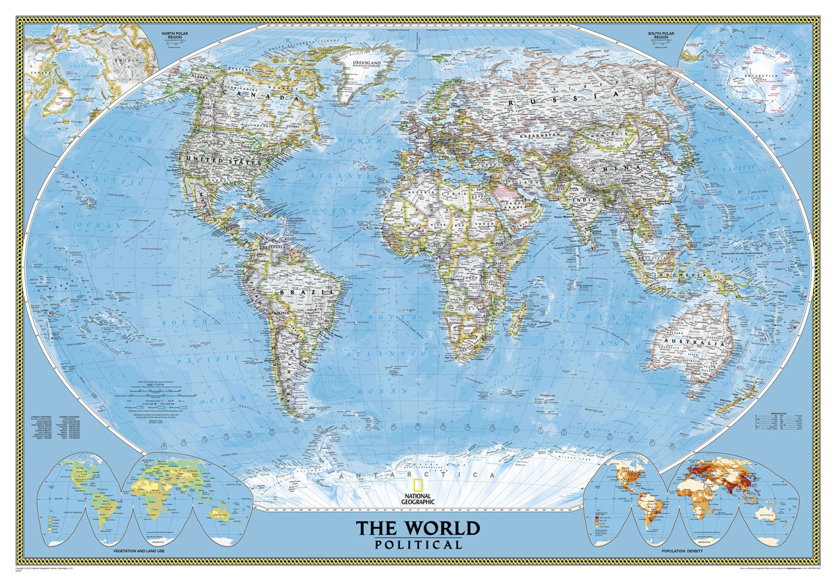
NGS Classic political map of the world, poster size 91 x 61cm (36″ x 24″ approx) ‘“ paper version, with the publishers’ characteristic lay-out providing an attractive alternative to the more conventional world maps, countries in white but defined by different colour borders, oceans in bright blue, plus interesting additional features. All place names are
Map of Discovery – Western Hemisphere NGS Wall Map PAPER
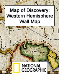
Map of Discovery: the Western Hemisphere from the National Geographic, size 53 x 48cm (21″ x 19″) is a reproduction of a decorative map produced by the renowned American artist and illustrator Newell Convers Wyeth. Country boundaries are as at the time of it publication in 1927. On continents and oceans the map shows the
Arizona
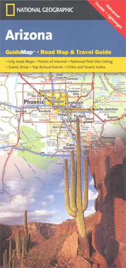
Arizona in a series of US state maps from the National Geographic with cartography from Mapquest, including city maps of the Phoenix conurbation, downtown Phoenix, Tucson, Flagstaff, Yuma and Bullhead City – Laughlin, enlargements of the Grand Canyon, Saguaro and Petrified Forest National Parks, plus a scenic Oak Creek Canyon drive route. The map is