Category Archives: Maps
Britain and Ireland NGS Executive Wall Map PAPER
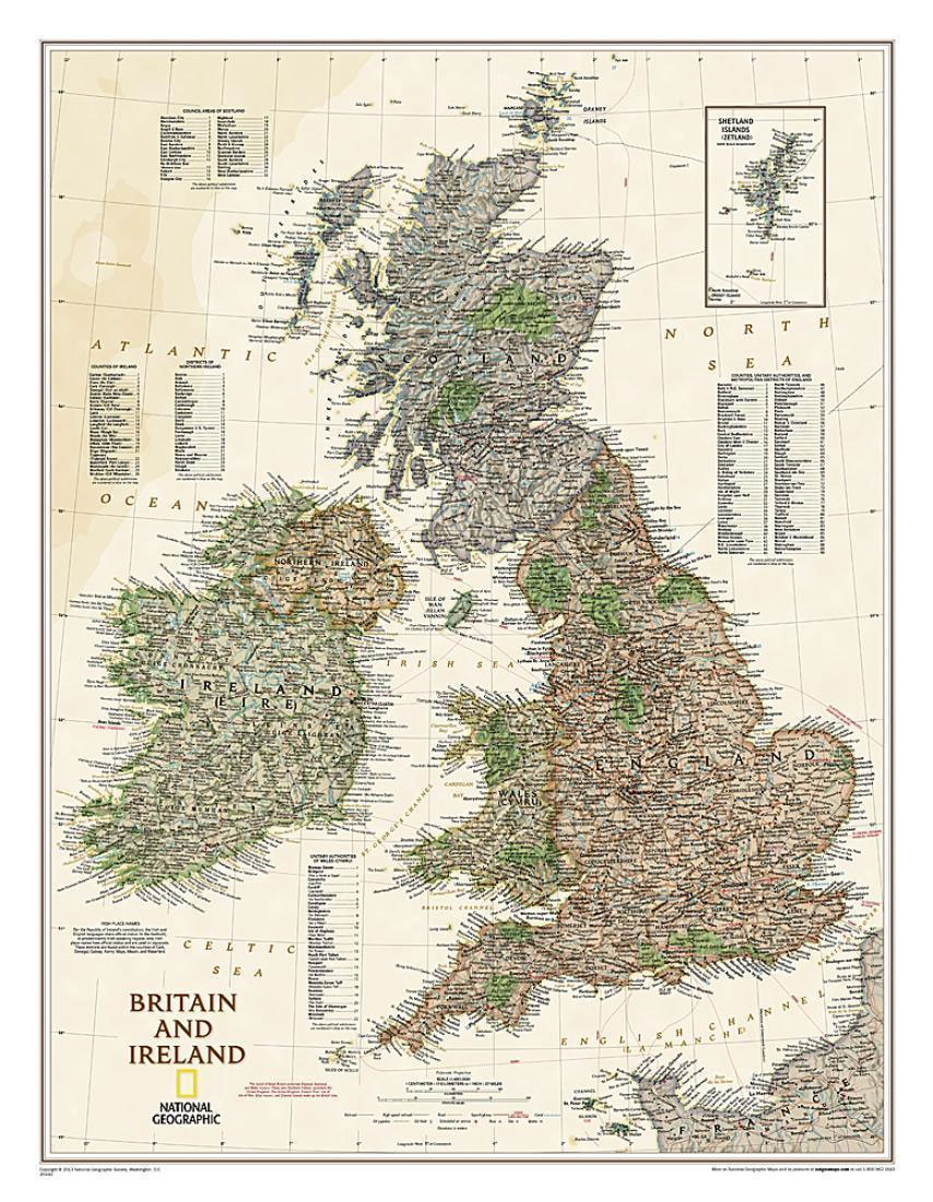
British Isles at 1:1,687,000 on a small wall map, 61 x 76cm (1’11″ x 2’5″ approx) – paper version, wall map from the National Geographic Society in their highly successful Executive style resembling antique maps in colouring, with muted hues for the land and the surrounding seas in shades of beige.The map has relief shading
Britain and Ireland NGS Executive Wall Map ENCAPSULATED
British Isles at 1:1,687,000 on a small wall map, 61 x 76cm (1’11″ x 2’5″ approx) – encapsulated version, wall map from the National Geographic Society in their highly successful Executive style resembling antique maps in colouring, with muted hues for the land and the surrounding seas in shades of beige.The map has relief shading
Italy NGS Executive Wall Map PAPER
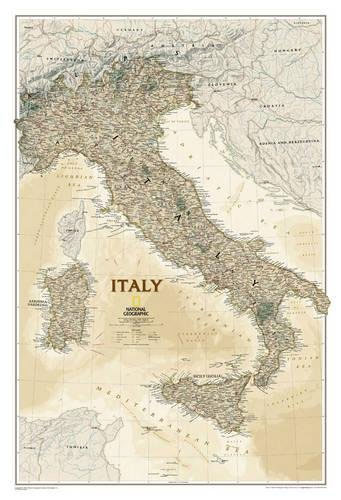
Italy at 1:1,765,000 wall map, size 59 x 87cm (23″ x 34″ approx) – paper version, from the National Geographic Society in their highly successful Executive style resembling antique maps in colouring, with muted hues for the land and the surrounding seas in shades of beige.The map shows the country’s division into administrative regions, with
Italy NGS Executive Wall Map ENCAPSULATED
Italy at 1:1,765,000 wall map, size 59 x 87cm (23″ x 34″ approx) – encapsulated version, from the National Geographic Society in their highly successful Executive style resembling antique maps in colouring, with muted hues for the land and the surrounding seas in shades of beige.The map shows the country’s division into administrative regions, with
South America NGS Executive Wall Map ENCAPSULATED
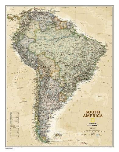
South America wall map, size 61 x 76cm (24″ x 30″ approx) ‘“ encapsulated version, from the National Geographic Society in their highly successful executive style resembling antique maps in colouring, with muted hues for the land and the surrounding seas in shades of beige.The map has relief shading to indicate the topography, clearly showing
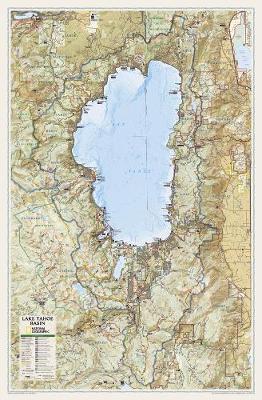
Lake Tahoe Basin NGS Wall Map PAPER
National Geographic Wall Maps offer a special glimpse into current and historical events, and they inform about the world and environment. Offered in a variety of styles and formats, these maps are excellent reference tools and a perfect addition to any home, business or school. There are a variety of map options to choose from,
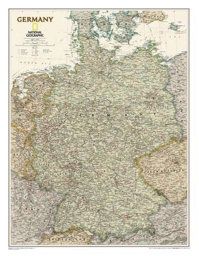
Germany NGS Executive Wall Map PAPER
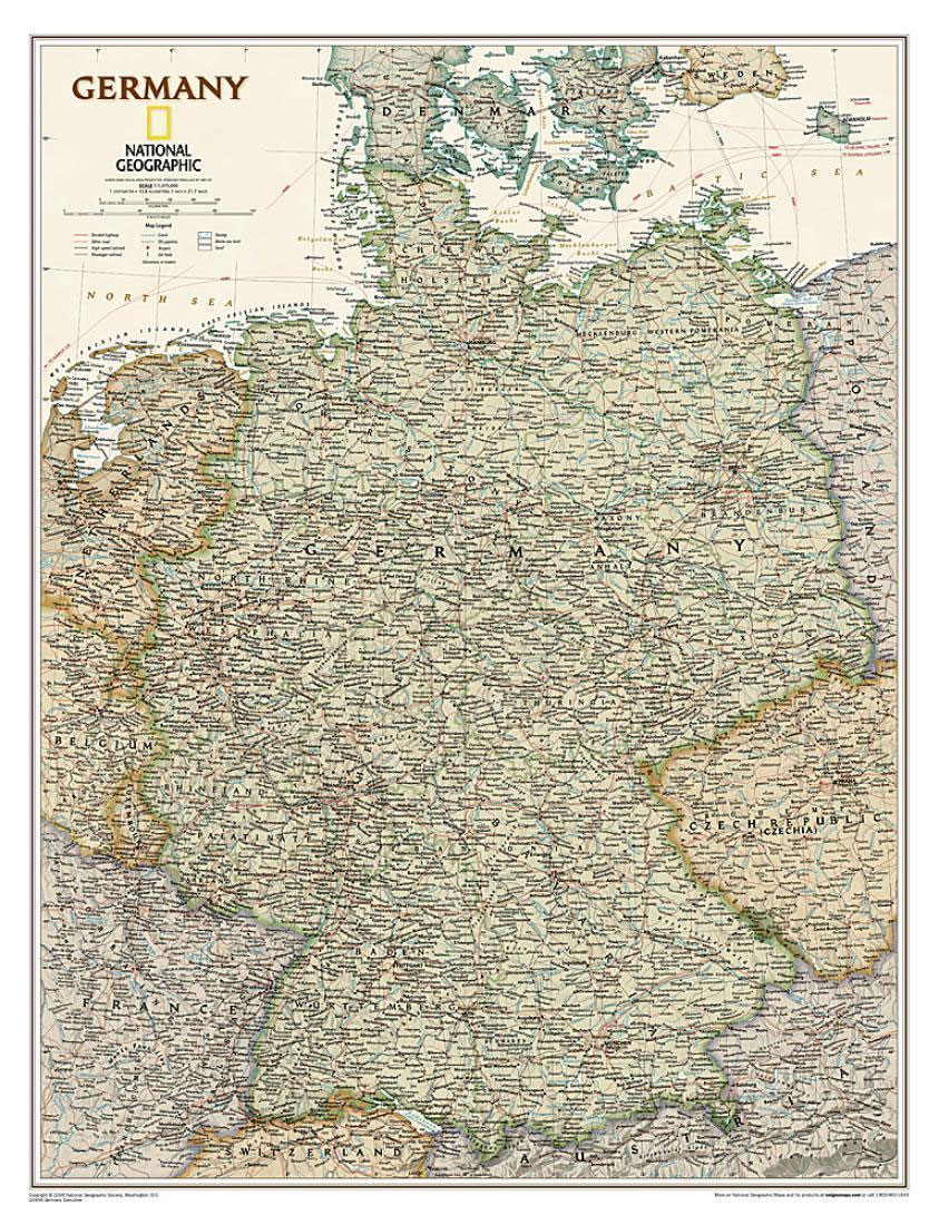
Germany at 1:1,375,000 on a wall map, size: 61 x 77cm (24″ x 30″ approx) ‘“ paper version, from the National Geographic Society in highly successful executive style with muted coluring designed to evoke antique maps.The map presents the division of Germany into individual states, showing their names in their English versions, e.g. Mecklenburg-Western Pomerania
Germany NGS Executive Wall Map ENCAPSULATED
Germany at 1:1,375,000 on a wall map, size: 61 x 77cm (24″ x 30″ approx) ‘“ encapsulated version, from the National Geographic Society in highly successful executive style with muted coluring designed to evoke antique maps.The map presents the division of Germany into individual states, showing their names in their English versions, e.g. Mecklenburg-Western Pomerania
France, Belgium and Netherlands NGS Executive Wall Map PAPER
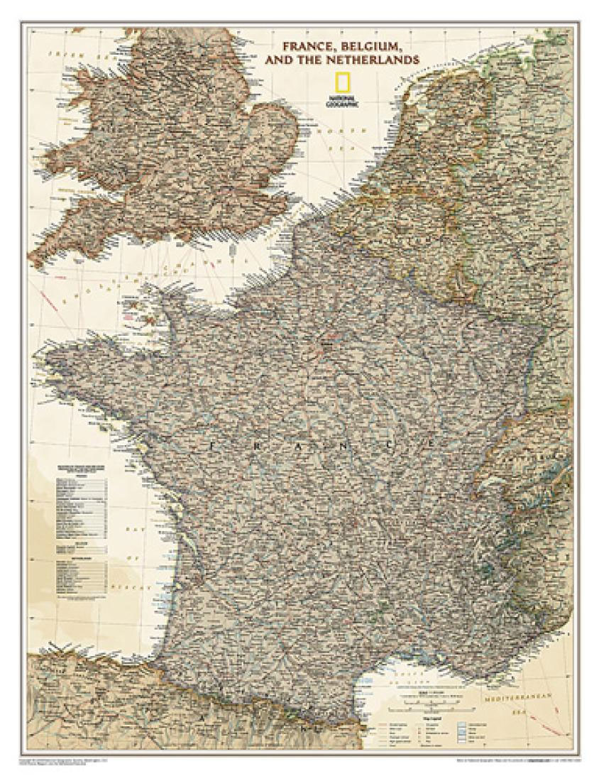
France, Belgium and Netherlands at 1:1,953,000 on a small wall map, 59 x 76cm (1’11″ x 2’5″ approx) – paper version, from the National Geographic Society in their highly successful Executive style resembling antique maps in colouring, with muted hues for the land and the surrounding seas in shades of beige.The map has relief shading
France, Belgium and Netherlands NGS Executive Wall Map ENCAPSULATED
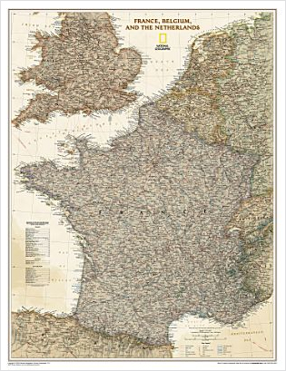
France, Belgium and Netherlands at 1:1,953,000 on a small wall map, 59 x 76cm (23″x30″ approx) – encapsulated version, from the National Geographic Society in their highly successful Executive style resembling antique maps in colouring, with muted hues for the land and the surrounding seas in shades of beige.The map has relief shading to show
North America NGS Executive Wall Map PAPER
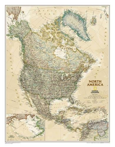
North America NGS Executive Style Wall Map, size 61 x 76cm (24″ x 30″ approx), paper version, published by National Geographic Society in an elegant presentation reminiscent of antique maps. Countries are in muted colours, with surrounding oceans in beige.Coverage includes Central America and the Caribbean, extending from the North Pole to Venezuela. Aleutian Islands
North America NGS Executive Wall Map ENCAPSULATED

North America NGS Executive Style Wall Map, size 61 x 76cm (24″ x 30″ approx), encapsulated version, published by National Geographic Society in an elegant presentation reminiscent of antique maps. Countries are in muted colours, with surrounding oceans in beige.Coverage includes Central America and the Caribbean, extending from the North Pole to Venezuela. Aleutian Islands
Asia NGS Executive Wall Map ENCAPSULATED
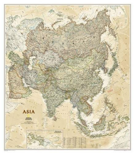
Asia wall map from the National Geographical Society, 84 x 97cm (2ft 9″ x 3ft 2″ approx) ‘“ encapsulated version, in their executive style designed to present current information in colouring reminiscent of antique maps. The map presents Asia at 1: 14,244,000. Coverage includes the whole of the European part of Russia, extending up to
Spain and Portugal NGS Executive Wall Map ENCAPSULATED
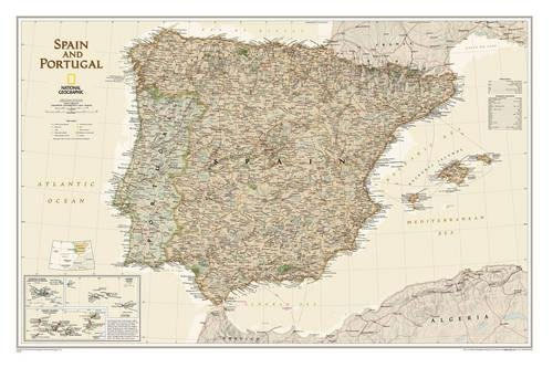
Spain and Portugal Executive Style Wall Map, size 84 x 56cm (33″ x 22″ approx) – encapsulated version, from the National Geographic Society, showing the Iberian Peninsula at 1:1,803,000 with current information presented in elegant antique style of muted shades of brown and beige.Within Spain the map shows internal administrative boundaries with names of the
Afghanistan and Pakistan NGS Classic Wall Map PAPER

Afghanistan and Pakistan wall map, 58 x 89cm (23″ x 2ft 11″ approx) ‘“ paper version, presenting the region at 1:3,363,300 in the NGS classic style on a light base with country boundaries outlined in contrasting colours. Coverage includes the whole of Tajikistan, as well as most of Uzbekistan and Kyrgyzstan. Topography of the region
Montreal
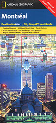
Central Montreal on an indexed tourist street plan from the National Geographic Society, highlighting sights and accommodation, and printed on light, waterproof and tear-resistant synthetic paper.On one side is a street plan of the city’s central districts 1:15,000, highlighting places of interest and selected hotels. Metro stations are clearly marked and for divers the map
Australia NGS Executive Wall Map PAPER
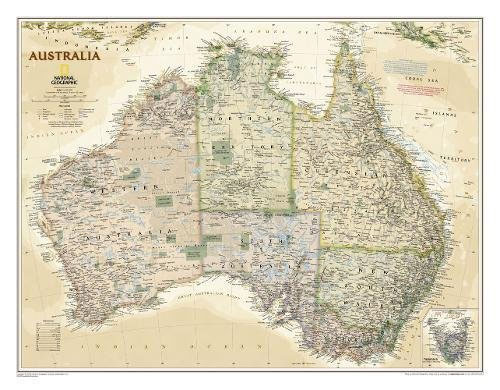
Australia on a wall map at 1:6,413,000, size: 77 x 60cm (30″ x 24″ approx) ‘“ paper version, from the National Geographic Society in their executive style designed to present current information in colouring reminiscent of antique maps.Individual states are shown in subdued pastel colours against the background of the surrounding oceans in shades of
Maine
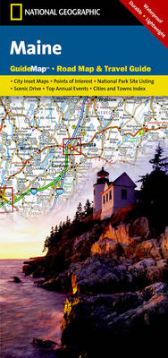
Maine in a series of US state maps from the National Geographic with cartography from Mapquest, including city maps of Portland with an enlargement for the downtown area, Bangor, Lewiston – Auburn, Augusta, Freeport – Yarmouth and Bar Harbour, an enlargement for the Acadia National Park, plus a scenic drive route along the coast from
Australia NGS Executive Wall Map ENCAPSULATED
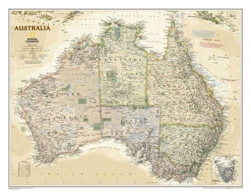
Australia on a wall map at 1:6,413,000, size: 77 x 60cm (30″ x 24″ approx) ‘“ encapsulated version, from the National Geographic Society in their executive style designed to present current information in colouring reminiscent of antique maps.Individual states are shown in subdued pastel colours against the background of the surrounding oceans in shades of