Category Archives: Maps
American War of Independence – War of 1812 NGS NGS Wall Map ENCAPSULATED
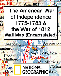
National Geographic’s double-sided wall map, encapsulated version, presenting on one side The American War of Independence 1775 – 1783, with on the reverse the War of 1812 fought to resolve many issues outstanding from the earlier conflict. Both maps cover the territory from the Atlantic to the Mississippi, including northern Florida and the border regions
Iraq NGS Classic Wall Map ENCAPSULATED

Wall map of Iraq from the National Geographic Society, ENCAPSULATED version, 72.5 x 62.5cm (29″ x 25″ approx), presenting the country in the classic NGS style: light beige background with relief shading to show the topography and country borders outlined in contrasting colours for clarity.Internal administrative boundaries are shown with names of the provinces. All
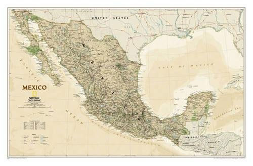
Mexico NGS Executive Wall Map PAPER
Mexico NGS Executive Style Wall Map from the National Geographic Society, paper version, showing the country at 1:4,370,000 with current information presented in elegant antique style of muted shades of predominantly brown and beige.The map shows internal administrative boundaries (if at times difficult to see against the more mountainous background of western and southern Mexico)
Iran NGS Classic Wall Map PAPER
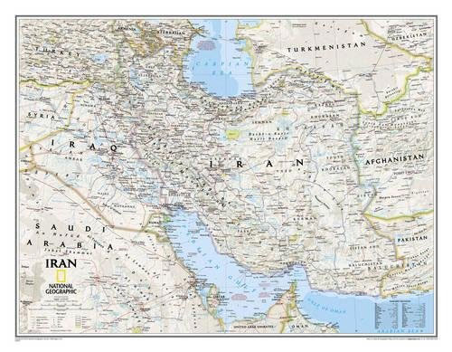
Wall map of Iran from the National Geographic Society, PAPER version, 77 x 59.5cm (30″ x 24″ approx), presenting the country in the classic NGS style: light beige background with relief shading to show the topography and country borders outlined in contrasting colours for clarity.Coverage includes the whole of Iraq and the coast of the
Mexico NGS Executive Wall Map ENCAPSULATED
Mexico NGS Executive Style Wall Map from the National Geographic Society, encapsulated version, showing the country at 1:4,370,000 with current information presented in elegant antique style of muted shades of predominantly brown and beige.The map shows internal administrative boundaries (if at times difficult to see against the more mountainous background of western and southern Mexico)
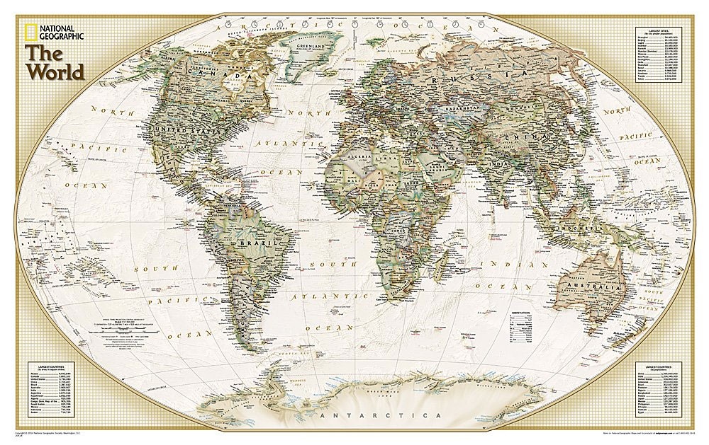
World NGS Explorer Executive Wall Map PAPER
National Geographic Society’s Explorer Executive political maps of the world, 81.5 x 51cm / 32″ x 20″ approx., in the publishers’ very popular style which offers current information presented in elegant antique style. Countries are in rich but muted colours and oceans in beige, with additional panels and framing in shades of brown.An unusual feature
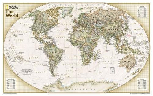
World NGS Explorer Executive Wall Map ENCAPSULATED
National Geographic Society’s Explorer Executive political maps of the world, 81.5 x 51cm / 32″ x 20″ approx. encapsulated version, in the publishers’ very popular style which offers current information presented in elegant antique style. Countries are in rich but muted colours and oceans in beige, with additional panels and framing in shades of brown.An
Ireland NGS Executive Wall Map PAPER
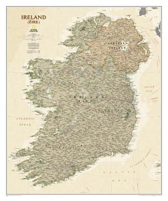
A wall map of Ireland with Northern Ireland at 1:550,000, 76 x 91cm (2ft 6″ x 3ft approx) ‘“ paper version, from the National Geographic Society in their executive style designed to present current information in colouring reminiscent of antique maps with shades of beige and brown. Where appropriate, both Irish and English place names
Ireland NGS Executive Wall Map ENCAPSULATED
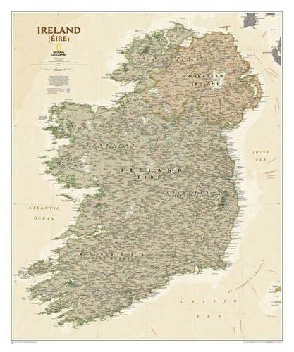
A wall map of Ireland with Northern Ireland at 1:550,000, 76 x 91cm (2ft 6″ x 3ft approx) ‘“ encapsulated version, from the National Geographic Society in their executive style designed to present current information in colouring reminiscent of antique maps with shades of beige and brown. Where appropriate, both Irish and English place names
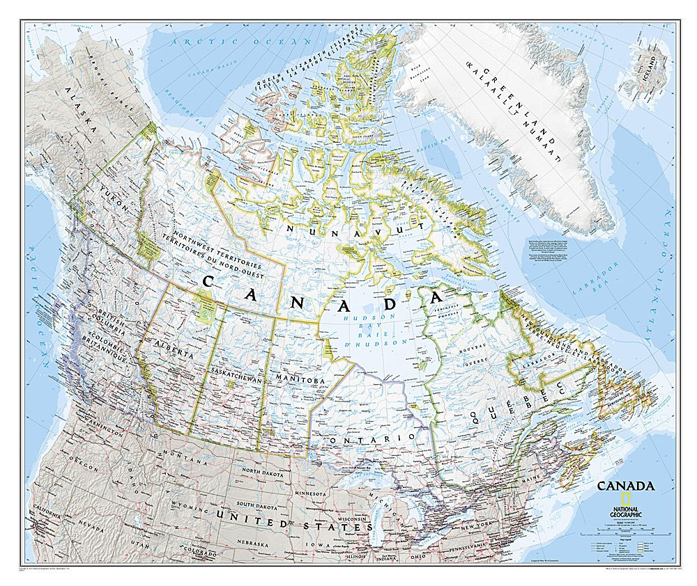
Canada NGS Classic Wall Map PAPER

Canada on the NGS Classic style wall map, size: 97 x 81cm (38″ x 32″ approx) – paper version, showing the country at 1:6,400,000 in the NGS traditional classic presentation with pale base and provincial boundaries shown in contrasting colours.The base map has relief shading to show the Rocky Mountains, plus plenty of names of
Canada NGS Classic Wall Map ENCAPSULATED
Canada on the NGS Classic style wall map, size: 97 x 81cm (38″ x 32″ approx) – encapsulated version, showing the country at 1:6,400,000 in the NGS traditional classic presentation with pale base and provincial boundaries shown in contrasting colours.The base map has relief shading to show the Rocky Mountains, plus plenty of names of
Canada NGS Executive Wall Map PAPER
Canada on the NGS Executive style wall map, size: 97 x 81cm (38″ x 32″ approx) – paper version, showing the country at 1:6,400,000 in an elegant presentation reminiscent of antique maps. Provinces are in muted colours, with seas and lakes in beige.The base map has relief shading to show the Rocky Mountains, plus plenty
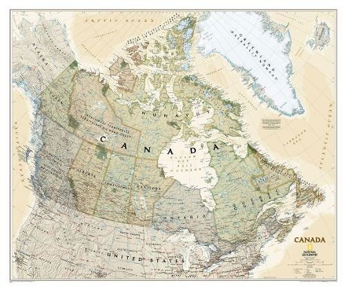
Canada NGS Executive Wall Map ENCAPSULATED

Canada on the NGS Executive style wall map, size: 97 x 81cm (38″ x 32″ approx) – encapsulated version, showing the country at 1:6,400,000 in an elegant presentation reminiscent of antique maps. Provinces are in muted colours, with seas and lakes in beige.The base map has relief shading to show the Rocky Mountains, plus plenty
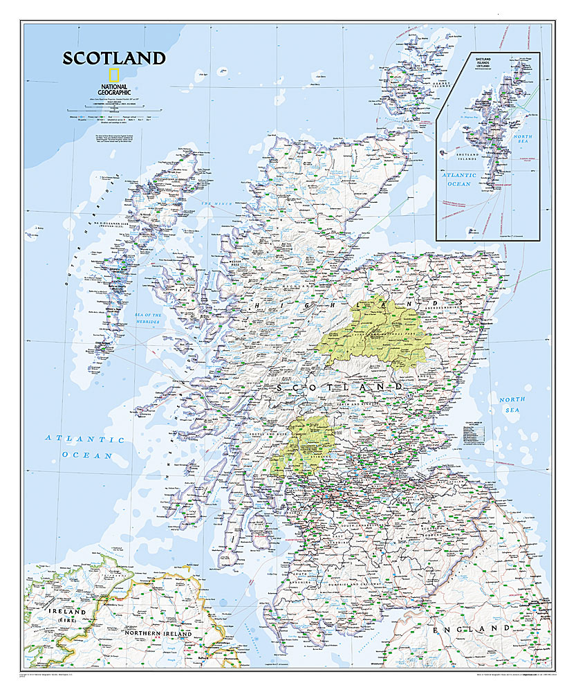
Scotland NGS Classic Wall Map PAPER

A wall map of Scotland, 76 x 91cm (2ft 6″ x 3ft approx) ‘“ paper version, from the National Geographic Society in their traditional ‘classic” style: a pale beige base with relief shading, road and rail networks, county boundaries, etc.The map presents Scotland on a base with relief shading to show the country’s topography, with
Scotland NGS Classic Wall Map ENCAPSULATED
A wall map of Scotland, 76 x 91cm (2ft 6″ x 3ft approx) ‘“ encapsulated version, from the National Geographic Society in their traditional ‘classic” style: a pale beige base with relief shading, road and rail networks, county boundaries, etc.The map presents Scotland on a base with relief shading to show the country’s topography, with
Scotland NGS Executive Wall Map PAPER
A wall map of Scotland, 76 x 91cm (2ft 6″ x 3ft approx) ‘“ paper version, from the National Geographic Society in their executive style designed to present current information in colouring reminiscent of antique maps with shades of beige and brown.The map presents Scotland on a base with relief shading to show the country’s
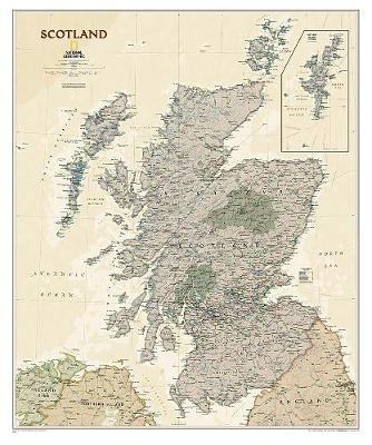
Scotland NGS Executive Wall Map ENCAPSULATED
A wall map of Scotland, 76 x 91cm (2ft 6″ x 3ft approx) ‘“ encapsulated version, from the National Geographic Society in their executive style designed to present current information in colouring reminiscent of antique maps with shades of beige and brown.The map presents Scotland on a base with relief shading to show the country’s
China NGS Executive Wall Map ENCAPSULATED
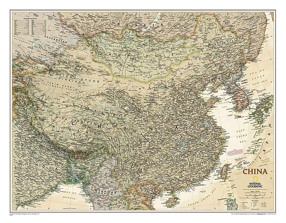
China NGS Executive Style Wall Map from the National Geographic Society, encapsulated version, showing the country at 1:7,804,000 with current information presented in elegant antique style of muted shades of predominantly brown and beige.Coverage includes the whole of Mongolia and the Koreas, southern Japan, the arch of the Himalayas with Nepal and Bhutan, northern India
Iraq NGS Classic Wall Map PAPER
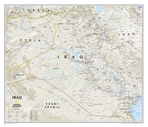
Wall map of Iraq from the National Geographic Society, PAPER version, 72 x 62cm (28″ x 24″ approx), presenting the country in the classic NGS style: light beige background with relief shading to show the topography and country borders outlined in contrasting colours for clarity.Internal administrative boundaries are shown with names of the provinces. All