Category Archives: Maps
World NGS Physical Wall Map POSTER-SIZE ENCAPSULATED
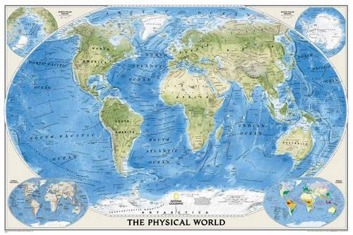
The Physical World wall map from the National Geographic Society, size 92 x 61cm (36″ x 24″ approx), encapsulated version, designed to show not only the physical features of the land masses but also to provide a superb representation of the ocean floor.Altitude colouring and subtle but effective relief shading are used to show the
Sierra Nevada Destination Map
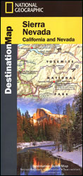
Sierra Nevada on a double-sided road map at 1:543,000 from the National Geographic, highlighting numerous places of interest and printed on light, waterproof and tear resistant synthetic paper. On one side coverage extends from the California/Oregon border to Sacramento and includes the region of Nevada around Lake Tahoe and Pyramid Lake. On the reverse the
United States NGS National Parks Wall Map ENCAPSULATED
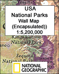
National Parks of the United States on a wall map from the National Geographic Society, size 107 x 76cm (42″ x 30″ approx) ‘“ encapsulated version, with enlargements showing the most popular destinations in greater detail.Locations of National Parks, National Park Service land, National Monuments and National Historic Sites are highlighted on a physical map
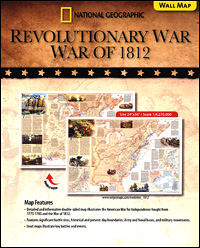
American War of Independence – War of 1812 NGS NGS Wall Map PAPER
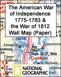
National Geographic’s double-sided wall map, paper version, presenting on one side The American War of Independence 1775 – 1783, with on the reverse the War of 1812 fought to resolve many issues outstanding from the earlier conflict. Both maps cover the territory from the Atlantic to the Mississippi, including northern Florida and the border regions
American War of Independence – War of 1812 NGS Folded Map
National Geographic’s double-sided map presenting on one side The American War of Independence 1775 – 1783, with on the reverse the War of 1812 fought to resolve many issues outstanding from the earlier conflict. Both maps cover the territory from the Atlantic to the Mississippi, including northern Florida and the border regions of Canada, and
American War of Independence – War of 1812 NGS NGS Wall Map ENCAPSULATED
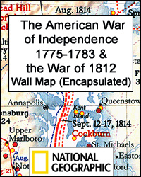
National Geographic’s double-sided wall map, encapsulated version, presenting on one side The American War of Independence 1775 – 1783, with on the reverse the War of 1812 fought to resolve many issues outstanding from the earlier conflict. Both maps cover the territory from the Atlantic to the Mississippi, including northern Florida and the border regions
Shipwrecks of the Northeast USA NGS Wall Map PAPER
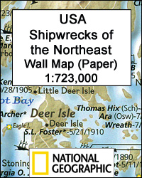
Shipwrecks of the Northeast USA Wall Map, paper version ‘“ size 71 x 91cm (21″ x 36″), from the National Geographic highlighting locations of more than 5400 shipwrecks along the coast of New England from the Canadian border to the Napatree Point in Rhode Island. Three panels provide enlargements presenting in greater detail the Boston
Shipwrecks of the Northeast USA
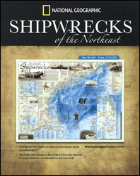
Shipwrecks of the Northeast USA, a folded map from the National Geographic highlighting locations of more than 5400 shipwrecks along the coast of New England from the Canadian border to the Napatree Point in Rhode Island. Three panels provide enlargements presenting in greater detail the Boston Harbour area, Cape Cod with Nantucket, and the Narragansett
Balkans NGS Classic Wall Map PAPER
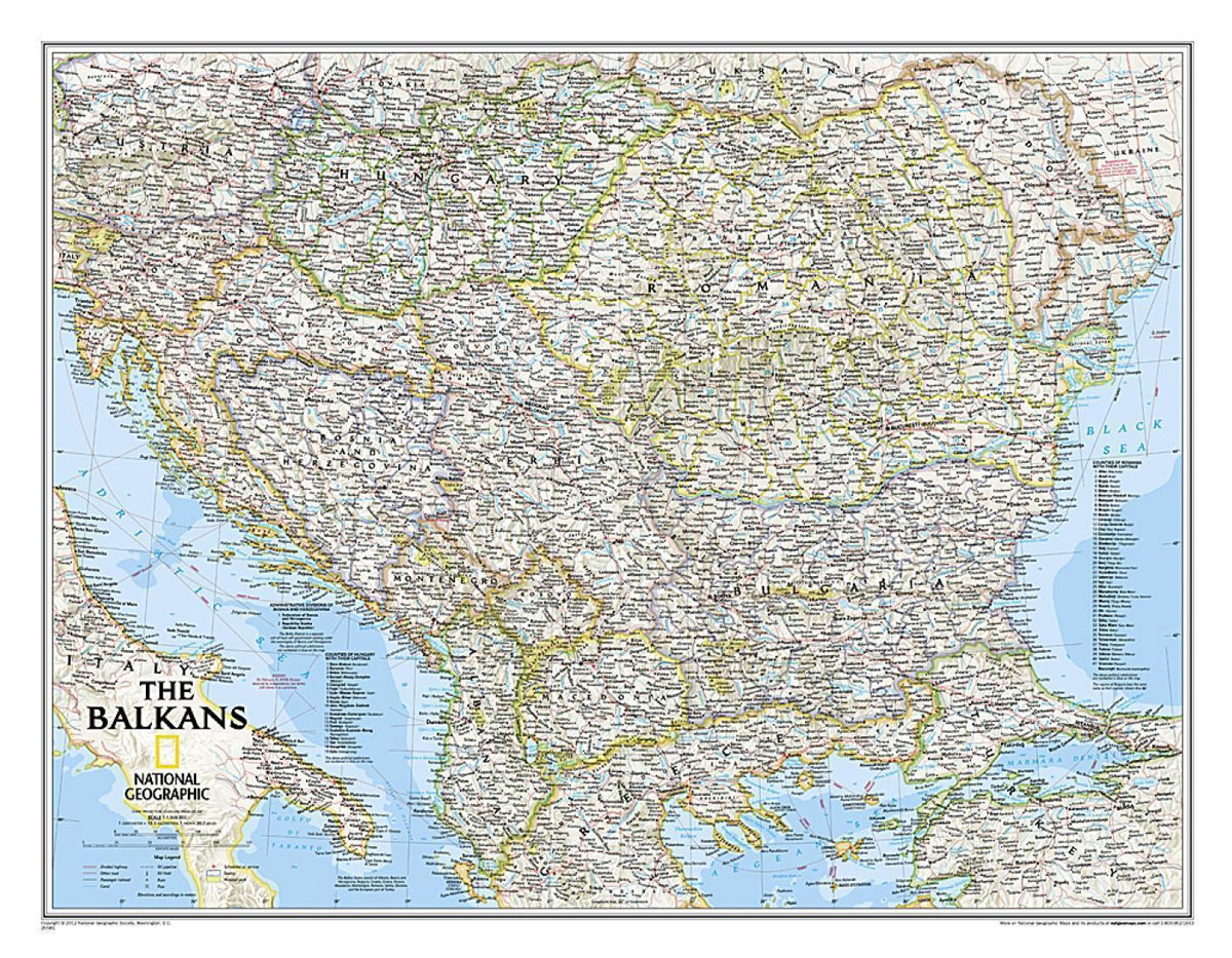
The Balkans at 1: 1,948,000 on a political wall map from the NGS, size 77 x 59.5cm (30″ x 23.5″ approx) ‘“ paper version, presenting the region their characteristic classic style: countries with a light base and international boundaries picked out in colour and the seas in light blue.Coverage extends from the Adriatic to the
Shipwrecks of the Northeast USA NGS Wall Map ENCAPSULATED
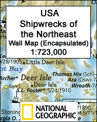
Shipwrecks of the Northeast USA Wall Map, encapsulated version ‘“ size 71 x 91cm (21″ x 36″), from the National Geographic highlighting locations of more than 5400 shipwrecks along the coast of New England from the Canadian border to the Napatree Point in Rhode Island. Three panels provide enlargements presenting in greater detail the Boston
Balkans NGS Classic Wall Map ENCAPSULATED
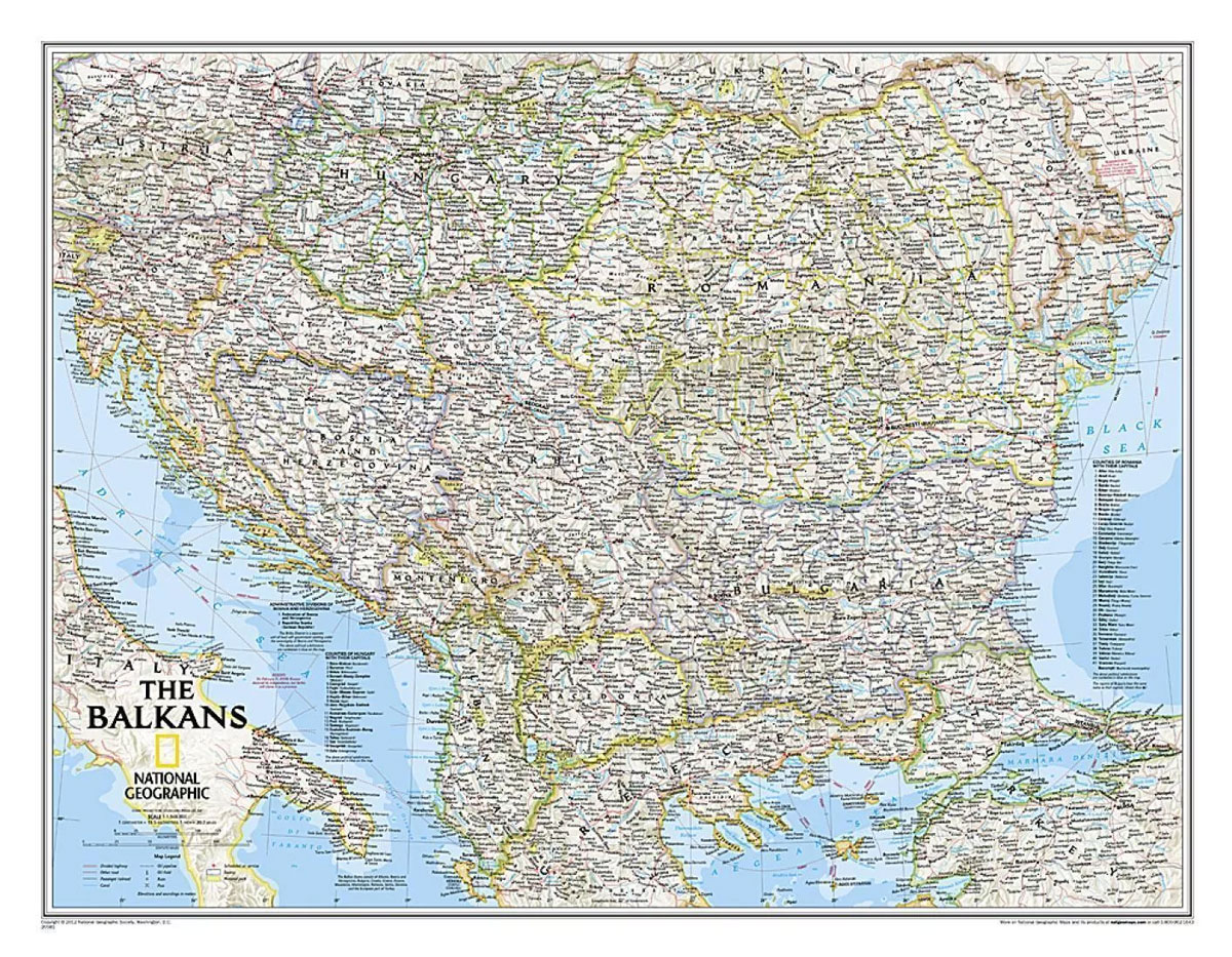
The Balkans at 1: 1,948,000 on a political wall map from the NGS, size 77 x 59.5cm (30″ x 23.5″ approx) ‘“ encapsulated version, presenting the region their characteristic classic style: countries with a light base and international boundaries picked out in colour and the seas in light blue.Coverage extends from the Adriatic to the
Brazil NGS Executive Wall Map PAPER
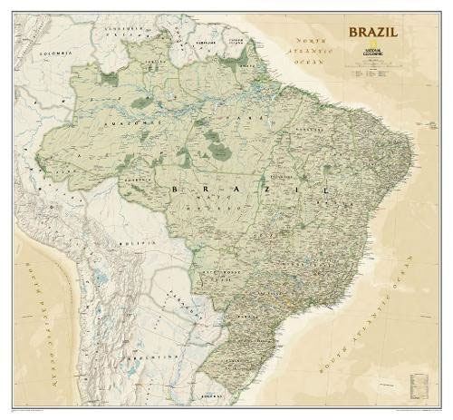
Brazil at 1:5,000,000 on a large wall map, paper version, in the National Geographic Society’s Executive style which offers current information presented in elegant antique style of muted shades of beige, with internal state boundaries outlined in green.The base map has subtle relief shading, with names of mountain ranges and spot heights in metres. Graphics
Brazil NGS Executive Wall Map ENCAPSULATED
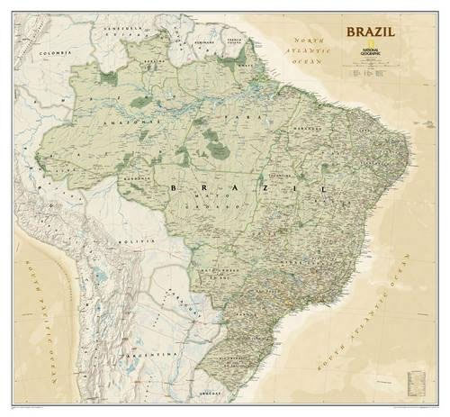
Brazil at 1:5,000,000 on a large wall map, encapsulated version, in the National Geographic Society’s Executive style which offers current information presented in elegant antique style of muted shades of beige, with internal state boundaries outlined in green.The base map has subtle relief shading, with names of mountain ranges and spot heights in metres. Graphics
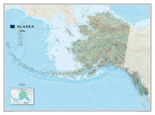
Alaska NGS Wall Map PAPER

Alaska physical wall map, size 103 x 78cm (40.5″ x 31″ approx) ‘“ paper version, at 1:3,660,000 from the National Geographic, with colouring to show the topography and plenty of place names. Coverage includes the panhandle and the outermost Aleutian Islands in their proper geographical placing.Altitude colouring and relief shading shows the topography, with names
Caribbean NGS Classic Wall Map PAPER
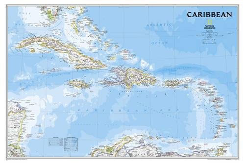
Caribbean NGS Classic Style Wall Map, size 91.5 x 61cm (36″ x 24″ approx), paper version, published by the National Geographic Society in their traditional classic style: countries with a light-coloured base and their borders in different colours. On larger islands, Cuba or Hispaniola, topography is presented by light relief shading with names of mountain
Alaska NGS Wall Map ENCAPSULATED
Alaska physical wall map, size 103 x 78cm (40.5″ x 31″ approx) ‘“ encapsulated version, at 1:3,660,000 from the National Geographic, with colouring to show the topography and plenty of place names. Coverage includes the panhandle and the outermost Aleutian Islands in their proper geographical placing.Altitude colouring and relief shading shows the topography, with names
New Orleans
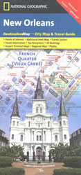
New Orleans on a light, waterproof and tear-resistant tourist map from the National Geographic combining a street plan of the city’s central districts with road maps of the environs and the Louisiana plantations, plan of the airport, tourist information, etc.On one side is a street plan of the city’s central districts, including the French Quarter,
Shipwrecks of the DelMarVa
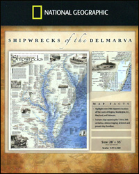
Shipwrecks of the DelMarVa DE/MD/VA, a folded map from the National Geographic highlighting over 2400 shipwreck locations off the coast of Virginia, Washington DC, Maryland and Delaware from the 17th to the 20th century. The map shows wrecks along the Atlantic coast of the Delmarva Peninsula, as well as in the Delaware Bay, in the
Shipwrecks of the DelMarVa NGS Wall Map ENCAPSULATED

Shipwrecks of the DelMarVa Wall Map, encapsulated version ‘“ size 79 x 89cm (28″ x 35″), from the National Geographic highlighting over 2400 shipwreck locations off the coast of Virginia, Washington DC, Maryland and Delaware from the 17th to the 20th century. The map shows wrecks along the Atlantic coast of the Delmarva Peninsula, as