Category Archives: Maps
Africa Cape to Cairo Map Studio
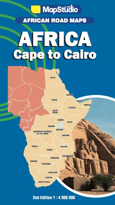
Cape to Cairo: the eastern half of Africa at 1:4,000,000 on a large route planning map from Map Studio, South Africa’s leading map publishers, providing an overview of the road network and rail connections, with numerous national parks and other protected areas prominently highlighted.Plain base map has no altitude colouring and only a few spot
Johannesburg Map Studio Pocket Map
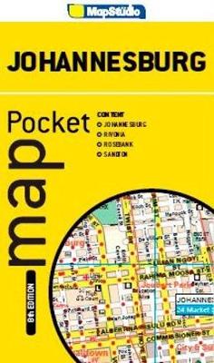
Johannesburg Pocket Tourist Map is a double-sided street plan showing on one side the city centre at 1;15,500, and on the reverse Rivonia, Sandton and Rosebank at 1;17,000. Each plan has a separate street index.Road detail includes freeways, through routes and minor roads, as well as indicating one way streets, parking facilities and petrol stations.
South Africa Map Studio Pocket Map
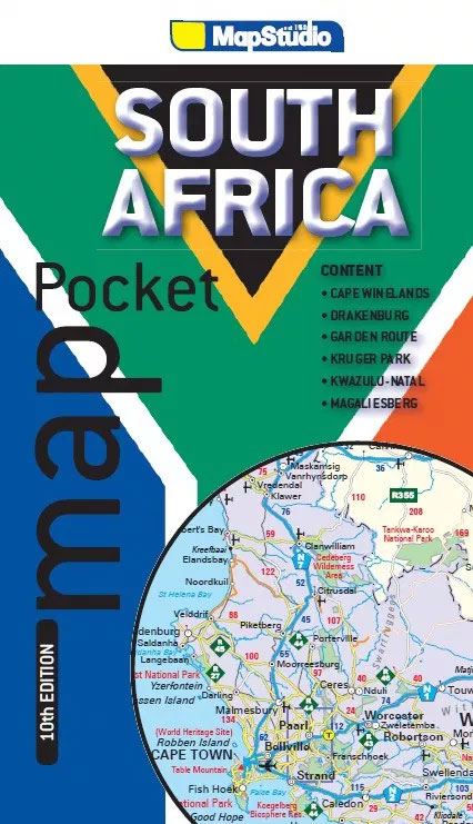
South Africa at 1:3,600,000 on a handy-size pocket map with enlargements for the Kruger National Park, Magaliesberg, Drakensberg, the Kwazulu-Natal coast, the Garden Route, and the Cape Winelands. The main map, which in addition to Lesotho and Swaziland also covers southern Namibia as far as Windhoek, southern Botswana and south-western Mozambique, shows the region`s road
Cape Town & the Peninsula Map Studio Visitors Guide
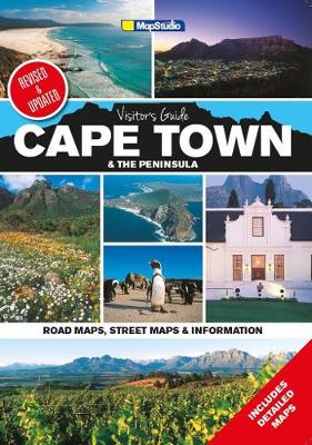
Cape Town and the Peninsula Visitor`s Guide and Atlas from Map Studio in a 24-page, A4 paperback format (5th edition, 2015), with highlighting of numerous places of interest and tourist facilities, descriptions of the area’s best sights, a winelands map, etc. Cape Town itself is shown on three maps: a street plan of its central
Lesotho Map Studio Adventure Map
Lesotho at 1: 375,000 on an indexed map from the South African publishers Map Studio, with GPS coordinates for important road junctions, locations with tourist accommodation or fuel supplies, etc, plus a street plan of central Maseru.The map uses satellite imagery enhanced by altitude colouring to present the topography of this mountainous country. Road network
Gauteng Map Studio Pocket Map
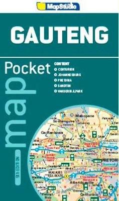
Gauteng Province of South Africa at 1:550,000 on a handy size indexed road map from Map Studio, with on the reverse street plans of central Johannesburg and Pretoria indicating places of interest and various facilities.The road map emphasises the motorway network, indicating toll plazas. Driving distances are marked on many local roads. Railway lines are
Zimbabwe Map Studio Adventure Map
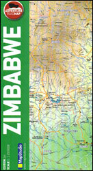
Zimbabwe at 1:1,200,000 on an indexed road map from Map Studio, with good presentation of the country’s topography, GPS waypoints for important road junctions, locations of filling stations, plus a large street plan of central Harare, The main map presents the network of roads and tracks, marking locations of borders crossings and petrol stations, and
East London and Gonubie
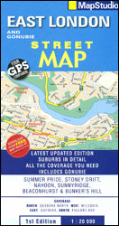
Street plan of East London at 1:20,000 from the South African travel publishers Map Studio, with an inset providing coverage of the nearby Gonubie. Coverage extends inland to include the city’s airport. The plan shows names of districts, indicates main traffic arteries, and highlights various facilities and important buildings. No street index is provided.
Botswana Map Studio Adventure Map

Botswana at 1:1,650,000 on an indexed road map from the South African publishers Map Studio, with the road network annotated with GPS waypoints for important locations, plus a street plan of Gaborone and an enlargement showing the nearby Victoria Falls area on the border of Zimbabwe and Zambia. The map shows Botswana’s topography by altitude
More Top Mountain Bike Trails

More top MTB trails covers the best trails, routes and rides in the Free State, Gauteng, Kwazulu-Natal, Limpopo, Mpumalanga & North West Provinces. Up-to-date route info, great photographs and excellent detailed maps, along with Imba trail. Difficulty rating system and African Mountain Bike Association approvals makes this book the perfect companion for experienced as well
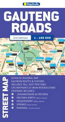
Gauteng Tolls – e-Tolls & Toll Plazas Street Map
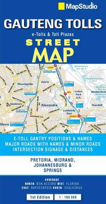
Gauteng Roads double-sided map from the Map Studio covers at 1:100,000 the conurbation centered on Johannesburg, including Pretoria, Soweto, Atteridgeville, Centurion, Roodepoort, Sandton, Edenvale, Germiston, Alberton, Springs, Nigel and Heidelberg.The map shows the area’s main traffic arteries and connecting roads with motorway junctions annotated with exit boards, plus GPS waypoints for exits and entries in
Limpopo & North West Map Studio Pocket Map
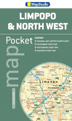
Limpopo, North West Pocket Map at 1:1,800,000 scale by Map Studio.The provincial map contains national roads, main and minor roads, topographic details, route numbers, places of interest and historic sites, airports and airfields, national parks and reserves, border crossings and a detailed index of place names.The map includes routes to Kruger National Park, Johannesburg, Kuruman
Durban MapStudio Pocket Map
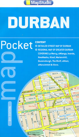
Central Durban at 1:12,500 on an indexed street plan from the South African map publishers, Map Studio, with on the reverse a road map of the city’s environs at 1:100,000, plus a plan of the uShaka Marine World. Also included is a list of renamed streets giving both the old and the new names, plus
South Africa Top MTB Trails

Top MTB trails covers the best trails, routes and rides in the three Cape provinces. Up-to-date route information, great photographs and excellent, detailed maps, along with IMBA Trail difficulty rating system and AMA approvals, make this book the perfect companion for experienced as well as aspiring mountain biking enthusiasts. A comprehensive list of trails to
Cape Town – Northern Suburbs
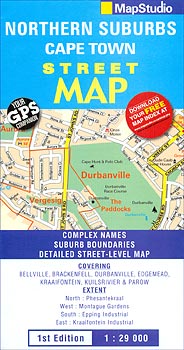
Cape Town’s north-western suburbs on a street plan at 1:29,000 from the Map Studio. Motorways and other main traffic arteries are indicated by colouring, with interchanges clearly drawn. One way streets, traffic lights, car parks and toll plazas are marked. A range of symbols highlight various places of interest, facilities and services. The plan has
Bloemfontein Pocket Tourist Map
Bloemfontein Pocket Tourist Map is an indexed street plan at a scale of 1:15,000, suitable for use with GPS systems. Road detail includes freeways, through routes and minor roads, as well as indicating one way streets, parking facilities and petrol stations. Railways lines and stations are marked and the bus/taxi terminus is located. Colour coding