Category Archives: Maps
Caucasus ITMB
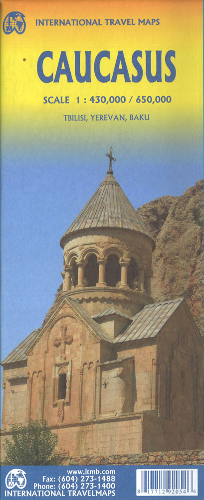
Indexed, double-sided map of the Caucasus region from ITMB with small plans of Yerevan, Baku and Tbilisi, printed on durable waterproof paper. Relief is depicted by altitude tinting, with spot heights for selected peaks. Swamp areas, national parks and reserves are marked, and bathymetric tinting is applied to the sea areas. Road detail distinguishes seasonal
Delhi & Northern India ITMB

Northwestern India at 1:1,900,000 on an indexed map from ITMB, with the reverse side showing a street plan of Delhi with its outer suburbs, plus an enlargement of the Connaught Place central area and diagrams of the metro and rail networks.On one side is an indexed road map of north-western India centred on Delhi and
Cape Verde & West Africa ITMB

Cape Verde Islands presented on an ITMB map both as a group at 1:500,000 and individually at more detailed scales with altitude colouring to show the topography, plus on the reverse an indexed map of Western Africa at 1:3,400,000 extending from the Atlantic coast to Port Harcourt in Nigeria.On one side is an indexed map
Bermuda ITMB
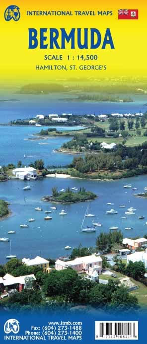
Double-sided detailed map dividing Bermuda east/west. Each half has two separate indexes: one for streets and roads and another for important places and points of interest, plus a street plan of its respective main town: St. George’s and Hamilton. Relief of the island is shown by elevation colouring. The map shows parks, numerous golf courses,
Bhutan & Northeast India ITMB
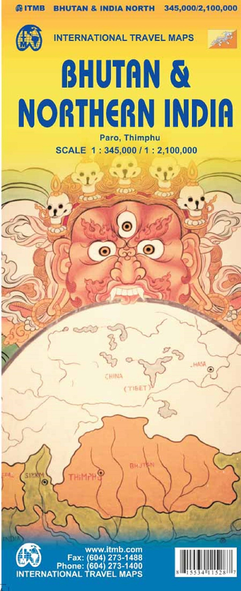
Bhutan at 1:345,000 on an indexed map from ITMB showing its topography by altitude colouring and highlighting places of interest, plus street plans of Thimpu and Paro annotated with useful tourist information and on the reverse a map of the northern half of India at 1:2,100,000.On one side is Bhutan on a map with altitude

British Columbia South ITMB
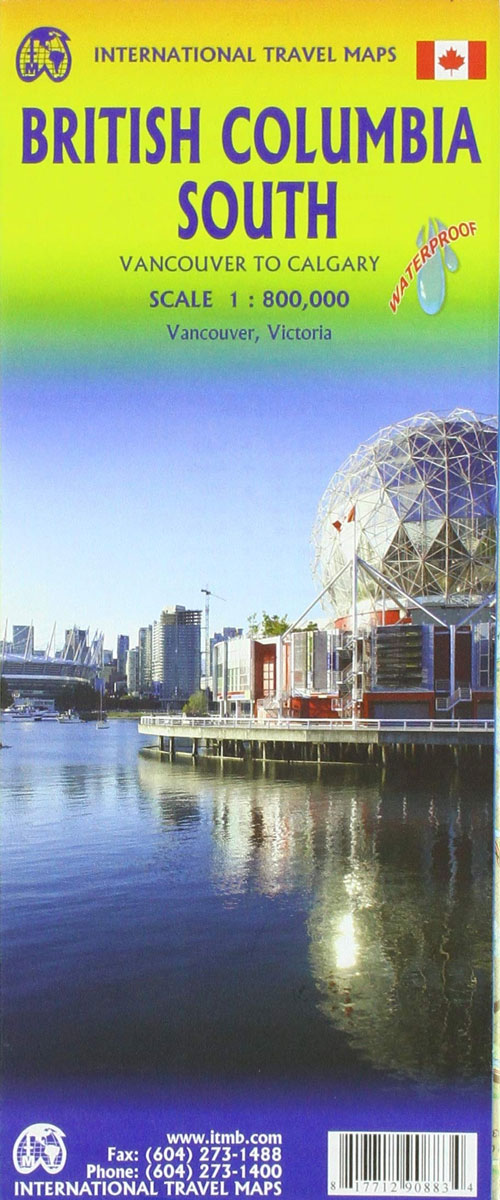
Indexed double-sided road map at 1:800,000 from ITMB of the southern part of British Columbia, extending from Vancouver Island to Calgary to cover the whole of the Banff and Jasper National Parks, with plans of downtown Vancouver and Victoria. Coverage northwards extends to include the southern part of Haida Gwai (Queen Charlotte) Islands and Prince
Bolivia ITMB

Bolivia at 1:1,250,000 on an indexed, double-sided map from ITMB, with large, clear street plans of central La Paz, Potosi and Santa Cruz highlighting various places of interest and tourist facilities.The map divides the country north/south, with a generous overlap – the area between La Paz with Cordillera Real and Cochabamba is shown on both
British Columbia ITMB
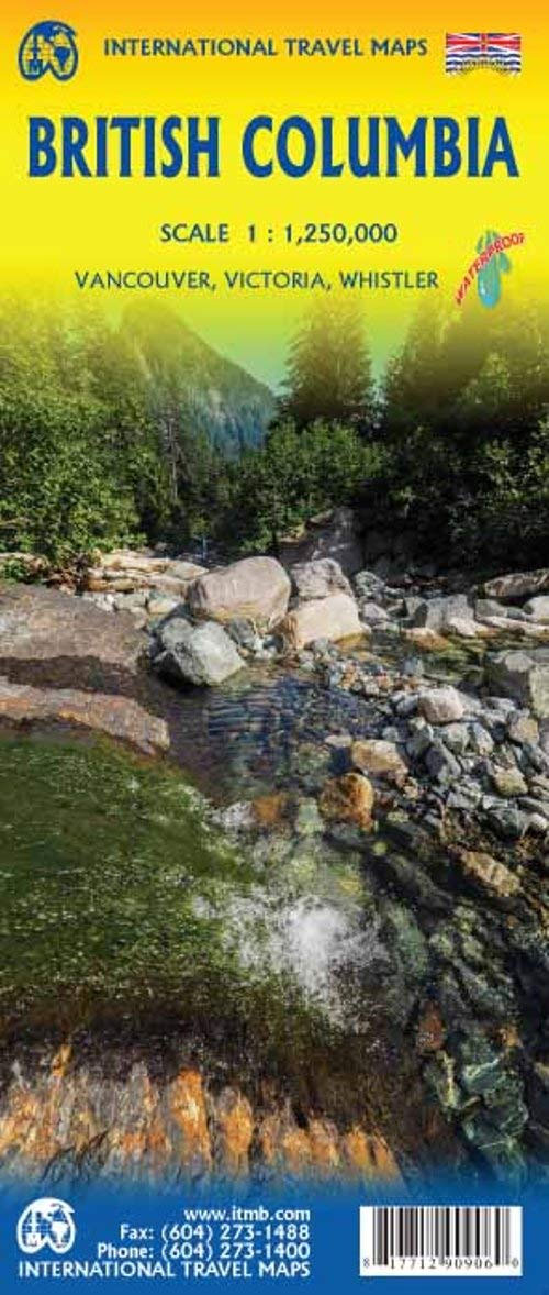
ITMB`s popular provincial map for Canada with updated road changes and new bridges. BC is not changing particularly quickly at the moment, but tens of thousands of people continue to migrate to the province each year, and its population is expected to double over the next twenty years. Thanks to its enormous size, huge tracts
Togo & Benin ITMB
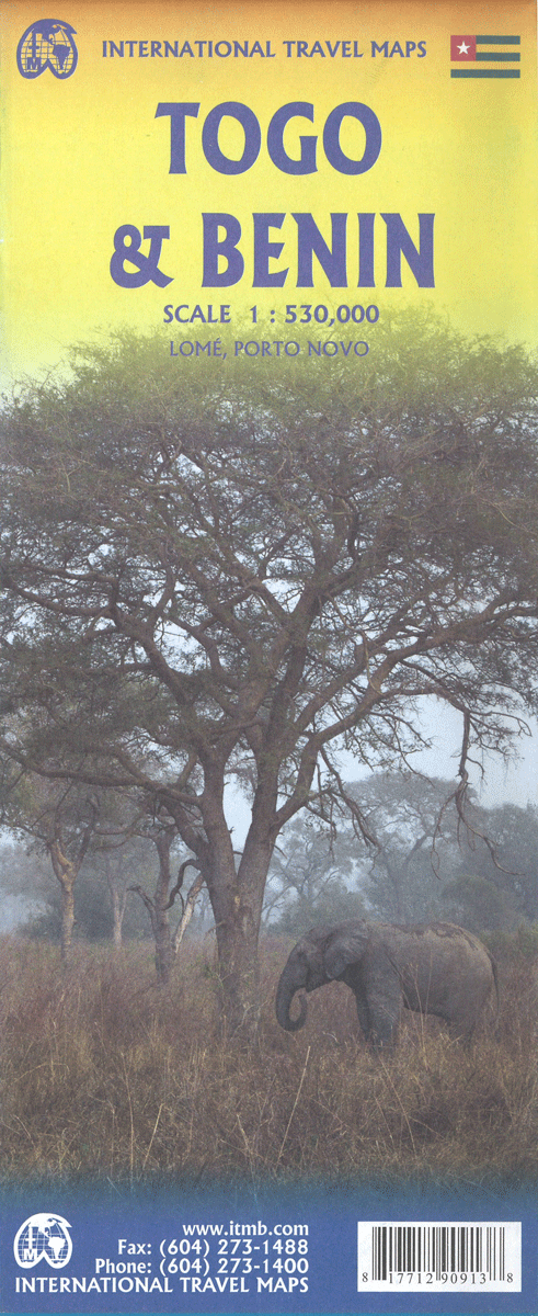
Togo and Benin at 1:530,000 on a double-sided, indexed road map from ITMB with altitude colouring to show their topography, plus large street plans of the two capital cities, Lomรฉ and Porto Novo annotated with places of interest, etc.The map divides the two countries north/south with a small overlap between the sides. Topography is shown
Alaska ITMB

Alaska at 1:1,500,000 on an indexed, double-side map from ITMB with altitude colouring to show the topography and highlighting for the state’s numerous national parks and protected areas. The main part of the state is divided north/south with a small overlap between the sides. The panhandle is shown as an inset at the same scale
Brisbane & Queensland ITMB
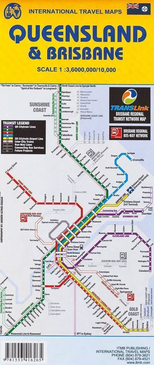
Indexed street plan of Brisbane with, on the reverse, an overview map of not just Queensland, as indicated in the map title, but the whole of eastern Australia, plus a street plan of central Sydney.The plan of Brisbane covers the inner districts and provides a very clear picture of the city’s road and rail networks,
Amazon & Brazil North ITMB
Double-sided, indexed map covering the whole of the Amazon basin from the eastern slopes of the Andes to its delta, dividing the area east/west. Along the Andes the coverage stretches from north of Bogota to south of Lima, whilst the eastern half extends from the borders of Venezuela and the Guyanas to approx. 12ยบ south.