Category Archives: Maps
Japan West & Central Railway & Road ITMB
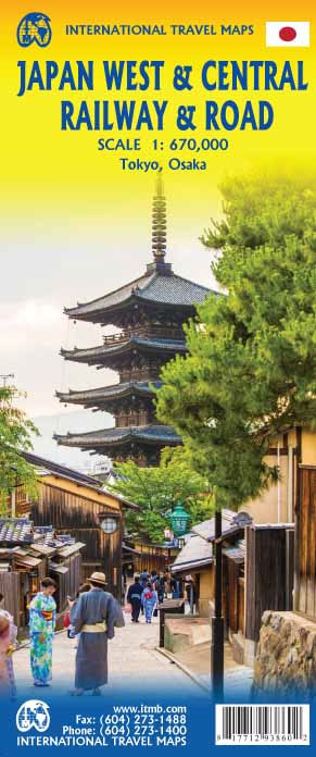
Japan is too large and densely populated a country to show effectively on one map while showing all the attractions and smaller towns of the country. With this map, we are attempting to concentrate on the way the vast majority of visitors travel around Japan – by rail. The road network is still shown in
Jersey & Guernsey ITMB
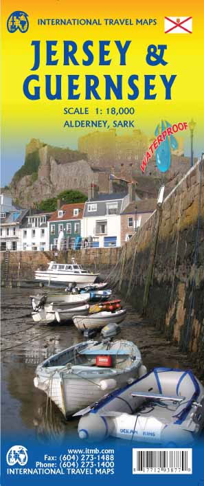
ITMB is pleased to re-introduce the Channel Islands map area after a lengthy hiatus. The islands, collectively known in English as the Channel Islands, are one of those anomalies that make Europe so attractive. There are actually, five inhabited islands, of which Jersey and Guernsey are the largest. Alderney, Sark, and Herm make up the
Jerusalem & Holy Land ITMB

Waterproof and tear-resistant map from ITMB combining an indexed street plan of Jerusalem with a more detailed enlargement of its Old City, plus on the reverse a road map at 1:225,000 covering the Holy Land: northern Israel and the Palestinian Territories. On both the plans and the road map all place names are shown only
Japan South ITMB Railway & Road Map

The southern part of Japan on an indexed, double-sided map at 1:670,000 from ITMB with a street plan of central Tokyo plus enlargements showing in greater detail the Tokyo Bay with Yokohama and Narita, the Kyoto – Nara area, and the Osaka – Kobe area. Coverage of Honshu starts north of Tokyo at Toyama and
Kyoto & Japan West ITMB
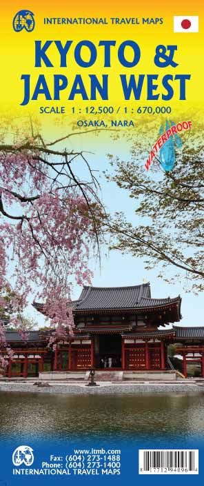
Kyoto on a detailed street plan at 1:12,500 from ITMB, with a road map of the Kyoto – Osaka – Nara area, plus a street plan of central Nara and, on the reverse, an indexed road map of western Japan at 1:670,000 and a street plan of central Osaka.On one side is a street plan
Kuala Lumpur & Malay Peninsula ITMB
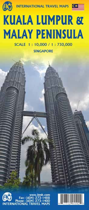
Street map of Kuala Lumpur at 1:10,000 covering the city from the Sentul Terminal and the Setapak Park in the north to the Chinese Cemetery in the south, and from the Parliament House (Bangunan Paliament) in the west to the Royal Selangor Golf Club in the east.Two insets show the Kuala Lumpur surroundings at 1:437,000
Korea South & North ITMB
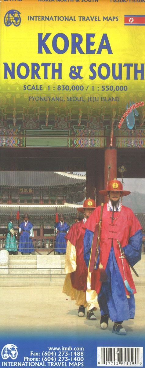
Indexed road map with Pyongyang street plan, personally researched by the president of ITMB, and complemented by a selection of his holiday photos! On the general map road detail shows highways, national roads and provincial roads. Main railways, sea ferry links, ports, international and domestic airports are also indicated. Further detail includes provincial boundaries and
Kyrgyzstan & Tajikistan ITMB
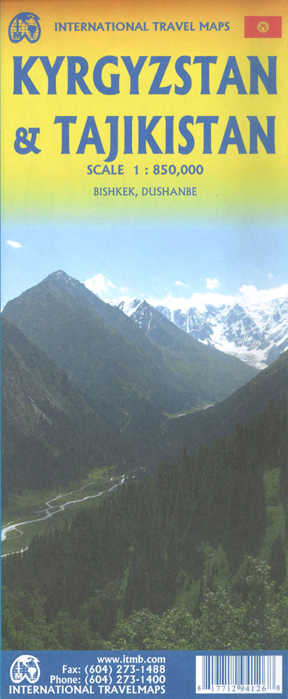
This is a new title for ITMB. The two Central Asian countries of Kyrgyzstan and Tajikistan are rapidly developing a touristic market and we feel that the world needs a good map to reflect their growing importance. The two ‘stans were part of the Soviet empire that fell apart in 1990, creating a dozen new
Germany South ITMB
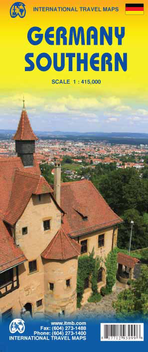
Southern Germany at 1:415,000 on an indexed, double-sided map from ITMB showing its network of roads and main railway lines on a base with altitude colouring to indicate the topography, plus highlighting for main places of interest. Coverage extends north to Cologne in the west and on the eastern side to Jena and Chemnitz. Latitude
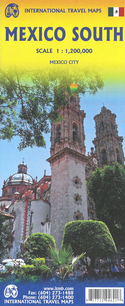
Mexico Pacific Coast & Guadalajara ITMB
Indexed road map covering south-western Mexico, with indexed plan of central Guadalajara on the reverse. The main map extends from Acapulco in the south-east to Durango in the north and Mazatlan in the west. Altitude tinting represents the general relief, with spot heights for major peaks, swamp areas and National Parks. Road detail includes some
India ITMB
India on an indexed, double-sided map, printed on waterproof and tear-resistant plastic paper, with a street plan of central New Delhi, enlargements for greater Mumbai and Kolkata and a separate index for each side of the map.The map divides India north/south, with Assam and the north-eastern states shown as an inset, and presents the country’s
Greenland & North Pole ITMB
Greenland at 1:3,000,000 on a map from ITMB with physical colouring of its coastal areas and on the reverse the North Circumpolar Region at 1:9,000,000, centered on the North Pole, on a political map showing the countries around the Arctic Ocean. The map of Greenland has elevation colouring for the coastal areas, with spot heights
Indonesia ITMB
Indonesia at 1:2,400,000 on a double-sided indexed map from ITMB and cartography designed to show the country’s topography through bright altitude colouring and spot heights (elevation shown in feet). The map divides Indonesia west/east, with Sumatra, Borneo, Java, Bali, Lombok and Sumbawa on one side, and Sulawesi with the remaining islands and West Papua on
USA Southwest ITMB
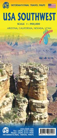
South-western USA on a waterproof and tear-resistant map at 1:1,000,000 from ITMB with highlighting for Route 66.Coverage, spread over the two sides of the map, extends east into western Colorado and New Mexico and in the north well beyond San Francisco and Reno in California and Nevada, and about half of Utah.Topography of this mountainous
Italy ITMB Railway & Road Map

A road map of Italy including the entire rail network at 1:850,000, ideal for the traveler who searches in a map for the essential tool for their travels in the Italian peninsula.
Grand Canyon & Arizona ITMB
Arizona and New Mexico at 1:900,000 on an indexed, double-side map from ITMB with topography shown by altitude colouring, plus enlargements showing in greater detail Flagstaff and Albuquerque and their environs. Coverage includes las Vegas and the whole of Lake Mead. Topography is indicated by altitude colouring with bands and spot heights in feet. Road