Category Archives: Maps
London Premier A-Z Wall Map PAPER
London Premier Wall Map, size 120 x 96cm – paper version, from Geographers` A-Z Map Company at 3 inches to 1 mile (1:21,477), designed to cover an area around at least a six-mile radius from Charing Cross.The plan shows A and B roads annotated with selected house numbers for easier identification of addresses. One way
Yorkshire Dales South Adventure Atlas
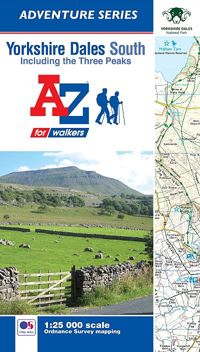
The southern part of the Yorkshire Dales at 1:25,000 in a series of handy A5 size Adventure Atlases from Geographers` A-Z Map Company with cartography from the Ordnance Survey’s Explorer series. The atlas covers Wharfedale and Ribblesdale, including Skipton, Gargrave, Long Preston, Settle, Austwick, High Bentham, Ingleton, Dent, Buckden Grassington, Malham, Bolton Abbey, etc, and
Glasgow – Edinburgh & Central Scotland A-Z Wall Map PAPER
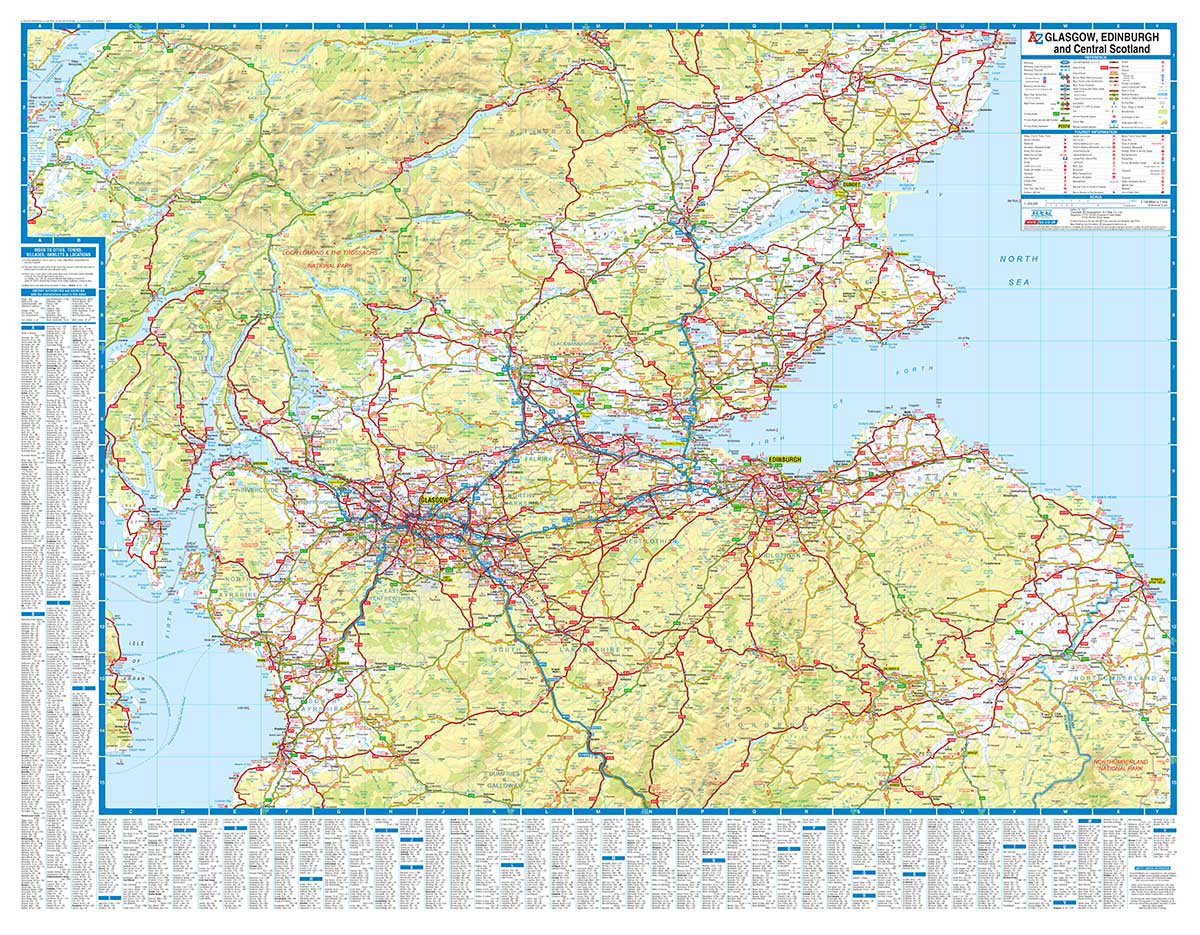
Regional wall map of Glasgow, Edinburgh & Central Scotland at 1:200,000 (3.2 miles to 1inch) from A to Z, covering: Glencoe, Dundee, St. Andrews, Kirkcaldy, Berwick-upon-Tweed, Ayr, and Oban. Clear presentation of the road network shows motorways, A and B roads, some minor and local roads, with gradients of 1:5 and steeper indicated. Service stations,
Pennine Way North A-Z Adventure Atlas
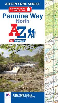
The Pennine Way North Adventure Atlas, presenting the northern section of the route between Kirk Yetholm in the Cheviot Hills and Bowes near Barnard Castle on mapping at 1:25,000 in a series of handy A5 size Adventure Atlases from Geographers` A-Z Map Company with cartography from the Ordnance Survey’s Explorer series. Coverage includes a large
Devon & Cornwall A-Z Wall Map PAPER
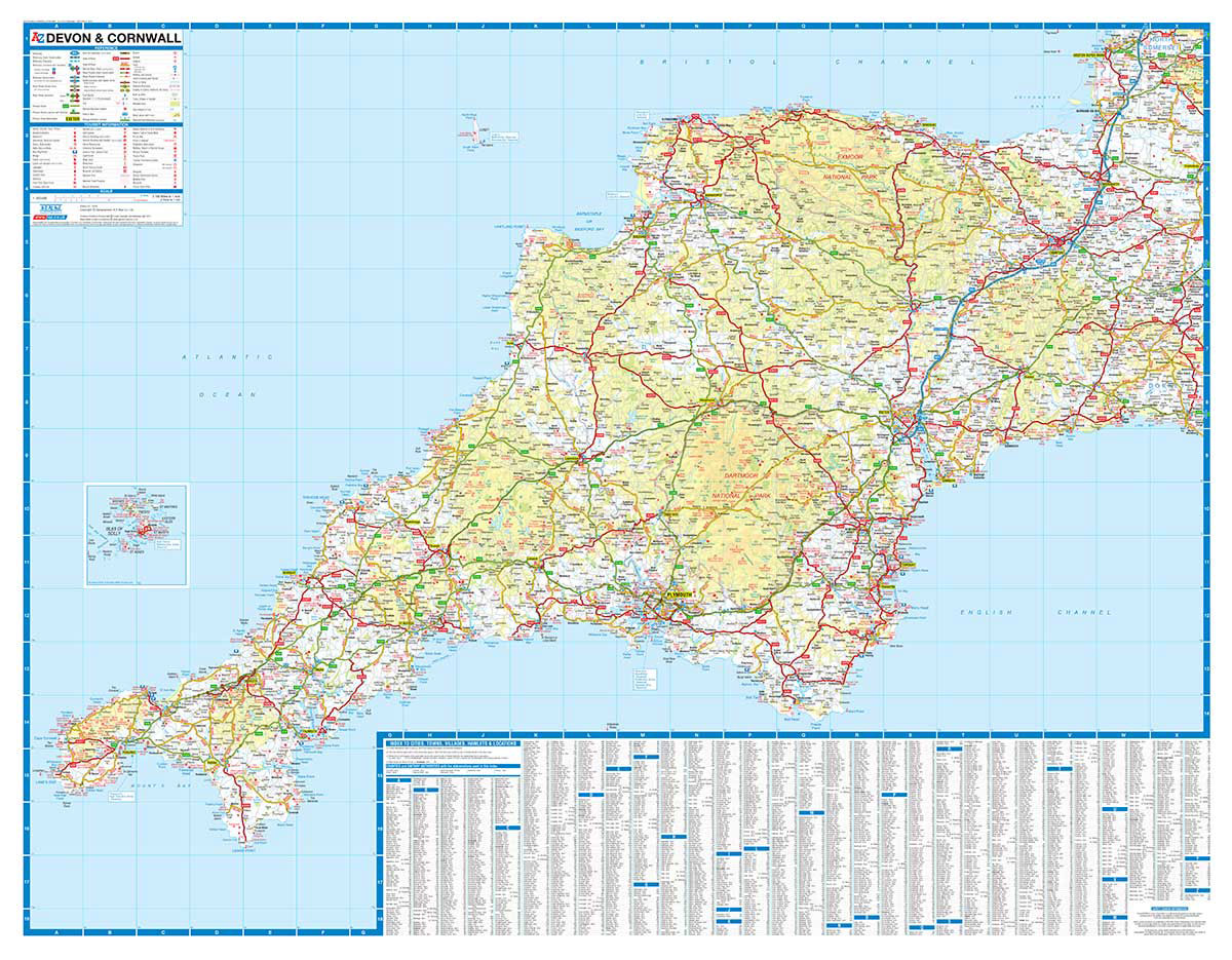
Regional wall map of at 1:200,000 (3.2 miles to 1inch) from A to Z, covering: Weston-super-Mare, Bridgwater, Bridport, Lyme Regis, Exmouth, Exeter, Torquay, Salcombe, Plymouth, Penzance, Land`s End, Newquay and Minehead.. Clear presentation of the road network shows motorways, A and B roads, some minor and local roads, with gradients of 1:5 and steeper indicated.
Hadrian`s Wall Path A-Z Adventure Atlas
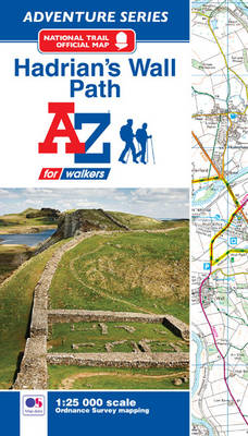
The A-Z Adventure Series of maps combines the best of OS and A-Z, creating the perfect companion for walkers, off-road cyclists, horse riders and anyone wishing to explore the great outdoors. Hadrian`s Wall Path is a National Trail which follows the line of Hadrian`s Wall from coast-to-coast.The 84 mile (135km) path weaves through beautiful countryside,
Bristol Premier A-Z Wall Map PAPER
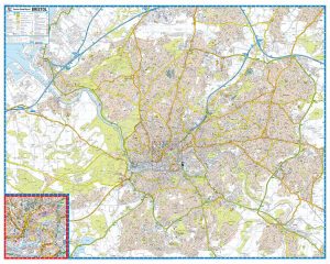
Bristol Premier Wall Map, size 121 x 96cm, *paper version*, from Geographers` A-Z Map Company designed to cover the city within its administrative boundaries, with a separate comprehensive index booklet listing streets, places and areas, industrial estates, selected flats and walkways, service areas, stations, and selected places of interest, shown where appropriate with their postcodes.The
South Downs Way A-Z Adventure Atlas
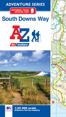
The South Downs Way at 1:25,000 in a series of handy A5 size Adventure Atlases from Geographers` A-Z Map Company with cartography from the Ordnance Survey’s Explorer series. The atlas shows the whole course of this national trail from Winchester to Eastbourne, with the variants via the Beachy Head and the Seven Sisters, or via
Cotswold Way A-Z Adventure Atlas
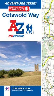
The Cotswold Way Adventure Atlas, presenting the 102 miles / 163 km long hiking route between Bath and Chipping Campden on mapping at 1:25,000 in a series of handy A5 size Adventure Atlases from Geographers` A-Z Map Company with cartography from the Ordnance Survey’s Explorer series. To see other titles in this series please click
Pembrokeshire Coast A-Z Adventure Atlas
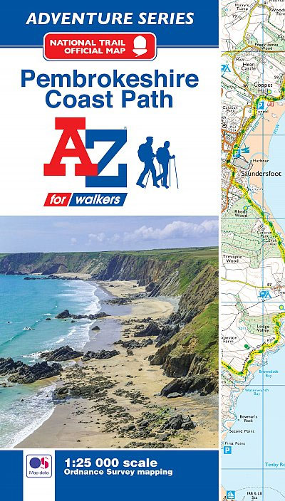
Pembrokeshire Coast Adventure Atlas at 1:25,000 in a series of handy A5 size Adventure Atlases from Geographers` A-Z Map Company with cartography from the Ordnance Survey’s Explorer series. Coverage extends along the coast from Cardigan to Tenby and Amroth and includes the Pembrokeshire Coast Paths – now a section of the Wales Coast Path.To see
Lake District – Northern Fells Adventure Atlas
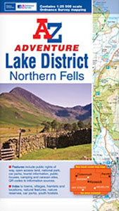
The A-Z Adventure Series of maps combines the best of OS and A-Z, creating the perfect companion for walkers, off-road cyclists, horse riders and anyone wishing to explore the great outdoors.The Lake District is a region and a National Park in the north-west of England; a popular hiking destination famous for its lakes and mountains
Taunton A-Z Street Atlas
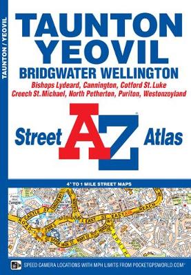
This A-Z map of Taunton, Bridgwater and Yeovil features 34 street map pages covering:Bishops Lydeard, Cannington, Cotford St. Luke, Creech St. Michael, North Petherton, Norton Fitzwarren, Puriton, Trull, Woolavington, Wellington, WestonzoylandPostcode districts, one-way streets, safety camera locations with speeds and park and ride sites are featured on the maps.The index section lists streets; selected flats,
England Coast Path – Camber to Folkestone Adventure Map
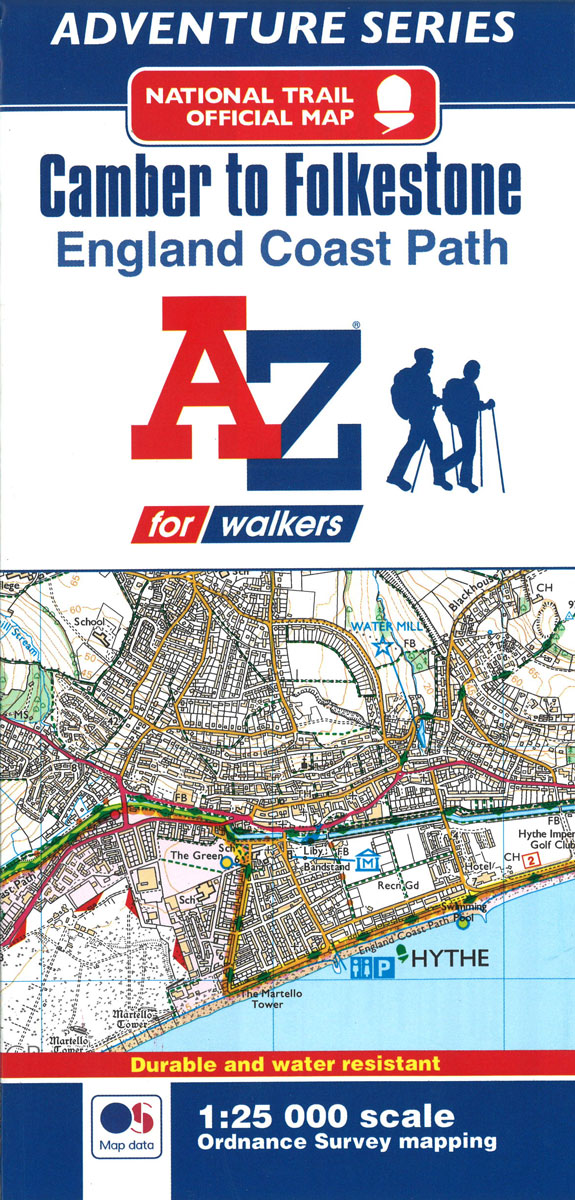
The A-Z Adventure Series of maps combines the best of OS and A-Z, creating the perfect companion for walkers, off-road cyclists, horse riders and anyone wishing to explore the great outdoors.This official Camber to Folkestone Adventure Map section of the England Coast Path, a new National Trail around England`s coast. More than just a path,
Plymouth A-Z Street Plan Wall Map
Plymouth Premier Street Plan from Geographers` A-Z Map Company designed to cover the city within its administrative boundaries, with a comprehensive index listing streets, places and areas, industrial estates, hospitals, selected flats and walkways, stations, and selected places of interest, shown where appropriate with their postcodes.The city is covered at 3.3 inches to 1 mile
Coventry A-Z Street Plan Wall Map
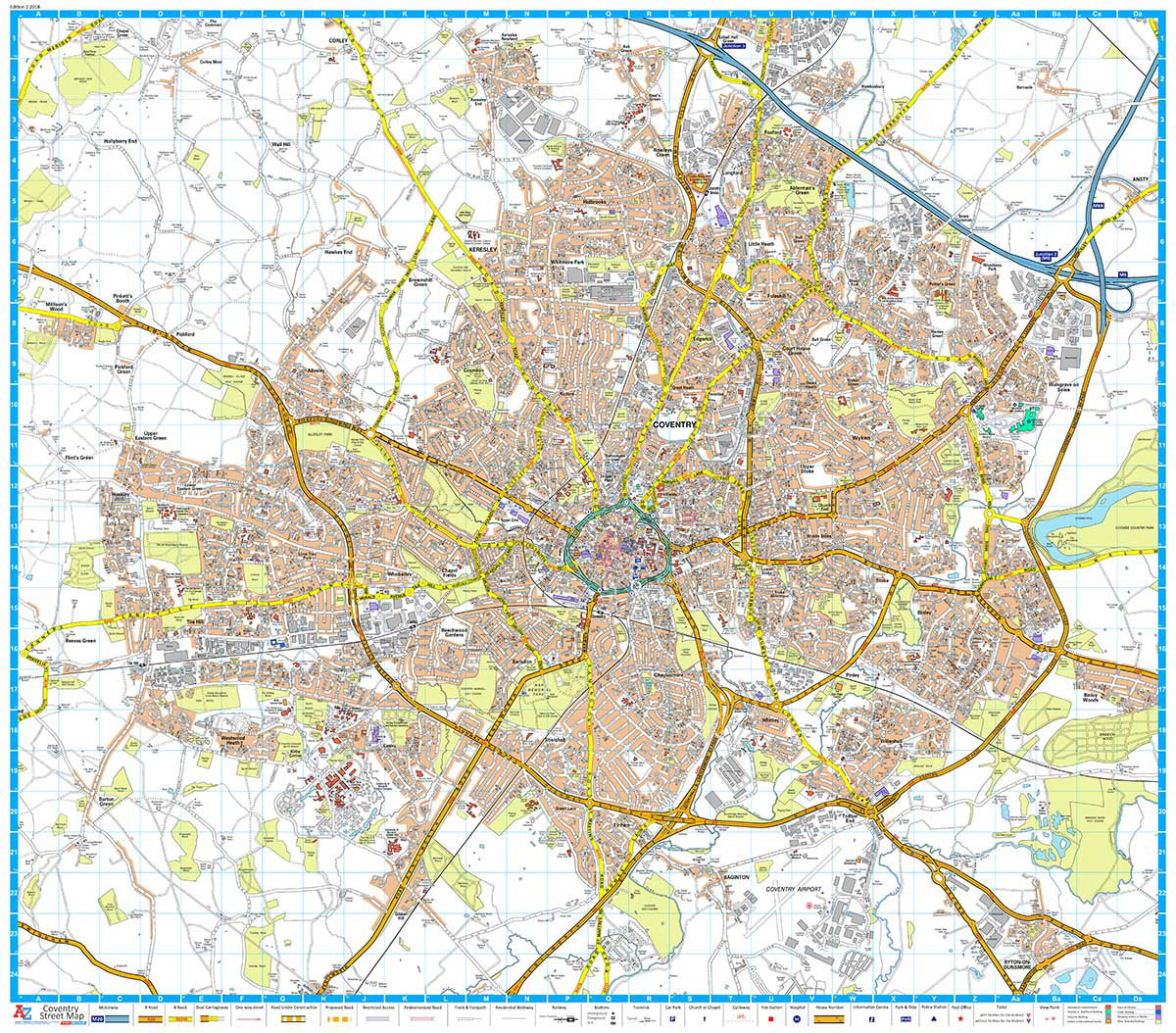
This Street Map of Coventry is extracted from A-Z digital data to ensure that the latest A-Z revision is available as a printed sheet map.The map area covers:Keresley NewlandsCoventryM6 Junction 3Walsgrave on StoweBinley WoodsRyton-on-DunsmoreCoventry AirportMillison`s WoodTile HillA-Z Street Mapping includes:Distinctive road classification coloursUnder construction and proposed roadsOne-way streetsRailway and other transport networksCategorised buildingsPlaces of Interest
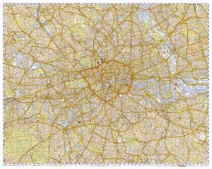
London A-Z M25 / Main Road Wall Map
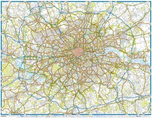
A wall map of the area within and adjoining to London’s orbital motorway, the M25, at 1:64,221 (approx. 1″ to 1 mile) from the Geographers` A-Z Map Company, paper version – size 117 x 91cm (46″ x 36″ approx). The map highlights primary routes and destinations, A and B roads, the capital’s Congestion Charge and
Wirral – Birkenhead – Ellesmere Port – Wallasey A-Z Street Atlas
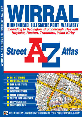
The Wirral: Birkenhead, Ellesmere Port and Wallasey Street Atlas from the Geographers` A-Z Map Company in a paperback format slightly smaller than A5. Map scale is 1:15,840 (4″ to a mile). Coverage includes Bebington, Bromborough, Heswall, Hoylake, Neston, Tranmere and West Kirby. Current edition of this title was published in 2015.To see other titles in
South West Coast Path 3 – South Cornwall A-Z Adventure Atlas
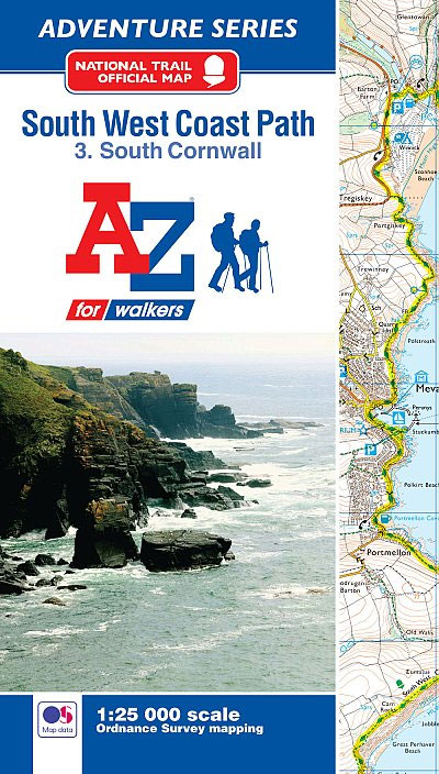
South West Coast Path 3 – South Cornwall Adventure Atlas at 1:25,000 in a series of handy A5 size Adventure Atlases from Geographers` A-Z Map Company with cartography from the Ordnance Survey’s Explorer series. The guide covers the 252km / 158 mile section of the SWCP National Trail between Land’s End and Plymouth and includes
50 Miles Around London A-Z Map
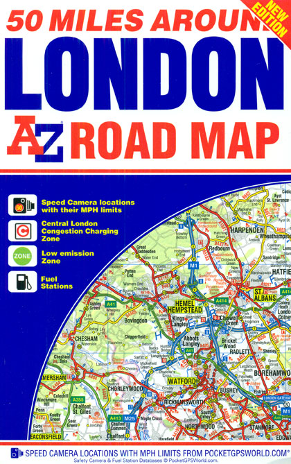
50 Miles around London on an indexed road map at 1:221.760 (1″ to 3.5 miles) from A-Z. Coverage extends west beyond Portsmouth and Oxford, north to Rugby and Huntingdon, and north-east beyond Ipswich. Additional maps show Greater London Low Emission Zone and the Congestion Charging Zone within London. The index is next to the map.
North Downs Way A-Z Adventure Atlas
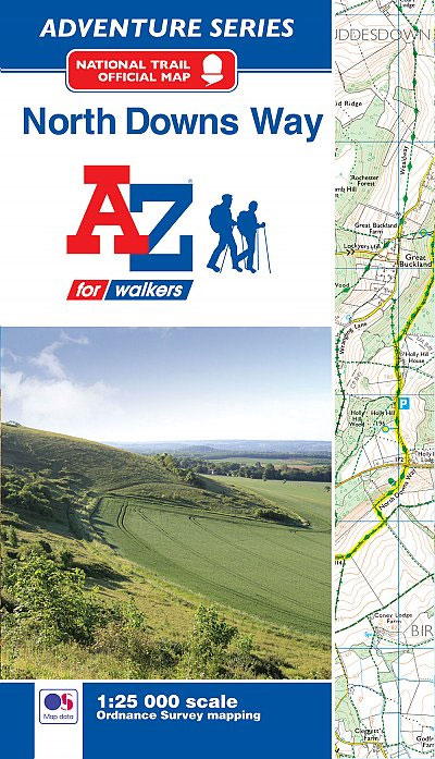
North Downs Way Adventure Atlas at 1:25,000 in a series of handy A5 size Adventure Atlases from Geographers` A-Z Map Company with cartography from the Ordnance Survey’s Explorer series. The route from Farnham to Dover is presented with the alternative final sections, either via Canterbury or via Folkestone. To see other titles in this series