Category Archives: Maps
Sierra de Aracena Tour & Trail Map

Sierra da Aracena Tour and Trail is an double sided map at a scale of 1:40,000 which is primarily designed for walkers but will also be of use to motorists. The map highlights twenty seven walking routes of between three and fourteen kilometres.Main and minor roads, dirt tracks, footpaths, trails are very clearly marked. Petrol
Walk! La Gomera
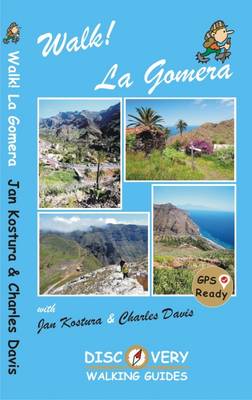
La Gomera is the ultimate get-away-from-it-all island: easy-going, unspoilt, friendly, isolated from the hustle and bustle of modern living, and so laid back it`s virtually supine – even the volcanoes have been dormant for millions of years. The walks, however, are a bit more energetic. For the new 4th edition of Walk! La Gomera Charles
Costa Blanca Mountains Super-Durable Map
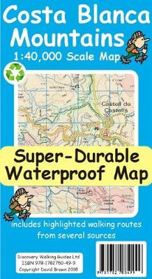
Costa Blanca Mountains at 1:40,000 on a double-sided, GPS compatible map from Discovery Walking Guides, with hiking routes and tourist information shown on detailed topographic mapping which provides an excellent presentation of the terrain. The map is printed on light, waterproof and tear-resistant synthetic paper and covers the mountainous area north of Benidorm, extending northwards
50 Miles Around Bristol Wall Map PAPER
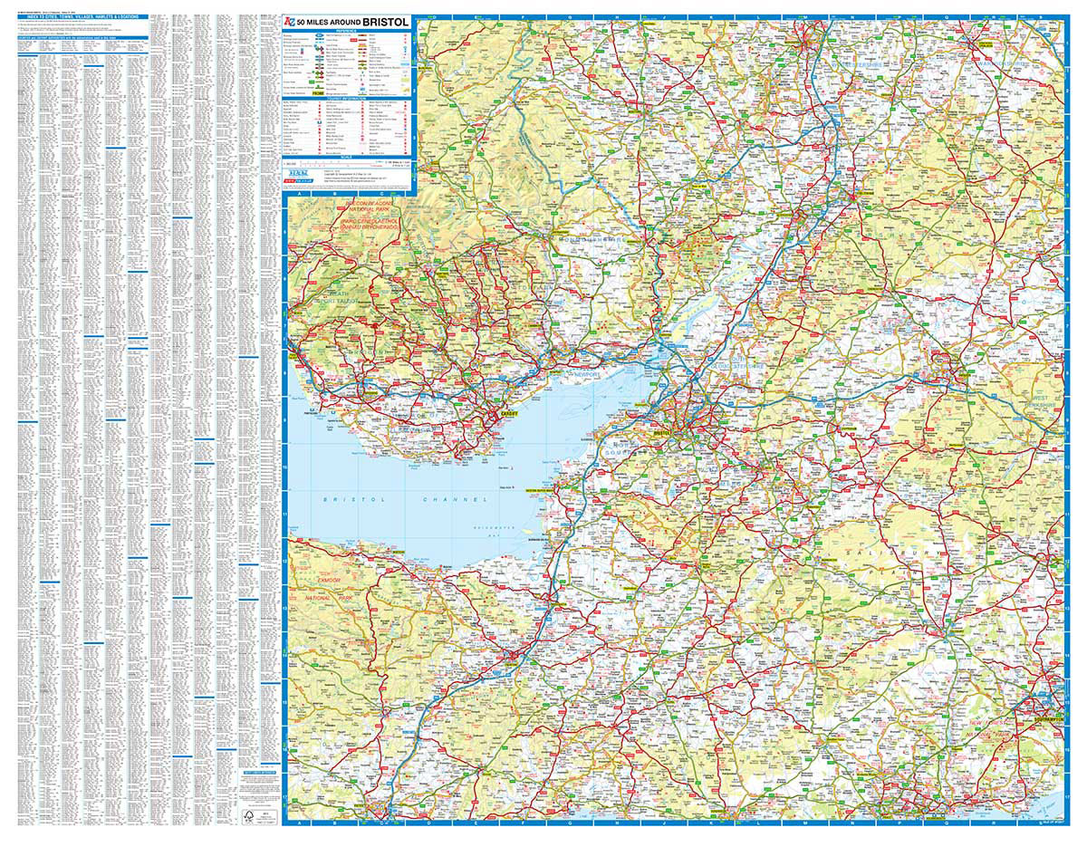
Regional wall map of 50 miles around Bristol, *paper version*, at 1:200,000 (3.2 miles to 1inch) from A to Z, covering: Builth Wells (Llanfair-ym-Muallt), Worcester, Stratford-upon-Avon, Southampton, Bournemouth, Dorchester, Exeter and Brecon (Aberhonddu). Clear presentation of the road network shows motorways, A and B roads, some minor and local roads, with gradients of 1:5 and
Gran Canaria Tour & Trail Super-Durable Map

Water-proof, split-proof, tear-proof, adventure-proof. Gran Canaria Tour & Trail Super-Durable Map is simply the toughest, most accurate, easy to read, easy to use map of the island you can buy at any price. David & Ros Brawn have partnered with Gran Canaria`s hiking experts `Rambling Roger`, Isabelle and Dane; five researchers with mapping gps units
Central London A-Z Map
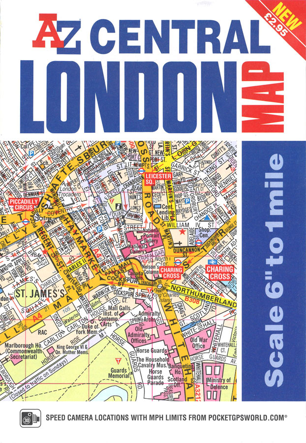
The A-Z Central London Map is a self-covered, fold-out sheet map which combines our more detailed, middle scale, street mapping with a comprehensive street and place of interest index on the reverse.Published at a scale of 6 inches to 1 mile, the map extends out from Charing Cross to:- St. John`s Wood and Shoreditch in
Fuerteventura Tour & Trail Super-Durable Map
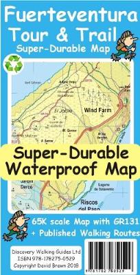
For the best adventures, use the best map. Fuerteventura is a large, 1,660 square kilometres, island. At 65k scale Fuerteventura Tour & Trail Super-Durable Map is a large 960mm by 620mm, double sided map sheet, which folds down to its 220mm by 120mm pocket size. A specialist concertina map fold means this map is easy
Nottingham – Ilkeston – Long Eaton – West Bridgford A-Z Street Atlas
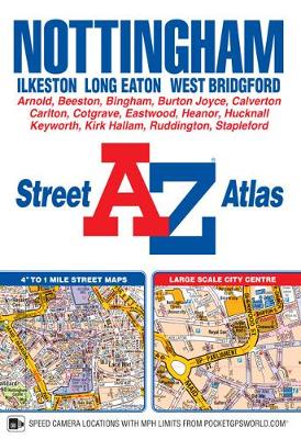
This A-Z map of Nottingham is a full colour, paperback atlas with 74 pages of continuous street mapping which extends to include:Arnold, Beeston, Burton Joyce, Calverton, Carlton, Clifton, Cotgrave, Eastwood, Heanor, Hucknall, Ilkeston, Keyworth, Long Eaton, Radcliffe on Trent, Stapleford, West BridgfordThere is also separate coverage of Bingham.Also included is:- a large scale city centre
Tenerife Hikers` Super-Durable Map
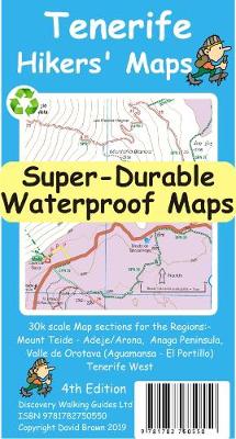
For the best adventures, use the best map. Our latest hiking research on Tenerife has resulted in new editions of Walk! Tenerife and Tenerife Hikers` Super-Durable Maps. Thanks to Jan Kostura`s research we have several new hiking adventures described in detail in Walk! Tenerife. Jan`s gps records of his research for new routes and updating
Canterbury – Margate – Ramsgate A-Z Street Atlas
This A-Z map of Canterbury, Margate and Ramsgate is a full colour street atlas which also includes a places of interest guide. The publication features 41 pages of street mapping which extends to include:Faversham, Whitstable, Herne Bay, Birchington, Westgate on Sea, Broadstairs, SandwichThere are also large scale city/town centre maps of Canterbury, Margate and Ramsgate.Postcode
La Gomera & El Hierro Tour & Trail Super-Durable Map
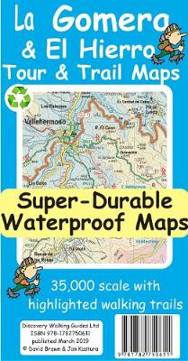
Quite simply La Gomera and El Hierro Tour & Trail Super-Durable Maps are the most detailed, accurate, toughest, easy to read, large scale maps of La Gomera and El Hierro that you can buy. Our map sheet is 840mm by 680mm. On the cover side you get the latest 35k scale 8th edition La Gomera
50 Miles Around Birmingham A-Z Wall Map
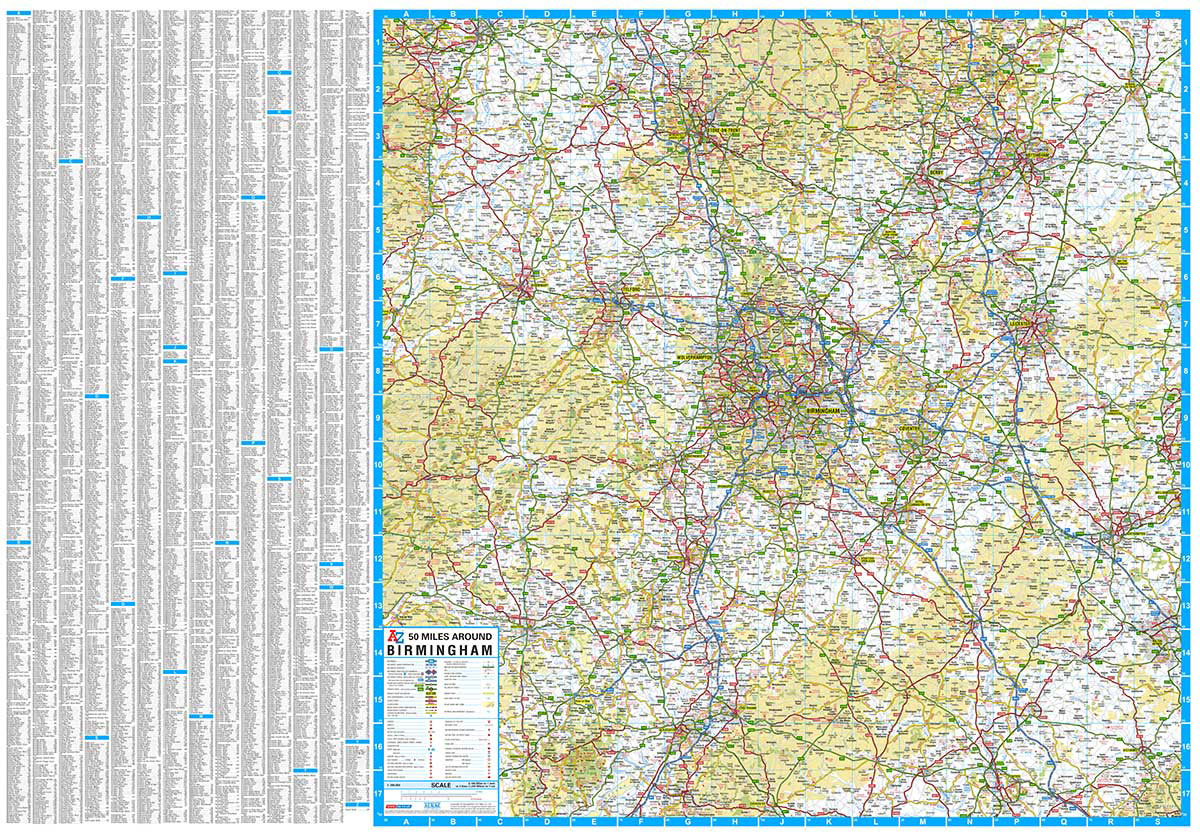
Regional wall map of 50 miles aournd Birmingham, at 1:200,000 (3.2 miles to 1inch) from A to Z, extending from central Birmingham to: Chester, Northampton, Milton Keynes, Aylesbury, Oxford, Cirencester, and Wrexham. Clear presentation of the road network shows motorways, A and B roads, some minor and local roads, with gradients of 1:5 and steeper
50 Miles Around Manchester A-Z Wall Map
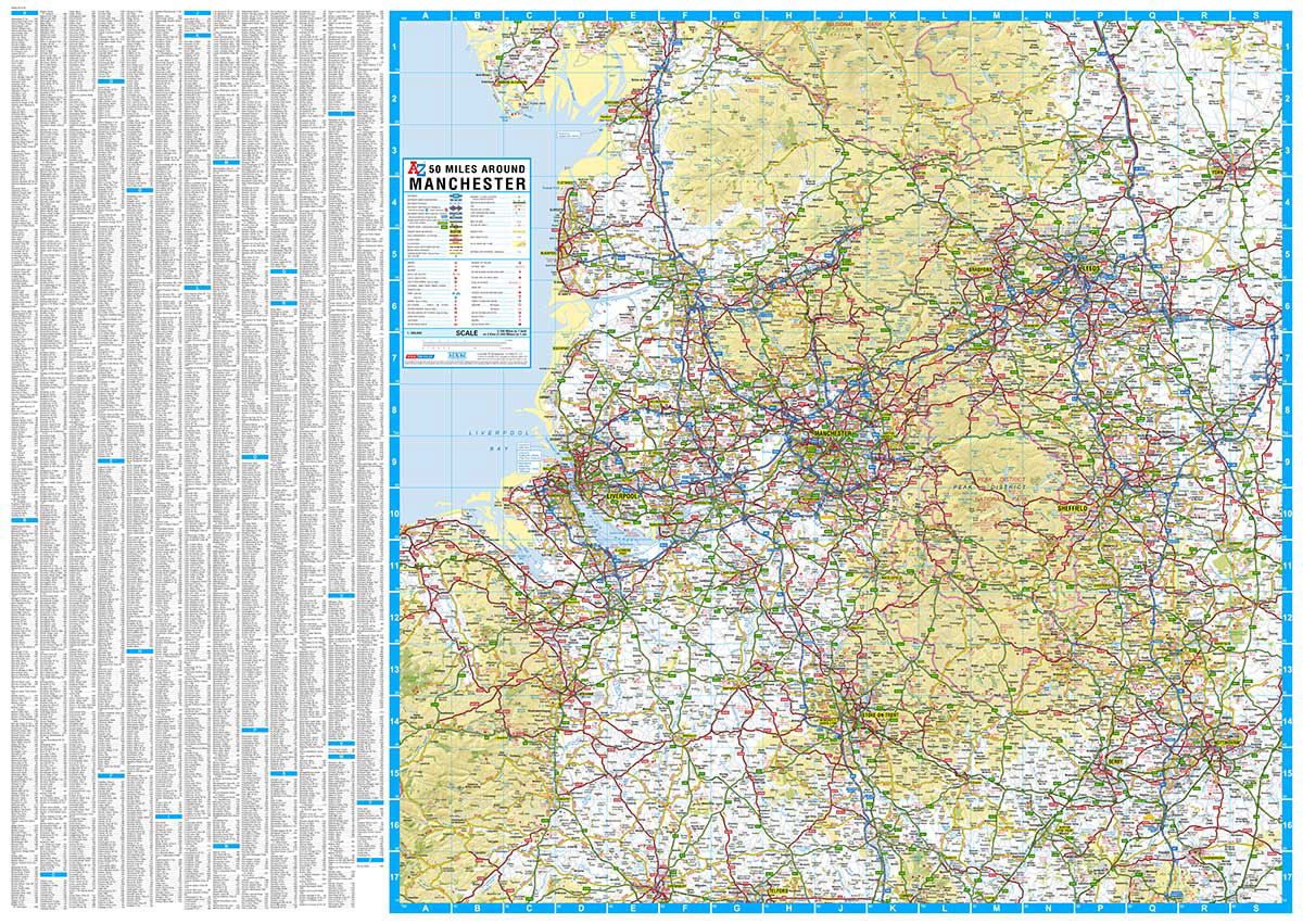
This full colour single-sided flat sheet 50 Miles Around Manchester Road Map covers an area extending to:Barrow-in-Furness, Kirby Lonsdale, Ripon, York, Selby, Doncaster, Worksop, Mansfield, Nottingham, Loughborough, Cannock, Telford, Shrewsbury, Llangadfan, Rhyll, Birkenhead, Liverpool, Southport, Blackpool, Fleetwood and Lancaster.Map information includes motorways open with full junction detail, motorways under construction and proposed, service areas, primary
South East & Central England A-Z Wall Map PAPER
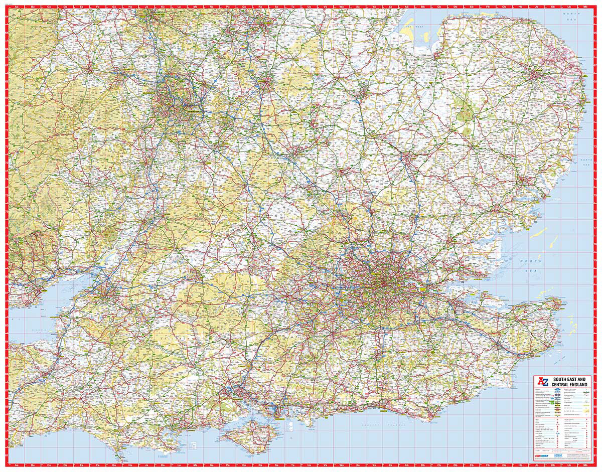
South East & Central England at 1:316,800 (5 miles to 1 inch) on an indexed road map from A-Z. Coverage extends west to Cardiff and north to Stoke-on-Trent, Derby and Nottingham. The index is in a separate booklet attached to the map cover. Current edition of this title was published in 2014.Maps in this ‘Five
Bath A-Z Handy Map
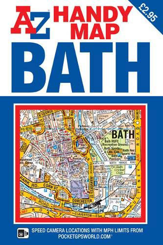
This A-Z map of Bath is a self-covered, double-sided foldout street map that also includes a large scale map of the city centre; the perfect choice for those visiting this popular tourist destination.This A-Z map of Bath is a self-covered, double-sided street map covering an area that extends to include Bathampton, Claverton, Combe Down, Newbridge,
Norwich A-Z Street Atlas
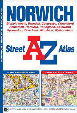
This A-Z map of Norwich is a full colour street atlas featuring 37 pages of street mapping. Coverage includes Taverham, Wroxham, Blofield, Hethersett, Wymondham and Poringland. A large scale city centre map of Norwich is also included.Postcode districts, one-way streets, park and ride sites, safety camera locations with their maximum speed and The Broads Authority
Lake District A-Z Adventure Atlas
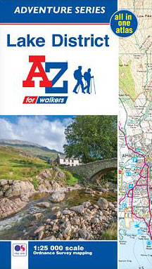
The A-Z Adventure Series of maps combines the best of OS and A-Z, creating the perfect companion for walkers, off-road cyclists, horse riders and anyone wishing to explore the great outdoors.The Lake District is a National Park and a Unesco World Heritage Site in northwest England. It is a region rich in natural beauty with
East Anglia A-Z Wall Map
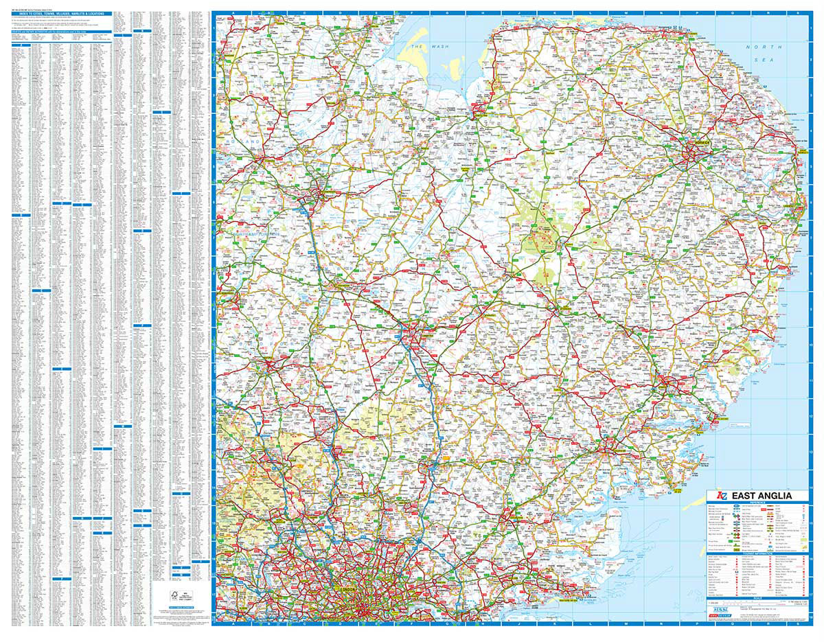
Regional wall map of East Anglia at 1:200,000 (3.2 miles to 1inch) from A to Z, covering: Grantham, King`s Lynn, Great Yarmouth, Felixstowe, Central London, Slough, Bedford and Stamford. Clear presentation of the road network shows motorways, A and B roads, some minor and local roads, with gradients of 1:5 and steeper indicated. Service stations,
Manchester Premier A-Z Wall Map
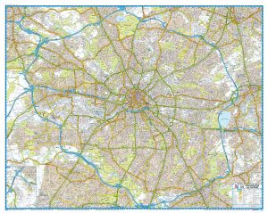
Manchester Premier Wall Map, size 121 x 96cm, *paper version*, from Geographers` A-Z Map Company designed to cover the city within its administrative boundaries, with a separate comprehensive index booklet listing streets, places and areas, industrial estates, selected flats and walkways, service areas, stations, and selected places of interest, shown where appropriate with their postcodes.The
London Premier A-Z Wall Map PAPER
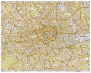
London Premier Wall Map, size 120 x 96cm – paper version, from Geographers` A-Z Map Company at 3 inches to 1 mile (1:21,477), designed to cover an area around at least a six-mile radius from Charing Cross.The plan shows A and B roads annotated with selected house numbers for easier identification of addresses. One way