Category Archives: Maps
Bagarchhap
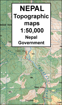
Bagarchhap, sheet no. 2884-06, in the topographic survey of Nepal at 1:50,000 published by the Nepali Government in the late 1990s and early 2000s and produced from remote sensing data by Finnish cartographers as part of that country’s international aid program. The maps cover 15’ x 15’ quadrangles.IMPORTANT ‘“ PLEASE NOTE BEFORE ORDERING: AVAILABILITY: although,
Mirandela

Topographic survey of Portugal at 1:50,000 from the Instituto Geogrรกfico do Exรฉrcito, the country’s military survey organisation. The maps have contours at 20m intervals and in addition to the standard features shown on topographic mapping at this scale also indicate various types of terrain or vegetation (sand, terraces, rocks, woodlands, vineyards, etc). Each sheet covers
Bahundada

Bahundada, sheet no. 2884-10, in the topographic survey of Nepal at 1:50,000 published by the Nepali Government in the late 1990s and early 2000s and produced from remote sensing data by Finnish cartographers as part of that country’s international aid program. The maps cover 15’ x 15’ quadrangles.IMPORTANT ‘“ PLEASE NOTE BEFORE ORDERING: AVAILABILITY: although,
Gamaar

Gamaar, sheet no. 2984-09, in the topographic survey of Nepal at 1:50,000 published by the Nepali Government in the late 1990s and early 2000s and produced from remote sensing data by Finnish cartographers as part of that country’s international aid program. The maps cover 15’ x 15’ quadrangles.IMPORTANT ‘“ PLEASE NOTE BEFORE ORDERING: AVAILABILITY: although,
Damodar Kunda

Damodar Kunda, sheet no. 2984-13, in the topographic survey of Nepal at 1:50,000 published by the Nepali Government in the late 1990s and early 2000s and produced from remote sensing data by Finnish cartographers as part of that country’s international aid program. The maps cover 15’ x 15’ quadrangles.IMPORTANT ‘“ PLEASE NOTE BEFORE ORDERING: AVAILABILITY:
Miranda do Douro

Topographic survey of Portugal at 1:50,000 from the Instituto Geogrรกfico do Exรฉrcito, the country’s military survey organisation. The maps have contours at 20m intervals and in addition to the standard features shown on topographic mapping at this scale also indicate various types of terrain or vegetation (sand, terraces, rocks, woodlands, vineyards, etc). Each sheet covers
Viana do Castelo

Topographic survey of Portugal at 1:50,000 from the Instituto Geogrรกfico do Exรฉrcito, the country’s military survey organisation. The maps have contours at 20m intervals and in addition to the standard features shown on topographic mapping at this scale also indicate various types of terrain or vegetation (sand, terraces, rocks, woodlands, vineyards, etc). Each sheet covers
Ciudad Acuna
Topographic mapping from Mexico’s national survey agency, Instituto Nacional de Estadรญstica, Geografรญa e Informรกtica. The maps have contours at 20m intervals with relief shading and indicate various types of terrain and vegetation, e.g. dense vegetation, cultivated areas, swamps, sand dunes, salt pans, etc. UTM grid is at 10km intervals, with latitude and longitude shown by
San Luis Potosi

Topographic mapping from Mexico’s national survey agency, Instituto Nacional de Estadรญstica, Geografรญa e Informรกtica. The maps have contours at 20m intervals with relief shading and indicate various types of terrain and vegetation, e.g. dense vegetation, cultivated areas, swamps, sand dunes, salt pans, etc. UTM grid is at 10km intervals, with latitude and longitude shown by
Braga

Topographic survey of Portugal at 1:50,000 from the Instituto Geogrรกfico do Exรฉrcito, the country’s military survey organisation. The maps have contours at 20m intervals and in addition to the standard features shown on topographic mapping at this scale also indicate various types of terrain or vegetation (sand, terraces, rocks, woodlands, vineyards, etc). Each sheet covers
San Martinho de Angueira

Topographic survey of Portugal at 1:50,000 from the Instituto Geogrรกfico do Exรฉrcito, the country’s military survey organisation. The maps have contours at 20m intervals and in addition to the standard features shown on topographic mapping at this scale also indicate various types of terrain or vegetation (sand, terraces, rocks, woodlands, vineyards, etc). Each sheet covers
Nile

Nile, sheet no. 2885-05, in the topographic survey of Nepal at 1:50,000 published by the Nepali Government in the late 1990s and early 2000s and produced from remote sensing data by Finnish cartographers as part of that country’s international aid program. The maps cover 15’ x 15’ quadrangles.IMPORTANT ‘“ PLEASE NOTE BEFORE ORDERING: AVAILABILITY: although,
Namrun

Namrun, sheet no. 2884-08, in the topographic survey of Nepal at 1:50,000 published by the Nepali Government in the late 1990s and early 2000s and produced from remote sensing data by Finnish cartographers as part of that country’s international aid program. The maps cover 15’ x 15’ quadrangles.IMPORTANT ‘“ PLEASE NOTE BEFORE ORDERING: AVAILABILITY: although,
Braganca

Topographic survey of Portugal at 1:50,000 from the Instituto Geogrรกfico do Exรฉrcito, the country’s military survey organisation. The maps have contours at 20m intervals and in addition to the standard features shown on topographic mapping at this scale also indicate various types of terrain or vegetation (sand, terraces, rocks, woodlands, vineyards, etc). Each sheet covers
Philim

Philim, sheet no. 2884-12, in the topographic survey of Nepal at 1:50,000 published by the Nepali Government in the late 1990s and early 2000s and produced from remote sensing data by Finnish cartographers as part of that country’s international aid program. The maps cover 15’ x 15’ quadrangles.IMPORTANT ‘“ PLEASE NOTE BEFORE ORDERING: AVAILABILITY: although,
Samagau

Samagau, sheet no. 2884-07, in the topographic survey of Nepal at 1:50,000 published by the Nepali Government in the late 1990s and early 2000s and produced from remote sensing data by Finnish cartographers as part of that country’s international aid program. The maps cover 15’ x 15’ quadrangles.IMPORTANT ‘“ PLEASE NOTE BEFORE ORDERING: AVAILABILITY: although,
Simi

Simi, sheet no. 2884-11, in the topographic survey of Nepal at 1:50,000 published by the Nepali Government in the late 1990s and early 2000s and produced from remote sensing data by Finnish cartographers as part of that country’s international aid program. The maps cover 15’ x 15’ quadrangles.IMPORTANT ‘“ PLEASE NOTE BEFORE ORDERING: AVAILABILITY: although,
Phugau Ghomion

Phugau Ghomion, sheet no. 2884-02, in the topographic survey of Nepal at 1:50,000 published by the Nepali Government in the late 1990s and early 2000s and produced from remote sensing data by Finnish cartographers as part of that country’s international aid program. The maps cover 15’ x 15’ quadrangles.IMPORTANT ‘“ PLEASE NOTE BEFORE ORDERING: AVAILABILITY:
Deilao

Topographic survey of Portugal at 1:50,000 from the Instituto Geogrรกfico do Exรฉrcito, the country’s military survey organisation. The maps have contours at 20m intervals and in addition to the standard features shown on topographic mapping at this scale also indicate various types of terrain or vegetation (sand, terraces, rocks, woodlands, vineyards, etc). Each sheet covers


