Category Archives: Maps
Lye 1914
Lye in 1914 in a fascinating series of reproductions of old Ordnance Survey plans in the Alan Godfrey Editions, ideal for anyone interested in the history of their neighbourhood or family. The map covers the western part of Cradley, Lye, a portion of Wollescote, and the southern part of Quarry Bank UDC. Coverage stretches from
Glasgow North East 1893

Glasgow North East in 1893 in a fascinating series of reproductions of old Ordnance Survey plans in the Alan Godfrey Editions, ideal for anyone interested in the history of their neighbourhood or family. The map covers an area north-east of Glasgow city centre, including Provanmill, Blackhill and Riddrie. Features include Hogganfield Church, Hogganfield Bleach Works,
Battersea & Clapham 1870 – 101.1
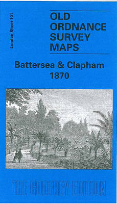
Battersea and Clapham in 1870 in a fascinating series of reproductions of old Ordnance Survey plans in the Alan Godfrey Editions, ideal for anyone interested in the history of their neighbourhood or family. Three versions have been published for this area, stretching from Eland Road and Culvert Road eastward to Hartington Road and Jeffrey`s Road,
Halesowen (East) 1913 – 5.13b
Halesowen East in 1913 in a fascinating series of reproductions of old Ordnance Survey plans in the Alan Godfrey Editions, ideal for anyone interested in the history of their neighbourhood or family. The map covers the eastern part of Halesowen, extending eastward to Lapal Farm and Carter`s Lane. Features include Halesowen & Northfield railway with
The Cheviot 1901-13 – 5
The Cheviot in 1901-1913 in a series of reproductions of Ordnance Survey’s famous “Inch to the Mile” maps published in the Alan Godfrey Editions to provide a historical record of England and Wales in the second half of 19th and early 20th century.The map covers a rural area of Northumberland, with the Scottish part left
East Surrey and Mole Valley 1885
East Surrey and Mole Valley in 1870 in a series of reproductions of Ordnance Survey’s famous “Inch to the Mile” maps published in the Alan Godfrey Editions to provide a historical record of England and Wales in the second half of 19th and early 20th century.Coverage stretches from Effingham Junction eastward to Oxted and Crowhurst,
Wylam and Clara Vale 1895
Wylam and Clara Vale in 1895 in a fascinating series of reproductions of old Ordnance Survey plans in the Alan Godfrey Editions, ideal for anyone interested in the history of their neighbourhood or family. To provide maximum coverage of this area the publishers have used both the Northumberland and Durham sheets for Wylam, which stands
Coombeswood 1914
Coombeswood in 1914 in a fascinating series of reproductions of old Ordnance Survey plans in the Alan Godfrey Editions, ideal for anyone interested in the history of their neighbourhood or family. The map covers part of the Halesowen hamlets of Hill, Cakemore and Coombeswood. Coverage stretches from Lewis Lane eastward to Ridgacre Road, and from
Tooting 1913 – 134.3
Tooting in 1913 in a fascinating series of reproductions of old Ordnance Survey plans in the Alan Godfrey Editions, ideal for anyone interested in the history of their neighbourhood or family. Two versions for this area have been published to show how it developed across the years; coverage is less complete on the 1913 map
Upper Edmonton 1894 – 3a

Upper Edmonton in 1894 in a fascinating series of reproductions of old Ordnance Survey plans in the Alan Godfrey Editions, ideal for anyone interested in the history of their neighbourhood or family. The map covers the south-western and central area of Edmonton, including Upper Edmonton, stretching from Weir Hall and Hedge Lane eastward to Brettenham
Tow Law 1897
Tow Law in 1897 in a fascinating series of reproductions of old Ordnance Survey plans in the Alan Godfrey Editions, ideal for anyone interested in the history of their neighbourhood or family. Tow Law stands over 1,000 feet up and developed in the mid 19th century with the growth of the Weardale Iron Co; the
Goodmayes and Seven Kings 1915
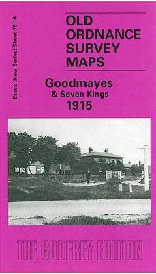
Goodmayes and Seven Kings in 1915 in a fascinating series of reproductions of old Ordnance Survey plans in the Alan Godfrey Editions, ideal for anyone interested in the history of their neighbourhood or family. Two versions have been published for this area to show how it developed across the years – the two maps are
Streatham Hill & Tulse Hill 1914 – 126.3
Streatham Hill and Tulse Hill in 1914 in a fascinating series of reproductions of old Ordnance Survey plans in the Alan Godfrey Editions, ideal for anyone interested in the history of their neighbourhood or family. Three versions cover this area, extending from Streatham Hill eastward to West Dulwich station, and from Brockwell Park southward to
Bristol (SW) & Bedminster 1902 – 75.04a
Bristol South West and Bedminster in 1902 in a fascinating series of reproductions of old Ordnance Survey plans in the Alan Godfrey Editions, ideal for anyone interested in the history of their neighbourhood or family. The map covers a very busy area of Bristol, including part of the city centre and much of Bedminster. Coverage
North Tynedale 1902 – 13
North Tynedale in 1902 in a series of reproductions of Ordnance Survey’s famous “Inch to the Mile” maps published in the Alan Godfrey Editions to provide a historical record of England and Wales in the second half of 19th and early 20th century.The map covers a rural part of west Northumberland, with the North Tyne
Fifty Bicycles That Changed the World

The bicycle is the world`s most popular form of transport, and its design has evolved over the decades both in terms of style and technology. From high-performance cycles to practical run-arounds, conceptual bikes to commercial models, the bicycle means different things to different people, from a means of transportation to a hobby, a way of
Iona
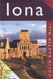
Detailed and easy-to-use map of the island showing sites of interest. Shows sites of interest, tracks and footpaths, caves, bays and sandy beaches, the abbey and other buildings. Ideal for visitors and tourists.
Cairngorms Reference Map
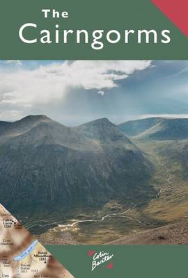
Cairngorm Mountains on an overview map from Colin Baxter presenting at 1:85,000 an area from Aviemore and Kincraig in the north-west to Braemar in the south-east. Bold colouring and relief shading shows the topography, with names of numerous peaks, glens, etc.The map indicates main paths in the mountains and facilities available in various locations, but