Category Archives: Maps
Leadgate 1895 – 11.11a

Leadgate in 1895 in a fascinating series of reproductions of old Ordnance Survey plans in the Alan Godfrey Editions, ideal for anyone interested in the history of their neighbourhood or family. The map covers virtually the whole of Leadgate and stretches east to Redwell Hills, the Eden Colliery and the Catholic church, and north to
Caernarfon 1913 – 15.04
Caernarfon in 1913 in a fascinating series of reproductions of old Ordnance Survey plans in the Alan Godfrey Editions, ideal for anyone interested in the history of their neighbourhood or family. The map gives very good coverage of the town of Caernarfon, extending from Warfield Road southward to Is-Helen, the Gasworks and South Road, and
Eyemouth 1898 – 6.13
Eyemouth in 1898 in a fascinating series of reproductions of old Ordnance Survey plans in the Alan Godfrey Editions, ideal for anyone interested in the history of their neighbourhood or family. The map double-sided. The main map covers most of the town, extending southward to Netherbyres, and westward to Highlaws Farm. Features include Eyecliffe, Eyemouth
Cambridge, Newmarket and District 1905
Cambridge, Newmarket and District in 1905 in a series of reproductions of Ordnance Survey’s famous “Inch to the Mile” maps published in the Alan Godfrey Editions to provide a historical record of England and Wales in the second half of 19th and early 20th century.Cambridge is at the foot of the map and coverage extends
Manchester and District 1896
Manchester and District in 1896 in a series of reproductions of Ordnance Survey’s famous “Inch to the Mile” maps published in the Alan Godfrey Editions to provide a historical record of England and Wales in the second half of 19th and early 20th century.In this title coverage stretches from Tyldesley eastward to Stalybridge, and from
Roding Valley and Epping Forest 1886
Roding Valley and Epping Forest in 1886 in a series of reproductions of Ordnance Survey’s famous “Inch to the Mile” maps published in the Alan Godfrey Editions to provide a historical record of England and Wales in the second half of 19th and early 20th century.The map covers the area of west Essex from Epping
Southampton Water 1884
Southampton Water in 1884 in a series of reproductions of Ordnance Survey’s famous “Inch to the Mile” maps published in the Alan Godfrey Editions to provide a historical record of England and Wales in the second half of 19th and early 20th century.The map covers an area of Hampshire centred on Southampton, stretching from Mogshade
Warrington 1905
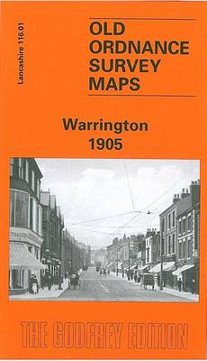
Warrington in 1905 in a fascinating series of reproductions of old Ordnance Survey plans in the Alan Godfrey Editions, ideal for anyone interested in the history of their neighbourhood or family. The map covers the centre of Warrington, extending eastward to the cemetery, and from Buckley Street southward to Black Bear Bridge at Latchford. Features
Colne Valley and Braintree 1887
Colne Valley and Braintree in 1887 in a series of reproductions of Ordnance Survey’s famous “Inch to the Mile” maps published in the Alan Godfrey Editions to provide a historical record of England and Wales in the second half of 19th and early 20th century.The map covers the area of Essex from Wethersfield eastward to
South East Essex 1884
South East Essex in 1884 in a series of reproductions of Ordnance Survey’s famous “Inch to the Mile” maps published in the Alan Godfrey Editions to provide a historical record of England and Wales in the second half of 19th and early 20th century.The map covers the area of south Essex from Corringham eastward to
Beckenham & Penge 1894 – 146
Beckenham and Penge in 1894 in a fascinating series of reproductions of old Ordnance Survey plans in the Alan Godfrey Editions, ideal for anyone interested in the history of their neighbourhood or family. Three versions for this area have been published to show how it developed across the years – the two maps are from
Duns & Greenlaw 1898 – 16.07
Duns and Greenlaw in 1898 in a fascinating series of reproductions of old Ordnance Survey plans in the Alan Godfrey Editions, ideal for anyone interested in the history of their neighbourhood or family. The map is double-sided. The main map covers Duns, stretching from Duns Castle eastward to Rulesmains. Features include Town Hall, auction mart,
Guildford 1895
Guildford in 1895 in a fascinating series of reproductions of old Ordnance Survey plans in the Alan Godfrey Editions, ideal for anyone interested in the history of their neighbourhood or family. The map covers the centre of Guildford, extending from Stag Hill eastward to London Road, and from Guildford Bridge and High Street northward to
Euston & Regent`s Park 1870 – 49.1
Euston and Regent`s Park in 1870 in a fascinating series of reproductions of old Ordnance Survey plans in the Alan Godfrey Editions, ideal for anyone interested in the history of their neighbourhood or family. Three versions of this map cover the same area, stretching from Baker Street station eastward to Tavistock Square and from The
Gateacre 1904
Gateacre in 1904 in a fascinating series of reproductions of old Ordnance Survey plans in the Alan Godfrey Editions, ideal for anyone interested in the history of their neighbourhood or family. The map covers much of the village of Gateacre, south-east of Liverpool. Coverage stretches from Etopn Lodge and Gipsy Lane eastward to St Stephen`s
Belfast Bloomfield 1902
Belfast Bloomfield in 1902 in a fascinating series of reproductions of old Ordnance Survey plans in the Alan Godfrey Editions, ideal for anyone interested in the history of their neighbourhood or family. The map covers parts of east Belfast, east of the Lagan. Coverage stretches from Conn`s Water and Belfast Rope Works eastward to Greenwood,
Mid Berkshire 1885
Mid Berkshire in 1885 in a series of reproductions of Ordnance Survey’s famous “Inch to the Mile” maps published in the Alan Godfrey Editions to provide a historical record of England and Wales in the second half of 19th and early 20th century.The map is centred on Reading, with coverage stretching from Hampstead Norris eastward
Belfast Knockdene Park 1902
Belfast Knockdene Park in 1902 in a fascinating series of reproductions of old Ordnance Survey plans in the Alan Godfrey Editions, ideal for anyone interested in the history of their neighbourhood or family. The map covers parts of east Belfast, east of the Lagan. Coverage stretches Knock Road and Hawthornden Road eastward to Ballyhanwood House.
Dun Laoghaire 1908
Dun Laoghaire in 1908 in a fascinating series of reproductions of old Ordnance Survey plans in the Alan Godfrey Editions, ideal for anyone interested in the history of their neighbourhood or family. About the Alan Godfrey Editions of the 25″ OS Series:Selected towns in Great Britain and Ireland are covered by maps showing the extent
The Solent 1888
The Solent in 1888 in a series of reproductions of Ordnance Survey’s famous “Inch to the Mile” maps published in the Alan Godfrey Editions to provide a historical record of England and Wales in the second half of 19th and early 20th century.Coverage stretches from Milton eastwards to Fawley on the Hampshire side, and from