Category Archives: Maps
Garston 1905 – 113.12b
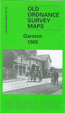
Garston in 1905 in a fascinating series of reproductions of old Ordnance Survey plans in the Alan Godfrey Editions, ideal for anyone interested in the history of their neighbourhood or family. SThe map covers most of Garston, south of Liverpool, including Grassendale and Aigburth Ward. Coverage stretches from the shoreline eastward to Garston station, and
Gravesend 1865

Gravesend in 1865 in a fascinating series of reproductions of old Ordnance Survey plans in the Alan Godfrey Editions, ideal for anyone interested in the history of their neighbourhood or family. The map covers the centre and east of Gravesend, stretching from the railway station eastward to the Ship & Lobster pub and West Court,
South Lancashire Coalfield 1907
South Lancashire Coalfield in 1907 in a series of reproductions of Ordnance Survey’s famous “Inch to the Mile” maps published in the Alan Godfrey Editions to provide a historical record of England and Wales in the second half of 19th and early 20th century.The map covers the area from Kirkby and Ormskirk eastward to Leigh,
Poplar 1894 – 65.2
Poplar in 1894 in a fascinating series of reproductions of old Ordnance Survey plans in the Alan Godfrey Editions, ideal for anyone interested in the history of their neighbourhood or family. Three versions cover the same area, stretching from Upper North Street at Poplar eastward to Rathbone Street at Canning Town, and from Empson Street
West India Docks & Greenwich Marshes 1894 – 79.2
West India Docks and Greenwich Marshes in 1894 in a fascinating series of reproductions of old Ordnance Survey plans in the Alan Godfrey Editions, ideal for anyone interested in the history of their neighbourhood or family. Three versions of this map have been published to show how the area developed across the years. The sheetlines
Coatdyke 1897 – 8.09
Coatdyke in 1897 in a fascinating series of reproductions of old Ordnance Survey plans in the Alan Godfrey Editions, ideal for anyone interested in the history of their neighbourhood or family. The map covers the eastern part of Coatbridge, including Coatdyke, part of Whifflet and the outskirts of Airdrie. Coverage stretches from Dunbeth Road eastward
Thame and District 1886
Thame and District in 1886 in a series of reproductions of Ordnance Survey’s famous “Inch to the Mile” maps published in the Alan Godfrey Editions to provide a historical record of England and Wales in the second half of 19th and early 20th century.The map covers the area from Cowley eastward to the west edge
Southfields & Wimbledon Park 1867 – 123.2
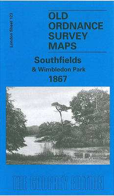
Southfields and Wimbledon Park in 1867 in a fascinating series of reproductions of old Ordnance Survey plans in the Alan Godfrey Editions, ideal for anyone interested in the history of their neighbourhood or family. Two versions cover this area, extending from Putney Heath eastward to Merton Road, and from Wincanton Road and Brathway Road southward
South West Suffolk 1893
South West Suffolk in 1893 in a series of reproductions of Ordnance Survey’s famous “Inch to the Mile” maps published in the Alan Godfrey Editions to provide a historical record of England and Wales in the second half of 19th and early 20th century.The map is centred on Long Melford and Glemsford, with coverage stretching
Newbury 1898 – 43.01
Newbury in 1898 in a fascinating series of reproductions of old Ordnance Survey plans in the Alan Godfrey Editions, ideal for anyone interested in the history of their neighbourhood or family. The map covers the centre and southern part of Newbury, concentrating on the area south of the River Kennet. Features include the Market Place,
Plymouth North 1893
Plymouth North in 1893 in a fascinating series of reproductions of old Ordnance Survey plans in the Alan Godfrey Editions, ideal for anyone interested in the history of their neighbourhood or family. The map covers the northern part of Plymouth, stretching from Wyndham Square eastward to Lipson Farm and Lipson House, and from Grenville Road
Halesowen (West) 1901 – 4.16
Halesowen West in 1901 in a fascinating series of reproductions of old Ordnance Survey plans in the Alan Godfrey Editions, ideal for anyone interested in the history of their neighbourhood or family. The map covers the western part of Halesowen and part of Hasbury, including Lower Hasbury and the suburbs of Town`s End, Spring Hill
Motherwell 1896
Motherwell in 1896 in a fascinating series of reproductions of old Ordnance Survey plans in the Alan Godfrey Editions, ideal for anyone interested in the history of their neighbourhood or family. Two versions have been published for this area. The maps cover central Motherwell around the station and the Town Hall. Coverage extends westward to
Edgbaston 1901
Edgbaston in 1901 in a fascinating series of reproductions of old Ordnance Survey plans in the Alan Godfrey Editions, ideal for anyone interested in the history of their neighbourhood or family. Two versions have been published for this area. The maps cover much of Edgbaston, stretching from Norfolk Road eastward to Elvetham Road, and from
Cavan Town 1909
Cavan Town in 1909 in a fascinating series of reproductions of old Ordnance Survey plans in the Alan Godfrey Editions, ideal for anyone interested in the history of their neighbourhood or family. The map is double-sided and covers the western part of the town, stretching from the Gaol and Farnham Place eastward to Drumconnick Post
Beckenham & Penge 1894 – 146
Beckenham and Penge in 1894 in a fascinating series of reproductions of old Ordnance Survey plans in the Alan Godfrey Editions, ideal for anyone interested in the history of their neighbourhood or family. Three versions for this area have been published to show how it developed across the years – the two maps are from
Duns & Greenlaw 1898 – 16.07
Duns and Greenlaw in 1898 in a fascinating series of reproductions of old Ordnance Survey plans in the Alan Godfrey Editions, ideal for anyone interested in the history of their neighbourhood or family. The map is double-sided. The main map covers Duns, stretching from Duns Castle eastward to Rulesmains. Features include Town Hall, auction mart,
Guildford 1895
Guildford in 1895 in a fascinating series of reproductions of old Ordnance Survey plans in the Alan Godfrey Editions, ideal for anyone interested in the history of their neighbourhood or family. The map covers the centre of Guildford, extending from Stag Hill eastward to London Road, and from Guildford Bridge and High Street northward to
Euston & Regent`s Park 1870 – 49.1
Euston and Regent`s Park in 1870 in a fascinating series of reproductions of old Ordnance Survey plans in the Alan Godfrey Editions, ideal for anyone interested in the history of their neighbourhood or family. Three versions of this map cover the same area, stretching from Baker Street station eastward to Tavistock Square and from The
Gateacre 1904
Gateacre in 1904 in a fascinating series of reproductions of old Ordnance Survey plans in the Alan Godfrey Editions, ideal for anyone interested in the history of their neighbourhood or family. The map covers much of the village of Gateacre, south-east of Liverpool. Coverage stretches from Etopn Lodge and Gipsy Lane eastward to St Stephen`s