Category Archives: Maps
Manchester North West and Central Salford 1915

Manchester North West and Central Salford in 1915 in a fascinating series of reproductions of old Ordnance Survey plans in the Alan Godfrey Editions, ideal for anyone interested in the history of their neighbourhood or family. The map covers major areas of both Salford and Manchester, stretching from Peel Park eastward to Shude Hill, and
Horwich North 1907
Horwich North in 1907 in a fascinating series of reproductions of old Ordnance Survey plans in the Alan Godfrey Editions, ideal for anyone interested in the history of their neighbourhood or family. The map covers the northern part of Horwich extending north-eastward to Wilderwood. Features include station, Gorton Fold, Grundy Hill, Holy Trinity church, Foxholes
Glasgow Queen`s Park 1910
Glasgow Queen`s Park in 1910 in a fascinating series of reproductions of old Ordnance Survey plans in the Alan Godfrey Editions, ideal for anyone interested in the history of their neighbourhood or family. The map is centred on Queen`s Park, while around it are several of Glasgow`s suburbs: Battlefield, Crosshill, Mount Florida, Langside, Shawlands, Waverley
South Huntingdonshire 1897
South Huntingdonshire in 1897 in a series of reproductions of Ordnance Survey’s famous “Inch to the Mile” maps published in the Alan Godfrey Editions to provide a historical record of England and Wales in the second half of 19th and early 20th century.In this title coverage stretches from Great Staughton eastward to Willingham, and from
Brandon 1903
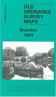
5Brandon in 1903 in a fascinating series of reproductions of old Ordnance Survey plans in the Alan Godfrey Editions, ideal for anyone interested in the history of their neighbourhood or family. The map straddles the Suffolk border and is also Norfolk Sheet 92.16. It covers the town of Brandon in good detail, and features here
Devonport North 1893
Devonport North in 1893 in a fascinating series of reproductions of old Ordnance Survey plans in the Alan Godfrey Editions, ideal for anyone interested in the history of their neighbourhood or family. The map covers much of the dockyard area of Devonport, extending from the Tamar Quay eastward to Crawford Road, and from St Levan
Devonport South and Stonehouse 1893
Devonport South and Stonehouse in 1893 in a fascinating series of reproductions of old Ordnance Survey plans in the Alan Godfrey Editions, ideal for anyone interested in the history of their neighbourhood or family. The map covers the southern part of Devonport and the East Stonehouse area of Plymouth. Coverage runs from the dockyard eastward
Cradley South 1901
Cradley South in 1901 in a fascinating series of reproductions of old Ordnance Survey plans in the Alan Godfrey Editions, ideal for anyone interested in the history of their neighbourhood or family. The map covers the eastern part of Cradley, southern part of Cradley Heath, the Haden Hill and Haden Cross area, and a rural
Annfield Plain 1896
Annfield Plain in 1896 in a fascinating series of reproductions of old Ordnance Survey plans in the Alan Godfrey Editions, ideal for anyone interested in the history of their neighbourhood or family. The map covers the mining village of Annfield Plain, just west of Stanley. Coverage stretches from Catchgate eastward to Oxhill and also includes
Kelvinside 1893
Kelvinside area of Glasgow in 1893 in a fascinating series of reproductions of old Ordnance Survey plans in the Alan Godfrey Editions, ideal for anyone interested in the history of their neighbourhood or family. The map covers an area of north-western Glasgow, together with smaller portions of Renfrewshire and Dumbartonshire. Features include the Stobcross Branch
Rutherglen West and Polmadie 1910
Rutherglen West and Polmadie 1910 in a fascinating series of reproductions of old Ordnance Survey plans in the Alan Godfrey Editions, ideal for anyone interested in the history of their neighbourhood or family. The map covers the western half of Rutherglen, plus the Polmadie area of south Glasgow. Coverage stretches from Hampden Park eastward to
Burnhope 1895
Burnhope in 1895 in a fascinating series of reproductions of old Ordnance Survey plans in the Alan Godfrey Editions, ideal for anyone interested in the history of their neighbourhood or family. Tthe map is double-sided. The main map covers the village itself and includes St John`s church, Burnhope Wagonway, and Burnhope Colliery – Fortune and
Rutherglen East 1910
Rutherglen East 1910 in a fascinating series of reproductions of old Ordnance Survey plans in the Alan Godfrey Editions, ideal for anyone interested in the history of their neighbourhood or family. The map covers the eastern half of Rutherglen. Coverage stretches from the Town Hall and Regent Street eastward to Hamilton Farm and the Clyde,
Hamilton Low Parks 1897
Hamilton Low Parks in 1897 in a fascinating series of reproductions of old Ordnance Survey plans in the Alan Godfrey Editions, ideal for anyone interested in the history of their neighbourhood or family. The map covers the northern part of Hamilton and is dominated by Hamilton Low Parks. In the south-western corner are Clyde Colliery,
Hammersmith & Fulham 1894 – 86.2
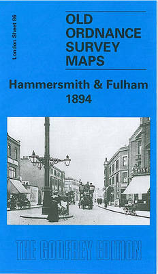
Hammersmith and Fulham in 1894 in a fascinating series of reproductions of old Ordnance Survey plans in the Alan Godfrey Editions, ideal for anyone interested in the history of their neighbourhood or family. Three versions for this area have been published, stretching from Hammersmith Bridge and Broadway eastward to Philbeach Gardens and Earls Court Exhibition
South West Suffolk 1893
South West Suffolk in 1893 in a series of reproductions of Ordnance Survey’s famous “Inch to the Mile” maps published in the Alan Godfrey Editions to provide a historical record of England and Wales in the second half of 19th and early 20th century.The map is centred on Long Melford and Glemsford, with coverage stretching
Newbury 1898 – 43.01
Newbury in 1898 in a fascinating series of reproductions of old Ordnance Survey plans in the Alan Godfrey Editions, ideal for anyone interested in the history of their neighbourhood or family. The map covers the centre and southern part of Newbury, concentrating on the area south of the River Kennet. Features include the Market Place,
Plymouth North 1893
Plymouth North in 1893 in a fascinating series of reproductions of old Ordnance Survey plans in the Alan Godfrey Editions, ideal for anyone interested in the history of their neighbourhood or family. The map covers the northern part of Plymouth, stretching from Wyndham Square eastward to Lipson Farm and Lipson House, and from Grenville Road
Halesowen (West) 1901 – 4.16
Halesowen West in 1901 in a fascinating series of reproductions of old Ordnance Survey plans in the Alan Godfrey Editions, ideal for anyone interested in the history of their neighbourhood or family. The map covers the western part of Halesowen and part of Hasbury, including Lower Hasbury and the suburbs of Town`s End, Spring Hill
Motherwell 1896
Motherwell in 1896 in a fascinating series of reproductions of old Ordnance Survey plans in the Alan Godfrey Editions, ideal for anyone interested in the history of their neighbourhood or family. Two versions have been published for this area. The maps cover central Motherwell around the station and the Town Hall. Coverage extends westward to