Category Archives: Maps
North London 1902-13 – 256
North London 1902-1913 in a series of reproductions of Ordnance Survey’s famous “Inch to the Mile” maps published in the Alan Godfrey Editions to provide a historical record of England and Wales in the second half of 19th and early 20th century.In this title coverage extends from Watford eastward to Chingford and Stratford, and from
Hampstead 1915 – 27.3
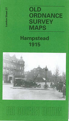
Hampstead in 1915 in a fascinating series of reproductions of old Ordnance Survey plans in the Alan Godfrey Editions, ideal for anyone interested in the history of their neighbourhood or family.Three versions of this map have been published, covering most of Hampstead Village and much of Hampstead Heath. Coverage extends from Finchley Road and Platts
Crook East 1896

Crook East in 1896 in a fascinating series of reproductions of old Ordnance Survey plans in the Alan Godfrey Editions, ideal for anyone interested in the history of their neighbourhood or family. The map covers the eastern part of the town, including town centre, St Catherine`s church, RC chapel, Wheat Bottom, Royal Hotel and Surtees
Crook West 1895
Crook West in 1895 in a fascinating series of reproductions of old Ordnance Survey plans in the Alan Godfrey Editions, ideal for anyone interested in the history of their neighbourhood or family. The map covers the western part of the town, including High Hope Street, West Road, station, goods station, the northern part of Woodifield
Foulness and Mersea 1904
Foulness and Mersea in 1904 in a series of reproductions of Ordnance Survey’s famous “Inch to the Mile” maps published in the Alan Godfrey Editions to provide a historical record of England and Wales in the second half of 19th and early 20th century.In this title two maps, 242 and 259, are printed side by
Wishaw 1896
Wishaw in 1896 in a fascinating series of reproductions of old Ordnance Survey plans in the Alan Godfrey Editions, ideal for anyone interested in the history of their neighbourhood or family. The map covers the centre of Wishaw together with the Iron & Steel Works to the south-west. Features include Main Street, Stewarton Street, Kirk
Bethnal Green & Bow 1870 – 52.1
Bethnal Green and Bow in 1870 in a fascinating series of reproductions of old Ordnance Survey plans in the Alan Godfrey Editions, ideal for anyone interested in the history of their neighbourhood or family. Three versions of this map have been published, stretching from Cambridge Road eastward to Fairfield Road, and from Morpeth Road southward
Middle Tamar and Caradon 1894
Middle Tamar and Caradon in 1894 in a series of reproductions of Ordnance Survey’s famous “Inch to the Mile” maps published in the Alan Godfrey Editions to provide a historical record of England and Wales in the second half of 19th and early 20th century.Coverage stretches from Smallacoombe Downs and St Clether eastwards to Tavistock
Houghton le Spring 1895
Houghton le Spring in 1895 in a fascinating series of reproductions of old Ordnance Survey plans in the Alan Godfrey Editions, ideal for anyone interested in the history of their neighbourhood or family. The map covers the town of Houghton le Spring and an area a mile or so north and east. Most of the
Southall 1894
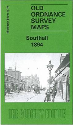
Southall in 1894 in a fascinating series of reproductions of old Ordnance Survey plans in the Alan Godfrey Editions, ideal for anyone interested in the history of their neighbourhood or family. The map covers the old village centre of Southall in the south-eastern corner and is based around the High Street (now Broadway), including Holy
New Eltham 1895 – 8.06
New Eltham in 1895 in a fascinating series of reproductions of old Ordnance Survey plans in the Alan Godfrey Editions, ideal for anyone interested in the history of their neighbourhood or family. The map centred on the hamlet of New Eltham, formerly known as Pope Street, a community that developed after the arrival of the
Bangor 1913 – 6.12
Bangor in 1913 in a fascinating series of reproductions of old Ordnance Survey plans in the Alan Godfrey Editions, ideal for anyone interested in the history of their neighbourhood or family. The map covers Bangor from Carnarvon Road and the station northward to Beach Road in Hirael. Features include the station, Friars School, West End,
North Kent Coast 1878
North Kent Coast in 1878 in a series of reproductions of Ordnance Survey’s famous “Inch to the Mile” maps published in the Alan Godfrey Editions to provide a historical record of England and Wales in the second half of 19th and early 20th century.The map covers the coast of north Kent from Faversham to Reculver
Looe 1905
Looe in 1905 in a fascinating series of reproductions of old Ordnance Survey plans in the Alan Godfrey Editions, ideal for anyone interested in the history of their neighbourhood or family. The map covers both West Looe and East Looe, and extends northward to Shutta and Barbican, and eastward to Millendreath Beach. Features include the
Cathcart 1910
Cathcart in 1910 in a fascinating series of reproductions of old Ordnance Survey plans in the Alan Godfrey Editions, ideal for anyone interested in the history of their neighbourhood or family. Coverage stretches from Merrylee Wood eastward to Carmunnock Road and Cathcart church, and from Millbrae Crescent southward to Muirend station. Features include Muirend House,
Burnhope 1895
Burnhope in 1895 in a fascinating series of reproductions of old Ordnance Survey plans in the Alan Godfrey Editions, ideal for anyone interested in the history of their neighbourhood or family. Tthe map is double-sided. The main map covers the village itself and includes St John`s church, Burnhope Wagonway, and Burnhope Colliery – Fortune and
Rutherglen East 1910
Rutherglen East 1910 in a fascinating series of reproductions of old Ordnance Survey plans in the Alan Godfrey Editions, ideal for anyone interested in the history of their neighbourhood or family. The map covers the eastern half of Rutherglen. Coverage stretches from the Town Hall and Regent Street eastward to Hamilton Farm and the Clyde,
Hamilton Low Parks 1897
Hamilton Low Parks in 1897 in a fascinating series of reproductions of old Ordnance Survey plans in the Alan Godfrey Editions, ideal for anyone interested in the history of their neighbourhood or family. The map covers the northern part of Hamilton and is dominated by Hamilton Low Parks. In the south-western corner are Clyde Colliery,
Hammersmith & Fulham 1894 – 86.2
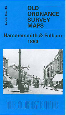
Hammersmith and Fulham in 1894 in a fascinating series of reproductions of old Ordnance Survey plans in the Alan Godfrey Editions, ideal for anyone interested in the history of their neighbourhood or family. Three versions for this area have been published, stretching from Hammersmith Bridge and Broadway eastward to Philbeach Gardens and Earls Court Exhibition
Stepney & Limehouse 1870 – 64.1
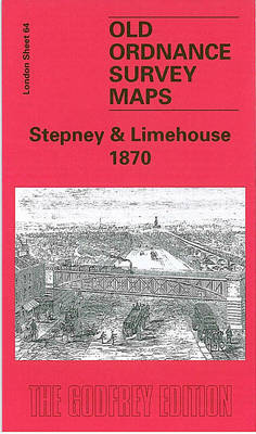
Stepney and Limehouse in 1870 in a fascinating series of reproductions of old Ordnance Survey plans in the Alan Godfrey Editions, ideal for anyone interested in the history of their neighbourhood or family. Three versions cover the same area, stretching from Sidney Street and Shadwell station eastward to Stainsby Road, and from the Mile End