Category Archives: Maps
Hammersmith & Fulham 1913 – 86.3
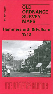
Hammersmith and Fulham in 1913 in a fascinating series of reproductions of old Ordnance Survey plans in the Alan Godfrey Editions, ideal for anyone interested in the history of their neighbourhood or family. Three versions for this area have been published, stretching from Hammersmith Bridge and Broadway eastward to Philbeach Gardens and Earls Court Exhibition
Aldershot 1909

Aldershot in 1909 in a fascinating series of reproductions of old Ordnance Survey plans in the Alan Godfrey Editions, ideal for anyone interested in the history of their neighbourhood or family. Coverage stretches from Greenham`s Hill eastward to Redan Hill and Waterloo Road, and from Albuhera Barracks southward to Cargate and Church Lane. Features include
Bristol (St George) 1902 – 72.14
Bristol St George in 1902 in a fascinating series of reproductions of old Ordnance Survey plans in the Alan Godfrey Editions, ideal for anyone interested in the history of their neighbourhood or family. The map covers the St George`s area east of Bristol, stretching from Blackwarth Road and Cossham Road eastward to Charlton Road and
Wrexham Central 1909
Wrexham Central in 1909 in a fascinating series of reproductions of old Ordnance Survey plans in the Alan Godfrey Editions, ideal for anyone interested in the history of their neighbourhood or family. The map covers most of the town centre, stretching from Bradley Road eastward to The Dunks and Hafod-y-wern, and from Grosvenor Road southward
Yeading 1894
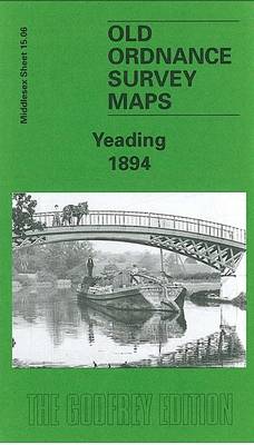
Yeading in 1894 in a fascinating series of reproductions of old Ordnance Survey plans in the Alan Godfrey Editions, ideal for anyone interested in the history of their neighbourhood or family. The map covers parts of three Middlesex parishes: Northolt to the top, Hayes to the south, and Southall in the south-east. It is an
Wrexham West 1909
Wrexham West in 1909 in a fascinating series of reproductions of old Ordnance Survey plans in the Alan Godfrey Editions, ideal for anyone interested in the history of their neighbourhood or family. Tthe map covers the western side of Wrexham, stretching from the cemetery and Wat`s Dike westward to Pool Covert and Bersham church, and
Stourport 1901
Stourport in 1901 in a fascinating series of reproductions of old Ordnance Survey plans in the Alan Godfrey Editions, ideal for anyone interested in the history of their neighbourhood or family. The map is double-sided; the main map covers the centre and north of the town, extending north of the railway to include the Newtown
Criccieth 1913
Criccieth in 1913 in a fascinating series of reproductions of old Ordnance Survey plans in the Alan Godfrey Editions, ideal for anyone interested in the history of their neighbourhood or family. The map covers most of the town, extending from the castle northward to Mynydd-Ednyfed, Antipodes Terrace and the reservoir. Features include railway with station,
Denbigh 1910
Denbigh in 1910 in a fascinating series of reproductions of old Ordnance Survey plans in the Alan Godfrey Editions, ideal for anyone interested in the history of their neighbourhood or family. The map covers most of the town and features include the town centre, Castle, Howells School, St David`s church, Copenhagen, Lenten Pool, Graig Quarry
Welshpool and District 1904-1912
Welshpool/Trallwn and District in 1904-1912 in a series of reproductions of Ordnance Survey’s famous “Inch to the Mile” maps published in the Alan Godfrey Editions to provide a historical record of England and Wales in the second half of 19th and early 20th century.In this title coverage stretches from Llanfair Caereinion eastward to Minsterley and
Devon North: Taw and Torridge Valleys 1907
Devon North: Taw and Torridge Valleys in 1907 in a series of reproductions of Ordnance Survey’s famous “Inch to the Mile” maps published in the Alan Godfrey Editions to provide a historical record of England and Wales in the second half of 19th and early 20th century.The map covers an area of north Devon stretching
Brymbo 1909
Brymbo in 1909 in a fascinating series of reproductions of old Ordnance Survey plans in the Alan Godfrey Editions, ideal for anyone interested in the history of their neighbourhood or family. Tthe map covers the industrial village of Brymbo, just north-west of Wrexham. Brymbo Hall is near the centre of the map and coverage stretches
Brockley & Honor Oak 1914 – 118.3
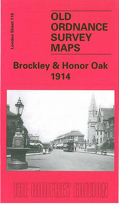
Brockley and Honor Oak in 1914 in a fascinating series of reproductions of old Ordnance Survey plans in the Alan Godfrey Editions, ideal for anyone interested in the history of their neighbourhood or family. Three versions for this area have been published, stretching from Homestall Road and Ryehill Park eastward to Chudleigh Road and Hilly
Putney Bridge & Fulham 1913 – 99.3
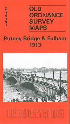
Putney Bridge and Fulham in 1913 in a fascinating series of reproductions of old Ordnance Survey plans in the Alan Godfrey Editions, ideal for anyone interested in the history of their neighbourhood or family. Three versions for this area have been published to show how it developed across the years. The maps each cover the
Burnopfield and The Leazes 1895
Burnopfield and The Leazes in 1895 in a fascinating series of reproductions of old Ordnance Survey plans in the Alan Godfrey Editions, ideal for anyone interested in the history of their neighbourhood or family. The map covers the village of Burnopfield, which stands on a shelf above the River Derwent, about 7 miles south-west of
Houghton le Spring 1895
Houghton le Spring in 1895 in a fascinating series of reproductions of old Ordnance Survey plans in the Alan Godfrey Editions, ideal for anyone interested in the history of their neighbourhood or family. The map covers the town of Houghton le Spring and an area a mile or so north and east. Most of the
Southall 1894
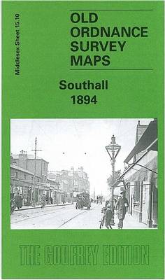
Southall in 1894 in a fascinating series of reproductions of old Ordnance Survey plans in the Alan Godfrey Editions, ideal for anyone interested in the history of their neighbourhood or family. The map covers the old village centre of Southall in the south-eastern corner and is based around the High Street (now Broadway), including Holy
New Eltham 1895 – 8.06
New Eltham in 1895 in a fascinating series of reproductions of old Ordnance Survey plans in the Alan Godfrey Editions, ideal for anyone interested in the history of their neighbourhood or family. The map centred on the hamlet of New Eltham, formerly known as Pope Street, a community that developed after the arrival of the
Bangor 1913 – 6.12
Bangor in 1913 in a fascinating series of reproductions of old Ordnance Survey plans in the Alan Godfrey Editions, ideal for anyone interested in the history of their neighbourhood or family. The map covers Bangor from Carnarvon Road and the station northward to Beach Road in Hirael. Features include the station, Friars School, West End,
North Kent Coast 1878
North Kent Coast in 1878 in a series of reproductions of Ordnance Survey’s famous “Inch to the Mile” maps published in the Alan Godfrey Editions to provide a historical record of England and Wales in the second half of 19th and early 20th century.The map covers the coast of north Kent from Faversham to Reculver