Category Archives: Maps
Beachy Head, Newhaven and Eastbourne 1880 – 1903
Beachy Head, Newhaven and Eastbourne in 1880 – 1903 in a series of reproductions of Ordnance Survey’s famous “Inch to the Mile” maps published in the Alan Godfrey Editions to provide a historical record of England and Wales in the second half of 19th and early 20th century.Coverage stretches from Newhaven to beyond Eastbourne, and
Knutsford North 1908

Knutsford North in 1908 in a fascinating series of reproductions of old Ordnance Survey plans in the Alan Godfrey Editions, ideal for anyone interested in the history of their neighbourhood or family. The map covers the northern part of Knutsford, from St John`s church (split by map margin) northward to Tatton Mere. Features include King
Tiverton 1903
Tiverton in 1903 in a fascinating series of reproductions of old Ordnance Survey plans in the Alan Godfrey Editions, ideal for anyone interested in the history of their neighbourhood or family. The map covers the centre and south of Tiverton, stretching from St Peter`s church southward to Howden Court, and from Gotham eastward to The
North Kirkcaldy & Dysart 1894 – 36.05
Kirkcaldy North and Dysart in 1894 in a fascinating series of reproductions of old Ordnance Survey plans in the Alan Godfrey Editions, ideal for anyone interested in the history of their neighbourhood or family. The map covers the northern part of Kirkcaldy and extends north-east to Dysart and Giffen Park. Features include railway with Sinclairtown
Kiveton Park and Wales 1901
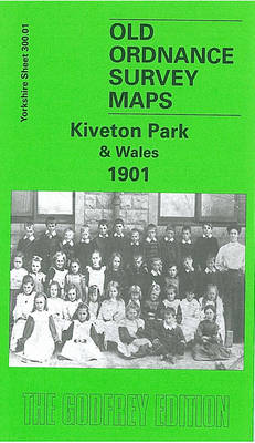
Kiveton Park and Wales in 1901 in a fascinating series of reproductions of old Ordnance Survey plans in the Alan Godfrey Editions, ideal for anyone interested in the history of their neighbourhood or family. The map is covers the small village of Wales, a few miles south-east of Sheffield, stretching from Wales Court southward to
North East Essex and Dedham Vale 1904
North East Essex and Dedham Vale in 1904 in a series of reproductions of Ordnance Survey’s famous “Inch to the Mile” maps published in the Alan Godfrey Editions to provide a historical record of England and Wales in the second half of 19th and early 20th century.The map covers the area of Essex from Colchester
Chigwell Station 1914
Chigwell Station in 1914 in a fascinating series of reproductions of old Ordnance Survey plans in the Alan Godfrey Editions, ideal for anyone interested in the history of their neighbourhood or family. The map covers the area around and to the south and west of Chigwell station. Coverage continues only a little way north, to
Alston 1898
Alston in 1898 in a fascinating series of reproductions of old Ordnance Survey plans in the Alan Godfrey Editions, ideal for anyone interested in the history of their neighbourhood or family. The map gives good coverage of the small town of Alston, with coverage extending from the town centre eastward to High Skelgill. Features include
East Tanfield and Causey Arch 1895
East Tanfield and Causey Arch in 1895 in a fascinating series of reproductions of old Ordnance Survey plans in the Alan Godfrey Editions, ideal for anyone interested in the history of their neighbourhood or family. The map covers an area stretching from Tanfield village eastward to Beamish Red Row. The Tanfield Railway runs through the
Penryn 1906
Penryn in 1906 in a fascinating series of reproductions of old Ordnance Survey plans in the Alan Godfrey Editions, ideal for anyone interested in the history of their neighbourhood or family. Coverage includes the town centre, with Lower Street, The Praze, Commercial Road, Town Hall, Market Street, Broad Street, The Green, West Street, Church Road,
Tettenhall 1900
Tettenhall in 1900 in a fascinating series of reproductions of old Ordnance Survey plans in the Alan Godfrey Editions, ideal for anyone interested in the history of their neighbourhood or family. The map covers most of Tettenhall, including Tettenhall Wood, west of Wolverhampton. Coverage extends from Tettenhall Upper Green southward to Compton Hall. Features include
Wirksworth 1920
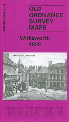
Wirksworth in 1920 in a fascinating series of reproductions of old Ordnance Survey plans in the Alan Godfrey Editions, ideal for anyone interested in the history of their neighbourhood or family. The map covers the small town of Wirksworth, extending northward to Bolehill and Middlepeak. Features include Midland Railway`s Wirksworth Branch with station, section of
Wickford 1919
Wickford in 1919 in a fascinating series of reproductions of old Ordnance Survey plans in the Alan Godfrey Editions, ideal for anyone interested in the history of their neighbourhood or family. The railway runs north-west/south-east across the map, with the station in the centre of the map. To the north streets are being laid out,
Sale South-West 1908
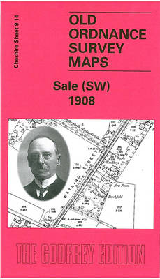
Sale South-West in 1908 in a fascinating series of reproductions of old Ordnance Survey plans in the Alan Godfrey Editions, ideal for anyone interested in the history of their neighbourhood or family. SThe map covers the south-western area of Sale along Washway Road, the old Watling Street. It is a semi-rural map but features include
Bollington 1907
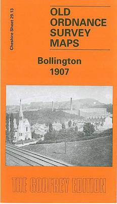
Bollington in 1907 in a fascinating series of reproductions of old Ordnance Survey plans in the Alan Godfrey Editions, ideal for anyone interested in the history of their neighbourhood or family. The map covers the village of Bollington, stretching from the railway station eastward to High Cliff and Ingersley Hall. Features include the village centre,
Fenton 1922
Fenton in 1922 in a fascinating series of reproductions of old Ordnance Survey plans in the Alan Godfrey Editions, ideal for anyone interested in the history of their neighbourhood or family. The map covers much of Fenton, one of the `Sixth Town` of the Potteries. Coverage stretches from Regent Road and Wellington Street eastward to
Eston 1927
Eston in 1927 in a fascinating series of reproductions of old Ordnance Survey plans in the Alan Godfrey Editions, ideal for anyone interested in the history of their neighbourhood or family. The map includes Old Eston, South Eston and California, with coverage extending eastward to Eston Nab, Eston Beacon and Lackenby Bank. Eston Bank with
Birmingham and District 1910
Birmingham and District in 1910 in a series of reproductions of Ordnance Survey’s famous “Inch to the Mile” maps published in the Alan Godfrey Editions to provide a historical record of England and Wales in the second half of 19th and early 20th century.The map is centred on Birmingham and stretches from Halesowen and Rowley
Holywell 1910
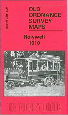
Holywell in 1910 in a fascinating series of reproductions of old Ordnance Survey plans in the Alan Godfrey Editions, ideal for anyone interested in the history of their neighbourhood or family. The map covers the centre of Holywell and the area to the west, with coverage westward to Mwdwl-eithin and Saith-aelwyd. Features include Pantasaph Farm,
Wivenhoe 1896
Wivenhoe in 1896 in a fascinating series of reproductions of old Ordnance Survey plans in the Alan Godfrey Editions, ideal for anyone interested in the history of their neighbourhood or family. SThe map covers most of this small, compact town, including its railway station, St Mary`s church, Wivenhoe Hall, shipbuilding yards, Station Hotel, wharf. Across