Category Archives: Maps
Newton Heath 1915

Newton Heath in 1915 in a fascinating series of reproductions of old Ordnance Survey plans in the Alan Godfrey Editions, ideal for anyone interested in the history of their neighbourhood or family. Two versions have been published for this area. The maps cover Newton Heath on the north-eastern side of Manchester, stretching from Hague Street
Ludlow, Tembury and Dirtrict 1897
Ludlow, Tembury and District 1897 in a series of reproductions of Ordnance Survey’s famous “Inch to the Mile” maps published in the Alan Godfrey Editions to provide a historical record of England and Wales in the second half of 19th and early 20th century.In this title coverage stretches from Leintwardine eastward to Tenbury Wells, and
Liverpool Mount Pleasant 1848
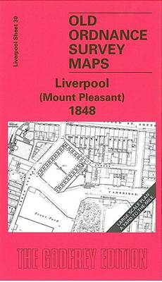
Mount Pleasant area of Liverpool in 1848 in a series of exceptionally detailed reproductions of old Ordnance Survey street plans for areas of larger cities which have undergone substantial redevelopment in the late 19th or the early 20th century, published in the Alan Godfrey Editions.The plans, printed in back and white, have been taken from
Ipswich, Bildeston and District 1893
Ipswich, Bildeston and District in 1893 in a series of reproductions of Ordnance Survey’s famous “Inch to the Mile” maps published in the Alan Godfrey Editions to provide a historical record of England and Wales in the second half of 19th and early 20th century.The map covers the area around Ipswich, stretching from Bildeston eastward
Chipping Ongar 1915
Chipping Ongar in 1915 in a fascinating series of reproductions of old Ordnance Survey plans in the Alan Godfrey Editions, ideal for anyone interested in the history of their neighbourhood or family. Coverage stretches from the station southward to Marden Ash. Features include the High Street, Sammes Cottages, and the castle site. Coverage continues westward
Motherwell (East) 1897 – 12.14
Motherwell East in 1897 in a fascinating series of reproductions of old Ordnance Survey plans in the Alan Godfrey Editions, ideal for anyone interested in the history of their neighbourhood or family. The map covers the eastern part of the town and extends eastward to Middle Johnston colliery. Features include Windmillhill Street, Millar Street, Poorhouse,
Lewisham 1914 – 119.3
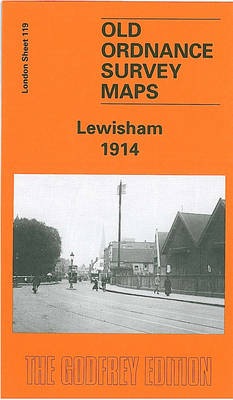
Lewisham in 1914 in a fascinating series of reproductions of old Ordnance Survey plans in the Alan Godfrey Editions, ideal for anyone interested in the history of their neighbourhood or family. Three versions have been published for this area, stretching from Algernon Road and Ladywell station eastward to Lee Road and Burnt Ash Road, and
Leeds Town Hall and Park Square 1847-1863
Town Hall and Park Square area of Leeds in 1847-1863 in a series of exceptionally detailed reproductions of old Ordnance Survey street plans for areas of larger cities which have undergone substantial redevelopment in the late 19th or the early 20th century, published in the Alan Godfrey Editions.The plans, printed in back and white, have
No Place, Beamish and West Pelton 1895
No Place, Beamish and West Pelton in 1895 in a fascinating series of reproductions of old Ordnance Survey plans in the Alan Godfrey Editions, ideal for anyone interested in the history of their neighbourhood or family. The map covers the village of Beamish (though Beamish Hall and the area now covered by the museum are
Tottenham 1936 – 13.4
Tottenham in 1936 in a fascinating series of reproductions of old Ordnance Survey plans in the Alan Godfrey Editions, ideal for anyone interested in the history of their neighbourhood or family. Two versions have been published to cover this area of the southern half of Tottenham, stretching from South Tottenham station northward to Bruce Grove
Brough 1908
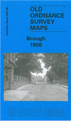
Brough in 1908 in a fascinating series of reproductions of old Ordnance Survey plans in the Alan Godfrey Editions, ideal for anyone interested in the history of their neighbourhood or family. The map covers the village of Brough, originally within the parish of Elloughton. Features include the station, a corn factory, wharf, Skillings Lodge Farm,
Sturminster Newton 1900
Sturminster Newton in 1900 in a fascinating series of reproductions of old Ordnance Survey plans in the Alan Godfrey Editions, ideal for anyone interested in the history of their neighbourhood or family. The map is double-sided to give maximum coverage. The main map shows the town centre and extends north to the workhouse and beyond
Durham City East 1894
Durham East in 1894 in a fascinating series of reproductions of old Ordnance Survey plans in the Alan Godfrey Editions, ideal for anyone interested in the history of their neighbourhood or family. Coverage stretches from Gilesgate eastward to Sherburn Grange and, near the south-eastern corner, Sherburnhouse station. Sunderland Road and Sherburn Road fan out across
Malvern Link 1926
Malvern Link in 1926 in a fascinating series of reproductions of old Ordnance Survey plans in the Alan Godfrey Editions, ideal for anyone interested in the history of their neighbourhood or family. The map covers most of Malvern Link, extending from Albert Park Road northward and eastward to St Leonard`s church, Newland. Features include railway
Furness Abbey 1931
Furness Abbey in 1931 in a fascinating series of reproductions of old Ordnance Survey plans in the Alan Godfrey Editions, ideal for anyone interested in the history of their neighbourhood or family.The map covers the northern part of Barrow around Furness Abbey, extending from Infield Convalescent Home and Croft Park northward to Breast Mill Beck,
Pelton Fell 1915
Pelton Fell in 1915 in a fascinating series of reproductions of old Ordnance Survey plans in the Alan Godfrey Editions, ideal for anyone interested in the history of their neighbourhood or family. The map covers two mining villages west of Chester-le-Street and south of the historic Pelton village. Two railways run through the map: the
Richmond North 1927
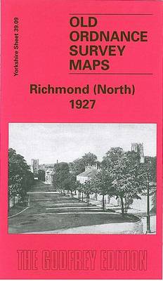
Richmond North in 1927 in a fascinating series of reproductions of old Ordnance Survey plans in the Alan Godfrey Editions, ideal for anyone interested in the history of their neighbourhood or family. The map covers the northern part of the historic Swaledale town of Richmond, with part of the Market Place including Newbiggin, The Friary,
Pelton and Urpeth 1895
Pelton and Urpeth in 1895 in a fascinating series of reproductions of old Ordnance Survey plans in the Alan Godfrey Editions, ideal for anyone interested in the history of their neighbourhood or family. The map covers the village of Pelton, just west of Chester-le-Street, extending north to Urpeth and part of Ouston, and north-west to
Richmond South and Easby 1927
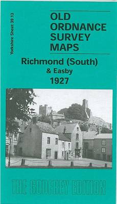
Richmond South and Easby in 1927 in a fascinating series of reproductions of old Ordnance Survey plans in the Alan Godfrey Editions, ideal for anyone interested in the history of their neighbourhood or family. The map covers the southern part of Richmond, with the Town Hall, the great Castle, The Green, River Swale, Bargate, Sleegill,
Flixton 1904
Flixton in 1904 in a fascinating series of reproductions of old Ordnance Survey plans in the Alan Godfrey Editions, ideal for anyone interested in the history of their neighbourhood or family. The map covers the area from Higher Irlam, in the top left corner, and the Manchester Ship Canal eastward to Flixton station. Features include