Category Archives: Maps
Pollok Park 1909

Pollok Park in 1909 in a fascinating series of reproductions of old Ordnance Survey plans in the Alan Godfrey Editions, ideal for anyone interested in the history of their neighbourhood or family. The map is centred on Pollok House with its extensive grounds. A small portion of Corkerhill is in the top left corner, while
Carlton Main & Shafton Two Gates 1914 – 263.13
Carlton Main and Shafton Two Gates in 1914 in a fascinating series of reproductions of old Ordnance Survey plans in the Alan Godfrey Editions, ideal for anyone interested in the history of their neighbourhood or family. The map covers an area on the northern side of Cudworth, near Barnsley, including Upper Cudworth, with the Pontefract
Liverpool Pierhead (Prince`s and George`s Docks) 1864
Pierhead (Prince`s and George`s Docks) area of Liverpool in 1864 in a series of exceptionally detailed reproductions of old Ordnance Survey street plans for areas of larger cities which have undergone substantial redevelopment in the late 19th or the early 20th century, published in the Alan Godfrey Editions.The plans, printed in back and white, have
Hazel Grove 1897
Stockport Offerton and Foggbrook in 1907 in a fascinating series of reproductions of old Ordnance Survey plans in the Alan Godfrey Editions, ideal for anyone interested in the history of their neighbourhood or family. The map covers an area south-eastern of Stockport that was still semi-rural. Coverage stretches from Maitland Street eastward to Foggbrook, and
Kirkby Stephen 1911 – 23.15
Kirkby Stephen in 1911 in a fascinating series of reproductions of old Ordnance Survey plans in the Alan Godfrey Editions, ideal for anyone interested in the history of their neighbourhood or family. The map is double-sided. The main map includes the town centre, stretching southward to Stenkrith Bridge and eastward to Hellgill Howe, Birkett Lane
Bristol and District 1912
Bristol and District in 1912 in a series of reproductions of Ordnance Survey’s famous “Inch to the Mile” maps published in the Alan Godfrey Editions to provide a historical record of England and Wales in the second half of 19th and early 20th century.In this title coverage stretches from Clevedon eastward to Keynsham and Kingswood,
Blackpool Central Pier 1909
Blackpool Central Pier in 1909 in a fascinating series of reproductions of old Ordnance Survey plans in the Alan Godfrey Editions, ideal for anyone interested in the history of their neighbourhood or family. The map covers the area of Blackpool around the Central Pier and “Golden Mile”. Features include most of Central station and the
Ashton-on-Mersey 1927
Ashton-on-Mersey in 1927 in a fascinating series of reproductions of old Ordnance Survey plans in the Alan Godfrey Editions, ideal for anyone interested in the history of their neighbourhood or family. Although this map is in the Lancashire series, most of the coverage is actually of Cheshire. The map covers a busy area of Sale
Ashton-under-Lyne 1916
Ashton-under-Lyne in 1916 in a fascinating series of reproductions of old Ordnance Survey plans in the Alan Godfrey Editions, ideal for anyone interested in the history of their neighbourhood or family. The map covers the central and western parts of Ashton, stretching from Old Square westward to Ashton Moss, and from Christ Church and Lord
Boscastle 1905
Boscastle in 1905 in a fascinating series of reproductions of old Ordnance Survey plans in the Alan Godfrey Editions, ideal for anyone interested in the history of their neighbourhood or family. The map covers much of the village of Boscastle, where the River Valency runs into the sea, stretching from Penally Point eastward to Minster
Heywood 1907
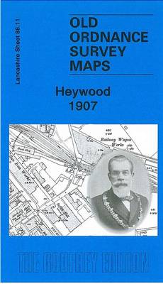
Heywood in 1907 in a fascinating series of reproductions of old Ordnance Survey plans in the Alan Godfrey Editions, ideal for anyone interested in the history of their neighbourhood or family. The map covers the mill town of Heywood, just west of Rochdale. About 35 cotton mills are shown, including Yew Mill, Plum Mill, Roeacre
Campbeltown 1898 – 257.08
Campbeltown in 1898 in a fascinating series of reproductions of old Ordnance Survey plans in the Alan Godfrey Editions, ideal for anyone interested in the history of their neighbourhood or family. Features include the Old Quay and New Quay, Dalintober, Kinloch Public Park, Balegreggan Glen, Balegreggan Hill, Drumore House, Calton Hill, Benmore Distillery, Highland Distillery,
Fairford 1920 – 52.12
Fairford in 1920 in a fascinating series of reproductions of old Ordnance Survey plans in the Alan Godfrey Editions, ideal for anyone interested in the history of their neighbourhood or family. The map covers the beautiful small town of Fairford plus Fairford Park, interrupted by the River Coln on its way to the Cotswolds. In
Peckham 1871 – 103.1
Peckham in 1871 in a fascinating series of reproductions of old Ordnance Survey plans in the Alan Godfrey Editions, ideal for anyone interested in the history of their neighbourhood or family. Three versions for this area have been published, stretching from Denmark Hill station eastward to Queen`s Road station and Asylum Road; and from Rosemary
Stansted Mountfitchet 1921 – 23.15
Stansted Mountfitchet in 1921 in a fascinating series of reproductions of old Ordnance Survey plans in the Alan Godfrey Editions, ideal for anyone interested in the history of their neighbourhood or family. The map is double-sided and shows Stansted Mountfichet in great detail, featuring individual houses, the remains of the castle, St John`s and St
Coventry (North) 1912 – 21.08
North Coventry in 1912 in a fascinating series of reproductions of old Ordnance Survey plans in the Alan Godfrey Editions, ideal for anyone interested in the history of their neighbourhood or family. Coventry in covered on four maps:COVENTRY CENTRAL 1905 map covers the city centre, extending from Queen Victoria Road eastward to Gosford Green and
Coventry (West) 1904-11 – 21.11
West Coventry in 1904-1911 in a fascinating series of reproductions of old Ordnance Survey plans in the Alan Godfrey Editions, ideal for anyone interested in the history of their neighbourhood or family. Coventry in covered on four maps:COVENTRY CENTRAL 1905 map covers the city centre, extending from Queen Victoria Road eastward to Gosford Green and
Coventry (South) 1912 – 21.16
South Coventry in 1912 in a fascinating series of reproductions of old Ordnance Survey plans in the Alan Godfrey Editions, ideal for anyone interested in the history of their neighbourhood or family. Coventry in covered on four maps:COVENTRY CENTRAL 1905 map covers the city centre, extending from Queen Victoria Road eastward to Gosford Green and
Andover, Whitchurch and the Hampshire Downs 1898
Andover, Whitechurch and the Hampshire Downs in 1898 in a series of reproductions of Ordnance Survey’s famous “Inch to the Mile” maps published in the Alan Godfrey Editions to provide a historical record of England and Wales in the second half of 19th and early 20th century.The map covers the area around and to the
East Dulwich & Peckham Rye 1894 – 117.2
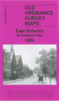
East Dulwich and Peckham Rye in 1894 in a fascinating series of reproductions of old Ordnance Survey plans in the Alan Godfrey Editions, ideal for anyone interested in the history of their neighbourhood or family.Three versions for this area have been published, stretching from Redpost Lane (or Redpost Hill) eastward to Peckham Rye Park, and