Category Archives: Maps
Northfield North 1903

Northfield North in 1903 in a fascinating series of reproductions of old Ordnance Survey plans in the Alan Godfrey Editions, ideal for anyone interested in the history of their neighbourhood or family. The map covers the northern part of Northfield, stretching from Griffins Brook Farm southward to Bunbury`s Road. The Bristol Road runs diagonally down
Tintagel 1905
Tintagel in 1905 in a fascinating series of reproductions of old Ordnance Survey plans in the Alan Godfrey Editions, ideal for anyone interested in the history of their neighbourhood or family. The map is double-sided; the main map covers the village of Tintagel, previously called Trevena. In 1820 the village was described as having houses
Hull Alexandra Dock 1908
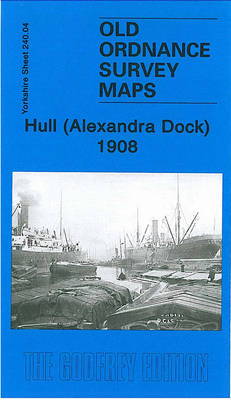
Hull Alexandra Dock in 1908 in a fascinating series of reproductions of old Ordnance Survey plans in the Alan Godfrey Editions, ideal for anyone interested in the history of their neighbourhood or family. The dominant feature on the map is the Alexandra Dock, opened in 1885 in association with the new Hull & Barnsley Railway.
Motherwell 1910 – 12.13b
Motherwell in 1910 in a fascinating series of reproductions of old Ordnance Survey plans in the Alan Godfrey Editions, ideal for anyone interested in the history of their neighbourhood or family. Two versions have been published for this area. The maps cover central Motherwell around the station and the Town Hall. Coverage extends westward to
Whiston 1925
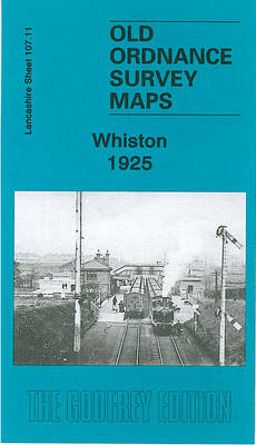
Whiston in 1925 in a fascinating series of reproductions of old Ordnance Survey plans in the Alan Godfrey Editions, ideal for anyone interested in the history of their neighbourhood or family. The map covers the village of Whiston, midway between Liverpool and Warrington. Coverage stretches from Prescot station southward to Whiston Lane Ends, and from
Hull North East 1908
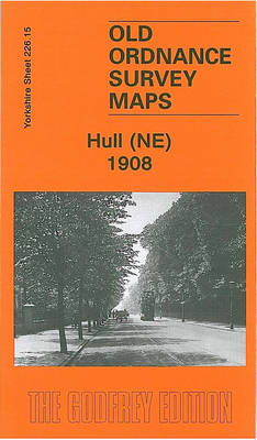
Hull North East in 1908 in a fascinating series of reproductions of old Ordnance Survey plans in the Alan Godfrey Editions, ideal for anyone interested in the history of their neighbourhood or family. The map covers a busy north-eastern area of Hull, stretching from Cannon Street station northward to Lorraine Street, and from St Paul`s
Motherwell (North) 1939 – 12.09
Motherwell North in 1939 in a fascinating series of reproductions of old Ordnance Survey plans in the Alan Godfrey Editions, ideal for anyone interested in the history of their neighbourhood or family. The map covers the area north of Motherwell, stretching along the Bellshill Road northward to Holm Forge Bridge. Features include Motherwell Mill, Colville
Llantwit Major 1914
Llantwit Major in 1914 in a fascinating series of reproductions of old Ordnance Survey plans in the Alan Godfrey Editions, ideal for anyone interested in the history of their neighbourhood or family. The map covers the village centre and extends south to Ham House and Mill-Lay Common. Features include the station and railway, St Illtyd`s
Dyserth and Meliden 1910
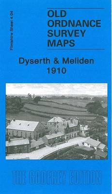
Dyserth and Meliden in 1910 in a fascinating series of reproductions of old Ordnance Survey plans in the Alan Godfrey Editions, ideal for anyone interested in the history of their neighbourhood or family. The map is double-sided. The main map covers the village of Dyserth, famed for its waterfall, and coverage stretches west to Bodrhyddan
Norham & Berwick 1864 – 1
Northam and Berwick in 1864 in a series of reproductions of Ordnance Survey’s famous “Inch to the Mile” maps published in the Alan Godfrey Editions to provide a historical record of England and Wales in the second half of 19th and early 20th century.This title includes both the original sheets 1 and 2, covering an
Wigan 1928 – 93.08c
Wigan in 1928 in a fascinating series of reproductions of old Ordnance Survey plans in the Alan Godfrey Editions, ideal for anyone interested in the history of their neighbourhood or family. Two maps have been published for this area, covering central Wigan, plus part of Ince in Makerfield. Coverage stretches from Wallgate eastward to Belle
Camelford 1905
Camelford in 1905 in a fascinating series of reproductions of old Ordnance Survey plans in the Alan Godfrey Editions, ideal for anyone interested in the history of their neighbourhood or family. The map covers the small market town of Camelford, founded by Earl Richard of Cornwall, brother of Henry III, in the mid-13th century. The
Kipling
Rudyard Kipling (1865-1936) is perhaps the most controversial major English poet of the last two centuries, not least because of his apparent enthusiasm for the empire. A child of British India, he first became famous for tales of imperial life, notably “Kim”, “the Jungle Book” and “Barrack Room Ballads”. Kipling wrote verse in every classical
Glasgow (Bellahouston & Dumbreck) 1934 – 6.13b
Glasgow Bellahouston and Dumbreck in 1934 in a fascinating series of reproductions of old Ordnance Survey plans in the Alan Godfrey Editions, ideal for anyone interested in the history of their neighbourhood or family. Two versions have been published for this area. The maps cover the area around Bellahouston, from Carsaig Drive and Bellahouston Drive
The Unseen Poems

Rumi: Unseen Poems ‘“ the second volume of Rumi in the Everyman Pocket Poet series ‘“ is a treasury of poems which have never been translated before, researched and translated by Rumi biographer Brad Gooch and the Iranian writer Maryam Mortaz.The thirteenth-century Persian poet Rumi was trained in Sufism, a mystic tradition within Islam. He
Redditch East 1903
Redditch East in 1903 in a fascinating series of reproductions of old Ordnance Survey plans in the Alan Godfrey Editions, ideal for anyone interested in the history of their neighbourhood or family. The map covers the eastern part of Redditch, stretching from Evesham Street eastward to the River Arrow and the county boundary (with some
Patricroft and Monton 1905
Patricroft and Monton 1905 in a fascinating series of reproductions of old Ordnance Survey plans in the Alan Godfrey Editions, ideal for anyone interested in the history of their neighbourhood or family. The map covers the Patricroft area, formerly part of the borough of Eccles, including Patricroft itself and stretches north to Monton and Monton
Rossall 1909
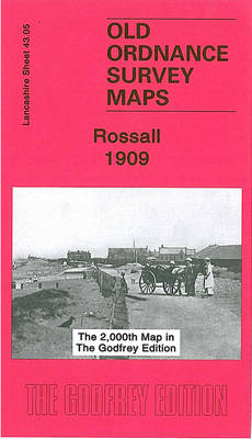
Rossall in 1909 in a fascinating series of reproductions of old Ordnance Survey plans in the Alan Godfrey Editions, ideal for anyone interested in the history of their neighbourhood or family. The map is double-sided. The main map covers the area east of Rossall, from Fleetwood Farm eastward to Fleetwood Salt Works and the Ammonia
Doncaster North 1929
Doncaster North in 1929 in a fascinating series of reproductions of old Ordnance Survey plans in the Alan Godfrey Editions, ideal for anyone interested in the history of their neighbourhood or family. Two versions have been published for this area. The map covers much of the town centre and the area to the north. Coverage
Doncaster South 1928 – 285.01b
Doncaster South in 1928 in a fascinating series of reproductions of old Ordnance Survey plans in the Alan Godfrey Editions, ideal for anyone interested in the history of their neighbourhood or family. Two versions have been published for this area, including part of the town centre and the area to the south. Coverage stretches from