Category Archives: Maps
Preston and Blackpool 1903-1904

Map No. 102, Preston and Blackpool 1903-1904, in the Cassini Historical Series of old Ordnance Survey mapping of England and Wales at 1:50,000 in a format designed to offer a convenient comparison with the present day coverage from the OS, and most locations in three different editions. Old historical maps have been combined so that
Grimsby 1903-1908
Map No. 113, Grimsby 1903-1908, in the Cassini Historical Series of old Ordnance Survey mapping of England and Wales at 1:50,000 in a format designed to offer a convenient comparison with the present day coverage from the OS, and most locations in three different editions. Old historical maps have been combined so that the sheet
Berwick-upon-Tweed 1901
Map No. 75, Berwick-upon-Tweed 1901, in the Cassini Historical Series of old Ordnance Survey mapping of England and Wales at 1:50,000 in a format designed to offer a convenient comparison with the present day coverage from the OS, and most locations in three different editions. Old historical maps have been combined so that the sheet
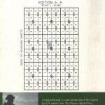
Cheviot Hills and Kielder Water 1901
Map No. 80, Cheviot Hills and Kielder Water 1901, in the Cassini Historical Series of old Ordnance Survey mapping of England and Wales at 1:50,000 in a format designed to offer a convenient comparison with the present day coverage from the OS, and most locations in three different editions. Old historical maps have been combined
Haltwhistle and Brampton 1901-1904
Map No. 86, Haltwhistle and Brampton 1901-1904, in the Cassini Historical Series of old Ordnance Survey mapping of England and Wales at 1:50,000 in a format designed to offer a convenient comparison with the present day coverage from the OS, and most locations in three different editions. Old historical maps have been combined so that
Hexham and Haltwhistle 1901-1904
Map No. 87, Hexham and Haltwhistle 1901-1904, in the Cassini Historical Series of old Ordnance Survey mapping of England and Wales at 1:50,000 in a format designed to offer a convenient comparison with the present day coverage from the OS, and most locations in three different editions. Old historical maps have been combined so that
West Cumbria 1901-1904
Map No. 89, West Cumbria 1901-1904, in the Cassini Historical Series of old Ordnance Survey mapping of England and Wales at 1:50,000 in a format designed to offer a convenient comparison with the present day coverage from the OS, and most locations in three different editions. Old historical maps have been combined so that the
Appleby-in-Westmorland 1903-1904
Map No. 91, Appleby-in-Westmorland 1903-1904, in the Cassini Historical Series of old Ordnance Survey mapping of England and Wales at 1:50,000 in a format designed to offer a convenient comparison with the present day coverage from the OS, and most locations in three different editions. Old historical maps have been combined so that the sheet
Cardigan and Mynydd Preseli / Aberteifi a Mynydd Preseli 1901
Map No. 145, Cardigan and Mynydd Preseli / Aberteifi a Mynydd Preseli 1901, in the Cassini Historical Series of old Ordnance Survey mapping of England and Wales at 1:50,000 in a format designed to offer a convenient comparison with the present day coverage from the OS, and most locations in three different editions. Old historical
Lampeter and Llandovery / Llanbedr Pont Steffan a Llanymddyfri 1901-1902
Map No. 146, Lampeter and Llandovery / Llanbedr Pont Steffan a Llanymddyfri 1901-1902, in the Cassini Historical Series of old Ordnance Survey mapping of England and Wales at 1:50,000 in a format designed to offer a convenient comparison with the present day coverage from the OS, and most locations in three different editions. Old historical
Presteigne and Hay-on-Wye / Llanandras a’r Gelli Gandryll 1900-1903
Map No. 148, Presteigne and Hay-on-Wye / Llanandras a’r Gelli Gandryll 1900-1903, in the Cassini Historical Series of old Ordnance Survey mapping of England and Wales at 1:50,000 in a format designed to offer a convenient comparison with the present day coverage from the OS, and most locations in three different editions. Old historical maps
St David`s and Haverfordwest / Tyddewi a Hwlffordd 1901-1912
Map No. 157, St David`s and Haverfordwest / Tyddewi a Hwlffordd 1901-1912, in the Cassini Historical Series of old Ordnance Survey mapping of England and Wales at 1:50,000 in a format designed to offer a convenient comparison with the present day coverage from the OS, and most locations in three different editions. Old historical maps
Mansfield and Worksop 1902-1903
Map No. 120, Mansfield and Worksop 1902-1093, in the Cassini Historical Series of old Ordnance Survey mapping of England and Wales at 1:50,000 in a format designed to offer a convenient comparison with the present day coverage from the OS, and most locations in three different editions. Old historical maps have been combined so that
Tenby and Pembroke / Dinbych-y-pysgod & Penfro 1901-1902
Map No. 158, Tenby and Pembroke / Dinbych-y-pysgod & Penfro 1901-1902, in the Cassini Historical Series of old Ordnance Survey mapping of England and Wales at 1:50,000 in a format designed to offer a convenient comparison with the present day coverage from the OS, and most locations in three different editions. Old historical maps have
Skegness and Horncastle 1902-1903
Map No. 122, Skegness and Horncastle 1902-1903, in the Cassini Historical Series of old Ordnance Survey mapping of England and Wales at 1:50,000 in a format designed to offer a convenient comparison with the present day coverage from the OS, and most locations in three different editions. Old historical maps have been combined so that
Brecon Beacons / Bannau Brycheiniog 1901-1902
Map No. 160, Brecon Beacons / Bannau Brycheiniog 1901-1902, in the Cassini Historical Series of old Ordnance Survey mapping of England and Wales at 1:50,000 in a format designed to offer a convenient comparison with the present day coverage from the OS, and most locations in three different editions. Old historical maps have been combined
Ludlow / Llwydlo & Church Stretton 1901-1903 – 137
Map No. 137, Church Stretton and Ludlow / Llwydlo 1901-1903, in the Cassini Historical Series of old Ordnance Survey mapping of England and Wales at 1:50,000 in a format designed to offer a convenient comparison with the present day coverage from the OS, and most locations in three different editions. Old historical maps have been
The Black Mountains / Y Mynyddoedd Duon 1900
Map No. 161, The Black Mountains / Y Mynyddoedd Duon 1900, in the Cassini Historical Series of old Ordnance Survey mapping of England and Wales at 1:50,000 in a format designed to offer a convenient comparison with the present day coverage from the OS, and most locations in three different editions. Old historical maps have
Kidderminster & Wyre Forest 1901-1902
Map No. 138, Kidderminster and Wyre Forest 1901-1902, in the Cassini Historical Series of old Ordnance Survey mapping of England and Wales at 1:50,000 in a format designed to offer a convenient comparison with the present day coverage from the OS, and most locations in three different editions. Old historical maps have been combined so
Snowdon / Yr Wyddfa 1903-1910
Map No. 115, Snowdon / Yr Wyddfa 1903-1910, in the Cassini Historical Series of old Ordnance Survey mapping of England and Wales at 1:50,000 in a format designed to offer a convenient comparison with the present day coverage from the OS, and most locations in three different editions. Old historical maps have been combined so