Category Archives: Maps
Coatbridge 1910 – 7.12b

Coatbridge in 1910 in a fascinating series of reproductions of old Ordnance Survey plans in the Alan Godfrey Editions, ideal for anyone interested in the history of their neighbourhood or family.Two versions have been published for this area. The maps cover the town centre and western portion of Coatbridge. Coverage stretches from Sunnyside Road and
Horsehay and Dawley 1901
Horsehay and Dawley in 1901 in a fascinating series of reproductions of old Ordnance Survey plans in the Alan Godfrey Editions, ideal for anyone interested in the history of their neighbourhood or family. The map covers Telford around Horsehay, extending eastward to Dawley High Street and westward to Coalmoor. Features include Horsehay Pool, Bridge &
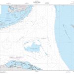
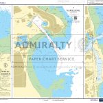
Liverpool (Great Howard Street) 1864 – 18
Great Howard Street area of Liverpool in 1864 in a series of exceptionally detailed reproductions of old Ordnance Survey street plans for areas of larger cities which have undergone substantial redevelopment in the late 19th or the early 20th century, published in the Alan Godfrey Editions.The plans, printed in back and white, have been taken
Mossend 1939 – 12.05
Mossend in 1939 in a fascinating series of reproductions of old Ordnance Survey plans in the Alan Godfrey Editions, ideal for anyone interested in the history of their neighbourhood or family. The map covers the steel town of Mossend and the principal features are the three large steelworks: Mossend Works, Milnwood Iron & Steel Works
Iraq
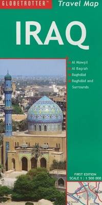
The Globetrotter Travel Map of Iraq caters specifically for the needs of tourists who are new to this destination. The town plans of the major centres pinpoint key buildings and places of interest as well as where to stay. Distance and climate charts enable travellers to plan their visits in advance.
Denbigh and Colwyn Bay / Dinbych a Bae Colwyn 1902-1903

Map No. 116, Denbigh and Colwyn Bay / Dinbych a Bae Colwyn 1902-1903, in the Cassini Historical Series of old Ordnance Survey mapping of England and Wales at 1:50,000 in a format designed to offer a convenient comparison with the present day coverage from the OS, and most locations in three different editions. Old historical
Lleyn Peninsula / Pen Llyn 1903
Map No. 123, Lleyn Peninsula / Pen Llyn 1903, in the Cassini Historical Series of old Ordnance Survey mapping of England and Wales at 1:50,000 in a format designed to offer a convenient comparison with the present day coverage from the OS, and most locations in three different editions. Old historical maps have been combined
Porthmadog and Dolgellau 1902-1903
Map No. 124, Porthmadog and Dolgellau 1902-1903, in the Cassini Historical Series of old Ordnance Survey mapping of England and Wales at 1:50,000 in a format designed to offer a convenient comparison with the present day coverage from the OS, and most locations in three different editions. Old historical maps have been combined so that
Bala and Lake Vyrnwy / Y Bala a Llyn Efyrnwy 1902-1903
Map No. 125, Bala and Lake Vyrnwy / Y Bala a Llyn Efyrnwy 1902-1903, in the Cassini Historical Series of old Ordnance Survey mapping of England and Wales at 1:50,000 in a format designed to offer a convenient comparison with the present day coverage from the OS, and most locations in three different editions. Old
Newtown and Llanidloes / Y Drenewydd a Llanidloes 1901-1903
Map No. 136, Newtown and Llanidloes / Y Drenewydd a Llanidloes 1901-1903, in the Cassini Historical Series of old Ordnance Survey mapping of England and Wales at 1:50,000 in a format designed to offer a convenient comparison with the present day coverage from the OS, and most locations in three different editions. Old historical maps
Marrakech
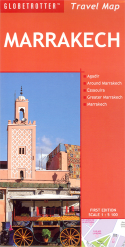
The highly successful “Globetrotter Travel Series”, which includes “Travel Guides”, “Travel Maps”, “Road Atlases`, `Best Of Pocket Guides” and “In Your Pocket Language Guides”, presently covers more than 90 destinations worldwide. The Packs are excellent value, including both a guidebook and a softcover version of the foldout Globetrotter map of the region, in a printed
Doncaster Past and Present
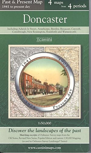
Doncaster in the Cassini Past and Present map series which covers town and cities of England and Wales and offers a unique way of tracing their history and expansion by showing four different periods of their development using Ordnance Survey mapping from the mid-19th century, the late 19th century, the 1920s and the present day.
Blackburn Past and Present
Blackburn in the Cassini Past and Present map series which covers town and cities of England and Wales and offers a unique way of tracing their history and expansion by showing four different periods of their development using Ordnance Survey mapping from the mid-19th century, the late 19th century, the 1920s and the present day.
Preston Past and Present
Preston in the Cassini Past and Present map series which covers town and cities of England and Wales and offers a unique way of tracing their history and expansion by showing four different periods of their development using Ordnance Survey mapping from the mid-19th century, the late 19th century, the 1920s and the present day.
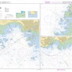
Edinburgh 1857-1869
Edinburgh 1857-1869 map from Cassini reproducing old Ordnance Survey mapping of Scotland presented in a format designed to offer a convenient comparison with the present day coverage from the OS.Old maps have been combined so that the sheet lines correspond to the current Landranger series map No. 66 and are reproduced with the scale changed
Edinburgh 1905-1907
Edinburgh 1905-1907 map from Cassini reproducing old Ordnance Survey mapping of Scotland presented in a format designed to offer a convenient comparison with the present day coverage from the OS.Old maps have been combined so that the sheet lines correspond to the current Landranger series map No. 66 and are reproduced with the scale changed
Edinburgh 1926-1928
Edinburgh 1926-1928 map from Cassini reproducing old Ordnance Survey mapping of Scotland presented in a format designed to offer a convenient comparison with the present day coverage from the OS.Old maps have been combined so that the sheet lines correspond to the current Landranger series map No. 66 and are reproduced with the scale changed
Edinburgh 1956-1957
Edinburgh 1956-1957 map from Cassini reproducing old Ordnance Survey mapping of Scotland presented in a format designed to offer a convenient comparison with the present day coverage from the OS.Old maps have been combined so that the sheet lines correspond to the current Landranger series map No. 66 and are reproduced with the scale changed
Jamrach`s Menagerie
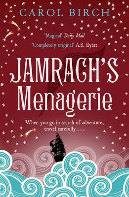
Young Jaffy Brown never expects to escape the slums of Victorian London. Then, aged eight, a chance encounter with Mr Jamrach changes Jaffy`s stars. And before he knows it, he finds himself at the docks waving goodbye to his beloved Ishbel and boarding a ship bound for the Indian Ocean. With his friend Tim at