Category Archives: Maps
New Broughton and Stansty Hall 1909

New Broughton and Stansty Hall in 1909 in a fascinating series of reproductions of old Ordnance Survey plans in the Alan Godfrey Editions, ideal for anyone interested in the history of their neighbourhood or family. The map covers the New Broughton area, on the north-western side of Wrexham. Coverage stretches from Broughton Colliery eastward to
Brighton 1909 – 66.09
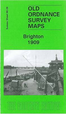
Brighton in 1909 in a fascinating series of reproductions of old Ordnance Survey plans in the Alan Godfrey Editions, ideal for anyone interested in the history of their neighbourhood or family. The map covers much of central and west Brighton, together with a large part of Hove. Coverage stretches from Old Steine and Grand Parade
South Ealing 1934 – 70.4
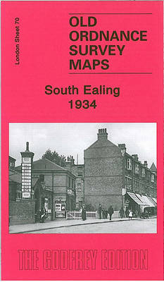
South Ealing in 1934 in a fascinating series of reproductions of old Ordnance Survey plans in the Alan Godfrey Editions, ideal for anyone interested in the history of their neighbourhood or family. Two versions of this map have been published, stretching from Elthorne Park eastward to Cedar Grove, and from Rathgar Avenue southward to Darwin
Ravenglass and Sellafield 1875
Ravenglass and Sellafield in 1875 in a series of reproductions of Ordnance Survey’s famous “Inch to the Mile” maps published in the Alan Godfrey Editions to provide a historical record of England and Wales in the second half of 19th and early 20th century.In this title extended coverage includes the coastal strip from just south
South Acton & Gunnersbury Park 1935 – 71.4
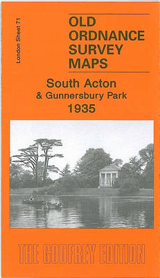
South Acton and Gunnersbury in 1935 in a fascinating series of reproductions of old Ordnance Survey plans in the Alan Godfrey Editions, ideal for anyone interested in the history of their neighbourhood or family. Two versions of this map have been published to show how the area developed across the years. The western half of
Keighley North 1913
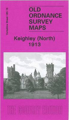
Keighley North in 1913 in a fascinating series of reproductions of old Ordnance Survey plans in the Alan Godfrey Editions, ideal for anyone interested in the history of their neighbourhood or family. The map covers the northern half of Keighley, extending from Town Hall Square northward to Keighley Cemetery, and from Cartmel Road eastward to
Atlas of Adventures: Natural Wonders, Exciting Experiences and Fun Festivities
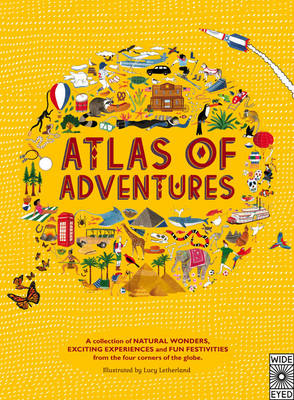
Set your spirit of adventure free with this lavishly illustrated trip around the world. Whether you`re visiting the penguins of Antarctica, joining the Carnival in Brazil or a canoe safari down the Zambezi River, this book brings together more than 100 activities and challenges to inspire armchair adventurers of any age. Find hundreds of things
Walthamstow Marshes 1913 – 22.3
Walthamstow Marches in 1913 in a fascinating series of reproductions of old Ordnance Survey plans in the Alan Godfrey Editions, ideal for anyone interested in the history of their neighbourhood or family. Two versions have been published for this area, from the River Lea and Coppermill Stream eastward to Park Place and Walthamstow Cemetery. The
Atlas of Animal Adventures: Natural Wonders, Exciting Experiences and Fun Festivities from the Four Corners of the Globe

Winner of the National Book Tokens Children’s Travel Book of the Year 2016.From the team behind the best-selling Atlas of Adventures. Head off on a journey of discovery, with this book that collects together nature`s most unmissable events from between the two poles, including epic migrations, extraordinary behaviours, and Herculean habits. Find hundreds of things
Swiss Cottage & South Hampstead 1937 – 37.4
Swiss Cottage and South Hampstead in 1937 in a fascinating series of reproductions of old Ordnance Survey plans in the Alan Godfrey Editions, ideal for anyone interested in the history of their neighbourhood or family. Three versions of this map have been published, centred on Swiss Cottage with its underground station, New College (a training
Hetton-le-Hole and East Rainton 1895
Hetton-le-Hole and East Rainton in 1895 in a fascinating series of reproductions of old Ordnance Survey plans in the Alan Godfrey Editions, ideal for anyone interested in the history of their neighbourhood or family. The map covers the village of Hetton-le-Hole, including The Square, Hetton Brewery, Hetton Hall, St Nicholas church, Bog Row, a stretch
Tannochside & North Uddingston 1935 – 11.03
Tannochside and North Uddingston in 1935 in a fascinating series of reproductions of old Ordnance Survey plans in the Alan Godfrey Editions, ideal for anyone interested in the history of their neighbourhood or family. The map covers the Tannochside area, south-east of Glasgow. Coverage stretches from Calderbraes eastward to Tannochside New Buildings, and southward to
Hull (East) 1908 – 240.03b
Hull East in 1908 in a fascinating series of reproductions of old Ordnance Survey plans in the Alan Godfrey Editions, ideal for anyone interested in the history of their neighbourhood or family. Three versions have been published for this area. The maps cover much of central Hull, stretching from Jameson Street and King Edward Street
Hayle and Lelant 1876
Hayle and Lelant in 1876 in a fascinating series of reproductions of old Ordnance Survey plans in the Alan Godfrey Editions, ideal for anyone interested in the history of their neighbourhood or family. The map is taken from the 1st Edition of the OS 25″ map and shows much of the small town of Hayle
West Norwood 1894 – 136.2
West Norwood in 1894 in a fascinating series of reproductions of old Ordnance Survey plans in the Alan Godfrey Editions, ideal for anyone interested in the history of their neighbourhood or family. Thee versions for this area have been published for this area. Coverage stretches from Wellfield Road and Angles Road eastward to Hamilton Road
Cirencester East 1920
Cirencester East in 1920 in a fascinating series of reproductions of old Ordnance Survey plans in the Alan Godfrey Editions, ideal for anyone interested in the history of their neighbourhood or family. Cirencester is covered by two maps. This title shows the eastern half of the town, stretching from the east end of Market Place
Leyton 1863-1867
Leyton in 1863-1867 in a fascinating series of reproductions of old Ordnance Survey plans in the Alan Godfrey Editions, ideal for anyone interested in the history of their neighbourhood or family. Three versions cover the same area, from Templemill Sidings eastward to Woodhouse Road and Newcomen Road, and from Carlisle Road and St Mary`s church
Holytown & New Stevenston 1910 – 12.06
Holytown and New Stevenston in 1910 in a fascinating series of reproductions of old Ordnance Survey plans in the Alan Godfrey Editions, ideal for anyone interested in the history of their neighbourhood or family. The map covers the Holytown and New Stevenston area, north of Motherwell. Coverage extends from Thankerton House eastward to Silverburn Place,
Carfin & Cleekhimin 1939 – 12.10
Carfin and Cleekhimin in 1939 in a fascinating series of reproductions of old Ordnance Survey plans in the Alan Godfrey Editions, ideal for anyone interested in the history of their neighbourhood or family. The map covers the Carfin and Cleekhimin area north of Motherwell. Coverage extends from Jerviston House eastward to Carfin Grotto, and from
NW Monmouthshire 1901 – 232.1 Coloured Edition
North West Monmouthshire in 1901 in a series of reproductions of Ordnance Survey’s famous “Inch to the Mile” maps published in the Alan Godfrey Editions to provide a historical record of England and Wales in the second half of 19th and early 20th century.Two versions have been published for this area. The maps cover the