Category Archives: Maps
Stockport Town Centre 1873
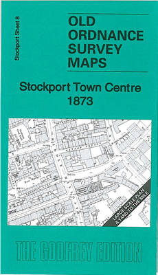
Stockport Town Centre in 1873 in a series of exceptionally detailed reproductions of old Ordnance Survey street plans for areas of mainly larger cities which have undergone substantial redevelopment in the late 19th or the early 20th century, published in the Alan Godfrey Editions.The plans, printed in back and white, have been taken from the
South Harrow and Northolt Park 1935
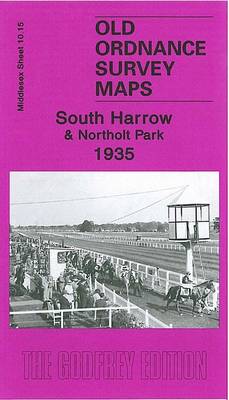
South Harrow and Northolt Park in 1935 in a fascinating series of reproductions of old Ordnance Survey plans in the Alan Godfrey Editions, ideal for anyone interested in the history of their neighbourhood or family. The map covers the southern part of Harrow and Roxeth and northern Greenford, stretching from Eastcote Lane southward to Wadham
Isles of Scilly 1896
The Isles of Scilly in 1896 a series of reproductions of Ordnance Survey’s famous “Inch to the Mile” maps published in the Alan Godfrey Editions to provide a historical record of England and Wales in the second half of 19th and early 20th century.The map covers the whole of the Scilly Isles, including Bryher, Tresco,
Finsbury Park & Stroud Green 1870 – 20.1
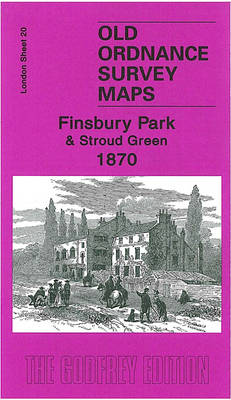
Finsbury Park and Stroud Green in 1870 in a fascinating series of reproductions of old Ordnance Survey plans in the Alan Godfrey Editions, ideal for anyone interested in the history of their neighbourhood or family. Three versions have been published to present how this area developed across the years. The 1870 map shows an almost
Chudleigh & Exmouth 1884-88 – 339
Chudleigh, Exmouth and Newton Abbot in 1884-1888 in a series of reproductions of Ordnance Survey’s famous “Inch to the Mile” maps published in the Alan Godfrey Editions to provide a historical record of England and Wales in the second half of 19th and early 20th century.Coverage stretches from Bickington and Lustleigh eastwards to Budleigh Salterton,
North Herefordshire 1898
North Herefordshire in 1898 in a series of reproductions of Ordnance Survey’s famous “Inch to the Mile” maps published in the Alan Godfrey Editions to provide a historical record of England and Wales in the second half of 19th and early 20th century.Coverage stretches from Hereford northward to the outskirts of Leominster, and from Weobley
Wick 1905
Wick in 1905 in a fascinating series of reproductions of old Ordnance Survey plans in the Alan Godfrey Editions, ideal for anyone interested in the history of their neighbourhood or family. Most of the town centre is shown and coverage stretches from Huddart Street westward to Gauliquoy, and from Louisburgh Street southward to the cemetery.
Formby, Crosby and District 1896
Formby, Crosby and District in 1896 in a series of reproductions of Ordnance Survey’s famous “Inch to the Mile” maps published in the Alan Godfrey Editions to provide a historical record of England and Wales in the second half of 19th and early 20th century.The map covers the coastal area from Bootle northward to Ainsdale,
North West Gloucestershire 1896
North West Gloucestershire in 1896 in a series of reproductions of Ordnance Survey’s famous “Inch to the Mile” maps published in the Alan Godfrey Editions to provide a historical record of England and Wales in the second half of 19th and early 20th century.Coverage stretches from Dymock and Little Marcle eastward to Ashchurch, and from
Swindon, Highworth and District 1893
Swindon, Highworth and District in 1893 in a series of reproductions of Ordnance Survey’s famous “Inch to the Mile” maps published in the Alan Godfrey Editions to provide a historical record of England and Wales in the second half of 19th and early 20th century.The map covers much of north Wiltshire, including the area around
Cirencester and Northleach 1898
Cirencester and Northleach in 1898 in a series of reproductions of Ordnance Survey’s famous “Inch to the Mile” maps published in the Alan Godfrey Editions to provide a historical record of England and Wales in the second half of 19th and early 20th century.The map covers the area of east Gloucestershire around and to the
Biggleswade, Sandy and Royston 1893
Biggleswade, Sandy and Royston in 1893 in a series of reproductions of Ordnance Survey’s famous “Inch to the Mile” maps published in the Alan Godfrey Editions to provide a historical record of England and Wales in the second half of 19th and early 20th century.Coverage stretches from Shefford eastward to Shepreth and northward to Little
New Brighton 1935

New Brighton in 1935 in a fascinating series of reproductions of old Ordnance Survey plans in the Alan Godfrey Editions, ideal for anyone interested in the history of their neighbourhood or family. Two versions of this map have been published and each one includes a large section of adjacent sheet 7.06, extending coverage westward to
Highams Park and Hale End 1915 – 78.01
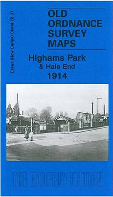
Highams Park and Hale End in 1915 in a fascinating series of reproductions of old Ordnance Survey plans in the Alan Godfrey Editions, ideal for anyone interested in the history of their neighbourhood or family. The map covers the area from Highams Park station southward to Macdonald Road, Walthamstow. Features include Hale End, part of
Chepstow and District 1894
Chepstow and District in 1894 in a series of reproductions of Ordnance Survey’s famous “Inch to the Mile” maps published in the Alan Godfrey Editions to provide a historical record of England and Wales in the second half of 19th and early 20th century.The map covers the area around Chepstow, stretching from Usk in the
Chadderton North 1932
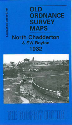
North Chadderton and South-West Royton in 1932 in a fascinating series of reproductions of old Ordnance Survey plans in the Alan Godfrey Editions, ideal for anyone interested in the history of their neighbourhood or family. The map covers North Chadderton and south-western Royton, with a small portion of Oldham around the Boundary Park football ground.
Holy Island & Seahouses 1898 – 4.1 Coloured Edition
Holy Island and Seahouses in 1898 in a series of reproductions of Ordnance Survey’s famous “Inch to the Mile” maps published in the Alan Godfrey Editions to provide a historical record of England and Wales in the second half of 19th and early 20th century.Two versions are available for this area, stretching from Holy Island
Lancaster and District 1896
Lancaster and District in 1896 in a series of reproductions of Ordnance Survey’s famous “Inch to the Mile” maps published in the Alan Godfrey Editions to provide a historical record of England and Wales in the second half of 19th and early 20th century.The map covers the area around Lancaster and Morecambe, extending eastward to
Durham City North: Framwellgate Moor 1895
Durham City North: Framwellgate Moor in 1895 in a fascinating series of reproductions of old Ordnance Survey plans in the Alan Godfrey Editions, ideal for anyone interested in the history of their neighbourhood or family. The map covers the northern part of Durham City; the area was quite empty in 1895, but now it includes
Garstang and District 1896
Garstang and District in 1896 in a series of reproductions of Ordnance Survey’s famous “Inch to the Mile” maps published in the Alan Godfrey Editions to provide a historical record of England and Wales in the second half of 19th and early 20th century.The map covers the area around and to the east of Garstang,