Category Archives: Maps
Rothesay 1886 – 204.06
Rothesay in 1896 in a fascinating series of reproductions of old Ordnance Survey plans in the Alan Godfrey Editions, ideal for anyone interested in the history of their neighbourhood or family. The map covers Rothesay, on the Island of Bute, extending from Mackinlay Street southward to St Mary`s church. Features include Castle, Inner and Outer
Tenterden & District 1893 – 304
Tenterden and District in 1893 in a series of reproductions of Ordnance Survey’s famous “Inch to the Mile” maps published in the Alan Godfrey Editions to provide a historical record of England and Wales in the second half of 19th and early 20th century.The map covers an area of south Kent and north-east Sussex, stretching
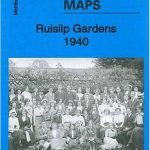
Ruislip 1939
Ruislip in 1939 in a fascinating series of reproductions of old Ordnance Survey plans in the Alan Godfrey Editions, ideal for anyone interested in the history of their neighbourhood or family. The map covers much of Ruislip, a town that developed rapidly in the early 20th century. Coverage stretches from Hill Lane and Heathfield Rise
Altrincham 1908
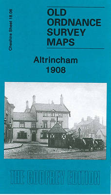
Altrincham in 1908 in a fascinating series of reproductions of old Ordnance Survey plans in the Alan Godfrey Editions, ideal for anyone interested in the history of their neighbourhood or family. The map covers the centre of Altrincham, plus parts of Bowdon and Hale. Coverage stretches from Margaret Road eastward to Hermitage Road, and from
Timperley 1897
Timperley in 1897 in a fascinating series of reproductions of old Ordnance Survey plans in the Alan Godfrey Editions, ideal for anyone interested in the history of their neighbourhood or family. The map is double-sided. The main map covers the eastern part of Timperley, including Belmont House, chapel, Thorley Lane area; coverage extends east to
Brixton & Herne Hill 1913 – 116.3
Brixton and Herne Hill in 1913 in a fascinating series of reproductions of old Ordnance Survey plans in the Alan Godfrey Editions, ideal for anyone interested in the history of their neighbourhood or family. Three versions for this area have been published, stretching from Branksome Road and Strathleven Road eastward to Beckwith Road, and from
Liverpool Wapping 1864
Wapping area of Liverpool in 1864 in a series of exceptionally detailed reproductions of old Ordnance Survey street plans for areas of larger cities which have undergone substantial redevelopment in the late 19th or the early 20th century, published in the Alan Godfrey Editions.The plans, printed in back and white, have been taken from the
Ryhope Village 1895
Ryhope Village in 1895 in a fascinating series of reproductions of old Ordnance Survey plans in the Alan Godfrey Editions, ideal for anyone interested in the history of their neighbourhood or family. The map is double-sided. Most of the village (but not colliery) is shown and features include both NER and Londonderry Railway stations, The
Gurnos 1914 – 43.14
Gurnos in 1914 in a fascinating series of reproductions of old Ordnance Survey plans in the Alan Godfrey Editions, ideal for anyone interested in the history of their neighbourhood or family. The map is divided between Brecknockshire and Glamorgan, covering the area from the eastern part of Ystalyfera eastward to Ystradgynlais station and colliery. Features
Bristol Knowle 1902

Bristol Knowle in 1902 in a fascinating series of reproductions of old Ordnance Survey plans in the Alan Godfrey Editions, ideal for anyone interested in the history of their neighbourhood or family. The map covers most of the village of Knowle, south of Bristol. Coverage stretches from Somerset Road southward to Hengrove House, and from
Royston 1904
Royston in 1904 in a fascinating series of reproductions of old Ordnance Survey plans in the Alan Godfrey Editions, ideal for anyone interested in the history of their neighbourhood or family. The map covers the village of Royston, about three miles north of Barnsley. Coverage extends from the Railway Hotel eastward to Whincover and Royston
Ashbourne, Cheadle and District 1895
Ashbourne, Cheadle and District in 1895 in a series of reproductions of Ordnance Survey’s famous “Inch to the Mile” maps published in the Alan Godfrey Editions to provide a historical record of England and Wales in the second half of 19th and early 20th century.The map covers an area from Dilhorne eastward to Hollington, and
Greenwich and the Isle of Dogs 1867
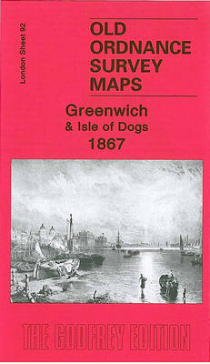
Greenwich and the Isle of Dogs in 1867 in a fascinating series of reproductions of old Ordnance Survey plans in the Alan Godfrey Editions, ideal for anyone interested in the history of their neighbourhood or family. Three versions have been published for this area, stretching from Deptford Creek eastward to Annandale Road and Selcroft Road,
SE Somerset 1899 – 312 Coloured Edition
South East Somerset in 1899 in a series of reproductions of Ordnance Survey’s famous “Inch to the Mile” maps published in the Alan Godfrey Editions to provide a historical record of England and Wales in the second half of 19th and early 20th century.The map, printed in colour, covers the area around Yeovil, IIlchester, Sherborne,
Hertford and St Albans 1898
Hertford and St Albans in 1898 in a series of reproductions of Ordnance Survey’s famous “Inch to the Mile” maps published in the Alan Godfrey Editions to provide a historical record of England and Wales in the second half of 19th and early 20th century.This title covers a large area of central and south-eastern Hertfordshire,
Stockport Town Centre 1873
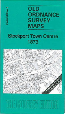
Stockport Town Centre in 1873 in a series of exceptionally detailed reproductions of old Ordnance Survey street plans for areas of mainly larger cities which have undergone substantial redevelopment in the late 19th or the early 20th century, published in the Alan Godfrey Editions.The plans, printed in back and white, have been taken from the
South Harrow and Northolt Park 1935
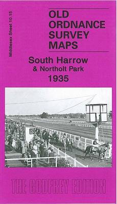
South Harrow and Northolt Park in 1935 in a fascinating series of reproductions of old Ordnance Survey plans in the Alan Godfrey Editions, ideal for anyone interested in the history of their neighbourhood or family. The map covers the southern part of Harrow and Roxeth and northern Greenford, stretching from Eastcote Lane southward to Wadham
Isles of Scilly 1896
The Isles of Scilly in 1896 a series of reproductions of Ordnance Survey’s famous “Inch to the Mile” maps published in the Alan Godfrey Editions to provide a historical record of England and Wales in the second half of 19th and early 20th century.The map covers the whole of the Scilly Isles, including Bryher, Tresco,
Finsbury Park & Stroud Green 1870 – 20.1
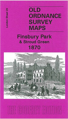
Finsbury Park and Stroud Green in 1870 in a fascinating series of reproductions of old Ordnance Survey plans in the Alan Godfrey Editions, ideal for anyone interested in the history of their neighbourhood or family. Three versions have been published to present how this area developed across the years. The 1870 map shows an almost