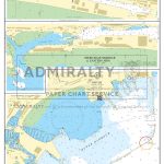
Category Archives: Maps
Bilston 1884 – 62.16a Coloured Edition
Bilston in 1884 in a fascinating series of reproductions of old Ordnance Survey plans in the Alan Godfrey Editions, ideal for anyone interested in the history of their neighbourhood or family. Two maps have been published for this area – the 1884 version, taken from the OS First Edition, is in colour. Most of the
The Mendips 1897 – 280
The Mendips in 1897 in a series of reproductions of Ordnance Survey’s famous “Inch to the Mile” maps published in the Alan Godfrey Editions to provide a historical record of England and Wales in the second half of 19th and early 20th century.The map covers the area from Wells and Shepton Mallet northward to Chew
Romford & SW Essex 1893 – 257
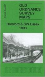
Romford and South-West Essex in 1893 in a series of reproductions of Ordnance Survey’s famous “Inch to the Mile” maps published in the Alan Godfrey Editions to provide a historical record of England and Wales in the second half of 19th and early 20th century.The map covers east London and south-west Essex, stretching from Plaistow
Tunbridge Wells and Ashdown Forest 1894
Tunbridge Wells and Ashdown Forest in 1894 in a series of reproductions of Ordnance Survey’s famous “Inch to the Mile” maps published in the Alan Godfrey Editions to provide a historical record of England and Wales in the second half of 19th and early 20th century.Coverage stretches from Tunbridge Wells southward to Marefield, and from
South London 1893
South London in 1893 in a series of reproductions of Ordnance Survey’s famous “Inch to the Mile” maps published in the Alan Godfrey Editions to provide a historical record of England and Wales in the second half of 19th and early 20th century.The map covers south London and much of north Surrey, extending from Westminster
Malvern: The Wyche 1926
Malvern: The Wyche in 1926 in a fascinating series of reproductions of old Ordnance Survey plans in the Alan Godfrey Editions, ideal for anyone interested in the history of their neighbourhood or family. The map covers part of Great Malvern with the northern tip of Malvern Wells. Coverage runs from the Worcestershire Beacon southward to
Canterbury 1906 – 46.03
Canterbury in 1906 in a fascinating series of reproductions of old Ordnance Survey plans in the Alan Godfrey Editions, ideal for anyone interested in the history of their neighbourhood or family. SThe map covers most of central Canterbury, stretching from the Cemetery and London Road eastward to Longport Street and the Barracks, and from Hanover
Enfield (NW) 1911 – 7.02
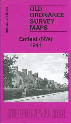
Enfield North-West in 1911 in a fascinating series of reproductions of old Ordnance Survey plans in the Alan Godfrey Editions, ideal for anyone interested in the history of their neighbourhood or family. This detailed map covers the north-western area of Enfield, stretching from Windmill Hill northward to the Cemetery and Chase Farm Schools, and from
Lewes and District 1894
Lewes and District in 1894 in a series of reproductions of Ordnance Survey’s famous “Inch to the Mile” maps published in the Alan Godfrey Editions to provide a historical record of England and Wales in the second half of 19th and early 20th century.Coverage stretches from Lewes eastward to Pevensey and Wartling, and from Alfriston
Nottingham (Arnold & Daybrook) 1899 – 38.06

Nottingham Arnold and Daybrook in 1899 in a fascinating series of reproductions of old Ordnance Survey plans in the Alan Godfrey Editions, ideal for anyone interested in the history of their neighbourhood or family. The map covers Daybrook and part of Arnold north of Nottingham. Coverage runs from Front Street Arnold westward toSunrise Farm and
Ossett Central 1905
Central Ossett in 1905 in a fascinating series of reproductions of old Ordnance Survey plans in the Alan Godfrey Editions, ideal for anyone interested in the history of their neighbourhood or family. Two versions have been published for this area, extending southward to Sowood Farm and Ossett Spa, and eastward to Haggs Lane. Features include
Westhoughton 1907
Westhoughton in 1907 in a fascinating series of reproductions of old Ordnance Survey plans in the Alan Godfrey Editions, ideal for anyone interested in the history of their neighbourhood or family. The map covers the centre of Westhoughton and extends eastward to include Chequerbent. Features include St Bartholomew`s church, Market Street, Town Hall, Glebe Mills,
Seaham Harbour 1895
Seaham Harbour in 1895 in a fascinating series of reproductions of old Ordnance Survey plans in the Alan Godfrey Editions, ideal for anyone interested in the history of their neighbourhood or family. The map is double-sided. The main map includes St John`s church, part of town centre, Londonderry Railway with Seaham Colliery and Seaham stations,
Nottingham (Sherwood) 1899 – 38.10
Nottingham Sherwood in 1899 in a fascinating series of reproductions of old Ordnance Survey plans in the Alan Godfrey Editions, ideal for anyone interested in the history of their neighbourhood or family. The map covers the Sherwood area, on the north side of Nottingham. Coverage extends northward to Thackeray`s Lane. Features include GNR railway with
Dartford and Gravesend 1893
Dartford and Gravesend in 1893 in a series of reproductions of Ordnance Survey’s famous “Inch to the Mile” maps published in the Alan Godfrey Editions to provide a historical record of England and Wales in the second half of 19th and early 20th century.The map covers an area from Bromley eastward to Gravesend and from
Drumsagard Hallside & Newton 1896 – 11.06
Drumsagard, Hallside and Newton in 1896 in a fascinating series of reproductions of old Ordnance Survey plans in the Alan Godfrey Editions, ideal for anyone interested in the history of their neighbourhood or family. The map covers the area from Newton southward to Flemington and eastward to Blantyreferme House. Features include Hallside Steel Works, St
Sevenoaks and Tonbridge 1893
Sevenoaks and Tonbridge in 1893 in a series of reproductions of Ordnance Survey’s famous “Inch to the Mile” maps published in the Alan Godfrey Editions to provide a historical record of England and Wales in the second half of 19th and early 20th century.The map covers map covers the area from Limpsfield eastward to West
Broomhouse, Daldowie and Haughead 1896
Broomhouse, Daldowie and Haughead in 1896 in a fascinating series of reproductions of old Ordnance Survey plans in the Alan Godfrey Editions, ideal for anyone interested in the history of their neighbourhood or family. The map covers the area from Broomhouse and Wester Daldowie southward to Newton House and Redlawood. Features include Maryville, Haughead Colliery,
Bromley North and Sundridge Park 1895
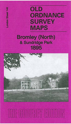
Bromley North and Sundridge Park in 1895 in a fascinating series of reproductions of old Ordnance Survey plans in the Alan Godfrey Editions, ideal for anyone interested in the history of their neighbourhood or family. The map covers the north part of Bromley, extending from East Street northward to Burntash Lane, and from College Road
West Drayton South 1935
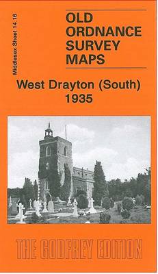
West Drayton South in 1935 in a fascinating series of reproductions of old Ordnance Survey plans in the Alan Godfrey Editions, ideal for anyone interested in the history of their neighbourhood or family. The map covers much of the village of West Drayton, which is in the north-western corner. Features include St Martin`s church, Drayton