Category Archives: Maps
Wakefield West 1905

Wakefield West in 1905 in a fascinating series of reproductions of old Ordnance Survey plans in the Alan Godfrey Editions, ideal for anyone interested in the history of their neighbourhood or family. The map covers the western edge of Wakefield, stretching from Thornes Park and Westgate Common westward to Roundwood Colliery. Features include tramway, Westgate
Leeds South and South East 1890 (Colour Edition)
Leeds South and South East in 1890 in a fascinating series of reproductions of old Ordnance Survey plans in the Alan Godfrey Editions, ideal for anyone interested in the history of their neighbourhood or family. Two versions have been published for this area. Coverage stretches from Wellington Station eastward to Pontefract Lane and southward to
Manchester: Ancoats North 1848

Ancoats North area of Manchester in 1848 in a series of exceptionally detailed reproductions of old Ordnance Survey street plans for areas of larger cities which have undergone substantial redevelopment in the late 19th or the early 20th century, published in the Alan Godfrey Editions. *In this title:* the map covers the area around Bradford
Leeds Central and North East 1890
Leeds Central and North East in 1890 in a fascinating series of reproductions of old Ordnance Survey plans in the Alan Godfrey Editions, ideal for anyone interested in the history of their neighbourhood or family. Two versions have been published for this area. The map captures much of central Leeds, together with the Burmantofts and
Mitcham 1910

Mitcham in 1910 in a fascinating series of reproductions of old Ordnance Survey plans in the Alan Godfrey Editions, ideal for anyone interested in the history of their neighbourhood or family. The map covers Lower Mitcham and the southern half of Upper Mitcham. Coverage stretches from the Upper Green and Eastfields southward to Mitcham Junction
Ancoats 1849 – 30

Ancoats area of Manchester in 1849 in a series of exceptionally detailed reproductions of old Ordnance Survey street plans for areas of larger cities which have undergone substantial redevelopment in the late 19th or the early 20th century, published in the Alan Godfrey Editions.The plans, printed in back and white, have been taken from the
South Norwood 1895
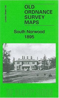
South Norwood in 1895 in a fascinating series of reproductions of old Ordnance Survey plans in the Alan Godfrey Editions, ideal for anyone interested in the history of their neighbourhood or family. The map covers the area around Norwood Junction, etending from Granbgewood House and Charnwood Road eastward to Marlow Road, and from Warminster Road
Exeter 1888 – 80.06a Colour Edition
Exeter in 1888 in a fascinating series of reproductions of old Ordnance Survey plans in the Alan Godfrey Editions, ideal for anyone interested in the history of their neighbourhood or family. Two versions of this map are available, covering most of central Exeter and its eastern suburbs and stretching from Bonhay Road eastward to Cemetery
Hull West 1890 (Colour Edition)
Hull West in 1890 in a fascinating series of reproductions of old Ordnance Survey plans in the Alan Godfrey Editions, ideal for anyone interested in the history of their neighbourhood or family. Three versions have been published for this area. The maps cover west Hull, stretching from Albert Avenue and Plane Street eastward to Prospect
Central Glasgow 1893 – 6.10a
Central Glasgow in 1893 in a fascinating series of reproductions of old Ordnance Survey plans in the Alan Godfrey Editions, ideal for anyone interested in the history of their neighbourhood or family. Three versions have been published for this area. Coverage stretches from West Nile Street westward to Kelvinhaugh Street and Overnewton Square, and from
Leeds SW: Holbeck & New Wortley 1888 – 218.05a
Leeds South West: Holbeck and New Wortley in 1888 in a fascinating series of reproductions of old Ordnance Survey plans in the Alan Godfrey Editions, ideal for anyone interested in the history of their neighbourhood or family. Two versions have been published for this area. Coverage stretches from Amberley Road eastward to David Street, and
Stafford 1879
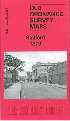
Stafford in 1879 in a fascinating series of reproductions of old Ordnance Survey plans in the Alan Godfrey Editions, ideal for anyone interested in the history of their neighbourhood or family. Two versions of this map have been published, showing how the area developed across the years. Coverage extends from the station eastward to Littleworth,
Bilston 1884 – 62.16a Coloured Edition
Bilston in 1884 in a fascinating series of reproductions of old Ordnance Survey plans in the Alan Godfrey Editions, ideal for anyone interested in the history of their neighbourhood or family. Two maps have been published for this area – the 1884 version, taken from the OS First Edition, is in colour. Most of the
The Mendips 1897 – 280
The Mendips in 1897 in a series of reproductions of Ordnance Survey’s famous “Inch to the Mile” maps published in the Alan Godfrey Editions to provide a historical record of England and Wales in the second half of 19th and early 20th century.The map covers the area from Wells and Shepton Mallet northward to Chew
Romford & SW Essex 1893 – 257
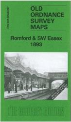
Romford and South-West Essex in 1893 in a series of reproductions of Ordnance Survey’s famous “Inch to the Mile” maps published in the Alan Godfrey Editions to provide a historical record of England and Wales in the second half of 19th and early 20th century.The map covers east London and south-west Essex, stretching from Plaistow
Tunbridge Wells and Ashdown Forest 1894
Tunbridge Wells and Ashdown Forest in 1894 in a series of reproductions of Ordnance Survey’s famous “Inch to the Mile” maps published in the Alan Godfrey Editions to provide a historical record of England and Wales in the second half of 19th and early 20th century.Coverage stretches from Tunbridge Wells southward to Marefield, and from
South London 1893
South London in 1893 in a series of reproductions of Ordnance Survey’s famous “Inch to the Mile” maps published in the Alan Godfrey Editions to provide a historical record of England and Wales in the second half of 19th and early 20th century.The map covers south London and much of north Surrey, extending from Westminster
Fareham, Hambledon and Havant 1894
Fareham, Hambledon and Havant in 1894 in a series of reproductions of Ordnance Survey’s famous “Inch to the Mile” maps published in the Alan Godfrey Editions to provide a historical record of England and Wales in the second half of 19th and early 20th century.The map covers an area from Fareham and Titchfield eastwards to
The Hawthorns 1913
The Hawthorns in 1913 in a fascinating series of reproductions of old Ordnance Survey plans in the Alan Godfrey Editions, ideal for anyone interested in the history of their neighbourhood or family. Two versions have been published for this area. The maps cover the eastern part of West Bromwich and western part of Handsworth, with
Springburn and Possilpark 1893
Springburn and Possilpark in 1893 in a fascinating series of reproductions of old Ordnance Survey plans in the Alan Godfrey Editions, ideal for anyone interested in the history of their neighbourhood or family. Two versions have been published for this area. The map is dominated by the North British Railway, which runs north-south through it.