Category Archives: Maps
Winson Green and Hockley 1888

Winson Green and Hockley in 1888 in a fascinating series of reproductions of old Ordnance Survey plans in the Alan Godfrey Editions, ideal for anyone interested in the history of their neighbourhood or family. Two versions have been published for this area; the maps cover the busy Winson Green part of north-west Birmingham, including parts
Dudley 1882 – 67.16a Coloured Edition

Dudley in 1882 in a fascinating series of reproductions of old Ordnance Survey plans in the Alan Godfrey Editions, ideal for anyone interested in the history of their neighbourhood or family. Two versions have been published for this area, covering central Dudley and extending eastward to Kate`s Hill, Cawney Hill and Oakham. The map covers
Hanworth and North West Hampton 1934

Hanworth and North West Hampton in 1934 in a fascinating series of reproductions of old Ordnance Survey plans in the Alan Godfrey Editions, ideal for anyone interested in the history of their neighbourhood or family. The map covers parts of Hampton and Hanworth, stretching from Castle Way eastward to Nightingale Road and southward to Barlow
Northwood Hills 1935
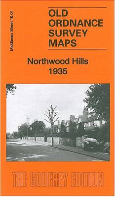
Northwood Hills in 1935 in a fascinating series of reproductions of old Ordnance Survey plans in the Alan Godfrey Editions, ideal for anyone interested in the history of their neighbourhood or family. The map covers the southern part of Northwood, stretching from Maxwell Road and Emmanuel Church southward to St Vincent`s Hospital. Features include Haste
Ashford (Middx) 1935 – 24.04
Ashford (Middlesex) in 1935 in a fascinating series of reproductions of old Ordnance Survey plans in the Alan Godfrey Editions, ideal for anyone interested in the history of their neighbourhood or family. The map covers the central and southern part of Ashford, stretching from Coleridge Road and Chattern Hill southward to the Queen Mary Reservoir.
Byker and Heaton 1895
Byker and Heaton in 1895 in a fascinating series of reproductions of old Ordnance Survey plans in the Alan Godfrey Editions, ideal for anyone interested in the history of their neighbourhood or family. Two maps have been published for this area to show how it has changed over the years. The maps extend from Rothbury
Axminster 1903 – 72.05
Axminster in 1903 in a fascinating series of reproductions of old Ordnance Survey plans in the Alan Godfrey Editions, ideal for anyone interested in the history of their neighbourhood or family. The map gives good coverage of Axminster and the area westward to Yarty Bridge and Gammons Hill. Features include the town centre, railway with
Surbiton & Long Ditton 1912 – 12.08
Surbiton and Long Ditton in 1912 in a fascinating series of reproductions of old Ordnance Survey plans in the Alan Godfrey Editions, ideal for anyone interested in the history of their neighbourhood or family. The map covers the centre of Surbiton, Surbiton Hill and parts of Long Ditton and Tolworth. Coverage extends from Surbiton Station
Liverpool Toxteth Mill Street 1847
Mill Street area of Toxteth in Liverpool in 1847 in a series of exceptionally detailed reproductions of old Ordnance Survey street plans for areas of larger cities which have undergone substantial redevelopment in the late 19th or the early 20th century, published in the Alan Godfrey Editions. *In this title:* coverage stretches from Grafton Street
Paisley 1858 (Colour Edition)
Paisley in 1858 in a fascinating series of reproductions of old Ordnance Survey plans in the Alan Godfrey Editions, ideal for anyone interested in the history of their neighbourhood or family. Two versions have been published for this area. Coverage extends from Ferguslie House and the cemetery eastward to Greenlaw Avenue and Kilnside Road, and
Carshalton & North Wallington 1910 – 13.12
Carshalton and North Wallington in 1910 in a fascinating series of reproductions of old Ordnance Survey plans in the Alan Godfrey Editions, ideal for anyone interested in the history of their neighbourhood or family. The map covers the centre of Carshalton, stretching northward to Hackbridge and eastward to north Wallington. Features include railway with Carshalton
Thames Ditton 1895 – 12.07
Thames Ditton in 1895 in a fascinating series of reproductions of old Ordnance Survey plans in the Alan Godfrey Editions, ideal for anyone interested in the history of their neighbourhood or family. The map covers Thames Ditton, part of Long Ditton, and Weston Green. Coverage stretches from St Nicholas church to Esher station. Features include
Southall Green 1935
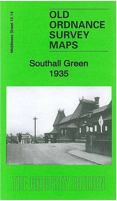
Southall Green in 1935 in a fascinating series of reproductions of old Ordnance Survey plans in the Alan Godfrey Editions, ideal for anyone interested in the history of their neighbourhood or family. Two versions have been published for this area, extending from Southall station southward to the Grand Union Canal, and from Brent Road eastward
Torquay 1904
Torquay in 1905 in a fascinating series of reproductions of old Ordnance Survey plans in the Alan Godfrey Editions, ideal for anyone interested in the history of their neighbourhood or family. The map covers the central area of Torquay, stretching from Tor Abbey eastward to Wellswood Hall, and from the Princess Pier northward to Ellacombe
Wakefield West 1905
Wakefield West in 1905 in a fascinating series of reproductions of old Ordnance Survey plans in the Alan Godfrey Editions, ideal for anyone interested in the history of their neighbourhood or family. The map covers the western edge of Wakefield, stretching from Thornes Park and Westgate Common westward to Roundwood Colliery. Features include tramway, Westgate
Leeds South and South East 1890 (Colour Edition)
Leeds South and South East in 1890 in a fascinating series of reproductions of old Ordnance Survey plans in the Alan Godfrey Editions, ideal for anyone interested in the history of their neighbourhood or family. Two versions have been published for this area. Coverage stretches from Wellington Station eastward to Pontefract Lane and southward to
Manchester: Ancoats North 1848

Ancoats North area of Manchester in 1848 in a series of exceptionally detailed reproductions of old Ordnance Survey street plans for areas of larger cities which have undergone substantial redevelopment in the late 19th or the early 20th century, published in the Alan Godfrey Editions. *In this title:* the map covers the area around Bradford
Leeds Central and North East 1890
Leeds Central and North East in 1890 in a fascinating series of reproductions of old Ordnance Survey plans in the Alan Godfrey Editions, ideal for anyone interested in the history of their neighbourhood or family. Two versions have been published for this area. The map captures much of central Leeds, together with the Burmantofts and
Mitcham 1910

Mitcham in 1910 in a fascinating series of reproductions of old Ordnance Survey plans in the Alan Godfrey Editions, ideal for anyone interested in the history of their neighbourhood or family. The map covers Lower Mitcham and the southern half of Upper Mitcham. Coverage stretches from the Upper Green and Eastfields southward to Mitcham Junction
Hull (East) 1890 – 240.03a Colour Edition
Hull East in 1890 in a fascinating series of reproductions of old Ordnance Survey plans in the Alan Godfrey Editions, ideal for anyone interested in the history of their neighbourhood or family. Three versions have been published for this area. The maps cover much of central Hull, stretching from Jameson Street and King Edward Street