Category Archives: Maps
Gurjakhani

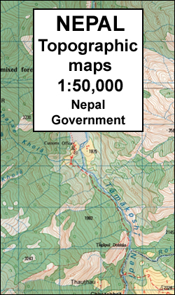
Gurjakhani, sheet no. 2883-05, in the topographic survey of Nepal at 1:50,000 published by the Nepali Government in the late 1990s and early 2000s and produced from remote sensing data by Finnish cartographers as part of that country’s international aid program. The maps cover 15’ x 15’ quadrangles.IMPORTANT ‘“ PLEASE NOTE BEFORE ORDERING: AVAILABILITY: although,
Bhijer

Bhijer, sheet no. 2982-12, in the topographic survey of Nepal at 1:50,000 published by the Nepali Government in the late 1990s and early 2000s and produced from remote sensing data by Finnish cartographers as part of that country’s international aid program. The maps cover 15’ x 15’ quadrangles.IMPORTANT ‘“ PLEASE NOTE BEFORE ORDERING: AVAILABILITY: although,
Dunai

Dunai, sheet no. 2882-04, in the topographic survey of Nepal at 1:50,000 published by the Nepali Government in the late 1990s and early 2000s and produced from remote sensing data by Finnish cartographers as part of that country’s international aid program. The maps cover 15’ x 15’ quadrangles.IMPORTANT ‘“ PLEASE NOTE BEFORE ORDERING: AVAILABILITY: although,
Lamjun Himal

Lamjun Himal, sheet no. 2884-09, in the topographic survey of Nepal at 1:50,000 published by the Nepali Government in the late 1990s and early 2000s and produced from remote sensing data by Finnish cartographers as part of that country’s international aid program. The maps cover 15’ x 15’ quadrangles.IMPORTANT ‘“ PLEASE NOTE BEFORE ORDERING: AVAILABILITY:
Takagau

Takagau, sheet no. 2882-08, in the topographic survey of Nepal at 1:50,000 published by the Nepali Government in the late 1990s and early 2000s and produced from remote sensing data by Finnish cartographers as part of that country’s international aid program. The maps cover 15’ x 15’ quadrangles.IMPORTANT ‘“ PLEASE NOTE BEFORE ORDERING: AVAILABILITY: although,
Panlham

Panlham, sheet no. 2983-12, in the topographic survey of Nepal at 1:50,000 published by the Nepali Government in the late 1990s and early 2000s and produced from remote sensing data by Finnish cartographers as part of that country’s international aid program. The maps cover 15’ x 15’ quadrangles.IMPORTANT ‘“ PLEASE NOTE BEFORE ORDERING: AVAILABILITY: although,
Sisne

Sisne, sheet no. 2883-03, in the topographic survey of Nepal at 1:50,000 published by the Nepali Government in the late 1990s and early 2000s and produced from remote sensing data by Finnish cartographers as part of that country’s international aid program. The maps cover 15’ x 15’ quadrangles.IMPORTANT ‘“ PLEASE NOTE BEFORE ORDERING: AVAILABILITY: although,
Tilicho

Tilicho, sheet no. 2883-08, in the topographic survey of Nepal at 1:50,000 published by the Nepali Government in the late 1990s and early 2000s and produced from remote sensing data by Finnish cartographers as part of that country’s international aid program. The maps cover 15’ x 15’ quadrangles.IMPORTANT ‘“ PLEASE NOTE BEFORE ORDERING: AVAILABILITY: although,
Sarmi

Sarmi, sheet no. 2982-14, in the topographic survey of Nepal at 1:50,000 published by the Nepali Government in the late 1990s and early 2000s and produced from remote sensing data by Finnish cartographers as part of that country’s international aid program. The maps cover 15’ x 15’ quadrangles.IMPORTANT ‘“ PLEASE NOTE BEFORE ORDERING: AVAILABILITY: although,
Ghandruk

Ghandruk, sheet no. 2883-12, in the topographic survey of Nepal at 1:50,000 published by the Nepali Government in the late 1990s and early 2000s and produced from remote sensing data by Finnish cartographers as part of that country’s international aid program. The maps cover 15’ x 15’ quadrangles.IMPORTANT ‘“ PLEASE NOTE BEFORE ORDERING: AVAILABILITY: although,
Gamgadhi

Gamgadji, sheet no. 2982-05, in the topographic survey of Nepal at 1:50,000 published by the Nepali Government in the late 1990s and early 2000s and produced from remote sensing data by Finnish cartographers as part of that country’s international aid program. The maps cover 15’ x 15’ quadrangles.IMPORTANT ‘“ PLEASE NOTE BEFORE ORDERING: AVAILABILITY: although,
Araniko Chuli

Araniko Chuli, sheet no. 2983-11/15, in the topographic survey of Nepal at 1:50,000 published by the Nepali Government in the late 1990s and early 2000s and produced from remote sensing data by Finnish cartographers as part of that country’s international aid program. The maps cover 15’ x 15’ quadrangles.IMPORTANT ‘“ PLEASE NOTE BEFORE ORDERING: AVAILABILITY:
Jomson

Jomson, sheet no. 2883-03, in the topographic survey of Nepal at 1:50,000 published by the Nepali Government in the late 1990s and early 2000s and produced from remote sensing data by Finnish cartographers as part of that country’s international aid program. The maps cover 15’ x 15’ quadrangles.IMPORTANT ‘“ PLEASE NOTE BEFORE ORDERING: AVAILABILITY: although,
Koban

Koban, sheet no. 2883-07, in the topographic survey of Nepal at 1:50,000 published by the Nepali Government in the late 1990s and early 2000s and produced from remote sensing data by Finnish cartographers as part of that country’s international aid program. The maps cover 15’ x 15’ quadrangles.IMPORTANT ‘“ PLEASE NOTE BEFORE ORDERING: AVAILABILITY: although,
Chala Bhanjyan

Chala Bhanjyan, sheet no. 2983-06, in the topographic survey of Nepal at 1:50,000 published by the Nepali Government in the late 1990s and early 2000s and produced from remote sensing data by Finnish cartographers as part of that country’s international aid program. The maps cover 15’ x 15’ quadrangles.IMPORTANT ‘“ PLEASE NOTE BEFORE ORDERING: AVAILABILITY:
Tinje

Tinje, sheet no. 2983-10, in the topographic survey of Nepal at 1:50,000 published by the Nepali Government in the late 1990s and early 2000s and produced from remote sensing data by Finnish cartographers as part of that country’s international aid program. The maps cover 15’ x 15’ quadrangles.IMPORTANT ‘“ PLEASE NOTE BEFORE ORDERING: AVAILABILITY: although,
Mukot

Mukot, sheet no. 2883-02, in the topographic survey of Nepal at 1:50,000 published by the Nepali Government in the late 1990s and early 2000s and produced from remote sensing data by Finnish cartographers as part of that country’s international aid program. The maps cover 15’ x 15’ quadrangles.IMPORTANT ‘“ PLEASE NOTE BEFORE ORDERING: AVAILABILITY: although,
Lamsun

Lamsun, sheet no. 2883-06, in the topographic survey of Nepal at 1:50,000 published by the Nepali Government in the late 1990s and early 2000s and produced from remote sensing data by Finnish cartographers as part of that country’s international aid program. The maps cover 15’ x 15’ quadrangles.IMPORTANT ‘“ PLEASE NOTE BEFORE ORDERING: AVAILABILITY: although,
Dho

Dho, sheet no. 2983-13, in the topographic survey of Nepal at 1:50,000 published by the Nepali Government in the late 1990s and early 2000s and produced from remote sensing data by Finnish cartographers as part of that country’s international aid program. The maps cover 15’ x 15’ quadrangles.IMPORTANT ‘“ PLEASE NOTE BEFORE ORDERING: AVAILABILITY: although,
Chhedhul Gumba

Chhedhul Gumba, sheet no. 2883-01, in the topographic survey of Nepal at 1:50,000 published by the Nepali Government in the late 1990s and early 2000s and produced from remote sensing data by Finnish cartographers as part of that country’s international aid program. The maps cover 15’ x 15’ quadrangles.IMPORTANT ‘“ PLEASE NOTE BEFORE ORDERING: AVAILABILITY:


