Category Archives: Maps
Dhaina
Dhaina, sheet no. 2981-08, in the topographic survey of Nepal at 1:50,000 published by the Nepali Government in the late 1990s and early 2000s and produced from remote sensing data by Finnish cartographers as part of that country’s international aid program. The maps cover 15’ x 15’ quadrangles.IMPORTANT ‘“ PLEASE NOTE BEFORE ORDERING: AVAILABILITY: although,
Silk Road Countries Wall Map
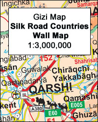
The Silk Route Countries Wall Map at 1:3,000,000 from Gizi Map, size 124 x 87cm (49″ x 34″ approx), with coverage extending from eastern Turkey and Syria, across the countries of Central Asia, to western China and south to the Arabian Sea; different variants of the route across this vast region are clearly highlighted.The map
Khin
Khin, sheet no. 2981-12, in the topographic survey of Nepal at 1:50,000 published by the Nepali Government in the late 1990s and early 2000s and produced from remote sensing data by Finnish cartographers as part of that country’s international aid program. The maps cover 15’ x 15’ quadrangles.IMPORTANT ‘“ PLEASE NOTE BEFORE ORDERING: AVAILABILITY: although,
Kyrgyzstan Wall Map

Kyrgyzstan Wall Map at 1:750,000 from Gizi Map, size 124 x 70cm (49″ x 27.5″ approx), with excellent presentation of the country’s mountainous terrain through bold altitude colouring and plenty of names of mountain ranges, etc, road network indicating routes of the old Silk Road, plus a street plan of Bishkek and an administrative map
Rachuli
Rachuli, sheet no. 2981-16, in the topographic survey of Nepal at 1:50,000 published by the Nepali Government in the late 1990s and early 2000s and produced from remote sensing data by Finnish cartographers as part of that country’s international aid program. The maps cover 15’ x 15’ quadrangles.IMPORTANT ‘“ PLEASE NOTE BEFORE ORDERING: AVAILABILITY: although,
Kolti
Kolti, sheet no. 2981-07 in the topographic survey of Nepal at 1:50,000 published by the Nepali Government in the late 1990s and early 2000s and produced from remote sensing data by Finnish cartographers as part of that country’s international aid program. The maps cover 15’ x 15’ quadrangles.IMPORTANT ‘“ PLEASE NOTE BEFORE ORDERING: AVAILABILITY: although,
Nanikot
Nanikot, sheet no. 2981-11, in the topographic survey of Nepal at 1:50,000 published by the Nepali Government in the late 1990s and early 2000s and produced from remote sensing data by Finnish cartographers as part of that country’s international aid program. The maps cover 15’ x 15’ quadrangles.IMPORTANT ‘“ PLEASE NOTE BEFORE ORDERING: AVAILABILITY: although,
Khadachakra
Khadachakra, sheet no. 2981-15, in the topographic survey of Nepal at 1:50,000 published by the Nepali Government in the late 1990s and early 2000s and produced from remote sensing data by Finnish cartographers as part of that country’s international aid program. The maps cover 15’ x 15’ quadrangles.IMPORTANT ‘“ PLEASE NOTE BEFORE ORDERING: AVAILABILITY: although,
Talkot
Talkot, sheet no. 2981-06, in the topographic survey of Nepal at 1:50,000 published by the Nepali Government in the late 1990s and early 2000s and produced from remote sensing data by Finnish cartographers as part of that country’s international aid program. The maps cover 15’ x 15’ quadrangles.IMPORTANT ‘“ PLEASE NOTE BEFORE ORDERING: AVAILABILITY: although,
Martadi
Martadi, sheet no. 2981-10, in the topographic survey of Nepal at 1:50,000 published by the Nepali Government in the late 1990s and early 2000s and produced from remote sensing data by Finnish cartographers as part of that country’s international aid program. The maps cover 15’ x 15’ quadrangles.IMPORTANT ‘“ PLEASE NOTE BEFORE ORDERING: AVAILABILITY: although,
Chainpur
Chainpur, sheet no. 2981-05, in the topographic survey of Nepal at 1:50,000 published by the Nepali Government in the late 1990s and early 2000s and produced from remote sensing data by Finnish cartographers as part of that country’s international aid program. The maps cover 15’ x 15’ quadrangles.IMPORTANT ‘“ PLEASE NOTE BEFORE ORDERING: AVAILABILITY: although,
Khiratadi (114) (2980 08)
Khiratadi, sheet no. 2980-08, in the topographic survey of Nepal at 1:50,000 published by the Nepali Government in the late 1990s and early 2000s and produced from remote sensing data by Finnish cartographers as part of that country’s international aid program. The maps cover 15’ x 15’ quadrangles.IMPORTANT ‘“ PLEASE NOTE BEFORE ORDERING: AVAILABILITY: although,
Khalanga Baja (Darchula)
Khalanga Baja (Darchula), sheet no. 2980-03 / 3080-15, in the topographic survey of Nepal at 1:50,000 published by the Nepali Government in the late 1990s and early 2000s and produced from remote sensing data by Finnish cartographers as part of that country’s international aid program. The maps cover 15’ x 15’ quadrangles.IMPORTANT ‘“ PLEASE NOTE
Dattu
Dattu, sheet no. 2980-02, in the topographic survey of Nepal at 1:50,000 published by the Nepali Government in the late 1990s and early 2000s and produced from remote sensing data by Finnish cartographers as part of that country’s international aid program. The maps cover 15’ x 15’ quadrangles.IMPORTANT ‘“ PLEASE NOTE BEFORE ORDERING: AVAILABILITY: although,
Admiralty Chart 4063 – Bellingshausen Sea to Valdivia
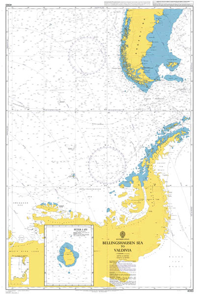
NEW EDITION OUT ON 09/04/2020Admiralty standard nautical charts comply with Safety of Life at Sea (SOLAS) regulations and are ideal for professional, commercial and recreational use. Charts within the series consist of a range of scales, useful for passage planning, ocean crossings, coastal navigation and entering port.Standard Admiralty charts are folded to fit in a
Phoksundo Tal
Phoksundo Tal, sheet no. 2982-16, in the topographic survey of Nepal at 1:50,000 published by the Nepali Government in the late 1990s and early 2000s and produced from remote sensing data by Finnish cartographers as part of that country’s international aid program. The maps cover 15’ x 15’ quadrangles.IMPORTANT ‘“ PLEASE NOTE BEFORE ORDERING: AVAILABILITY:
Kalanga Bajar (Jumla)
Kalanga Bajar (Jumla), sheet no. 2982-09, in the topographic survey of Nepal at 1:50,000 published by the Nepali Government in the late 1990s and early 2000s and produced from remote sensing data by Finnish cartographers as part of that country’s international aid program. The maps cover 15’ x 15’ quadrangles.IMPORTANT ‘“ PLEASE NOTE BEFORE ORDERING:
Iquitos (8-P)

One of the maps in the topographic survey of Peru from the country’s national survey organization, Instituto Geogrรกfico Nacional. Contours are at 25m intervals and colouring/symbols indicate different types of terrain and vegetation. Some of the maps may contain small blank spaces representing as yet unmapped areas. Each sheet covers 30’ latitude by 30’ longitude.
Dhime
Dhime, sheet no. 2882-01, in the topographic survey of Nepal at 1:50,000 published by the Nepali Government in the late 1990s and early 2000s and produced from remote sensing data by Finnish cartographers as part of that country’s international aid program. The maps cover 15’ x 15’ quadrangles.IMPORTANT ‘“ PLEASE NOTE BEFORE ORDERING: AVAILABILITY: although,
Sudan and South Sudan Wall Map

Sudan and South Sudan as separate countries on a wall map at 1:2,500,000 from Gizi Maps (size 87 x 94cm / 34″ x 37″ approx), with detailed presentation of the topography, administrative divisions, street plans of Khartoum and Juba, etc.Excellent presentation of the terrain in the publisher’s characteristic style provides a vivid picture of the