Category Archives: Maps
Bulgaria (with Mountain Resorts)
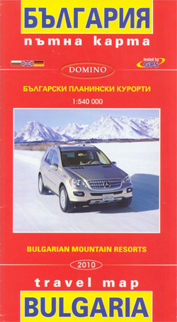
Bulgaria at 1:540,000 from Domino with on the reverse detailed topographic hiking maps, panorama drawings with ski runs, street plans and/or lists of hotels in the country’s main holiday resorts; Bansko, Borovets and Pamporovo.The main map provides a clear picture of the country’s topography with bright altitude colouring enhanced by relief shading and spot heights.
World Michelin Wall Map PIN-BOARD FRAMED
Political map of the world from Michelin, 144 x 100cm (4’7″ x 3’3″ approx.), mounted on pin board and framed. The map has pleasant subdued colours of different countries contrasted against light blue oceans, and is presented with panels of country flags above and below the map.Country names are in large, clearly legible print. English
Georgia: Russian Invasion and Occupation Map as of 16.9.2009
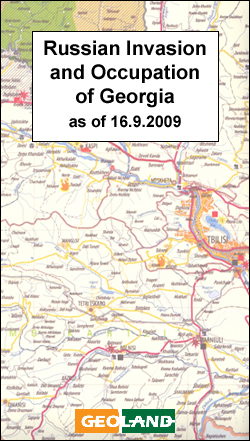
Georgia on a large wall map from the Tbilisi bases Geoland overprinted with information relating to the armed conflict with Russia in 2008, including occupied areas, artillery and air attacks, etc. The base is the publishers’ road map of the country which also shows its administrative division into provinces, including Abkhazia and South Ossetia.Colouring shows
Santa Margherita to Calasetta
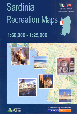
Santa Margherita to Calasetta area in a series of contoured, GPS compatible maps at 1:60,000 from Ed. Abies, with extensive tourist information including special recreational routes plus additional coverage at more detailed scales of selected popular areas.*Main series at 1:60,000 (Nos. 1 to 12)*The maps have contours at 100m intervals and colouring for woodlands and
Appennino Tosco-Romagnolo East

Map No. 135, Appennino Tosco-Romagnolo East, in a series of GPS compatible hiking maps at 1:50,000 from the Istituto Geografico Adriatico, covering parts of central Italy: eastern Tuscany, with northern Umbria and the Marches, plus the south-eastern of part of Emilia-Romagna.The maps have contours at 50m intervals with additional shading and numerous spot heights. Colouring
Gulf of Oristano

The Gulf of Oristano area in a series of contoured, GPS compatible maps at 1:60,000 from Ed. Abies, with extensive tourist information including special recreational routes plus additional coverage at more detailed scales of selected popular areas.*Main series at 1:60,000 (Nos. 1 to 12)*The maps have contours at 100m intervals and colouring for woodlands and
Alta Val Tiberina

Map No. 125, Alta Val Tiberina, in a series of GPS compatible hiking maps at 1:50,000 from the Istituto Geografico Adriatico, covering parts of central Italy: eastern Tuscany, with northern Umbria and the Marches, plus the south-eastern of part of Emilia-Romagna.The maps have contours at 50m intervals with additional shading and numerous spot heights. Colouring
Bay of Porto Conte to Platamona

Bay of Porto Conte to Platamona area in a series of contoured, GPS compatible maps at 1:60,000 from Ed. Abies, with extensive tourist information including special recreational routes plus additional coverage at more detailed scales of selected popular areas.*Main series at 1:60,000 (Nos. 1 to 12)*The maps have contours at 100m intervals and colouring for
Riviera Cesenate – San Marino

Map No. 128, Riviera Cesenate – San Marino, in a series of GPS compatible hiking maps at 1:50,000 from the Istituto Geografico Adriatico, covering parts of central Italy: eastern Tuscany, with northern Umbria and the Marches, plus the south-eastern of part of Emilia-Romagna.The maps have contours at 50m intervals with additional shading and numerous spot
Marina di Sorso to Costa Paradiso

Marina di Sorso to Costa Paradiso area in a series of contoured, GPS compatible maps at 1:60,000 from Ed. Abies, with extensive tourist information including special recreational routes plus additional coverage at more detailed scales of selected popular areas.*Main series at 1:60,000 (Nos. 1 to 12)*The maps have contours at 100m intervals and colouring for
Alta Val Marecchia

Map No. 126, Alta Val Marecchia, in a series of GPS compatible hiking maps at 1:50,000 from the Istituto Geografico Adriatico, covering parts of central Italy: eastern Tuscany, with northern Umbria and the Marches, plus the south-eastern of part of Emilia-Romagna.The maps have contours at 50m intervals with additional shading and numerous spot heights. Colouring
Capo San Lorenzo to Capitana

Capo San Lorenzo to Capitana area in a series of contoured, GPS compatible maps at 1:60,000 from Ed. Abies, with extensive tourist information including special recreational routes plus additional coverage at more detailed scales of selected popular areas.*Main series at 1:60,000 (Nos. 1 to 12)*The maps have contours at 100m intervals and colouring for woodlands
Isola di San Pietro

Isola di San Pietro at 1:25,000 in a series of contoured maps from Ed. Abies. Overprint highlights campsites, caravan parks, B&B and hotel accommodation, beaches and diving sites, caves and archaeological remains. This title has a UTM grid.*Main series at 1:60,000 (Nos. 1 to 12)*The maps have contours at 100m intervals and colouring for woodlands
Loiri – Porto San Paolo

Loiri – Porto San Paolo area at 1:25,000 in a series of contoured, GPS compatible maps from Ed. Abies. Overprint highlights campsites, B&B and agriturismo accommodation, golf courses, horse riding facilities and viewpoints. The map has a UTM grid.*Main series at 1:60,000 (Nos. 1 to 12)*The maps have contours at 100m intervals and colouring for
Posada

The environs of Posada at 1:25,000 in a series of contoured maps from Ed. Abies. Overprint highlights agriturismo accommodation, beaches, climbing sites, horse riding facilities and archaeological remains. This title has no UTM grid.*Main series at 1:60,000 (Nos. 1 to 12)*The maps have contours at 100m intervals and colouring for woodlands and maquis shrubland. Local
Siniscola

Siniscola area at 1:25,000 in a series of contoured maps from Ed. Abies. Overprint highlights campsites and agriturismo accommodation, climbing sites, wild sheep and bird watching sites and archaeological remains. This title has no UTM grid.*Main series at 1:60,000 (Nos. 1 to 12)*The maps have contours at 100m intervals and colouring for woodlands and maquis
Villasimius – Torre delle Stelle – Costa Rei

Villasimius – Torre delle Stelle – Costa Rei area at 1:30,000 in a series of contoured maps from Ed. Abies. Overprint highlights campsites, caravan parks, hotels, agriturismo farms, restaurants, shops with local produce, petrol stations, beaches and diving sites, golf courses, horse riding facilities, etc. This title has no UTM grid.*Main series at 1:60,000 (Nos.
Goa Tourist Map/Guide

Goa on a simple but colourful map, from GoaHolidayHomes.com, designed to provide a wealth tourist information for visitors rather than give an accurate cartographic representation of the state and its transport networks. The map itself shows each administrative unit of the state in different colour as a base for a very approximate representation of the
Nuremburg in 3-D Street Plan
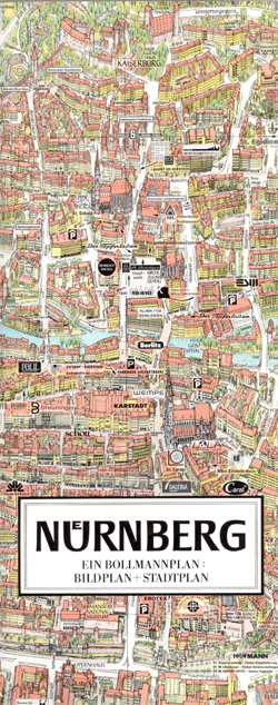
Unusual, very attractive street plan of Nuremburg offering a bird’s-eye view of the city with every building drawn to scale with full architectural detail, from street arcades to rooftops and inner courtyards. The city’s famous churches, the town hall and the castle, the old town walls and gates, its splendid railway station are all presented
Hampshire
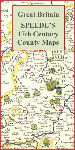
Hampshire in a series of colourful reproductions of attractive county maps by John Speede from about 1610-1611, printed on thick art paper and ideal for framing. Each title, 58 x 45cm / approx. 23″ x 18″, is decorated with additional notes, drawings, coats of arms, street plans, etc.Little drawings are used to show locations of


